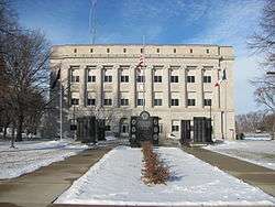
Pocahontas, Iowa
| Pocahontas, Iowa | |
|---|---|
| City | |
 | |
| Nickname(s): The Princess City | |
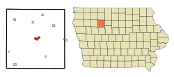 Location of Pocahontas, Iowa | |
| Coordinates: 42°44′4″N 94°40′23″W / 42.73444°N 94.67306°WCoordinates: 42°44′4″N 94°40′23″W / 42.73444°N 94.67306°W | |
| Country |
|
| State |
|
| County | Pocahontas |
| Incorporated | May 16, 1892 [1] |
| Government | |
| • Mayor | Dick Gruber |
| Area[2] | |
| • Total | 2.02 sq mi (5.23 km2) |
| • Land | 2.02 sq mi (5.23 km2) |
| • Water | 0 sq mi (0 km2) |
| Elevation | 1,220 ft (372 m) |
| Population (2010)[3] | |
| • Total | 1,789 |
| • Estimate (2016)[4] | 1,710 |
| • Density | 886/sq mi (341.9/km2) |
| Time zone | UTC-6 (Central (CST)) |
| • Summer (DST) | UTC-5 (CDT) |
| ZIP code | 50574 |
| Area code(s) | 712 |
| FIPS code | 19-63975 |
| GNIS feature ID | 0460342 |
| Website |
www |
Pocahontas is a city in and the county seat of Pocahontas County, Iowa, United States.[5] The population was 1,789 in the 2010 census, a decline from the 1,970 population in 2000.[6][7]
History
This city was named after the Pocahontas, a Powhatan woman from Jamestown, Virginia. Other geographical names in the county related to the colony at Jamestown are Rolfe, Powhatan Township and Varina.[8]
Pocahontas was incorporated as a city on May 16, 1892.[1]
April 9, 2011 tornado
During the tornado outbreak of April 9–11, 2011, several tornadoes hit Pocahontas County and the surrounding area. No one was injured and there were no fatalities. The largest was an EF4 and touched-down West of town.
Geography
Pocahontas's longitude and latitude coordinates in decimal form are 42.734476, -94.673017.[9]
According to the United States Census Bureau, the city has a total area of 2.02 square miles (5.23 km2), all of it land.[2]
Demographics
| Historical population | |||
|---|---|---|---|
| Census | Pop. | %± | |
| 1880 | 37 | — | |
| 1900 | 625 | — | |
| 1910 | 987 | 57.9% | |
| 1920 | 1,302 | 31.9% | |
| 1930 | 1,308 | 0.5% | |
| 1940 | 1,730 | 32.3% | |
| 1950 | 1,949 | 12.7% | |
| 1960 | 2,011 | 3.2% | |
| 1970 | 2,338 | 16.3% | |
| 1980 | 2,352 | 0.6% | |
| 1990 | 2,085 | −11.4% | |
| 2000 | 1,970 | −5.5% | |
| 2010 | 1,789 | −9.2% | |
| Est. 2016 | 1,710 | [4] | −4.4% |
| U.S. Decennial Census[10] | |||
2010 census
As of the census[3] of 2010, there were 1,789 people, 852 households, and 493 families residing in the city. The population density was 885.6 inhabitants per square mile (341.9/km2). There were 953 housing units at an average density of 471.8 per square mile (182.2/km2). The racial makeup of the city was 98.3% White, 0.3% African American, 0.1% Native American, 0.1% Asian, 0.1% Pacific Islander, 0.1% from other races, and 1.0% from two or more races. Hispanic or Latino of any race were 1.3% of the population.
There were 852 households of which 21.6% had children under the age of 18 living with them, 48.0% were married couples living together, 7.2% had a female householder with no husband present, 2.7% had a male householder with no wife present, and 42.1% were non-families. 39.1% of all households were made up of individuals and 22.4% had someone living alone who was 65 years of age or older. The average household size was 2.04 and the average family size was 2.70.
The median age in the city was 51.1 years. 19.2% of residents were under the age of 18; 5.5% were between the ages of 18 and 24; 16.6% were from 25 to 44; 29.5% were from 45 to 64; and 29.2% were 65 years of age or older. The gender makeup of the city was 46.6% male and 53.4% female.
2000 census
As of the census[11] of 2000, there were 1,970 people, 883 households, and 549 families residing in the city. The population density was 1,059.8 people per square mile (408.9/km²). There were 946 housing units at an average density of 508.9 per square mile (196.4/km²). The racial makeup of the city was 98.68% White, 0.25% African American, 0.15% Native American, 0.10% Asian, 0.20% from other races, and 0.61% from two or more races. Hispanic or Latino of any race were 0.51% of the population.
There were 883 households out of which 25.8% had children under the age of 18 living with them, 53.3% were married couples living together, 7.1% had a female householder with no husband present, and 37.8% were non-families. 36.1% of all households were made up of individuals and 24.0% had someone living alone who was 65 years of age or older. The average household size was 2.16 and the average family size was 2.79.
Age spread: 23.1% under the age of 18, 4.8% from 18 to 24, 22.1% from 25 to 44, 25.3% from 45 to 64, and 24.7% who were 65 years of age or older. The median age was 45 years. For every 100 females, there were 84.6 males. For every 100 females age 18 and over, there were 79.1 males.
The median income for a household in the city was $30,865, and the median income for a family was $42,690. Males had a median income of $29,806 versus $19,886 for females. The per capita income for the city was $17,556. About 6.7% of families and 9.1% of the population were below the poverty line, including 12.9% of those under age 18 and 5.9% of those age 65 or over.
Infrastructure
Transportation
Air transportation for Pocahontas is provided by Pocahontas Municipal Airport (FAA Identifier POH), located approximately 1 mile northeast of the city. The airport has 2 runways, the first is designated 11/29, with a concrete surface 4100 x 60 ft (1250 x 18 m) and runway edge lights, the second is designated 18/36 with a turf surface 1998 x 135 ft (609 x 41 m) and is unlighted.[12]
Education
Pocahontas Area Community School District operates public schools.[13]
Notable people
- Larry Biittner (born 1945), former Major League Baseball player[14]
- Peg Mullen (1917–2009), anti-war activist and writer[15]
- James V. Schall (born 1928), Jesuit priest, professor of Government at Georgetown University, and prolific Roman Catholic writer[16]
See also
References
- 1 2 "LIST OF INCORPORATED CITIES" (PDF). Iowa Secretary of State - Matt Schultz. Retrieved 2011-08-09.
- 1 2 "US Gazetteer files 2010". United States Census Bureau. Archived from the original on 2012-01-24. Retrieved 2012-05-11.
- 1 2 "American FactFinder". United States Census Bureau. Retrieved 2012-05-11.
- 1 2 "Population and Housing Unit Estimates". Retrieved June 9, 2017.
- ↑ "Find a County". National Association of Counties. Retrieved 2011-06-07.
- ↑ "Population & Housing Occupancy Status 2010". United States Census Bureau American FactFinder. Retrieved 2011-08-08.
- ↑ "Data from the 2010 Census". State Data Center of Iowa. Retrieved 2011-08-08.
- ↑ "Pocahontas County Economic Development – History page". Northwest Web Solutions. Retrieved 2011-01-13.
- ↑ "US Gazetteer files: 2010, 2000, and 1990". United States Census Bureau. 2011-02-12. Retrieved 2011-04-23.
- ↑ "Census of Population and Housing". Census.gov. Retrieved June 4, 2015.
- ↑ "American FactFinder". United States Census Bureau. Retrieved 2008-01-31.
- ↑ "Individual Airport Report - Pocahontas Municipal Airport" (PDF). Iowa Department of Transportation. Retrieved 2011-08-09.
- ↑ "Pocahontas Area." Iowa Department of Education. Retrieved on July 20, 2018.
- ↑ "BASEBALL Reference". Larry Biittner. Retrieved 2010-12-16.
- ↑ Martin, Douglas (October 5, 2009). "Peg Mullen, 92, Who Fanned Her Anger Over Son's Death Into Antiwar Drive, Dies". The New York Times. Retrieved 2011-01-13.
- ↑ "Georgetown University". CURRICULUM VITAE -- James V. Schall. Retrieved 2011-01-12.
External links
| Wikimedia Commons has media related to Pocahontas, Iowa. |
- Pocahontas portal style website City government, Businesses, Economic Development
- City Data Comprehensive Statistical Data and more about Pocahontas
Municipalities and communities of Pocahontas County, Iowa, United States | ||
|---|---|---|
| Cities | ||
| Townships | ||
| Unincorporated community | ||
| Ghost town | ||
| Footnotes | ‡This populated place also has portions in an adjacent county or counties | |