Poweshiek County, Iowa
| Poweshiek County, Iowa | |
|---|---|
 | |
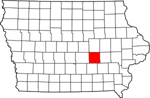 Location in the U.S. state of Iowa | |
 Iowa's location in the U.S. | |
| Founded | 1843 |
| Seat | Montezuma |
| Largest city | Grinnell |
| Area | |
| • Total | 586 sq mi (1,518 km2) |
| • Land | 585 sq mi (1,515 km2) |
| • Water | 1.1 sq mi (3 km2), 0.2% |
| Population | |
| • (2010) | 18,914 |
| • Density | 32/sq mi (12/km2) |
| Congressional district | 1st |
| Time zone | Central: UTC−6/−5 |
Poweshiek County is a county in the southeastern part of the U.S. state of Iowa. As of the 2010 census, the population was 18,914.[1] The county seat is Montezuma.[2] The county is named for the chief of the Fox tribe who signed the treaty ending the Black Hawk War. It lies along Interstate 80 between Des Moines and Iowa City. Poweshiek County's biggest city is Grinnell.
History
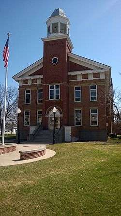
Poweshiek County was formed in 1843. It was named for a chief of the Fox Indian people. The Poweshiek County Courthouse, completed in 1859, is listed on the National Register of Historic Places.[3]
Government and Infrastructure
County business is overseen by three elected county supervisors. The county website provides names and contact information for the current supervisors.[4]
| Year | Republican | Democratic | Third Parties |
|---|---|---|---|
| 2016 | 50.3% 4,946 | 43.8% 4,304 | 5.9% 583 |
| 2012 | 44.4% 4,424 | 53.7% 5,357 | 1.9% 194 |
| 2008 | 43.3% 4,340 | 55.0% 5,519 | 1.7% 174 |
| 2004 | 49.2% 4,965 | 50.0% 5,043 | 0.8% 83 |
| 2000 | 49.0% 4,396 | 47.0% 4,222 | 4.0% 362 |
| 1996 | 39.2% 3,221 | 50.9% 4,183 | 9.9% 810 |
| 1992 | 35.9% 3,245 | 44.8% 4,056 | 19.3% 1,746 |
| 1988 | 42.7% 3,683 | 56.5% 4,876 | 0.8% 66 |
| 1984 | 53.0% 4,715 | 46.2% 4,103 | 0.8% 71 |
| 1980 | 50.5% 4,598 | 38.8% 3,529 | 10.7% 975 |
| 1976 | 48.0% 4,194 | 49.9% 4,360 | 2.1% 181 |
| 1972 | 55.3% 4,785 | 43.0% 3,718 | 1.7% 145 |
| 1968 | 55.1% 4,470 | 40.1% 3,250 | 4.8% 392 |
| 1964 | 37.3% 3,109 | 62.6% 5,213 | 0.1% 12 |
| 1960 | 58.8% 5,232 | 41.2% 3,671 | 0.0% 1 |
| 1956 | 58.8% 5,145 | 41.2% 3,602 | 0.0% 2 |
| 1952 | 64.3% 6,105 | 34.9% 3,318 | 0.8% 75 |
| 1948 | 46.4% 3,888 | 51.6% 4,324 | 2.1% 173 |
| 1944 | 49.5% 4,186 | 50.0% 4,234 | 0.5% 41 |
| 1940 | 49.7% 4,773 | 49.9% 4,794 | 0.5% 44 |
| 1936 | 44.9% 4,037 | 52.8% 4,745 | 2.4% 214 |
| 1932 | 41.8% 3,490 | 55.6% 4,649 | 2.6% 216 |
| 1928 | 64.0% 5,212 | 34.2% 2,787 | 1.9% 151 |
| 1924 | 53.6% 4,414 | 17.3% 1,428 | 29.1% 2,397 |
| 1920 | 71.4% 5,806 | 26.1% 2,125 | 2.5% 199 |
| 1916 | 57.4% 2,748 | 39.3% 1,880 | 3.3% 160 |
| 1912 | 19.9% 902 | 35.9% 1,631 | 44.3% 2,012 |
| 1908 | 59.7% 2,794 | 35.5% 1,661 | 4.8% 223 |
| 1904 | 67.5% 3,137 | 26.1% 1,212 | 6.5% 300 |
| 1900 | 63.1% 3,199 | 34.8% 1,765 | 2.2% 110 |
| 1896 | 58.5% 2,969 | 39.7% 2,013 | 1.9% 94 |
Healthcare
Poweshiek County is served by Grinnell Regional Medical Center, an acute care hospital licensed for 81 beds. GRMC was established in 1967 after the merger of two hospitals.
Geography
According to the U.S. Census Bureau, the county has a total area of 586 square miles (1,520 km2), of which 585 square miles (1,520 km2) is land and 1.1 square miles (2.8 km2) (0.2%) is water.[6] It is drained by the north fork of Skunk River, which crosses the southwest corner, and by English River and other streams.[7]
Major highways
Adjacent counties
- Tama County (north)
- Iowa County (east)
- Keokuk County (southeast)
- Mahaska County (south)
- Jasper County (west)
Demographics
| Historical population | |||
|---|---|---|---|
| Census | Pop. | %± | |
| 1850 | 615 | — | |
| 1860 | 5,668 | 821.6% | |
| 1870 | 15,581 | 174.9% | |
| 1880 | 18,936 | 21.5% | |
| 1890 | 18,394 | −2.9% | |
| 1900 | 19,414 | 5.5% | |
| 1910 | 19,589 | 0.9% | |
| 1920 | 19,910 | 1.6% | |
| 1930 | 18,727 | −5.9% | |
| 1940 | 18,758 | 0.2% | |
| 1950 | 19,344 | 3.1% | |
| 1960 | 19,300 | −0.2% | |
| 1970 | 18,803 | −2.6% | |
| 1980 | 19,306 | 2.7% | |
| 1990 | 19,033 | −1.4% | |
| 2000 | 18,815 | −1.1% | |
| 2010 | 18,914 | 0.5% | |
| Est. 2016 | 18,533 | [8] | −2.0% |
| U.S. Decennial Census[9] 1790-1960[10] 1900-1990[11] 1990-2000[12] 2010-2013[1] | |||
2010 census
The 2010 census recorded a population of 18,914 in the county, with a population density of 32.3300/sq mi (12.4827/km2). There were 8,949 housing units, of which 7,555 were occupied.[13]
2000 census
As of the census[14] of 2000, there were 18,815 people, 7,398 households, and 4,882 families residing in the county. The population density was 32 people per square mile (12/km²). There were 8,556 housing units at an average density of 15 per square mile (6/km²). The racial makeup of the county was 96.74% White, 0.55% Black or African American, 0.23% Native American, 1.07% Asian, 0.05% Pacific Islander, 0.49% from other races, and 0.87% from two or more races. 1.20% of the population were Hispanic or Latino of any race.
There were 7,398 households out of which 29.0% had children under the age of 18 living with them, 55.8% were married couples living together, 7.4% had a female householder with no husband present, and 34.0% were non-families. 29.2% of all households were made up of individuals and 13.9% had someone living alone who was 65 years of age or older. The average household size was 2.35 and the average family size was 2.88.
In the county, the population was spread out with 22.7% under the age of 18, 12.8% from 18 to 24, 24.4% from 25 to 44, 22.5% from 45 to 64, and 17.6% who were 65 years of age or older. The median age was 38 years. For every 100 females there were 92.5 males. For every 100 females age 18 and over, there were 88.8 males.
The median income for a household in the county was $37,836, and the median income for a family was $46,599. Males had a median income of $32,781 versus $22,465 for females. The per capita income for the county was $18,629. About 6.2% of families and 9.8% of the population were below the poverty line, including 12.0% of those under age 18 and 5.9% of those age 65 or over.
Education
Poweshiek County is served by three community school districts: [15]
| School District | Location | Num of Campuses (inc. parochial) |
Num of Students | Student- Teacher Ratio | High School | District Web site |
|---|---|---|---|---|---|---|
| BGM Community School District (Brooklyn-Guernsey-Malcom) | Brooklyn | 1 | 537 | - | BGM | BGM |
| Grinnell-Newburg School District | Grinnell | 6 | 1,750 | - | Grinnell | Grinnell |
| Montezuma Community School District | Montezuma | 1 | 512 | - | Montezuma | Montezuma |
Poweshiek County is home to Grinnell College, a small liberal arts college founded in 1846.
There is one private school in the county, Central Iowa Christian School, in Grinnell.
Communities
Cities
Census-designated places
Unincorporated communities
- Ewart
Townships
- Bear Creek
- Chester
- Deep River
- Grant
- Jackson
- Jefferson
- Lincoln
- Madison
- Malcom
- Pleasant
- Scott
- Sheridan
- Sugar Creek
- Union
- Warren
- Washington
Population ranking
The population ranking of the following table is based on the 2010 census of Poweshiek County.[16]
† county seat
| Rank | City/Town/etc. | Municipal type | Population (2010 Census)
|
|---|---|---|---|
| 1 | Grinnell | City | 9,218 |
| 2 | Brooklyn | City | 1,468 |
| 3 | † Montezuma | City | 1,462 |
| 4 | Victor (mostly in Iowa County) | City | 893 |
| 5 | Holiday Lake | CDP | 433 |
| 6 | Malcom | City | 287 |
| 7 | Deep River | City | 279 |
| 8 | Barnes City (partially in Mahaska County) | City | 176 |
| 9 | Searsboro | City | 148 |
| 10 | Hartwick | City | 86 |
| 11 | Guernsey | City | 63 |
See also
References
- 1 2 "State & County QuickFacts". United States Census Bureau. Retrieved 20 July 2014.
- ↑ "Find a County". National Association of Counties. Retrieved 7 June 2011.
- ↑ National Park Service (2009-03-13). "National Register Information System". National Register of Historic Places. National Park Service.
- ↑ "Supervisors - Poweshiek County Iowa". Poweshiek County Iowa. Retrieved 27 April 2018.
- ↑ Leip, David. "Dave Leip's Atlas of U.S. Presidential Elections". uselectionatlas.org. Retrieved 27 April 2018.
- ↑ "US Gazetteer files: 2010, 2000, and 1990". United States Census Bureau. 12 February 2011. Retrieved 23 April 2011.
- ↑

- ↑ "Population and Housing Unit Estimates". Retrieved 9 June 2017.
- ↑ "U.S. Decennial Census". United States Census Bureau. Retrieved 20 July 2014.
- ↑ "Historical Census Browser". University of Virginia Library. Retrieved 20 July 2014.
- ↑ "Population of Counties by Decennial Census: 1900 to 1990". United States Census Bureau. Retrieved 20 July 2014.
- ↑ "Census 2000 PHC-T-4. Ranking Tables for Counties: 1990 and 2000" (PDF). United States Census Bureau. Retrieved 20 July 2014.
- ↑ "Population & Housing Occupancy Status 2010". United States Census Bureau – American FactFinder. Retrieved 1 June 2011.
- ↑ "American FactFinder". United States Census Bureau. Retrieved 31 January 2008.
- ↑ "Poweshiek County Schools | FindOurSchool.com". Archived from the original on 8 August 2014. Retrieved 4 May 2013.
- ↑ 2010 Census
External links
| Wikimedia Commons has media related to Poweshiek County, Iowa. |
- Poweshiek County Official County website
Places adjacent to Poweshiek County, Iowa | ||||||||||
|---|---|---|---|---|---|---|---|---|---|---|
| ||||||||||
Municipalities and communities of Poweshiek County, Iowa, United States | ||
|---|---|---|
| Cities | ||
| CDP | ||
| Unincorporated communities | ||
| Footnotes | ‡This populated place also has portions in an adjacent county or counties | |

Coordinates: 41°41′03″N 92°31′48″W / 41.68417°N 92.53000°W