Humboldt County, Iowa
| Humboldt County, Iowa | |
|---|---|
.jpg) Humboldt County Courthouse in Dakota City | |
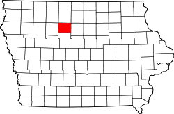 Location in the U.S. state of Iowa | |
 Iowa's location in the U.S. | |
| Founded | January 28, 1857 |
| Named for | Alexander von Humboldt |
| Seat | Dakota City |
| Largest city | Humboldt |
| Area | |
| • Total | 436 sq mi (1,129 km2) |
| • Land | 434 sq mi (1,124 km2) |
| • Water | 1.3 sq mi (3 km2), 0.3% |
| Population | |
| • (2010) | 9,815 |
| • Density | 23/sq mi (9/km2) |
| Congressional district | 4th |
| Time zone | Central: UTC−6/−5 |
| Website |
www |
Humboldt County is a county in the U.S. state of Iowa. As of the 2010 census, the population was 9,815.[1] The county seat is Dakota City.[2] The county was created in 1857 and named in honor of Alexander von Humboldt.
History
Founding
Iowa's entry to the union was approved by Congress on March 3, 1845, with statehood beginning on December 28, 1846, following approval of the state's constitution and boundaries. In order to establish county government across the state, the Iowa General Assembly passed an act on January 15, 1851 which created fifty counties in the half of the state where county government had not yet been established. Humboldt County was created by this act, containing its present area, as well as four townships in present-day Webster County: Jackson, Deer Creek, Badger, and Newark.[3] It was named after Alexander von Humboldt.[4] On January 21, 1855, an act merged the northern half of Humboldt County and Bancroft County into Kossuth County, with the southern half of Humboldt County merging into Webster County.[5]
The Sixth General Assembly passed another act, reestablishing Humboldt County. The act was passed on January 28, 1857 and went into effect on February 26.[6] However, an error omitted the lower four townships (Jackson, Deer Creek, Badger, and Newark) from returning to Humboldt County. The error was not caught until the next session of the general assembly, and the general assembly passed a bill redefining Humboldt County to include the four townships on March 11, 1858.[7] However, in the interceding time, the Constitution of Iowa came into effect, including the provision that "future laws altering county boundaries should be submitted to a vote of the people of the counties concerned and must be approved by them before going into effect".[8] In a court case originating in the disputed area, the Iowa Supreme Court was asked to decide which county court had original jurisdiction. In their clarification, they ruled the March 11, 1858 clarification of Humboldt County's boundaries unconstitutional, as it had not been submitted to a public vote in the counties involved. In his decision, Chief Justice Ralph P. Lowe wrote, "We are compelled to conclude that township 90, in ranges 27 to 30, west of the 5th principal meridian, is still in and forms a part of Webster county. Of course we can pay no attention to conjectural surmises and vague suspicions, which have been made and entertained in relation to some unfairness which may have been practiced in the final passage of the act of 1857, creating the county of Humboldt. If such was the case, no evidence of the fact has been presented to us."[9] The "vague suspicions" include a rumor that John Duncombe of Fort Dodge (namesake of Duncombe, Iowa and plaintiff in the lawsuit) had tricked Humboldt County into cedeing the southern four townships to Webster County "on loan", or was otherwise responsible for the "error".[10]
In 1872, Humboldt College was opened and closed in 1916 because there was no agreement with the county about taxation.[11]
Geography

According to the U.S. Census Bureau, the county has an area of 436 square miles (1,130 km2), of which 434 square miles (1,120 km2) is land and 1.3 square miles (3.4 km2) (0.3%) is water.[12]
Unlike all counties to its east and west, Humboldt County has only 12 townships. Although founded with the standard 16 townships in January 15, 1851, the county was removed from existence in 1855.[13]
Major highways
Adjacent counties
- Kossuth County (north)
- Wright County (east)
- Webster County (south)
- Pocahontas County (west)
Parks
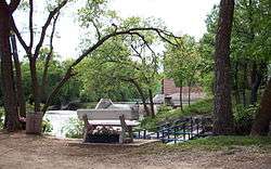
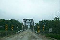
While Humboldt County does not have any state parks, it has county parks. South of Humboldt is Frank A. Gotch County Park. It is named for Frank Gotch, a world-champion, undefeated wrestler from Humboldt. The park is near his childhood farm and is also home to the confluence of the East and West Forks of the Des Moines River. The park features campgrounds and a well-known converted railroad bridge used by the Minneapolis and St. Louis Railway. The bridge is part of the Three Rivers Trail, a converted rail route that runs from Eagle Grove west to Rolfe.
Near Bradgate is the Willow Access Area. The terrain is very wooded. In south Rutland is Rose Mill Park. The area can be used for camping and also has access to the Rutland Dam and West Fork of the Des Moines River. The dam is being restored, and most of the park is new. The river is known for its forested limestone bluffs and grassy banks.
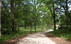
Further downriver near Humboldt is Oxbow Park, which contains boating access ramps and lots of scenic open space. The park's southern border is Iowa Highway 3, and south of that is Joe Sheldon County Park. The park is split into two sections, one mostly for camping and one focused on recreation. There is access to the West Fork of the Des Moines River from the lower part of the park.
Continuing along the river, the Lake Nokomis area begins, popular for its woods and small ponds. The Cottonwood Trail also runs through the area.
West of Livermore, Lott's Park allows access to Lott's Creek. The park has lots of benches and picnic tables. South of Ottosen is the Ottosen Marsh State Game Management Area, colloquially the Ottosen Potholes. East of Dakota City is the Dakota City River Park, near an old dam and the Humboldt County Historical Museum. Near the unincorporated community of Pioneer is the Pioneer Prairie Pothole Wildlife Area.
Demographics
| Historical population | |||
|---|---|---|---|
| Census | Pop. | %± | |
| 1860 | 332 | — | |
| 1870 | 2,596 | 681.9% | |
| 1880 | 5,341 | 105.7% | |
| 1890 | 9,836 | 84.2% | |
| 1900 | 12,667 | 28.8% | |
| 1910 | 12,182 | −3.8% | |
| 1920 | 12,951 | 6.3% | |
| 1930 | 13,202 | 1.9% | |
| 1940 | 13,459 | 1.9% | |
| 1950 | 13,117 | −2.5% | |
| 1960 | 13,156 | 0.3% | |
| 1970 | 12,519 | −4.8% | |
| 1980 | 12,246 | −2.2% | |
| 1990 | 10,756 | −12.2% | |
| 2000 | 10,381 | −3.5% | |
| 2010 | 9,815 | −5.5% | |
| Est. 2016 | 9,487 | [14] | −3.3% |
| U.S. Decennial Census[15] 1790-1960[16] 1900-1990[17] 1990-2000[18] 2010-2013[1] | |||
2010 census
The 2010 census recorded a population of 9,815 in the county, with a population density of 22.5939/sq mi (8.7235/km2). There were 4,684 housing units, of which 4,209 were occupied.[19]
2000 census

As of the census[20] of 2000, there were 10,381 people, 4,295 households, and 2,881 families residing in the county. The population density was 24 people per square mile (9/km²). There were 4,645 housing units at an average density of 11 per square mile (4/km²). The racial makeup of the county was 98.63% White, 0.11% Black or African American, 0.06% Native American, 0.23% Asian, 0.10% Pacific Islander, 0.40% from other races, and 0.47% from two or more races. 0.96% of the population were Hispanic or Latino of any race.
There were 4,295 households out of which 29.70% had children under the age of 18 living with them, 57.40% were married couples living together, 6.40% had a female householder with no husband present, and 32.90% were non-families. 29.80% of all households were made up of individuals and 16.30% had someone living alone who was 65 years of age or older. The average household size was 2.38 and the average family size was 2.94.
In the county, the population was spread out with 24.90% under the age of 18, 7.00% from 18 to 24, 24.60% from 25 to 44, 22.50% from 45 to 64, and 21.00% who were 65 years of age or older. The median age was 41 years. For every 100 females there were 95.70 males. For every 100 females age 18 and over, there were 92.20 males.
The median income for a household in the county was $38,201, and the median income for a family was $46,510. Males had a median income of $31,004 versus $22,312 for females. The per capita income for the county was $18,300. About 5.30% of families and 8.30% of the population were below the poverty line, including 13.80% of those under age 18 and 5.10% of those age 65 or over.
Communities
Cities
Ghost town
Townships
Population ranking
The population ranking of the following table is based on the 2010 census of Humboldt County.[21]
† county seat
| Rank | City/Town/etc. | Municipal type | Population (2010 Census)
|
|---|---|---|---|
| 1 | Humboldt | City | 4,690 |
| 2 | † Dakota City | City | 843 |
| 3 | Gilmore City (partially in Pocahontas County) | City | 504 |
| 4 | Livermore | City | 384 |
| 5 | Bode | City | 302 |
| 6 | Lu Verne (partially in Kossuth County) | City | 261 |
| 7 | Renwick | City | 242 |
| 8 | Thor | City | 186 |
| 9 | Rutland | City | 126 |
| 10 | Bradgate | City | 86 |
| 11 | Ottosen | City | 55 |
| 12 | Hardy | City | 47 |
| 13 | Pioneer | City | 23 |
Politics
| Year | Republican | Democratic | Third Parties |
|---|---|---|---|
| 2016 | 70.1% 3,568 | 24.6% 1,252 | 5.3% 267 |
| 2012 | 60.1% 3,099 | 38.2% 1,972 | 1.7% 87 |
| 2008 | 56.5% 2,895 | 42.2% 2,160 | 1.3% 68 |
| 2004 | 59.1% 3,162 | 40.1% 2,146 | 0.8% 42 |
| 2000 | 57.6% 2,846 | 39.5% 1,949 | 2.9% 145 |
| 1996 | 45.3% 2,236 | 42.2% 2,080 | 12.5% 617 |
| 1992 | 44.3% 2,299 | 34.0% 1,765 | 21.6% 1,121 |
| 1988 | 48.4% 2,594 | 50.6% 2,713 | 0.9% 50 |
| 1984 | 57.9% 3,396 | 41.0% 2,406 | 1.0% 61 |
| 1980 | 60.6% 3,575 | 31.2% 1,840 | 8.2% 484 |
| 1976 | 52.7% 3,075 | 45.8% 2,677 | 1.5% 89 |
| 1972 | 62.5% 3,622 | 35.6% 2,062 | 1.9% 108 |
| 1968 | 59.9% 3,239 | 35.9% 1,940 | 4.3% 231 |
| 1964 | 40.0% 2,250 | 60.0% 3,376 | 0.1% 4 |
| 1960 | 56.7% 3,537 | 43.3% 2,706 | 0.0% 0 |
| 1956 | 57.6% 3,747 | 42.4% 2,756 | 0.1% 4 |
| 1952 | 67.9% 4,534 | 31.8% 2,124 | 0.2% 16 |
| 1948 | 46.0% 2,498 | 52.6% 2,855 | 1.5% 79 |
| 1944 | 47.7% 2,525 | 52.0% 2,749 | 0.3% 16 |
| 1940 | 46.4% 2,853 | 53.2% 3,268 | 0.4% 22 |
| 1936 | 39.0% 2,262 | 59.0% 3,420 | 2.0% 115 |
| 1932 | 41.5% 2,028 | 57.4% 2,804 | 1.2% 57 |
| 1928 | 62.5% 2,828 | 37.1% 1,679 | 0.4% 16 |
| 1924 | 59.7% 2,841 | 7.8% 370 | 32.5% 1,547 |
| 1920 | 82.8% 3,577 | 15.8% 681 | 1.4% 61 |
| 1916 | 66.7% 1,676 | 32.2% 809 | 1.1% 28 |
| 1912 | 18.8% 477 | 24.9% 634 | 56.3% 1,432 |
| 1908 | 73.7% 1,818 | 23.8% 587 | 2.6% 63 |
| 1904 | 81.8% 1,950 | 15.5% 369 | 2.8% 66 |
| 1900 | 77.9% 2,214 | 20.9% 595 | 1.2% 34 |
| 1896 | 71.2% 2,010 | 27.7% 783 | 1.1% 31 |
See also
References
- 1 2 "State & County QuickFacts". United States Census Bureau. Archived from the original on July 11, 2011. Retrieved July 17, 2014.
- ↑ "Find a County". National Association of Counties. Archived from the original on May 31, 2011. Retrieved 2011-06-07.
- ↑ "Webster" (1913), p. 73.
- ↑ Gannett, Henry (1905). The Origin of Certain Place Names in the United States. Govt. Print. Off. p. 163.
- ↑ "Webster" (1913), p. 74.
- ↑ "Webster" (1913), p. 74.
- ↑ "Webster" (1913), pp. 74-75.
- ↑ "Webster" (1913), p. 75.
- ↑ "Webster" (1913), pp. 75-76.
- ↑ "About Humboldt County". 2011. Archived from the original on December 20, 2011. Retrieved December 5, 2011.
- ↑ "City of Humboldt History." City of Humboldt. Online History. Archived 2007-09-19 at the Wayback Machine. Retrieved August 10, 2010.
- ↑ "US Gazetteer files: 2010, 2000, and 1990". United States Census Bureau. 2011-02-12. Retrieved 2011-04-23.
- ↑ "Beaver Township, Dakota City". Humboldt County Historical Association. 2011. Archived from the original on April 26, 2012. Retrieved December 5, 2011.
|chapter=ignored (help) - ↑ "Population and Housing Unit Estimates". Retrieved June 9, 2017.
- ↑ "U.S. Decennial Census". United States Census Bureau. Archived from the original on May 12, 2015. Retrieved July 17, 2014.
- ↑ "Historical Census Browser". University of Virginia Library. Retrieved July 17, 2014.
- ↑ "Population of Counties by Decennial Census: 1900 to 1990". United States Census Bureau. Retrieved July 17, 2014.
- ↑ "Census 2000 PHC-T-4. Ranking Tables for Counties: 1990 and 2000" (PDF). United States Census Bureau. Retrieved July 17, 2014.
- ↑ "Population & Housing Occupancy Status 2010". United States Census Bureau American FactFinder. Retrieved May 17, 2011.
- ↑ "American FactFinder". United States Census Bureau. Archived from the original on September 11, 2013. Retrieved 2008-01-31.
- ↑ "Archived copy". Archived from the original on December 21, 2013. Retrieved February 10, 2013.
- ↑ Leip, David. "Dave Leip's Atlas of U.S. Presidential Elections". uselectionatlas.org. Retrieved 2018-04-26.
- Pratt, Harlow Munson (1913). History of Fort Dodge and Webster County, Iowa. 1. Chicago: The Pioneer Publishing Company. OCLC 6672352 – via Archive.org.
External links
| Wikimedia Commons has media related to Humboldt County, Iowa. |
Places adjacent to Humboldt County, Iowa | ||||||||||
|---|---|---|---|---|---|---|---|---|---|---|
| ||||||||||
Municipalities and communities of Humboldt County, Iowa, United States | ||
|---|---|---|
| Cities | ||
| Townships | ||
| Unincorporated community | ||
| Ghost town | ||
| Footnotes | ‡This populated place also has portions in an adjacent county or counties | |

Coordinates: 42°46′38″N 94°12′15″W / 42.77722°N 94.20417°W