Sioux City, Iowa
| Sioux City, Iowa | |
|---|---|
| City | |
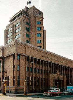
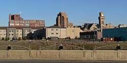 Sioux City skyline. | |
| Motto(s): "Successful, Surprising, Sioux City"[1] | |
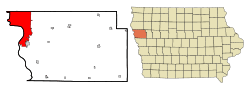 Location in Iowa | |
 Sioux City, Iowa Location in the United States | |
| Coordinates: 42°29′53″N 96°23′44″W / 42.49806°N 96.39556°WCoordinates: 42°29′53″N 96°23′44″W / 42.49806°N 96.39556°W | |
| Country | United States |
| State | Iowa |
| Counties | Woodbury, Plymouth |
| Founded | 1854 |
| Incorporated | 1857 |
| Government | |
| • Mayor | Bob Scott[2] |
| • City Manager | Robert Padmore |
| Area[3] | |
| • City | 59.49 sq mi (152.5 km2) |
| • Land | 58.35 sq mi (149.54 km2) |
| • Water | 1.14 sq mi (2.95 km2) |
| Elevation | 1,201 ft (366 m) |
| Population (2010)[4] | |
| • City | 82,684 |
| • Estimate (2016)[5] | 82,872 |
| • Rank |
US: 4th in Iowa 393rd in the US. |
| • Density | 1,449/sq mi (559.6/km2) |
| • Urban | 106,494 (US: 292nd) |
| • Metro | 168,714 (US: 241st) |
| Time zone | UTC−6 (Central) |
| • Summer (DST) | UTC−5 (Central) |
| ZIP codes | 51101, 51102, 51103, 51104, 51105, 51106, 51108, 51109, 51111 |
| Area code(s) | 712 |
| FIPS code | 19-73335 |
| GNIS feature ID | 0461653 |
| Website | City of Sioux City |

Sioux City (/suː/) is a city in Woodbury and Plymouth counties in the northwestern part of the U.S. state of Iowa. The population was 82,684 in the 2010 census, which makes it the fourth largest city in Iowa.[6][7] The bulk of the city is in Woodbury County, of which it is the county seat, though a small portion is in Plymouth County. Sioux City is located at the navigational head of the Missouri River. The city is home to several cultural points of interest including the Sioux City Public Museum, Sioux City Art Center and Sergeant Floyd Monument, which is a National Historical Landmark. The city is also home to Chris Larsen Park, commonly referred to as “the Riverfront,” includes the Anderson Dance Pavilion, Sergeant Floyd Riverboat Museum and Lewis and Clark Interpretive Center. Sioux City is the primary city of the five-county Sioux City, IA–NE–SD Metropolitan Statistical Area (MSA), with a population of 168,825 in 2010 and a slight increase to an estimated 168,921 in 2012.[8] The Sioux City–Vermillion, IA–NE–SD Combined Statistical Area had a population of 182,675 as of 2010 and has grown to an estimated population of 183,052 as of 2012.[8]
Sioux City is at the navigational head, or the most upstream point to which general cargo ships can travel, of the Missouri River, about 95 miles (153 km) north of the Omaha–Council Bluffs metropolitan area. Sioux City and the surrounding areas of northwestern Iowa, northeastern Nebraska and southeastern South Dakota are sometimes referred to as Siouxland, especially by local media and residents.
History

Iowa is in the tallgrass prairie of the North American Great Plains, historically inhabited by speakers of Siouan languages. The area of Sioux City was inhabited by Yankton Sioux when it was first reached by Spanish and French furtrappers in the 18th century. The first documented US citizens to record their travels through this area were Meriwether Lewis and William Clark during the summer of 1804. Sergeant Charles Floyd, a member of the Lewis and Clark Expedition, died here on August 20, 1804, the only death during the two and a half-year expedition.[9]

Sioux City was laid out in the winter of 1854-55.[10] It became a major Entrepôt to the western Plains, including Mormons heading to Salt Lake City and speculators heading to Wyoming gold fields.
In 1891, the Sioux City Elevated Railway was opened and became the third steam powered elevated rapid transit system in the world, and later the first electric-powered elevated railway in the world after a conversion in 1892. However, the system fell into bankruptcy and closed within a decade.[11]
The city gained the nickname "Little Chicago" during the Prohibition era due to its reputation for being a purveyor of alcoholic beverages.[12]
On July 19, 1989, United Airlines Flight 232 crash landed at Sioux Gateway Airport, killing 111 people, but 184 survived the crash and ensuing fire due to outstandingly quick performances by fire and emergency local teams that earned them several National Congress Medals, given by President George H. W. Bush in 1990.
Geography and climate
Geography
Sioux City is located at 42°29′53″N 96°23′45″W / 42.49806°N 96.39583°W (42.497957, −96.395705).[13] Sioux City is at an altitude of 1,135 feet (345.9 m) above sea level.
According to the United States Census Bureau, the city has a total area of 58.49 square miles (151.49 km2), of which, 57.35 square miles (148.54 km2) is land and 1.14 square miles (2.95 km2) is water.[3]
Climate
Typical of Iowa, Sioux City has a humid continental climate, with very warm, humid summers, cold, dry winters, and wide temperature extremes; it is part of USDA Hardiness zone 5a.[14] The normal monthly mean temperature ranges from 20.4 °F (−6.4 °C) in January to 74.3 °F (23.5 °C) in July. On average, there are 25 days that reach 90 °F (32 °C) or higher, 52 days that do not climb above freezing, and 17 days with a low of 0 °F (−18 °C) or below annually. The average window for freezing temperatures is October 1 thru April 26, allowing a growing season of 157 days. Extreme temperatures officially range from −35 °F (−37 °C) on January 12, 1912 up to 111 °F (44 °C) on July 4 and 17, 1936 as well as July 11, 1939; the record cold daily maximum is −22 °F (−30 °C) on February 8, 1899, while, conversely, the record warm daily minimum is 86 °F (30 °C) on August 18, 1936.
Precipitation is greatest in May and June and averages 27.7 in (700 mm) annually, but has ranged from 14.33 in (364 mm) in 1976 to 41.10 in (1,044 mm) in 1903. Snowfall averages 34.8 in (88 cm) per season, and has historically ranged from 6.9 in (18 cm) in 1895–96 to 65.9 in (167 cm) in 1961–62; the average window for measurable (≥0.1 in or 0.25 cm) snowfall is November 8 thru April 7, although snow in October occurs several times per decade. On May 14, 2013, the high temperature reached 106 °F (41 °C), setting a new all-time May record high, along with a 77 °F (43 °C) rise from the morning of the 12th.[15]
| Climate data for Sioux City, Iowa (Sioux Gateway Airport), 1981–2010 normals, extremes 1889–present | |||||||||||||
|---|---|---|---|---|---|---|---|---|---|---|---|---|---|
| Month | Jan | Feb | Mar | Apr | May | Jun | Jul | Aug | Sep | Oct | Nov | Dec | Year |
| Record high °F (°C) | 71 (22) |
75 (24) |
91 (33) |
98 (37) |
106 (41) |
108 (42) |
111 (44) |
108 (42) |
103 (39) |
96 (36) |
82 (28) |
71 (22) |
111 (44) |
| Average high °F (°C) | 30.5 (−0.8) |
34.9 (1.6) |
47.5 (8.6) |
62.3 (16.8) |
73.0 (22.8) |
82.1 (27.8) |
85.5 (29.7) |
83.3 (28.5) |
76.2 (24.6) |
63.3 (17.4) |
46.4 (8) |
32.1 (0.1) |
59.8 (15.4) |
| Average low °F (°C) | 10.2 (−12.1) |
15.2 (−9.3) |
25.5 (−3.6) |
36.8 (2.7) |
48.7 (9.3) |
58.6 (14.8) |
63.2 (17.3) |
60.9 (16.1) |
50.6 (10.3) |
38.0 (3.3) |
25.2 (−3.8) |
13.0 (−10.6) |
37.2 (2.9) |
| Record low °F (°C) | −35 (−37) |
−31 (−35) |
−22 (−30) |
−2 (−19) |
23 (−5) |
38 (3) |
41 (5) |
37 (3) |
24 (−4) |
5 (−15) |
−9 (−23) |
−28 (−33) |
−35 (−37) |
| Average precipitation inches (mm) | 0.62 (15.7) |
0.67 (17) |
2.00 (50.8) |
2.95 (74.9) |
3.74 (95) |
3.89 (98.8) |
3.44 (87.4) |
3.23 (82) |
2.96 (75.2) |
2.13 (54.1) |
1.31 (33.3) |
0.80 (20.3) |
27.74 (704.6) |
| Average snowfall inches (cm) | 6.7 (17) |
6.6 (16.8) |
6.5 (16.5) |
1.8 (4.6) |
0 (0) |
0 (0) |
0 (0) |
0 (0) |
0 (0) |
1.0 (2.5) |
4.4 (11.2) |
7.8 (19.8) |
34.8 (88.4) |
| Average precipitation days (≥ 0.01 in) | 6.3 | 6.0 | 8.3 | 9.9 | 11.3 | 10.9 | 9.5 | 9.4 | 8.3 | 7.4 | 6.7 | 6.9 | 100.9 |
| Average snowy days (≥ 0.1 in) | 5.9 | 5.0 | 3.8 | 1.4 | 0 | 0 | 0 | 0 | 0 | 0.5 | 3.2 | 5.7 | 25.5 |
| Average relative humidity (%) | 72.2 | 72.4 | 69.7 | 61.6 | 62.3 | 65.5 | 69.2 | 72.0 | 70.8 | 66.2 | 72.3 | 75.9 | 69.2 |
| Mean monthly sunshine hours | 171.1 | 165.5 | 211.9 | 232.3 | 271.8 | 310.2 | 330.9 | 292.9 | 235.5 | 209.3 | 146.4 | 138.3 | 2,716.1 |
| Percent possible sunshine | 58 | 56 | 57 | 58 | 60 | 68 | 71 | 68 | 63 | 61 | 50 | 49 | 61 |
| Source: NOAA (relative humidity and sun 1961–1990)[16][17][18], The Weather Channel[19] | |||||||||||||
Demographics
| Historical population | |||
|---|---|---|---|
| Census | Pop. | %± | |
| 1870 | 3,401 | — | |
| 1880 | 7,366 | 116.6% | |
| 1890 | 37,806 | 413.3% | |
| 1900 | 33,111 | −12.4% | |
| 1910 | 47,828 | 44.4% | |
| 1920 | 71,227 | 48.9% | |
| 1930 | 79,183 | 11.2% | |
| 1940 | 82,364 | 4.0% | |
| 1950 | 83,991 | 2.0% | |
| 1960 | 89,159 | 6.2% | |
| 1970 | 85,925 | −3.6% | |
| 1980 | 82,003 | −4.6% | |
| 1990 | 80,505 | −1.8% | |
| 2000 | 85,013 | 5.6% | |
| 2010 | 82,684 | −2.7% | |
| Est. 2016 | 82,872 | [5] | 0.2% |
| U.S. Decennial Census[20] | |||
2010 census
As of the census[4] of 2010, there were 82,684 people, 31,571 households, and 20,144 families residing in the city. The population density was 1,441.7 inhabitants per square mile (556.6/km2). There were 33,425 housing units at an average density of 582.8 per square mile (225.0/km2). The racial makeup of the city was 80.6% White, 2.9% African American, 2.6% Native American, 2.7% Asian, 0.1% Pacific Islander, 7.4% from other races, and 3.7% from two or more races. Hispanic or Latino of any race were 16.4% of the population.
There were 31,571 households of which 34.3% had children under the age of 18 living with them, 44.2% were married couples living together, 13.8% had a female householder with no husband present, 5.9% had a male householder with no wife present, and 36.2% were non-families. 29.4% of all households were made up of individuals and 11.1% had someone living alone who was 65 years of age or older. The average household size was 2.54 and the average family size was 3.14.
The median age in the city was 33.7 years. 26.6% of residents were under the age of 18; 11.4% were between the ages of 18 and 24; 25.6% were from 25 to 44; 24% were from 45 to 64; and 12.4% were 65 years of age or older. The gender makeup of the city was 49.2% male and 50.8% female.
2000 census
As of the census of 2000, there were 85,013 people, 32,054 households, and 21,091 families residing in the city. The population density was 1,551.3 people per square mile (599.0/km²). There were 33,816 housing units at an average density of 617.1 per square mile (238.3/km²). The racial makeup of the city was 85.23% White, 2.41% African American, 1.95% Native American, 2.82% Asian, 0.04% Pacific Islander, 5.27% from other races, and 2.28% from two or more races. Hispanic or Latino of any race were 10.89% of the population.
There were 32,054 households of which 33.4% had children under the age of 18 living with them, 49.1% were married couples living together, 12.2% had a female householder with no husband present, and 34.2% were non-families. 27.7% of all households were made up of individuals and 11.3% had someone living alone who was 65 years of age or older. The average household size was 2.57 and the average family size was 3.14.
Age spread: 27.1% under the age of 18, 11.0% from 18 to 24, 28.5% from 25 to 44, 20.2% from 45 to 64, and 13.3% who were 65 years of age or older. The median age was 33 years. For every 100 females, there were 95.4 males. For every 100 females age 18 and over, there were 92.2 males.
The median income for a household in the city was $37,429, and the median income for a family was $45,751. Males had a median income of $31,385 versus $22,470 for females. The per capita income for the city was $18,666. About 7.9% of families and 11.2% of the population were below the poverty line, including 15.0% of those under age 18 and 7.8% of those age 65 or over. This compares with a median household income for the state of Iowa of $54,736 and an Iowa median family income of $69,382.[21] (current data from State of Iowa, see also List of U.S. states by income for historical data).
Metropolitan area
As of the 2010 census, the Sioux City Metropolitan Area had 168,825 residents in five counties; the population was estimated at 168,921 in 2012.[8] As defined by the Office of Management and Budget, the counties comprising the metropolitan area are (in descending order of population):
Economy

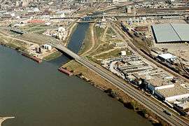
Floyd River in Sioux City
- Top employers
Statistics from Sioux City's 2010 Comprehensive Annual Financial Report[22]
| Rank | Employer | Number of Employees |
% of Total City Employment |
|---|---|---|---|
| 1 | Tyson Fresh Meats | 4,768 | 11.30% |
| 2 | Sioux City Community School District | 2,057 | 4.87% |
| 3 | Mercy Medical Center | 1,800 | 4.27% |
| 4 | St. Luke's Regional Medical Center | 1,229 | 2.91% |
| 5 | City of Sioux City | 1,024 | 2.43% |
| 6 | 185th Air Refueling Wing | 950 | 2.25% |
| 7 | Morningside College | 880 | 2.09% |
| 8 | Curly's Foods | 700 | 1.66% |
| 8 | Tri-State Nursing | 700 | 1.66% |
| 10 | MidAmerican Energy | 659 | 1.56% |
| Totals | 14,767 | 34.99% |
Arts and culture
- The Sioux City Public Museum was originally located in a Northside neighborhood of fine Victorian mansions. The portico-and-gabled stone building was originally the home of the banker, John Peirce, and was built in 1890. The museum was recently relocated to downtown Sioux City, where it features Native American, pioneer, early Sioux City, and natural history exhibits.
- The Sioux City Art Center, located Downtown, was formed in 1938 as part of the WPA's support of the arts.[23] The Art Center supports artists from Iowa and the greater Midwest. Also, the Center has a general program of acquisition of work by national and international artists, including important works by Thomas Hart Benton, Salvador Dalí, Käthe Kollwitz, Robert Motherwell, Claes Oldenburg, James Abbott McNeill Whistler, and Grant Wood.
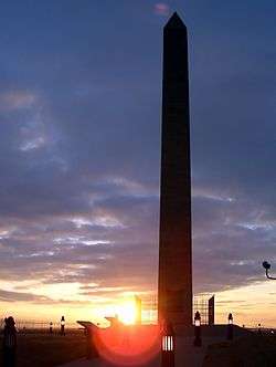
- The Sergeant Floyd Monument commemorates the burial site of U.S. Army Sergeant Charles Floyd, the only man to die on the Lewis and Clark Expedition.[9] It is a National Historic Landmark, with its prominent 100-foot (30 m) obelisk situated on 23 acres (93,000 m2) of parkland, high on a river bluff with a view of the Missouri River valley.
- Chris Larsen Park, informally known as "The Riverfront," includes the Anderson Dance Pavilion, the Sergeant Floyd Riverboat Museum and the Lewis and Clark Interpretive Center, opened in 2004. Missouri River development began in 2005 with the opening of the MLR Tyme Marina area, which includes Bev's on the River, an upscale restaurant.
 | |
|
|
- Milwaukee Railroad Shop is a 31.5 acre facility that is being renovated by the Siouxland Historical Railroad Association. It includes a 4-6-2 Pacific type steam locomotive Great Northern 1355, a model railroad exhibit, as well as multiple buildings including the roundhouse that are open to the public.
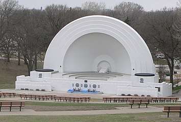
- Grandview Park is located north of the downtown area, up from Rose Hill, between The Northside and The Heights. The Municipal Bandshell is located in the park with Sunday evening municipal band concerts. The Saturday in the Park music festival began in 1991 and is held there annually on a weekend close to the Fourth of July holiday. Behind the bandshell is a rose garden with an arbor and trellises which has been a site for outdoor weddings, prom and other special occasion photographs, and for children to play during the Sunday evening band concerts and other events. Downtown is also home to the largest historic theatre in Iowa, the Orpheum Theatre.
- Theatre is produced in Sioux City by three main entities, the Sioux City Community Theatre (SCCT), LAMB Arts Regional Theatre, and Shot in the Dark Productions. Each of these produce a full season of shows each year.
Neighborhoods, commercial districts, and suburbs
City neighborhoods
Nearby communities
- Elk Point, South Dakota is 15 miles north of Sioux City off of Interstate 29 with a population of 1,963 as of 2010.
- Dakota City, Nebraska is just south of South Sioux City with a population of 1,919 as of 2010. It is the county seat of Dakota County.
- Dakota Dunes, South Dakota is an unincorporated "master-planned community" just west of Sioux City in the extreme southeast corner of South Dakota with a population of 2,554 as of 2011.[24] Construction began circa 1989. Up-scale homes, suburban-style office parks, and a country club golf course designed by Arnold Palmer characterize this area.
- Hinton, Iowa is 6 miles north of Sioux City on Highway 75 with a population of 928 as of 2010.
- Lawton, Iowa is 8 miles on Highway 20 with a population of 908 as of 2010.
- Merrill, Iowa is 13 miles north of Sioux City on Highway 75 with a population of 755 as of 2010.
- Le Mars, Iowa is 20 miles north of Sioux City off of Highway 75 with a population of 9,826 as of 2010.
- Jefferson, South Dakota is 9 miles north of Sioux City off of Interstate 29 with a population of 547 as of 2010.
- North Sioux City, South Dakota is just across the Big Sioux River in Union County with a population of 2,575 as of 2010.
- Sergeant Bluff is a mainly residential suburb adjacent to the southern city limits of Sioux City with a population of 4,227 as of 2010, and is less than a mile east of the Sioux City Airport.
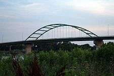
- South Sioux City, Nebraska is directly across the Missouri River in Dakota County. With nearly 13,353 residents as of 2010, it is the largest suburb of Sioux City. It was an All America City in 2003. Two bridges—the Veterans Memorial Bridge and the Interstate 129 bridge—connect Sioux City with South Sioux City.
- Vermillion, South Dakota is home to the University of South Dakota, a Division I university located 33 miles northwest of Sioux City with a population of 10,571 as of 2010.
Parks and recreation
- Stone State Park is in the northwest corner of the city, overlooking the South Dakota/Iowa border. Stone Park is near the northernmost extent of the Loess Hills, and is at the transition from clay bluffs and prairie to sedimentary rock hills and bur oak forest along the Iowa side of the Big Sioux River. The park is used by picnickers, day hikers, and for mountain biking.
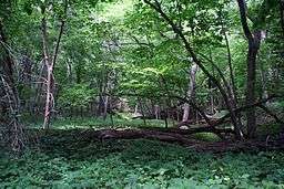
- Dorothy Pecaut Nature Center is a destination nature preserve for Woodbury County, and is located within the boundaries of Stone State Park. The butterfly garden is unique to the area; wild turkeys and white-tail deer are commonly sighted from the well-marked trails.
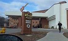
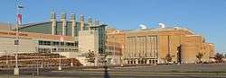
- Downtown entertainment venues include the Hard Rock Hotel & Casino, the 10,000-seat Tyson Event Center/ Gateway Arena, Sioux City Orpheum Theatre, Promenade Cinema 14 and the Anderson Dance Pavilion which overlooks the Missouri River.
- Pulaski Park is named for the Polish General Kazimierz Pułaski, who fought in the American Revolution. This park features baseball diamond facilities, and is located in western Morningside along old U.S. Highway 75 (South Lewis Blvd.). It is largely built on the filled lakebed of Half Moon Lake, which was originally created in the 1890s by the excavation of fill dirt to build the approaches for the iron railroad bridge spanning the Missouri near the stockyards. The neighborhood on the bluff overlooking the park was historically settled by Lithuanian and Polish immigrants, many of whom worked in the meatpacking industry during the early 20th century.
- Latham Park is located in a residential area of Morningside, and is the only privately owned and maintained open-to-the-public park within the city limits. It was left in trust in 1937 under the terms of Clara Latham's will; her family had built the house on 1-acre (4,000 m2) of ground in 1915. The house and grounds are currently being restored by the Friends of Latham Park.
- First Bride's Grave is tucked in a corner pocket of South Ravine Park, lies a series of paths, trails, and steps leading to the grave of the First Bride of Sioux City, Rosalie Menard. She was the first bride of a non-Native American to be wed in Sioux City, Iowa, thus receiving her title.
- War Eagle Park is named for the Yankton Sioux chief Wambdi Okicize (d. 1851) who befriended early settlers. A monument overlooks the confluence of the Big Sioux and Missouri Rivers. The sculpture represents the chief in his role as a leader and peacemaker, wearing the eagle feather bonnet and holding the ceremonial pipe.
- Riverside Park is located on the banks of the Big Sioux River. One of the oldest recreational areas of the city, it is home to the Sioux City Boat Club and Sioux City Community Theater. The park is on land that once belonged to the first white settler in the area, Théophile Bruguier; his original cabin is preserved in the park.[25]
- Bacon Creek Park is located northeast of Morningside and features a scenic walking trail, dog park, picnic shelters, and playground equipment.
Golf courses, city parks, and aquatics: Sioux City is also home to several municipal public golf courses, including Floyd Park in Morningside, Green Valley near the Southern Hills, Sun Valley on the northern West Side, and Hidden Acres in nearby Plymouth County. Sioux City also has a number of private golf clubs, including Sioux City Country Club, and Whispering Creek Golf Club. The city has over 1,132 acres (5 km2) of public parkland located at 53 locations, including the riverfront and many miles of recreation trails. Five public swimming pools/aquatics centers are located within Sioux City neighborhoods.
Education
- Public schools
The Sioux City Community School District serves 13,480 students[26] living in Sioux City; there are three public high schools West High School, North High School, East High School (grades 9-12), three public Middle Schools, West Middle, North Middle, and East Middle (grades 6-8), and 19 Elementary Schools (grades K-5).[27]
Because of sprawl, districts around Sioux City continue to grow at dramatic rates. South Sioux City, Hinton, North Sioux City, Lawton, Bronson, Elk Point, Jefferson, Vermillion, Le Mars, Hawarden, Akron, Westfield, Ponca, Sergeant Bluff, Wayne, Sioux Center, along with other school districts that serve many metro-area students.
- Private schools
Bishop Heelan Catholic Schools is a centralized private Catholic School System that includes six schools: They teach preschool through twelfth grade.
Siouxland Community Christian School educates grades K-12.
- Advanced education
Sioux City is home to Briar Cliff University, Morningside College, Western Iowa Tech Community College, St. Lukes College of Nursing, Bellevue University outreach center and the Tri-State Graduate Center.
City ratings
Money recognized Sioux City in its August 2010 issue of the "Best Places To Live".[28] Sioux City is no longer on the list of the top 50 in 2016.[29]
Sioux City has a crime rate that is 100% higher than the average for Iowa and 63% higher than the national average. The violent crime rate is 47% above the Iowa average and 13% higher than the national average, based on the FBI's uniform crime reports for the year of 2015.[30] According to the report this represented an 11% increase over the prior year.
In 2008, 2009,[31] 2012, 2013 and 2015 the Sioux City Tri-State Metropolitan Area was recognized by Site Selection as the top economic development community in the United States for communities with populations between 50,000 and 200,000 people. In March 2013, Site Selection also recognized Sioux City as the 4th Top Metro area in the Midwest Region behind 1st place Kansas City, 2nd place Minneapolis–Saint Paul and 3rd place Omaha-Council Bluffs. Sioux City was also ranked 1st in regards to Metro Populations between 50,000 and 200,000.[32]
Forbes placed the Sioux City metro in the Top 15 Best Small Places for Businesses and Careers in 2011. By 2015 it had fallen to number 54 on the list.[33] MSN.com ranked the area the #2 Most Livable Bargain Market.[34] The Daily Beast, an American news reporting website, placed Sioux City on their list of The Top 40 Drunkest Cities in America, with a ranking of 14th.[35] According to a 2015 University of Iowa study for the Iowa Initiative for Sustainable Communities,[36] blight and disinvestment are serious problems in the downtown core as investment has shifted to suburbs.[37]
Media
Television stations
- KTIV, Channel 4, NBC affiliate (4.1); CW affiliate (4.2); MeTV affiliate (4.3)
- KCAU-TV, Channel 9, ABC affiliate
- KMEG, Channel 14, CBS affiliate (14.1); Decades affiliate (14.2)
- KSIN, Channel 27, PBS member station
- KPTH, Channel 44, Fox affiliate (44.1); MyNetworkTV affiliate and this TV affiliate (44.2); Grit affiliate (44.3)
Radio stations
- FM stations
- K-LOVE, 88.9, contemporary Christian music. Also can be received on 107.5 from Castana, Iowa.
- KMSC, 92.9, operated by Morningside College
- KWIT, 90.3, public radio, operated by Western Iowa Tech Community College
- KGLI, 95.5, "KG95" -- adult contemporary; previously played top 40; signed on in 1983
- KSEZ, 97.9, "Z98"—plays rock music (classic and new rock); previously top 40 station "Rock 98" in the 1980s
- KKMA, 99.5, "Classic Rock 99.5"—plays classic rock; formerly classic hits and adult contemporary "Magic 99"; call letters were KZZL in the early 1980s as an easy listening format Home of Iowa State Cyclones athletics
- KKYY, 101.3, "Y101.3" -- country music; the newest FM signal in the market
- KQNU, 102.3, ("Q 102.3") -- an "adult hits" station. It has been under the names Star, Bob, Jack, and New 102.3.
- KTFC, 103.3, Religious radio station ("Midwest Bible Radio")
- WNAX, 104.1, country; broadcasts from Yankton, South Dakota; low-power translator K283AG broadcasts at 104.5 FM in Sioux City, but both frequencies are audible in Sioux City. Previously oldies/classic hits KCLH; was top 40 KQHU "Q104" in 1990.
- KSUX, 105.7, "The SuperPig, K-Sioux 105.7"; has played country music since the signal went on-air in the fall of 1990.
- KSFT-FM, 107.1, "107.1 KISS FM" -- top 40 station as of March 13, 2006; previously played adult contemporary; signed on in the mid-1990s.
- KFHC-FM Catholic radio station featuring programming from EWTN.
- AM stations
- WNAX, 570, talk radio and farm news from Yankton, South Dakota
- KMNS, 620, sports talk radio; was previously "62 Country"
- KSCJ, 1360, talk radio; call letters derive from the Sioux City Journal, which once owned the station
- KWSL, 1470, is currently broadcasting Spanish language music under the 'La Preciosa' branding
- Sioux City Journal, daily newspaper serving greater Sioux City area, including Iowa, Nebraska and South Dakota.
- Dakota County Star, weekly newspaper serving northeast Nebraska.
- Sioux City Hispanos Unidos, bi-weekly Spanish readers paper.
- The Weekender, weekly arts and entertainment magazine serving the Sioux City metro area east into Western Iowa and north to the South Dakota border.
- Siouxland Magazine, quarterly magazine with community/lifestyle features.
Sports
- The Sioux City Bandits are an indoor football team that play in Champions Indoor Football. The Bandits play their home games at the Tyson Events Center.
- The Sioux City Explorers are an independent baseball team playing in the American Association. The Explorers play their home games at Lewis and Clark Park. They have been to the league playoffs five times.
- The Sioux City Musketeers are a junior hockey team based in Sioux City. They play in the United States Hockey League (USHL). They play their home games at the Tyson Events Center. Their first year of hockey was in 1972. The Musketeers have won the gold cup in the 1985-1986 season, the National Runner-up twice (1993–94, 1995–96), the Anderson Cup three times (1981–82, 1985–86, 2016–17), the Clark Cup three times (1981–82, 1985–86, 2001–02), and Western Division Champions for the 2004-05, and 2016-17 seasons.
- The Sioux City Roller Dames are a non-profit roller derby corporation. The Roller Dames play all home games at the Longlines Family Recreation Center. The Dames hosted their first tournament in November 2008.
- In the late 19th century, the Sioux City Cornhuskers played baseball in the Western League. After a five-year stint in St. Paul, Minnesota, the league changed its name to the American League, and the team moved to Chicago, where it continues today as the Chicago White Sox.
- The Sioux City Stampede play amateur outdoor football in the Midwest Football Alliance.
The Sioux City Swine- Official City Rugby Team.
Transportation
Highways
Interstate 29 is a major controlled-access highway in Sioux City and the surrounding area providing easy access of the 20 mile stretch covering Sioux City and the majority of its suburbs. It approaches the city from Omaha to the south before curving northwest along the Missouri River near downtown. The highway then enters South Dakota and curves back to the north as it approaches Sioux Falls. Interstate 129 is an auxiliary Interstate that connects South Sioux City, Nebraska to the south side of Sioux City and works as a bypass for travelers to other surrounding suburbs. Interstate 129 also interconnects with U.S. Route 75 which is in expansion to expressway form connecting Sioux City to Worthington, Minnesota. U.S. Route 20, the longest road in the United States spanning 3,365 mi (5,415 km) is also in the works of expanding from a two-lane highway to four-lanes from Sioux City to Dubuque, Iowa which will provide faster and easier access comparable to Interstate 80 in Iowa. Sioux City operates automatic speed cameras on interstate highways. The cameras are operated by Redflex Holdings and are reported to provide approximately $4.5 million per year for the city budget.[38] The state of South Dakota has been refusing to provide addresses associated with licence plates due to the large number of South Dakota residents fined by Sioux City.[39][40][41][42]
Public transportation
Sioux City Transit, the local public transit organization, operates several bus lines within the city. Buses transfer downtown in the Martin Luther King Jr. Transportation Center at 505 Nebraska Street.[43] The Sioux City Paratransit serves members of the community who would otherwise not be able to travel by providing door to door service.[44]
Air travel
The city is served by Sioux Gateway Airport (SUX) 6 mi (9.7 km) to its south where American Airlines' affiliate American Eagle began service to Chicago in 2012.[45]
Charter flights are also available here. Currently there are two flights to Dallas (DFW).
Others
Jefferson Lines runs long-distance bus routes to Sioux City. Non-Transfer destinations include Winnipeg, Kansas City, Minneapolis, and Omaha.
Sioux City also has several private taxi companies that operate within the city.
There is no established water or rail passenger transportation in the area. The last passenger train was the Illinois Central's Hawkeye, a daily train to Chicago via Waterloo, Dubuque and Rockford, discontinued in 1971.[46]
Big Soo Terminal offers barge transportation.[47]
Notable people
- John W. Aldridge, born in Sioux City, grew up in Tennessee, literary critic, author
- Jim Aton, jazz bassist, pianist, vocalist and composer with Billie Holiday, Bill Evans, Anita O'Day, others
- Dave Bancroft, Major League Baseball Hall of Fame shortstop; nicknamed "Beauty"
- Emmett Barrett, football player
- Joe Bisenius, Philadelphia Phillies relief pitcher, graduate of Bishop Heelan Catholic High School
- Tommy Bolin, born in Sioux City, member of Deep Purple and the James Gang, also had a solo career
- Bread of Stone an American contemporary Christian music and pop rock band formed in 2004.
- Mildred Brown, African-American journalist, worked in Iowa as teacher before moving to Omaha and founding Omaha Star
- Macdonald Carey, actor; the longtime patriarch on Days of Our Lives
- Paul B. Carpenter, California state legislator; born in Sioux City
- Matt Chatham, NFL linebacker, born in Newton, Iowa, graduate of North High School
- Eli Chesen, psychiatrist and writer
- Ron Clements, Disney animator, co-director of The Little Mermaid, Aladdin and The Princess and the Frog
- Vern Clark, former Chief of Naval Operations (CNO) in the United States Navy
- Carroll Edward Cole Serial Killer.
- Dave Croston (1963– ), former NFL player for Green Bay Packers[48]
- Colonel George E. "Bud" Day, U.S. Air Force, Vietnam POW, recipient of the Medal of Honor; the United States' most highly decorated officer since General Douglas MacArthur; Sioux City's airport is named Colonel Bud Day Field in his honor, as is 6th Street (Honorable Bud Day Street)
- W. Edwards Deming, born in Sioux City but raised in Polk City; quality-control expert, helped improve Japan's quality control
- Todd Doxzon, football player
- Sharon Farrell (1940– ), actress (birth name Sharon Forsmoe)[49]
- Tommy Lee Farmer, criminal, first person in US convicted under Three-Strikes Law[50]
- Vergilius Ferm (1896-1974), philosopher, historian, and Compton Professor of Philosophy at the College of Wooster.
- Bruce Forbes, author, professor of Religious Studies Morningside College relationship to Sioux City
- For Today, a Christian metal band signed to Razor & Tie Records
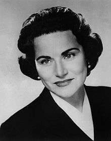
- Esther and Pauline Friedman, better known as Ann Landers and Abigail Van Buren, respectively; advice columnists; both born in Sioux City and graduates of Central High School
- Peggy Gilbert, jazz saxophonist and bandleader
- Dan Goldie, tennis player, winner of two ATP singles titles
- Fred Grandy, television actor who played Gopher Smith on The Love Boat; later became a U.S. congressman, CEO of Goodwill, and a radio personality for WMAL in Washington, D.C.
- Dick Green, former MLB second baseman with Kansas City and Oakland Athletics, raised in South Dakota
- Marcus Hahnemann, goalkeeper for United States men's national soccer team
- William L. Harding (1877–1934), born in Sibley, the 22nd Governor of Iowa 1917–1921[51]
- Jules Harlow, conservative Jewish rabbi and liturgist
- Matthew C. Harrison, 13th president of the Lutheran Church–Missouri Synod
- Tim Hauff, jazz bassist, performed with Herbie Hancock, Wayne Shoter, Bruce Forman, others
- Alan Hurwitz, born in Sioux City, 10th president of Gallaudet University
- Kirk Hinrich, professional basketball player
- J.B.E. Hittle, author and historian
- Noah Holcomb, professional cyclist
- Harry Hopkins, Secretary of Commerce, moved to Council Bluffs shortly after birth, advisor to FDR during World War II
- Shelby Houlihan competed in the 5000m in the 2016 Rio Olympics. Currently holds the American Record in the 5000.
- Fred Jackson, born in Fort Worth, Texas, attended Coe in Cedar Rapids; played football for Bandits and later NFL's Buffalo Bills
- Ryan Kisor, jazz trumpeter
- Judy Kimball, LPGA champion golfer, member of Iowa Sports Hall of Fame
- George Koval (1913–2006), Soviet atomic spy and only Soviet agent to infiltrate the Manhattan Project
- Jerry Lacy, actor of theatre and television and films, primarily known for roles in the Gothic soap opera Dark Shadows
- Kian Lawley, Social Media Star, YouTuber and Actor, best known for being a member of O2L, a YouTube collab channel alongside JC Caylen.
- Dave Loebsack, U.S. congressman for Iowa's 2nd congressional district
- Al McIntosh, born in Park River, North Dakota, newspaper editor whose columns are featured in Ken Burns' The War
- Jerry Mathers, actor, played Beaver Cleaver on TV's Leave It to Beaver
- Daniel Matousek, lead singer and guitarist for The Velaires, graduate of Central High School
- John Melcher, U.S. Senator from Montana from 1977 to 1989
- Iris Meredith, actress
- Big Miller (Clarence Horatius Miller), jazz and blues singer and double bassist
- Constance Moore, singer and actress, star of 1940s films
- Marshall F. Moore, 7th Governor of Washington Territory[52]
- John Mosher, jazz bassist, composer, with Cal Tjader, Brew Moore, Earl Hines, Tennessee Ernie Ford
- Melissa Ohden, Christian and pro-life public speaker
- John Osborn, tenor
- Lori Petty, born in Chattanooga, Tennessee, actress best known for her starring role in A League of Their Own
- Frances Rafferty, MGM film actress of the 1940s, also known for TV sitcom December Bride
- Max Rafferty, brother of Frances Rafferty; California State Superintendent of Public Instruction from 1963 to 1971, was reared in Sioux City
- John Redwine, Iowa state senator and physician, lived in Sioux Falls
- Ann Royer, painter, sculptor
- Laurens Shull, All-American football player killed in France during World War I
- Edward J. Sperling, born in Slutsk, Belarus, Jewish writer and humorist
- Paul Splittorff, born in Evansville, Indiana, former Major League Baseball pitcher, attended college in Sioux City
- Morgan Taylor, athlete, set 400-meter hurdles Olympic record while winning gold medal in 1924, also NCAA champion, 1928 and 1932 Olympic bronze medalist
- Morgan Thomas, jazz trombonist with Louis Prima Orchestra, recorded prolifically with Prima and Keely Smith in the 1950s and 1960s
- Gertrude Van Wagenen, Yale professor, pioneer in reproductive biology, primate research
- Ted Waitt, co-founder of Gateway, Inc.
- Brian Wansink, Cornell University professor and author of Mindless Eating: Why We Eat More Than We Think
- Pierre Watkin, actor in radio, films and TV from 1930s-1950s; played editor Perry White in original Superman serials
- Tony Watson, MLB pitcher for the Pittsburgh Pirates
- Kathleen Weaver, writer and editor
- Brandon Wegher, football player for NFL's Carolina Panthers
- Don Wengert, MLB pitcher from 1995–2001
- Gerald W. Wolff, historian of American West and Indians; lived in Sioux City
- Paul Zaeske, football player
Sister cities


See also
- Siouxland, the vernacular region in which Sioux City, Iowa, is located
References
- ↑ City of Sioux City. "City of Sioux City".
- ↑ "Mayor Bob Scott", "Sioux City Journal" January 3, 2012. Retrieved on January 8, 2012.
- 1 2 "US Gazetteer files 2010". United States Census Bureau. Archived from the original on 2012-01-24. Retrieved 2012-05-11.
- 1 2 "American FactFinder". United States Census Bureau. Retrieved 2012-05-11.
- 1 2 "Population and Housing Unit Estimates". Retrieved June 9, 2017.
- ↑ "Population & Housing Occupancy Status 2010". United States Census Bureau American FactFinder. Archived from the original on July 21, 2011. Retrieved May 5, 2011.
- ↑ "Data from the 2010 Census". State Data Center of Iowa. Archived from the original on July 18, 2011. Retrieved May 5, 2011.
- 1 2 3 US Census Bureau. "Metropolitan and Micropolitan Statistical Areas".
- 1 2 "The Lewis & Clark Expedition - A History Brief". Sioux City Public Library. Archived from the original on 26 May 2011. Retrieved 28 July 2010.
- ↑ History of Western Iowa, Its Settlement and Growth. Western Publishing Company. 1882. p. 178.
- ↑ "Elevated Railway". SiouxCityHistory.org. Retrieved 31 January 2011.
- ↑ Rebecca Sunshine Our Hometown: "Downtown Sioux City", KTIV NewsChannel, 4 July 20, 2008
- ↑ "US Gazetteer files: 2010, 2000, and 1990". United States Census Bureau. 2011-02-12. Retrieved 2011-04-23.
- ↑ "USDA Plant Hardiness Zone Map". http://planthardiness.ars.usda.gov/PHZMWeb/. United States Department of Agriculture. External link in
|website=(help); Missing or empty|url=(help);|access-date=requires|url=(help) - ↑ Masters, Jeff. "Extreme Weather Whiplash: 106° in Iowa on the Heels of Record May Snows". Wunderground. Retrieved 2014-06-01.
- ↑ "NOWData - NOAA Online Weather Data". National Oceanic and Atmospheric Administration. Retrieved February 18, 2013.
- ↑ "Station Name: IA SIOUX CITY GATEWAY AP". National Oceanic and Atmospheric Administration. Retrieved 2014-03-26.
- ↑ "WMO Climate Normals for SIOUX CITY/MUNICIPAL, IA 1961–1990". National Oceanic and Atmospheric Administration. Retrieved 2014-03-10.
- ↑ "Monthly Averages for Sioux Gateway Airport". The Weather Channel. Retrieved October 20, 2011.
- ↑ "Census of Population and Housing". Census.gov. Retrieved June 4, 2015.
- ↑ http://www.iowadatacenter.org/quickfacts
- ↑ "Statistical Section Table XVI" (PDF). City of Sioux City, Iowa. March 2, 2010. p. 21. Retrieved 2010-12-24.
- ↑ "WPA opens forty-eighth federal art center at Sioux City". Museum News: 1, 4. April 1, 1938. Sioux City Art Center opens on February 20, 1938. Also notes that Butte, Montana, has plans for an art center; other proposed sites include Spokane, WA; Salem, OR; Sacramento, CA; Long Beach, CA; Poughkeepsie, NY; and Key West, FL.
- ↑ Dakota Dunes: Demographics Archived 2008-06-08 at the Wayback Machine.
- ↑ Schalge, Gretchen E. (2010). "Theophile Bruguier Cabin" (PDF). National Park Service. Retrieved 2016-12-13.
- ↑ Enrollments and Projections. Edinfo.state.ia.us. Retrieved on 2013-08-25.
- ↑ http://www.siouxcityschools.org/
- ↑ "CNN Money Best Places To Live". Archived from the original on 17 July 2010. Retrieved 6 January 2011.
- ↑ http://time.com/money/collection/best-places-to-live/50-best-places-to-live/
- ↑ http://www.areavibes.com/sioux+city-ia/crime/
- ↑ "Sioux City Again Claims Tier 3 Crown". Site Selection Online. March 2009. Archived from the original on 28 July 2010. Retrieved 28 July 2010.
- ↑ "'Houston, We Have a Winner'". Site Selection Online. March 2013. Archived from the original on 29 March 2013. Retrieved 28 March 2013.
- ↑ "Best Small Places for Businesses and Careers". Forbes.com. June 2011. Retrieved 4 October 2011.
- ↑ Fulmer, Melinda (2011). "2011 MSN Real Estate Most Livable Bargain Markets - 2. Sioux City, Iowa-Neb.-S.D." MSN.com. Retrieved 4 October 2011.
- ↑ "USA's Drunkest Cities Are Milwaukee, Fargo And San Francisco". Medical News Today. January 2011. Retrieved 6 January 2011.
- ↑ https://www.urban.uiowa.edu/iowa-initiative-for-sustainable-communities
- ↑ https://www.urban.uiowa.edu/system/files/ExecutiveSummary%20%20AND%20Sioux%20City%20neighborhood%20housing.pdf
- ↑ https://townhall.com/watchdog/iowa/2014/07/29/speed-camera-law-n5717
- ↑ http://www.kwwl.com/story/24635436/2014/02/Tuesday/camera-controversy-continues-sioux-citys-speed-camera-company-faces-legal-problems
- ↑ https://www.usatoday.com/story/news/2016/01/06/daugaard-sd-wont-tell-sioux-city-where-you-live/78356070/
- ↑ https://www.npr.org/2014/05/28/316728734/south-dakota-to-drivers-ignore-those-pesky-iowa-speeding-cameras
- ↑ http://www.washingtontimes.com/news/2014/apr/3/editorial-three-cheers-for-south-dakota/
- ↑ Transit Archived 2013-02-08 at the Wayback Machine.. Sioux-city.org. Retrieved on 2013-08-25.
- ↑
- ↑ Archived August 21, 2015, at the Wayback Machine.
- ↑ "Routes and Trains on the Eve of Amtrak" http://broadway.pennsyrr.com/Rail/Amtk/routes_pre1971.html
- ↑ Dreeszen, Dave (May 26, 2005). "Local ports face second straight season without barge traffic". Sioux City Journal. Retrieved June 17, 2013.
- ↑ "National Football League". Dave Croston. Retrieved 2010-12-11.
- ↑ "TV.com". Sharon Farrell. Retrieved 2010-12-11.
- ↑ Three-strikes law
- ↑ "Find A Grave". William Lloyd Harding. Retrieved 2010-12-11.
- ↑ "Marshall Frank Moore". Washington Secretary of State. Retrieved October 9, 2012.
- ↑ "Krewe de Charlie Sioux". Retrieved 28 July 2010.
- ↑ "Dancing and formality mark signing of sister city agreement". Sioux City Journal. 6 November 2003. Retrieved 28 July 2010.
External links
| Wikisource has the text of the 1911 Encyclopædia Britannica article Sioux City. |
| Wikimedia Commons has media related to Sioux City, Iowa. |
| Wikivoyage has a travel guide for Sioux City. |
- City website
- Sioux City History
- Sioux City 1848-1923
- Sioux City and Woodbury County 1890
- Sioux City Journal (local newspaper)
- Sioux City Public Museum
- Siouxland.net (local arts and entertainment paper)
- History of the Stockyards
Municipalities and communities of Plymouth County, Iowa, United States | ||
|---|---|---|
| Cities | ||
| Unincorporated communities | ||
| Footnotes | ‡This populated place also has portions in an adjacent county or counties | |
Municipalities and communities of Woodbury County, Iowa, United States | ||
|---|---|---|
| Cities | ||
| CDP | ||
| Other communities |
| |
| Indian reservations | ||
| Ghost towns |
| |
| Civil townships |
| |
| Footnotes | ‡This populated place also has portions in an adjacent county or counties | |
