Story County, Iowa
| Story County, Iowa | |
|---|---|
 Story County Administration Building | |
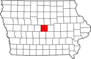 Location in the U.S. state of Iowa | |
 Iowa's location in the U.S. | |
| Founded | 1846 |
| Named for | Joseph Story |
| Seat | Nevada |
| Largest city | Ames |
| Area | |
| • Total | 574 sq mi (1,487 km2) |
| • Land | 573 sq mi (1,484 km2) |
| • Water | 0.8 sq mi (2 km2), 0.1% |
| Population | |
| • (2010) | 89,542 |
| • Density | 156/sq mi (60/km2) |
| Congressional district | 4th |
| Time zone | Central: UTC−6/−5 |
Story County is a county in the U.S. state of Iowa. As of the 2010 census, the population was 89,542.[1][2] The county seat is Nevada.[3]
Story County comprises the Ames, IA Metropolitan Statistical Area, which is included in the Des Moines-Ames-West Des Moines, IA Combined Statistical Area.[4]
The county is home to Iowa State University in Ames.
History

The land that today is known as Story County was originally prairie with the exception of some groves along the larger streams in the area. In 1846 the boundaries of Story County were established. The County has an area of 576 square miles (1,490 km2) and is square in shape.
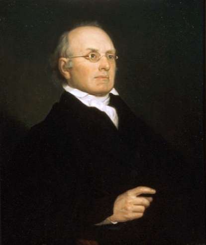
The county was named after Joseph Story, a preeminent United States Supreme Court Justice, in 1853. The first settlers to the area came from Indiana, then from the New England states of New York and Pennsylvania. Later, many Norwegians, Germans and Danes came directly from overseas and inhabited the area. The first large population influx occurred during the 1850s. Story County was not mentioned in the Federal Census in 1850, but figures from the State of Iowa put the population at 214 in 1852. By 1860 the population had increased to 4,501.
Three commissioners were appointed by the Iowa legislature to determine the county seat location. On 27 June 1853, they announced Nevada as their choice. Nevada (pronounced Nuh-VAY-Dah) was named after the Sierra Nevada mountain range in California. Like many Midwestern towns, cities and counties, many prominent locations from the newly explored West and Mexican–American War of the late 1840s inspired the naming of towns and counties in Iowa during this period.
Railroad construction did more to develop Story County than any other single factor. The first railroad came to the county in 1864. Railroads were such a decisive factor in determining the location of towns that several communities in Story County moved to be closer to the rail line. Some flourishing little towns that were bypassed by the railroad soon disappeared. Although Nevada was long the population center of the county, Ames was the most widely known of the towns because of the busy railroad depot where travelers would transfer to their next train.
Story County has had five courthouses. The first, a two-level frame building, was erected in 1856. Fire destroyed it in 1863, and it was replaced by a similar structure, which was replaced by a larger three-level building in 1877, situated on the town square. This building's tower served as a vantage point to view the countryside; it was eventually removed for safety reasons. The fourth courthouse was built in 1967 and placed in service on 18 May 1968. That building is still in use as offices for the Board of Supervisors, Auditor, Treasurer, Recorder, Assessor, Information Technology, Facilities Management, Health and Planning & Development Offices. A cannon from the Civil War rests on the lawn. The current courthouse, the Story County Justice Center, opened in 2002. It houses the Justice Center, comprising the law enforcement and judicial aspects of Story County Government. The Story County Sheriff's Office, Attorney, and Clerk of Court are all housed in this building.[5]
Story County consists of 16 townships and 15 incorporated cities, and 4 unincorporated towns. The population of 79,981 in the 2000 census consisted of 71,114 in urban areas and 8867 in rural areas.
Geography
According to the U.S. Census Bureau, the county has a total area of 574 square miles (1,490 km2), of which 573 square miles (1,480 km2) is land and 0.8 square miles (2.1 km2) (0.1%) is water.[6]
The geographical center of Iowa lies in Story County, 5 miles (8.0 km) northeast of Ames.[7]
Adjacent counties
- Hamilton County (northwest)
- Hardin County (northeast)
- Marshall County (east)
- Jasper County (southeast)
- Polk County (south)
- Boone County (west)
Transportation
Major highways
Airports
Story County is home to the Ames Municipal Airport, on the south side of Ames. The nearest large airport is the Des Moines International Airport, on the south side of Des Moines, some 30 miles from Story County.
Rail lines
Story County contains three rail lines, all controlled by the Union Pacific Railroad Company. The Overland Route runs east–west on its route from Chicago to California, passing near Ames, Colo and Nevada in Story County. The Spine Line runs north–south on its route from Minneapolis to Kansas City, Missouri, passing near McCallsburg, Nevada and Cambridge. The third line in Story County begins at Ames and runs near Gilbert and Story City.
Demographics
| Historical population | |||
|---|---|---|---|
| Census | Pop. | %± | |
| 1860 | 4,051 | — | |
| 1870 | 11,651 | 187.6% | |
| 1880 | 16,906 | 45.1% | |
| 1890 | 18,127 | 7.2% | |
| 1900 | 23,159 | 27.8% | |
| 1910 | 24,083 | 4.0% | |
| 1920 | 26,185 | 8.7% | |
| 1930 | 31,141 | 18.9% | |
| 1940 | 33,434 | 7.4% | |
| 1950 | 44,294 | 32.5% | |
| 1960 | 49,327 | 11.4% | |
| 1970 | 62,783 | 27.3% | |
| 1980 | 72,326 | 15.2% | |
| 1990 | 74,252 | 2.7% | |
| 2000 | 79,981 | 7.7% | |
| 2010 | 89,542 | 12.0% | |
| Est. 2016 | 97,090 | [8] | 8.4% |
| U.S. Decennial Census[9] 1790-1960[10] 1900-1990[11] 1990-2000[12] 2010-2013[1] | |||
2010 census
The following Story County statistics were gathered by the 2010 U.S. Census.[13]
Population Story County had a population of 89,542, a 12% increase from the 2000 Census. Of that number, 17.8% of those people are under the age of 18, and 10% are over the age of 65, 95.1% of those people (age 25+) are high school graduates, and 45.4% (age 25+) hold at least a bachelor's degree.
Commuting time Story County workers age 16 and older spent an average of 16.6 minutes traveling to work between 2005 and 2009.
Workforce data There were 45,010 individuals working in Story County and 81.5% of those people live in Story County. The remaining percentages break down as follows: 6.8% live in Boone County (directly west) 4.2% live in Polk County (directly south) 2.1% live in Hamilton County (directly north) 1.2% live in Hardin County (directly north) 1.1% live in Marshal County (directly east).
There were 43,839 working individuals who lived in Story County and worked anywhere, and 83.7% of those people worked in Story County.
Household data According to the 2010 U.S. Census, the median household income in 2009 was $48,165, with an average of 2.41 people per household between 2005 and 2009.
The per capita income in the past 12 months (2009 dollars) between 2005 and 2009 was $24,202.
2000 census
As of the census[14] of 2000, there were 79,981 people, 29,383 households, and 17,042 families residing in the county. The population density was 140 people per square mile (54/km²). There were 30,630 housing units at an average density of 54 per square mile (21/km²). The racial makeup of the county was 91.14% White, 1.83% Black or African American, 0.16% Native American, 5.10% Asian, 0.03% Pacific Islander, 0.60% from other races, and 1.14% from two or more races. 1.55% of the population were Hispanic or Latino of any race.
There were 29,383 households out of which 27.30% had children under the age of 18 living with them, 49.60% were married couples living together, 5.90% had a female householder with no husband present, and 42.00% were non-families. 26.70% of all households were made up of individuals and 7.60% had someone living alone who was 65 years of age or older. The average household size was 2.39 and the average family size was 2.94.
Age spread: 19.10% under the age of 18, 28.30% from 18 to 24, 25.50% from 25 to 44, 17.30% from 45 to 64, and 9.80% who were 65 years of age or older. The median age was 26 years. For every 100 females there were 104.60 males. For every 100 females age 18 and over, there were 104.40 males.
The median income for a household in the county was $40,442, and the median income for a family was $55,472. Males had a median income of $36,756 versus $26,941 for females. The per capita income for the county was $19,949. About 5.50% of families and 14.10% of the population were below the poverty line, including 6.80% of those under age 18 and 4.30% of those age 65 or over.
Story County laborshed
Total potential labor force
According to the Story County Laborshed Analysis, which was analyzed and compiled by the Iowa Workforce Development in August 2011, Story County has a total potential labor force of 424,702 people, which breaks down as follows:
- Employed – 75.3%
- Unemployed – 8.37%
- Homemakers – 7.8%
- Retired – 8.2%
Likelihood to accept / change employment The estimated number of individuals who are very likely or somewhat likely to change or accept employment is 106,383, or 25%.
- Employed – 87.6%
- Unemployed – 3%
- Homemakers – 5.2%
- Retired – 4.2%
Unemployment Of those unemployed and willing to enter / re-enter employment:
- Average age – 45
- Male – 50%
- Female – 50%
- Have Education Beyond High School – 67.5%
Wages The estimated wage range to attract the upper 66-75% of qualified hourly wage applicants is $10 to $10.44 per hour, with a median of the lowest wage at $10 per hour.
Commute Those unemployed and willing to enter / re-enter employment are willing to commute an average of 24 miles one way for the right opportunity.
Law enforcement
Primary law enforcement for the county rests with the Story County Sheriff's Office.
Law enforcement agencies in the county include:
- Story County Sheriff's Office
- Ames Police Department
- Iowa State University Police Division
- Nevada Police Department
- Huxley Police Department
- Story City Police Department
Communities
Cities
Unincorporated communities
Townships
Population ranking
The population ranking of the following table is based on the 2010 census of Story County.[13]
† county seat
| Rank | City/Town/etc. | Municipal type | Population (2010 Census) |
|---|---|---|---|
| 1 | Ames | City | 58,965 |
| 2 | † Nevada | City | 6,798 |
| 3 | Story City | City | 3,431 |
| 4 | Huxley | City | 3,317 |
| 5 | Slater | City | 1,489 |
| 6 | Roland | City | 1,284 |
| 7 | Gilbert | City | 1,082 |
| 8 | Maxwell | City | 920 |
| 9 | Colo | City | 876 |
| 10 | Cambridge | City | 827 |
| 11 | Zearing | City | 554 |
| 12 | Collins | City | 495 |
| 13 | McCallsburg | City | 333 |
| 14 | Sheldahl (partially in Boone and Polk Counties) | City | 319 |
| 15 | Kelley | City | 309 |
Politics
| Year | Republican | Democratic | Third Parties |
|---|---|---|---|
| 2016 | 38.4% 19,458 | 50.7% 25,709 | 10.9% 5,500 |
| 2012 | 41.7% 19,668 | 55.6% 26,192 | 2.7% 1,290 |
| 2008 | 40.8% 18,995 | 57.0% 26,548 | 2.2% 1,038 |
| 2004 | 46.6% 20,819 | 52.2% 23,296 | 1.2% 537 |
| 2000 | 45.9% 16,228 | 49.4% 17,478 | 4.7% 1,658 |
| 1996 | 38.1% 12,468 | 52.7% 17,234 | 9.2% 2,993 |
| 1992 | 35.0% 12,702 | 47.1% 17,118 | 17.9% 6,491 |
| 1988 | 41.6% 13,782 | 57.6% 19,051 | 0.8% 272 |
| 1984 | 51.6% 19,804 | 47.6% 18,277 | 0.9% 329 |
| 1980 | 42.4% 15,829 | 36.2% 13,529 | 21.5% 8,013 |
| 1976 | 51.9% 18,394 | 44.3% 15,717 | 3.9% 1,365 |
| 1972 | 53.6% 16,617 | 45.0% 13,972 | 1.4% 436 |
| 1968 | 56.3% 13,327 | 39.9% 9,456 | 3.8% 892 |
| 1964 | 39.7% 8,188 | 59.8% 12,329 | 0.5% 93 |
| 1960 | 65.3% 13,708 | 34.7% 7,281 | 0.1% 15 |
| 1956 | 67.5% 13,264 | 32.3% 6,352 | 0.1% 24 |
| 1952 | 71.8% 13,857 | 27.5% 5,299 | 0.7% 140 |
| 1948 | 54.5% 8,307 | 40.3% 6,152 | 5.2% 792 |
| 1944 | 51.8% 7,163 | 47.4% 6,554 | 0.7% 101 |
| 1940 | 52.1% 7,853 | 47.5% 7,152 | 0.4% 65 |
| 1936 | 46.8% 6,358 | 51.0% 6,933 | 2.2% 297 |
| 1932 | 51.8% 6,735 | 43.4% 5,638 | 4.8% 619 |
| 1928 | 75.7% 9,035 | 22.8% 2,714 | 1.5% 183 |
| 1924 | 63.1% 6,916 | 11.9% 1,310 | 25.0% 2,742 |
| 1920 | 80.8% 8,713 | 17.7% 1,909 | 1.5% 162 |
| 1916 | 66.2% 3,722 | 31.5% 1,772 | 2.3% 130 |
| 1912 | 23.8% 1,247 | 23.4% 1,224 | 52.8% 2,763 |
| 1908 | 71.1% 3,790 | 22.4% 1,195 | 6.5% 349 |
| 1904 | 78.7% 3,919 | 15.1% 752 | 6.2% 306 |
| 1900 | 71.9% 4,032 | 24.0% 1,343 | 4.1% 232 |
| 1896 | 68.7% 3,630 | 30.1% 1,589 | 1.2% 63 |
See also
References
- 1 2 "State & County QuickFacts". United States Census Bureau. Retrieved 20 July 2014.
- ↑ "Data from the 2010 Census". State Data Center of Iowa. Retrieved 23 May 2011.
- ↑ "Find a County". National Association of Counties. Archived from the original on 31 May 2011. Retrieved 7 June 2011.
- ↑ United States Office of Management and Budget. "Update of Statistical Area Definitions and Guidance on Their Uses" (PDF). pp. 5, 36. Archived (PDF) from the original on 14 May 2006. Retrieved 21 July 2006.
- ↑ Story County
- ↑ "US Gazetteer files: 2010, 2000, and 1990". United States Census Bureau. 12 February 2011. Retrieved 23 April 2011.
- ↑ U.S. Geological Survey Geographic Names Information System: state of Iowa
- ↑ "Population and Housing Unit Estimates". Retrieved 9 June 2017.
- ↑ "U.S. Decennial Census". United States Census Bureau. Archived from the original on 12 May 2015. Retrieved 20 July 2014.
- ↑ "Historical Census Browser". University of Virginia Library. Retrieved 20 July 2014.
- ↑ "Population of Counties by Decennial Census: 1900 to 1990". United States Census Bureau. Retrieved 20 July 2014.
- ↑ "Census 2000 PHC-T-4. Ranking Tables for Counties: 1990 and 2000" (PDF). United States Census Bureau. Retrieved 20 July 2014.
- 1 2 2010 Census
- ↑ "American FactFinder". United States Census Bureau. Archived from the original on 11 September 2013. Retrieved 31 January 2008.
- ↑ Leip, David. "Dave Leip's Atlas of U.S. Presidential Elections". uselectionatlas.org. Retrieved 28 April 2018.
External links
| Wikimedia Commons has media related to Story County, Iowa. |
- Story County government's website
- Ames Historical Society Includes reference materials, early maps and lots of historical images
- ISU Extension - Story County
- Story County Foundation
Places adjacent to Story County, Iowa | ||||||||||
|---|---|---|---|---|---|---|---|---|---|---|
| ||||||||||
Municipalities and communities of Story County, Iowa, United States | ||
|---|---|---|
| Cities | ||
| Townships | ||
| Unincorporated communities | ||
| Footnotes | ‡This populated place also has portions in an adjacent county or counties | |

Coordinates: 42°02′16″N 93°27′59″W / 42.03778°N 93.46639°W