Jackson, Minnesota
| Jackson, Minnesota | |
|---|---|
| City | |
 Jackson County Courthouse in Jackson | |
| Motto(s): "Come Grow With Us" | |
 Location of Jackson within Jackson County and state of Minnesota | |
| Coordinates: 43°37′15″N 94°59′19″W / 43.62083°N 94.98861°WCoordinates: 43°37′15″N 94°59′19″W / 43.62083°N 94.98861°W | |
| Country |
|
| State |
|
| County | Jackson |
| Government | |
| • Type | Mayor – Council |
| • Mayor | Wayne Walter |
| Area[1] | |
| • Total | 4.60 sq mi (11.91 km2) |
| • Land | 4.58 sq mi (11.86 km2) |
| • Water | 0.02 sq mi (0.05 km2) |
| Elevation | 1,316 ft (401 m) |
| Population (2010)[2] | |
| • Total | 3,299 |
| • Estimate (2016)[3] | 3,238 |
| • Density | 720/sq mi (280/km2) |
| Time zone | UTC-6 (Central (CST)) |
| • Summer (DST) | UTC-5 (CDT) |
| ZIP code | 56143 |
| Area code(s) | 507 |
| FIPS code | 27-31562 [4] |
| GNIS feature ID | 0645559 [5] |
| Website | cityofjacksonmn.com |
Jackson is a city and county seat of Jackson County, Minnesota, United States.[6] The population was 3,299 at the 2010 census.[7]
History
Jackson was originally called Springfield, and under the latter name was laid out in 1856.[8] A post office called Jackson has been in operation since 1858.[9]
Geography
According to the United States Census Bureau, the city has a total area of 4.60 square miles (11.91 km2), of which 4.58 square miles (11.86 km2) is land and 0.02 square miles (0.05 km2) is water.[1]
Interstate 90 and U.S. Highway 71 are two of the main routes in the city. Jackson is located near the center of the county of the same name. To the south is the Iowa Lakes region, which comprises Spirit Lake, West Okoboji Lake and several other small lakes.
Demographics
| Historical population | |||
|---|---|---|---|
| Census | Pop. | %± | |
| 1880 | 501 | — | |
| 1890 | 720 | 43.7% | |
| 1900 | 1,756 | 143.9% | |
| 1910 | 1,907 | 8.6% | |
| 1920 | 2,144 | 12.4% | |
| 1930 | 2,206 | 2.9% | |
| 1940 | 2,840 | 28.7% | |
| 1950 | 3,313 | 16.7% | |
| 1960 | 3,370 | 1.7% | |
| 1970 | 3,550 | 5.3% | |
| 1980 | 3,797 | 7.0% | |
| 1990 | 3,559 | −6.3% | |
| 2000 | 3,501 | −1.6% | |
| 2010 | 3,299 | −5.8% | |
| Est. 2016 | 3,238 | [3] | −1.8% |
| U.S. Decennial Census | |||
2010 census
As of the census[2] of 2010, there were 3,299 people, 1,489 households, and 856 families residing in the city. The population density was 720.3 inhabitants per square mile (278.1/km2). There were 1,635 housing units at an average density of 357.0 per square mile (137.8/km2). The racial makeup of the city was 93.3% White, 0.5% African American, 0.4% Native American, 3.4% Asian, 0.8% from other races, and 1.6% from two or more races. Hispanic or Latino of any race were 1.8% of the population.
There were 1,489 households of which 27.2% had children under the age of 18 living with them, 42.6% were married couples living together, 10.3% had a female householder with no husband present, 4.5% had a male householder with no wife present, and 42.5% were non-families. 37.9% of all households were made up of individuals and 16.1% had someone living alone who was 65 years of age or older. The average household size was 2.17 and the average family size was 2.84.
The median age in the city was 40.8 years. 22.7% of residents were under the age of 18; 8.4% were between the ages of 18 and 24; 23.1% were from 25 to 44; 26.4% were from 45 to 64; and 19.3% were 65 years of age or older. The gender makeup of the city was 48.4% male and 51.6% female.
2000 census
As of the census[4] of 2000, there were 3,501 people, 1,487 households, and 887 families residing in the city. The population density was 921.7 people per square mile (355.7/km²). There were 1,659 housing units at an average density of 436.8 per square mile (168.6/km²). The racial makeup of the city was 94.03% White, 0.26% African American, 0.17% Native American, 4.03% Asian, 0.77% from other races, and 0.74% from two or more races. Hispanic or Latino of any race were 1.51% of the population.
There were 1,487 households out of which 27.2% had children under the age of 18 living with them, 49.0% were married couples living together, 7.9% had a female householder with no husband present, and 40.3% were non-families. 36.3% of all households were made up of individuals and 16.5% had someone living alone who was 65 years of age or older. The average household size was 2.24 and the average family size was 2.93.
In the city, the population was spread out with 23.3% under the age of 18, 9.5% from 18 to 24, 24.5% from 25 to 44, 20.5% from 45 to 64, and 22.2% who were 65 years of age or older. The median age was 40 years. For every 100 females, there were 94.2 males. For every 100 females age 18 and over, there were 89.8 males.
The median income for a household in the city was $33,452, and the median income for a family was $42,553. Males had a median income of $30,503 versus $21,676 for females. The per capita income for the city was $18,444. About 4.6% of families and 11.1% of the population were below the poverty line, including 17.4% of those under age 18 and 9.4% of those age 65 or over.
Historic sites
- Ashley Park – Olson-Slaabakken cabin, Jackson County's oldest structure.
- Fort Belmont – 1873 farmhouse, blacksmith shop, log cabin and stockade, 1902 Delafield Lutheran Church.
- Jackson County Fair Village – 20 historical buildings and is located at the Jackson County Fairgrounds
- Jackson County Historical Society and Museum – west of Jackson at Lakefield, Minnesota, provides a look back at the County’s history.
- Jackson County Courthouse – Constructed in 1908 with murals adorn the Court Room and Rotunda, listed on the National Register of Historic Places
Economy
Though largely a farming community, Jackson has a large industrial park with such businesses as: AGCO, USF Holland, New Fashion Pork,Last Deck, HitchDock, Pioneer, TS AGCO and Challenger tractors are manufactured in Jackson.
Government
Jackson is located in Minnesota's 1st congressional district, represented by Mankato educator Tim Walz, a Democrat. At the state level, Jackson is located in Senate District 22, represented by Republican Doug Magnus, and in House District 22B, represented by Republican Rod Hamilton.
Transportation
The city-owned Jackson Municipal Airport is located 2.3 miles (3.7 km) north of Jackson's central business district.[10]
Notable people
- David Ellefson - bassist in Megadeth
- Bjarne Elgar Grottum, Minnesota State Senator who was raised in Jackson.[11]
References
- 1 2 "US Gazetteer files 2010". United States Census Bureau. Archived from the original on January 24, 2012. Retrieved 2012-11-13.
- 1 2 "American FactFinder". United States Census Bureau. Retrieved 2012-11-13.
- 1 2 "Population and Housing Unit Estimates". Retrieved June 9, 2017.
- 1 2 "American FactFinder". United States Census Bureau. Archived from the original on September 11, 2013. Retrieved 2008-01-31.
- ↑ "US Board on Geographic Names". United States Geological Survey. 2007-10-25. Retrieved 2008-01-31.
- ↑ "Find a County". National Association of Counties. Archived from the original on May 31, 2011. Retrieved 2011-06-07.
- ↑ "2010 Census Redistricting Data (Public Law 94-171) Summary File". American FactFinder. United States Census Bureau. Archived from the original on July 21, 2011. Retrieved 27 April 2011.
- ↑ Upham, Warren (1920). Minnesota Geographic Names: Their Origin and Historic Significance. Minnesota Historical Society. p. 262.
- ↑ "Jackson County". Jim Forte Postal History. Retrieved 13 July 2015.
- ↑ FAA Airport Master Record for MJQ (Form 5010 PDF). Federal Aviation Administration. Effective 30 June 2011.
- ↑ "Grottum, Bjarne Elgar "B.E."". Legislators Past and Present. Minnesota Legislative Reference Library. Retrieved 8 June 2012.
External links
| Wikimedia Commons has media related to Jackson, Minnesota. |
Municipalities and communities of Jackson County, Minnesota, United States | ||
|---|---|---|
| Cities | 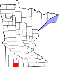 | |
| Townships | ||
| CDP | ||
| Unincorporated communities | ||