Rural Municipality of Rosedale No. 283
The Rural Municipality of Rosedale No. 283 (2016 population: 526) is a rural municipality (RM) in the Canadian province of Saskatchewan within Census Division No. 11 and SARM Division No. 5. It is located in the central portion of the province along Highway 11 between Saskatoon and Regina.
Rosedale No. 283 | |
|---|---|
| Rural Municipality of Rosedale No. 283 | |
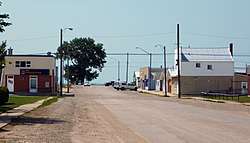 Downtown Hanley | |
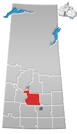
 Location of the RM of Rosedale No. 283 in Saskatchewan | |
| Coordinates: 51.572°N 106.471°W[1] | |
| Country | Canada |
| Province | Saskatchewan |
| Census division | 11 |
| SARM division | 5 |
| Formed[2] | December 13, 1909 |
| Government | |
| • Reeve | Kevin Ouellette |
| • Governing body | RM of Rosedale No. 283 Council |
| • Administrator | Danielle Hache |
| • Office location | Hanley |
| Area (2016)[4] | |
| • Land | 921.51 km2 (355.80 sq mi) |
| Population (2016)[4] | |
| • Total | 526 |
| • Density | 0.6/km2 (2/sq mi) |
| Time zone | CST |
| • Summer (DST) | CST |
| Area code(s) | 306 and 639 |
History
The RM of Rosedale No. 283 incorporated as a rural municipality on December 13, 1909.[2] It was formed through the amalgamation of Local Improvement District (LID) 15-B-3 and LID 15-C-3.
Geography
Communities and localities
The following urban municipalities are surrounded by the RM.
The following unincorporated communities are within the RM.
- Localities
- Jays
Demographics
In the 2016 Census of Population conducted by Statistics Canada, the RM of Rosedale No. 283 recorded a population of 526 living in 147 of its 153 total private dwellings, a 2.1% change from its 2011 population of 515. With a land area of 921.51 km2 (355.80 sq mi), it had a population density of 0.6/km2 (1.5/sq mi) in 2016.[4]
In the 2011 Census of Population, the RM of Rosedale No. 283 recorded a population of 515, a 13.2% change from its 2006 population of 455. With a land area of 921.51 km2 (355.80 sq mi), it had a population density of 0.6/km2 (1.4/sq mi) in 2011.[7]
Government
The RM of Rosedale No. 283 is governed by an elected municipal council and an appointed administrator that meets on the second Tuesday of every month.[3] The reeve of the RM is Kevin Ouellette while its administrator is Danielle Hache.[3] The RM's office is located in Hanley.[3]
Transportation
- Rail[8]
- Regina Branch C.N.R—serves Davidson, Bladworth, Kenaston, Strong, Hanley, Indi, Dundurn, Strehlow, Haultain, Grasswood, Nutana, Saskatoon
- Roads
- Highway 11—serves Hanley, Saskatchewan
- Highway 764—serves Hanley, Saskatchewan
- Highway 15—located between Hanley, Saskatchewan and Hawarden, Saskatchewan runs east-west
- Highway 19—serves Hawarden, Saskatchewan
References
- "Pre-packaged CSV files - CGN, Canada/Province/Territory (cgn_sk_csv_eng.zip)". Government of Canada. July 24, 2019. Retrieved May 23, 2020.
- "Rural Municipality Incorporations (Alphabetical)". Saskatchewan Ministry of Municipal Affairs. Archived from the original on April 21, 2011. Retrieved May 9, 2020.
- "Municipality Details: RM of Rosedale No. 283". Government of Saskatchewan. Retrieved May 21, 2020.
- "Population and dwelling counts, for Canada, provinces and territories, and census subdivisions (municipalities), 2016 and 2011 censuses – 100% data (Saskatchewan)". Statistics Canada. February 8, 2017. Retrieved May 1, 2020.
- "Saskatchewan Census Population" (PDF). Saskatchewan Bureau of Statistics. Archived from the original (PDF) on September 24, 2015. Retrieved May 9, 2020.
- "Saskatchewan Census Population". Saskatchewan Bureau of Statistics. Retrieved May 9, 2020.
- "Population and dwelling counts, for Canada, provinces and territories, and census subdivisions (municipalities), 2011 and 2006 censuses (Saskatchewan)". Statistics Canada. June 3, 2019. Retrieved May 1, 2020.
- Canadian Maps: January 1925 Waghorn's Guide. Post Offices in Man. Sask. Alta. and West Ontario.