Rural Municipality of Wreford No. 280
The Rural Municipality of Wreford No. 280 (2016 population: 135) is a rural municipality (RM) in the Canadian province of Saskatchewan within Census Division No. 11 and SARM Division No. 5. Located in the south-central portion of the province, it is north of the City of Regina.
Wreford No. 280 | |
|---|---|
| Rural Municipality of Wreford No. 280 | |
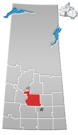
 Location of the RM of Wreford No. 280 in Saskatchewan | |
| Coordinates: 51.499°N 105.139°W[1] | |
| Country | Canada |
| Province | Saskatchewan |
| Census division | 11 |
| SARM division | 5 |
| Formed[2] | December 12, 1910 |
| Government | |
| • Reeve | Dean Hobman |
| • Governing body | RM of Wreford No. 280 Council |
| • Administrator | Melanie Rich |
| • Office location | Nokomis |
| Area (2016)[4] | |
| • Land | 798.55 km2 (308.32 sq mi) |
| Population (2016)[4] | |
| • Total | 135 |
| • Density | 0.2/km2 (0.5/sq mi) |
| Time zone | CST |
| • Summer (DST) | CST |
| Postal code | S0G 3R0 |
| Area code(s) | 306 and 639 |
| Highway(s) | Highway 15 Highway 20 |
History
The RM of Wreford No. 280 incorporated as a rural municipality on December 12, 1910.[2]
Geography
Communities and localities
The following urban municipalities are surrounded by the RM.
The following unincorporated communities are within the RM.
- Localities
- Ambassador
- Hatfield
- Undora
- Venn
Demographics
In the 2016 Census of Population conducted by Statistics Canada, the RM of Wreford No. 280 recorded a population of 135 living in 59 of its 72 total private dwellings, a -10% change from its 2011 population of 150. With a land area of 798.55 km2 (308.32 sq mi), it had a population density of 0.2/km2 (0.4/sq mi) in 2016.[4]
In the 2011 Census of Population, the RM of Wreford No. 280 recorded a population of 150, a -14.3% change from its 2006 population of 175. With a land area of 798.55 km2 (308.32 sq mi), it had a population density of 0.2/km2 (0.5/sq mi) in 2011.[7]
Government
The RM of Wreford No. 280 is governed by an elected municipal council and an appointed administrator that meets on the second Tuesday of every month.[3] The reeve of the RM is Dean Hobman while its administrator is Melanie Rich.[3] The RM's office is located in Nokomis.[3]
Transportation
| Highway | Starting point | Communities | Ending point |
|---|---|---|---|
| Highway 15 | Highway 4 | Nokomis, Hatfield | Highway 16 |
| Highway 20 | Highway 3 | Ambassador, Nokomis | Highway 99 |
References
- "Pre-packaged CSV files - CGN, Canada/Province/Territory (cgn_sk_csv_eng.zip)". Government of Canada. July 24, 2019. Retrieved May 23, 2020.
- "Rural Municipality Incorporations (Alphabetical)". Saskatchewan Ministry of Municipal Affairs. Archived from the original on April 21, 2011. Retrieved May 9, 2020.
- "Municipality Details: RM of Wreford No. 280". Government of Saskatchewan. Retrieved May 21, 2020.
- "Population and dwelling counts, for Canada, provinces and territories, and census subdivisions (municipalities), 2016 and 2011 censuses – 100% data (Saskatchewan)". Statistics Canada. February 8, 2017. Retrieved May 1, 2020.
- "Saskatchewan Census Population" (PDF). Saskatchewan Bureau of Statistics. Archived from the original (PDF) on September 24, 2015. Retrieved May 9, 2020.
- "Saskatchewan Census Population". Saskatchewan Bureau of Statistics. Retrieved May 9, 2020.
- "Population and dwelling counts, for Canada, provinces and territories, and census subdivisions (municipalities), 2011 and 2006 censuses (Saskatchewan)". Statistics Canada. June 3, 2019. Retrieved May 1, 2020.