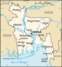
List of cities and towns in Bangladesh
This article presents a list of cities and towns in Bangladesh. According to the Bangladesh Bureau of Statistics and the Ministry of Local Government, Rural Development and Co-operatives of Bangladesh, there are 532 urban centres in Bangladesh.[1][2][3]
 |
|---|
| This article is part of a series on the politics and government of Bangladesh |
|
Constitution and law
|
|
Government |
|
|
|
|
|

The bureau defines an urban centre with a population of 100,000 or more as a "city". Altogether, there are 42 such cities in Bangladesh. 11 of these cities can be considered major cities as these are governed by "City Corporations". All of the "City Corporation"-governed cities currently have a population of more than 200,000 (which is not a criterion for the status). Besides the 11 major cities, there are 31 other cities in Bangladesh that are not governed by "City Corporations", rather by "Municipal Corporations". A city with a population of more than 5,000,000 is defined by the bureau as a "megacity". Dhaka is the only megacity in Bangladesh according to this definition.[2] Together, Dhaka and the port city of Chittagong account for 48% of the country's urban population.[4]
An urban centre with a population of less than 100,000 is defined as a "town". In total, there are 490 such towns in Bangladesh.[2] Among these, 287 towns are governed by "Municipal Corporations". These are called "Paurashava"s in the local Bengali language. Altogether, including the ones governing 31 non-major cities, there are 318 Municipal Corporations.
In addition, there are another 203 towns which are Upazila centres (and other urban centres) and not governed by any Municipal Corporation or "Paurashava". These are the non-Municipal Corporation or "non-Paurashava" towns.[2][3]
In 1951, Bangladesh was mostly a rural country and only 4% of the population lived in urban centres. The urban population rose to 19% in 1991 and to 26% by 2005. As of 2011, Bangladesh has an urban population of 28%.[2] The rate of urban population growth is estimated at 2.8%. At this growth rate, Bangladesh's urban population will reach 79 million or 42% of the population by 2035. The urban centers of Bangladesh have a combined area of about 10600 square kilometers, which is 7% of the total area of Bangladesh. As such, Bangladesh has a very high urban population density: 4028 persons per square kilometer (2011), whereas the rural density is significantly lower: 790 persons per square kilometer (2011).[1] The number of municipalities have tripled from 104 municipalities in 1991 to 318 municipalities in 2011.[4]
Major cities
There are 11 major cities in Bangladesh which are governed by 12 City Corporations. These are: Dhaka North, Dhaka South, Chittagong, Rajshahi, Khulna, Mymensingh, Sylhet, Comilla, Barisal, Rangpur, Gazipur and Narayanganj. Among these, Dhaka is a megacity, governed by 2 City Corporations.
| Rank | City | Area(km2)[2] | Population (2011)[2] | District | Division |
|---|---|---|---|---|---|
| 1. | Dhaka | 316 | 8,906,039 | Dhaka | Dhaka Division |
| 2. | Chittagong | 155 | 2,592,439 | Chittagong | Chittagong Division |
| 3. | Rajshahi | 97 | 763,952 | Rajshahi | Rajshahi Division |
| 4. | Mymensingh | 91.315 | 476,543 | Mymensingh | Mymensingh Division |
| 5. | Khulna | 51 | 664,728 | Khulna | Khulna Division |
| 6. | Sylhet | 42 | 526,412 | Sylhet | Sylhet Division |
| 7. | Barisal | 69 | 339,308 | Barisal | Barisal Division |
| 8. | Rangpur | 50.69 | 307,053 | Rangpur | Rangpur Division |
| 9. | Comilla | 23.44 | 296,010 | Comilla | Chittagong Division |
| 10. | Narayanganj | 12.69 | 286,330 | Narayanganj | Dhaka Division |
| 11. | Gazipur | 47.23 | 213,061 | Gazipur | Dhaka Division |
Gallery of major cities in Bangladesh
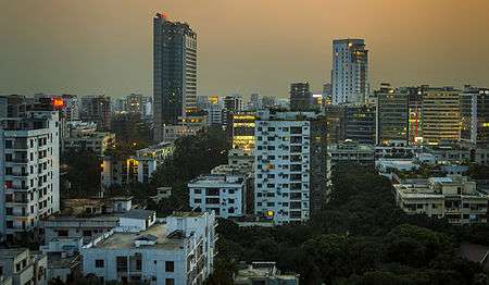 Dhaka, capital of Bangladesh
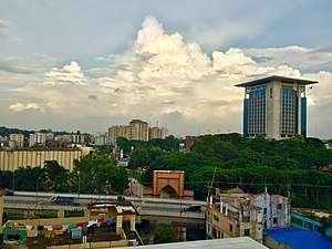


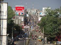
 Rangpur
-01.jpg)
.jpg)
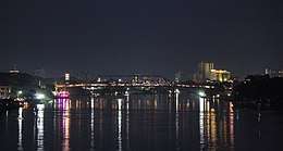
 Gazipur
Metropolitan areas
Eight (8) of the aforementioned major cities are also part of eight bigger metropolitan areas. Metropolitan areas can be loosely defined as a major city combined with some of its adjacent municipalities and peri-urban areas. The eight metropolitan areas of Bangladesh are the Dhaka, Chittagong, Khulna, Rajshahi, Barisal, Sylhet, Gazipur and Rangpur metropolitan areas.
Cities
These are other cities of Bangladesh which are governed by Municipal Corporations .
| Rank | City | Area(km2) | Population(2011) | District | Division |
|---|---|---|---|---|---|
| 1. | Bogra | 69.56[5] | 540,000[5] | Bogra | Rajshahi Division |
| 2. | Kushtia | 42.79[6] | 418,322[7] | Kushtia | Khulna Division |
| 3. | Jessore | 28.56 | 237,478 | Jessore | Khulna Division |
| 4. | Cox's Bazar | 24.45 | 223,522 | Cox's Bazar | Chittagong Division |
| 5. | Manikganj | 42.28 | 200,000 | Manikganj | Dhaka Division |
| 6. | Brahmanbaria | 22.49 | 193,814 | Brahmanbaria | Chittagong Division |
| 7. | Dinajpur | 22.00 | 191,329 | Dinajpur | Rangpur Division |
| 8. | Nawabganj | 32.09 | 180,731 | Chapai Nawabganj | Rajshahi Division |
| 9. | Tangail | 33.80 | 167,412 | Tangail | Dhaka Division |
| 10. | Sirajganj | 31.27 | 167,200 | Sirajganj | Rajshahi Division |
| 11. | Chandpur | 22 | 159,021 | Chandpur | Chittagong Division |
| 12. | Feni | 22.00 | 156,971 | Feni | Chittagong Division |
| 13. | Jamalpur | 55.25 | 150,172 | Jamalpur | Mymensingh Division |
| 14. | Naogaon | 38.36 | 150,025 | Naogaon | Rajshahi Division |
| 15. | Narsingdi | 14.8 | 146,115 | Narsingdi | Dhaka Division |
| 16. | Pabna | 27.27 | 144,442 | Pabna | Rajshahi Division |
| 17. | Maijdee | 23.79 | 130,842 | Noakhali | Chittagong Division |
| 18. | Faridpur | 19.78 | 122,425 | Faridpur | Dhaka Division |
Source: 2011 Bangladesh census[8]
Gallery of some municipal cities
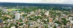
 Bogra City
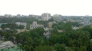 Tangail City
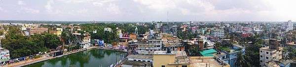
 Kishoreganj City
 Kishoreganj City
Towns
The following is a list of towns in Bangladesh governed by Municipal Corporations.
| Division | Number | Towns |
|---|---|---|
| Barisal Division | 21 | |
| Chittagong Division | 27 | |
| Dhaka Division | 23 | |
| Khulna Division | 9 | |
| Mymensingh Division | 13 | |
| Rajshahi Division | 15 | |
| Rangpur Division | 7 | |
| Sylhet Division | 9 |
|
Urban areas by population
Dhaka is by far the largest urban area as well as the largest metropolitan area in Bangladesh. Chittagong is the second largest city and urban area in Bangladesh as well as second largest metropolitan in Bangladesh while Khulna is the third largest metropolitan in Bangladesh. Other major cities with a population of more than 300,000 include Mymensingh, Narayanganj, Sylhet, Rajshahi,Rangpur,Bogra, Barisal and Comilla. The following table shows the largest populated area within a local government area.
See also
References
- About Us, Local Government Engineering Department, Ministry of Local Government, Bangladesh, archived from the original on 9 October 2018, retrieved 9 October 2018
- Population and Housing Census 2011 - Volume 3: Urban Area Report (PDF), Bangladesh Bureau of Statistics, August 2014
- Statistical Pocketbook Bangladesh 2017 (PDF), Bangladesh Bureau of Statistics, 2018
- Elisa Muzzini; Gabriela Aparicio (11 April 2013), Bangladesh: The Path to Middle-Income Status from an Urban Perspective, World Bank Publications, p. 51
- http://bograpaurashavabd.org/2016/04/29/detail-information-of-bogra-paurashava/
- http://municipality.kushtia.gov.bd/site/page/3ed097e8-0fbf-48c5-8371-2ec343f0f870/%E0%A6%8F%E0%A6%95%20%E0%A6%A8%E0%A6%9C%E0%A6%B0%E0%A7%87
- http://municipality.kushtia.gov.bd/site/page/3ed097e8-0fbf-48c5-8371-2ec343f0f870/%E0%A6%8F%E0%A6%95%20%E0%A6%A8%E0%A6%9C%E0%A6%B0%E0%A7%87
- "Population Census 2011: National Volume-3: Urban Area Report" (PDF). Bangladesh Bureau of Statistics. pp. 24–25. Retrieved 26 September 2017.
- Population and Housing Census 2011 - Volume 3: Urban Area Report (PDF), Bangladesh Bureau of Statistics, August 2014
External links
| Wikimedia Commons has media related to Cities in Bangladesh. |
- Principal cities and municipalities in Bangladesh
- International city telephone codes for Bangladesh
- Bangladesh postal codes
- List of Bangladesh cities
- The Paurashava Ordinance 1977
| Divisions |
|  |
|---|---|---|
| Districts |
| |
| Upazilas (lit. Sub-Districts) |
| |
| Rural Councils, Cities and Towns |
| |
| Lowest level elective unit | ||
| Non elective ceremonial unit |
| |
List of cities in Asia | |
|---|---|
| Sovereign states |
|
| States with limited recognition |
|
| Dependencies and other territories |
|
| |