Jhenaidah
Jhenaidah(Bengali: ঝিনাইদহ) is a city in the Khulna Division of southeastern Bangladesh.[4] It is the headquarters of Jhenaidah Sadar Upazila and Jhenaidah District. [1]The city has a population of about 110,541 making it the 41st largest city in Bangladesh.[2]
Jhenaidah ঝিনাইদহ | |
|---|---|
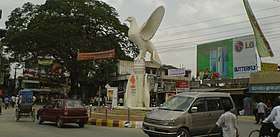 Payra Chattar, an urban square of Jhenaidah | |
 Jhenaidah Location in Bangladesh | |
| Coordinates: 23.541668°N 89.183334°E | |
| Country | |
| Division | Khulna Division |
| District | Jhenaidah District |
| Government | |
| • Type | Mayor–Council |
| • Body | Jhenaidah Municipality |
| Area | |
| • Total | 44.33 km2 (17.12 sq mi) |
| Population | |
| • Total | 110,541[2] |
| • Rank | 41st[2] |
| Time zone | UTC+6 (Bangladesh Time) |
| Postal code | 7300 [3] |
| National Dialing Code | +880 |
Etymology
It is learnt that once this area was very popular for trading oyster meaning Jhinuk in Bengali. In the past, people of this area used to collect a huge quantity of oysters from the river bed Nabaganga and the adjacent khaals and beels. It is believe that this place might have originated its name from Jhinuk.[5]
History
Jhenaidah the largest city of Jhenaidah District came into existence probably in the middle of eighteenth century. [5]
Demographic
The city occupies an area of 44.33 km2. The total population of the city is 110541 of which 56389 are males and 54152 are females. The total number of households in the city is 25963.[5]
Administration
The city consists of a paurashava which is further divided into 9 wards and 34 mahallas with an adjoining mauza as the other urban area of Bangladesh which all together occupies a total area of 44.33 of which 40.86 is under paurashava.[5]
Education
The literay rate(7 years and above) of this city is 67.2%.[5]
References
- Bhuiyan, Md Abu Taher (2012). "Jhenaidah Sadar Upazila". In Islam, Sirajul; Jamal, Ahmed A. (eds.). Banglapedia: National Encyclopedia of Bangladesh (Second ed.). Asiatic Society of Bangladesh.
- "Population & Housing Census-2011: Urban Area Report" (PDF). Bangladesh Bureau of Statistics. p. 11. Retrieved 2019-10-06.
- "ZIP Code database of Bangladesh". Geopostcodes.com. Retrieved 11 June 2008.
- "NGA GeoNames Database". National Geospatial-Intelligence Agency. Retrieved 2 January 2015.
- "Population & Housing Census-2011: Urban Area Report" (PDF). Bangladesh Bureau of Statistics. p. 70. Retrieved 2019-10-06.