Golapganj Upazila
Golapganj Upazila (Bengali: গোলাপগঞ্জ), previously known as Gulabganj, is an Upazila of Sylhet District in the Division of Sylhet, Bangladesh.[1]
Golapganj Upazila গোলাপগঞ্জ | |
|---|---|
 | |
| Division | Sylhet Division |
| District | Sylhet District |
| Government | |
| • MP (Sylhet-6) | Nurul Islam Nahid (Awami League) |
| Area | |
| • Total | 278.34 km2 (107.47 sq mi) |
| Population (2010) | |
| • Total | 263,953 |
| Demonym(s) | Golapganji, Golapgonji, Gulabgoinji |
| Time zone | UTC+6 (BST) |
| Postal code | 3160 |
| Website | golapganj |
Geography
Golapganj Upazila (Sylhet District) area 278.34 km2, located in between 24°41' and 24°55' north latitudes and in between 91°55' and 92°06' east longitudes. It is bounded by Sylhet Sadar, Jaintiapur and Kanaighat upazilas on the north, Fenchuganj and Barlekha upazilas on the south, Beanibazar and Barlekha on the east, Sylhet Sadar and Dakshin Surma upazila on the west.[1]
History
After the Conquest of Gour in 1303, two disciple of Shah Jalal; Shah Bahauddin and Shah Putla Fattah, migrated to Bhadeshwar in modern-day Golapganj where their mazars remains today.
In 1740, during the reign of Mughal emperor Muhammad Shah, Gulab Ram Ray of Murshidabad was appointed the Dewan of Sylhet with the permission of the Faujdar of Sylhet, Shamsher Khan, and the Nawab of Bengal, Shuja-ud-Din Muhammad Khan. Gulab was a practising Hindu, and was informed about how Krishna Chaitanya's paternal home was in Dhakadakshin (in present-day Golapganj). The Dewan then ordered for a road and bridge to be made from Sylhet town to Dhakadakshin, to make it easier for those wanting to visit the place. When the Dewan reached Chaitanya's home, he built a Hindu temple and created a large pond next to it. From Hetimganj to Dhakadakshin, the road is now known as Dewan Road after Gulab himself. The Dewan's Bridge also remains today as an ancient culvert. The area was also renamed Gulabganj after the Dewan, which eventually changed to Golapganj (although older records mention the name Golabganj).
A thana was founded in Hetimganj originally and then moved to Golabganj Bazaar. The Golabganj Thana was formed in 1906. Revolts in Ronikeli and Bhadeshwar were held during the Nankar Rebellion.[2] In the aftermath of the Bangladesh Liberation War of 1971, a mass grave was found in Sundisail and there remains a monument in the upazila as a memorial.[3] It was upgraded to an upazila in 1983.[1]
Demographics
Total 263953; male 132189, female 131764; Muslim 252167, Hindu 11725, Buddhist 21, and others 40. Indigenous communities such as manipuri and tripura belong to this upazila.[1] According to the census 2011, Golapganj Upazila has a population of 316,149. Males constitute 50.29% of the population, and females 49.71%. 48.17% of the population is age eighteen or older. Average Household size 6.23 person and population density is 1136 person per km2. Golapganj has an average literacy rate of 57.0% (7+ years), and the national average of 32.4% literate.[3]
Main sources of income
Agriculture 34.05%, non-agricultural laborer 6.03%, industry 0.94%, commerce 14.64%, transport and communication 4.01%, service 6.16%, construction 2.88%, religious service 0.58%, rent and remittance 18.34% and others 12.37%.[2] Main crops are Paddy, chilli, pumpkin, arum,' barbati.[3] Nearly extinct crops are Mustard, sesame, linseed.[3] Main fruits are Jackfruit, mango, litchi, banana, latkon, guava, lemon, shaddock, betel nut, coconut.[3]
Ownership of agricultural land
Landowner 42.76%, landless 57.24%; agricultural landowner: urban 27.98% and rural 43.91%.[2]
Education
Literacy rate and educational institutions Average literacy 48.24%; male 50.89%, female 45.64%.[1] College 3, Technical college 1, Secondary school 33, Primary school 160, Community school 15, Kindergarten 60, Madrasa 25.[3]
Noted educational institutions:[1]
- Dhaka Dakshin Degree College
- Dhakadakshin Darul Uloom Hussainia Madrasa
- Bhadeshwar Mahila Degree College
- Jamea Islamia Barokut Madrasa
- Dhaka Dakshin Multilateral High School and College (1898),
- Arobiya Husainiya Ranaping Madrasa
- Bhadeshwar Nasiruddin High School (1919),
- MC Academy (1934),
- Fulbaria Madrasa (1882).
- Badepasha Hafijia Dakhil Madrasah
- Kawsarabad College
- Kushiara College
Administration
Golapganj Upazila has 11 Unions, 108 Mauzas, and 256 villages.[1][4]
The unions are:
- Amura Union
- Uttar Bade Pasha Union
- Golapganj Union
- Dhaka Dakshin Union
- Fulbari Union
- Bagha Union
- Budbaribazar Union
- Bhadeshwar Union
- Lakshanaband Union
- Lakshmi Pasha Union
- Shorifgonj Union
List of chairmen
| Number | Name | Term |
|---|---|---|
| 01 | Fazlul Haq Tanu Mian | |
| 02 | Ghulam Muhammad Tepon | |
| 03 | Iqbal Ahmad Choudhury | 22/2/2009 - 19/9/2013 |
| 04 | Humayun Islam Kamal | 20/9/2013 - 31/10/2013 |
| 05 | Iqbal Ahmad Choudhury | 1/11/2013 - present |
| Vice-chairman | Muhammad Mansur Ahmad Kanishaili | present |
Water bodies Main rivers
surma, kushiyara, Sonai; Singari Beel, Bagha Beel, Fatamati Beel, Parea Beel and Sonadubi Beel are notable.[1]
Newspapers and periodicals
Weekly; Golap, Sonar Sylhet.[1]
Tourist spots
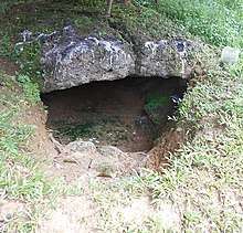
Bangladesh Scouts (Sylhet region), Petrobangla, Kailash Tila and the birthplace of Dream Land Park|Sri Chaitanya Dev.'[1] Mazar of Bahauddin, house and temple of sri chaitanya Dev, Kailash Tila and Dewan Bridge.[3]
Health centres
Upazila health centre 1, union health centre 1, health and family planning centre 5, community clinic 11, maternity and child welfare centre 1, diagnostic centre 3, veterinary hospital 1.
| Climate data for Golapganj | |||||||||||||
|---|---|---|---|---|---|---|---|---|---|---|---|---|---|
| Month | Jan | Feb | Mar | Apr | May | Jun | Jul | Aug | Sep | Oct | Nov | Dec | Year |
| Average high °C (°F) | 25.1 (77.2) |
27.2 (81.0) |
30.8 (87.4) |
31.4 (88.5) |
31.1 (88.0) |
30.9 (87.6) |
31.1 (88.0) |
31.5 (88.7) |
31.4 (88.5) |
30.7 (87.3) |
28.9 (84.0) |
26.2 (79.2) |
29.7 (85.5) |
| Average low °C (°F) | 11.8 (53.2) |
13.5 (56.3) |
17.6 (63.7) |
21.0 (69.8) |
22.6 (72.7) |
24.5 (76.1) |
25.0 (77.0) |
25.1 (77.2) |
24.5 (76.1) |
22.2 (72.0) |
17.5 (63.5) |
13.3 (55.9) |
19.9 (67.8) |
| Average precipitation mm (inches) | 14 (0.6) |
31 (1.2) |
119 (4.7) |
322 (12.7) |
566 (22.3) |
752 (29.6) |
694 (27.3) |
556 (21.9) |
440 (17.3) |
231 (9.1) |
36 (1.4) |
7 (0.3) |
3,768 (148.3) |
| Source: Climate-data.org | |||||||||||||
See also
- Beanibazar Upazila
- Upazilas of Bangladesh
- Districts of Bangladesh
- Divisions of Bangladesh
References
- Parvez, Azizul (2012). "Golapganj Upazila". In Islam, Sirajul; Jamal, Ahmed A. (eds.). Banglapedia: National Encyclopedia of Bangladesh (Second ed.). Asiatic Society of Bangladesh.
- Bangladesh Population Census 2001, Bangladesh Bureau of Statistics; Field report of Golabganj Upazila 2010.
- "Population Census Wing, BBS". Archived from the original on 27 March 2005. Retrieved 10 November 2006.
- "Local Government Engineering Department (LGED)". www.lged.gov.bd. Retrieved 11 June 2019.
Source Bangladesh Population Census 2001, Bangladesh Bureau of Statistics.
External links
- List Of Union Parishad - Local Government Engineering Department
- Golapganj Upazila - Banglapedia
- Official Website - Golapganj Upazila
Capital: Sylhet | ||
| Habiganj District | 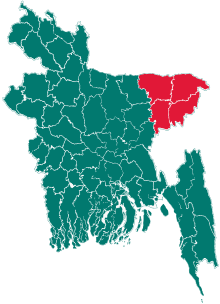 | |
| Moulvibazar District | ||
| Sunamganj District | ||
| Sylhet District | ||