Jamalpur Sadar Upazila
Jamalpur Sadar (Bengali: জামালপুর সদর) is an Upazila of Jamalpur District in the Division of Mymensingh, Bangladesh.[1]
Jamalpur Sadar জামালপুর সদর | |
|---|---|
Upazila | |
 Jamalpur Sadar Location in Bangladesh | |
| Coordinates: 24°55′N 89°57.5′E | |
| Country | Bangladesh |
| Division | Mymensingh Division |
| District | Jamalpur District |
| Area | |
| • Total | 489.56 km2 (189.02 sq mi) |
| Population (1991) | |
| • Total | 501,924 |
| • Density | 1,000/km2 (2,700/sq mi) |
| Time zone | UTC+6 (BST) |
| Postal code | 2000 |
| Website | Official Map of Jamalpur Sadar |
Geography
Jamalpur Sadar is located at 24.9167°N 89.9583°E . It has 102,578 households and a total area of 489.56 km².
Demographics
According to the 1991 Bangladesh census, Jamalpur Sadar had a population of 501,924, of whom 263,338 were aged 18 or over. Males constituted 51.47% of the population, and females 48.53%. Jamalpur Sadar had an average literacy rate of 27.6% (7+ years), against the national average of 32.4% .[2]
Upazila Nirbahi Officer (UNO): Mohammad Abdul Salam
Jamalpur Sadar has 19 Unions/Wards, 374 Mauzas/Mahallas, and 333 villages.
See also
- Upazilas of Bangladesh
- Districts of Bangladesh
- Divisions of Bangladesh
- Narayanganj-Bahadurabad Ghat Line
References
- MA Rahim Talukder (2012), "Jamalpur Sadar Upazila", in Sirajul Islam and Ahmed A. Jamal (ed.), Banglapedia: National Encyclopedia of Bangladesh (Second ed.), Asiatic Society of Bangladesh
- "Population Census Wing, BBS". Archived from the original on 27 March 2005. Retrieved 10 November 2006.
| Upazila/Thana: | ||
|---|---|---|
Headquarters: Mymensingh | ||
| Jamalpur District | 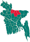 | |
| Mymensingh District | ||
| Netrokona District | ||
| Sherpur District | ||
This article is issued from Wikipedia. The text is licensed under Creative Commons - Attribution - Sharealike. Additional terms may apply for the media files.