Mirsharai Upazila
Mirsharai (Bengali: মীরসরাই) is an upazila of Chittagong District in the division of Chittagong, Bangladesh.
Mirsarai মীরসরাই | |
|---|---|
Upazila | |
 Mirsarai Location in Bangladesh | |
| Coordinates: 22°46.3′N 91°34.5′E | |
| Country | Bangladesh |
| Division | Chittagong Division |
| District | Chittagong District |
| Area | |
| • Total | 482.88 km2 (186.44 sq mi) |
| Population (1991) | |
| • Total | 325,712 |
| • Density | 670/km2 (1,700/sq mi) |
| Time zone | UTC+6 (BST) |
| 4320 | 4320 |
| Website | www.mirsarai.info |
Geography
Mirsharai is located at 22.7722°N 91.5750°E . It has 55771 households and total area 482.88 km².
Demographics
In the 1991 census in Bangladesh, Mirsharai had a population of 325712. Males constituted 49.97% of the population, and females 50.03%. This Upazila's eighteen up population is 160496. Mirsharai has an average literacy rate of 37.2% (7+ years), and the national average of 32.4% literate.[1]
Administration
Mirsharai has 16 Unions/Wards, 116 Mauzas/Mahallas, and 207 villages. The unions are:
- Ichhakhali
- Wahedpur
- Mithanala
- Osmanpur
- Karerhat [2]
- Katachhara
- Jorarganj[3]
- Durgapur[4]
- Dhum
- Hinguly
- Mirsarai
- Moghadia
- Khayachara
- Mayani
- Hayetkandi
- Shaherkhali
The villages are:
- Syedpur
[ Syedpur Dakhil Madrasha is one of the educational institution of this village. ]
Education
According to Banglapedia, [[Sarkarhat N. R. High School,Osmanpur multi-lateral,Julonpool Beni Madhob High school,Baroiarhat Girls High School,Naherpoor High school,Durgapup N C High School,Joynaddanpur High School,Tetoya Madrsas,Osmanpur Nuria Islamia Madrasa,Mithacara Madrasa,Mirsari Pilot School,Aburhat High School,Korerhat High school,Sayed Ali High School]], founded in 1939, is a notable secondary school.[5]
Zahedul Islam Zulonpole Govt Primary School multi-lateral
See also
- Mahamaya irrigation project
- Upazilas of Bangladesh
- Districts of Bangladesh
- Divisions of Bangladesh
- Mirsharai bus crash
References
- "Population Census Wing, BBS". Archived from the original on 2005-03-27. Retrieved November 10, 2006.
- "Mirsharai Upazila".
- "ইউনিয়ন সমূহ - মীরসরাই উপজেলা-NULL". mirsharai.chittagong.gov.bd. Retrieved 2018-12-01.
- "ইউনিয়ন সমূহ - মীরসরাই উপজেলা-NULL". mirsharai.chittagong.gov.bd. Retrieved 2018-12-01.
- Momtaz, Ahmed (2012). "Mirsharai Upazila". In Islam, Sirajul; Jamal, Ahmed A. (eds.). Banglapedia: National Encyclopedia of Bangladesh (Second ed.). Asiatic Society of Bangladesh.
Capital: Chattogram | ||
| Bandarban District | 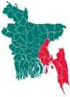 | |
| Brahmanbaria District | ||
| Chandpur District | ||
| Chattogram District | ||
| Cumilla District |
| |
| Cox's Bazar District | ||
| Feni District | ||
| Khagrachari District |
| |
| Lakshmipur District | ||
| Noakhali District | ||
| Rangamati District | ||