Nilphamari District
Nilphamari (Bengali: নীলফামারী জেলা, Nilphamari Jela also Nilphamari Zila) is a district in Northern Bangladesh. It is a part of the Rangpur Division. It is about 400 kilometres to the northwest of the capital Dhaka. It has an area of 1,547 square kilometres (597 sq mi). Nilphamari is bounded by Rangpur and Lalmonirhat in east, Rangpur and Dinajpur in south, Dinajpur and Panchagarh in west, Cooch Behar of India in north.[2] There are many rivers in Nilphamari such as the Tista, Buritista, Isamoti, Jamuneshwari, Dhum, Kumlai, Charalkata, Sorbomongola, Salki, Chikli, Deonai and many more.[3]
Nilphamari নীলফামারী | |
|---|---|
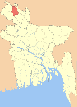 Location of Nilphamari District in Bangladesh | |

Expandable map of Nilphamari District | |
| Coordinates: 25.95°N 88.95°E | |
| Country | |
| Division | Rangpur Division |
| Area | |
| • Total | 1,643.70 km2 (634.64 sq mi) |
| Population (2011 census) | |
| • Total | 1,907,497 |
| • Density | 1,200/km2 (3,000/sq mi) |
| Time zone | UTC+06:00 (BST) |
| Postal code | 5300 |
| HDI (2018) | 0.614[1] medium · 7th of 21 |
| Website | nilphamari |
Etymology
About 200 years ago, the British established farms for cultivating indigo (nil). The soil of this area was very fertile for indigo cultivation. As a result, a lot of nil kuthi and nil khamar (farm) were built here compared to the other districts. It is widely believed that the term "nil khamari" was derived from "nil khamar" by the local farmers. And then the word "Nilphamari" was derived from "Nil khamari".[4]
Religion in Nilphamari as of 2001.
History
Nilphamari was previously under the Rajshahi division. The Nilphamari subdivision was established in 1875.[5] It was a subdivision of the Rangpur District. It was turned into a district in 1984. The district consists of 3 municipalities, 33 wards, 65 mahallas, 62 union parishads, 390 mouzas and 370 villages.
Historical speciality
The historical Tebhaga movement spread over Domar and Dimla of this district in the 1940s. Indigo used to be cultivated extensively in this district. Syedpur is best known for its railway workshop. In 1870, the Assam-Bengal railway set up its largest workshop in Syedpur and many Biharis or Urdu-speakers came to work there. During the British rule the telephone exchange for the whole Assam-Bengal District was also situated in Syedpur, and it was the third-largest city of Bangladesh after Dhaka and Chittagong. Syedpur had the first airport in North Bengal. There was also a cantonment during the British period.[6]
Administration
| Upazila (subdistrict) | Population | Male | Female |
|---|---|---|---|
| Nilphamari Sadar (Bengali: নীলফামারী সদর) | 435,165 | 219,080 | 216,082 |
| Saidpur Upazila (Bengali: সৈয়দপুর alt. spelling: Syedpur) | 265,461 | 134,737 | 131,724 |
| Jaldhaka (Bengali: জলঢাকা) | 341,672 | 171,466 | 169,206 |
| Kishoreganj (Bengali: কিশোরগঞ্জ) | 261,069 | 130,931 | 130,138 |
| Domar (Bengali: ডোমার) | 249,429 | 125,338 | 124,091 |
| Dimla (Bengali: ডিমলা) | 283,438 | 142,412 | 141,026 |
| Total | 1,834,231 | 922,964 | 911,267 |
Source: Bangladesh Bureau of Statistics (Census 2011).[7]
Economy
Nilphamari has an agriculture-based economy. Nilphamari produces rice, wheat, potato, tobacco, and many seasonal crops. The major occupation of the people is farming. Among the working population 45.28% are farmers, 27.81% are farm labourers, 3.42% are daily workers, 8.65% are businessmen, 6.07% are government and non-government employers, 8.77% have other occupations.[8]
Places of interest
- Nilsagar Nilphamari: Nilsagar a historical dighi (big pond) which stands at Dhobadanga mauza of Gorgram union about 14 km southwest of Nilphamari district headquarters. During the reign of Raja Birat, there were many cow farms at Gorgram. Raja Birat dug a large dighi named Birat Dighi or Birna Dighi or Binna Dighi for the cows. After the independence of Bangladesh, the dighi was renamed as Nilsagar. A Hindu mandir stands on the east bank and an abode of a Muslim darvesh on the west bank of the dighi. The area of the dighi is 21.449 ha and depth ranges from 7m to 12m. The entire dighi is surrounded by brick walls. The main decorated ghat of the dighi was made by Raja Birat. Every year the banks of the dighi are used as a village fair site especially during the Baruni Snan festival of the full moon in the month of Baisakh. The Harikirtan singers usually play music during the fair, with many kinds of kirtan songs. Every year many tourists and various kinds of migratory birds come here. It is well known as a recreation zone and a picnic spot.[9]
- The palace of Raja Harish Chandra (ninth century)
- Garh (Fort) of Raja Dharmapal and his palace (eighteenth century)
- Three domed Jami Mosque at Bherberi (eighteenth century)
- Tomb of Hazrat Pir Mohiuddin (Kundupukur)
- Dimla Rajbari[10]
- Saidpur Airport
- Railway Factory in Saidpur
- Uttara Export Processing Zone
- Teesta Barrage
- Saidpur Church (1893)
- Nat Settlement (prison, 1871)
- Leprosy Hospital[6]
- Chini Mosque
Education
The literacy rate of Nilphamari is 49.69% according to the 2011 consensus. There are 940 primary schools, 295 high schools, 95 colleges, 1 medical college, 2 government and 17 non-government technical institutes, 1 P.T.I., 115 dakhil madrasas, 24 alim madrasas, 14 fajil madrasas and one kamil madrasa in Nilphamari.
- Nilphamari Medical College
- Nilphamari Government College
- Nilphamari Government Mohila College
- Nilphamari Government High School
- Nilphamari Government Girls' School
- Nilphamari Technical School and College
- Nilphamari Teachers Training College
- Collectorate Public School & College, Nilphamari
- Nilphamari Model College, Nilphamari
- Domar Government College
- Domar ML High School
- Domar Women College
- Domar Government Girls' School
- Domar Balika Nikaton School
- Domar Shohid Smrity Government Primary School
- Saidpur College
- Sonaray High School
- Sonaray Dristi Nondon Govt. Primary School
- Chhitmirganj Shalongram Fazil Madrasah
Place to visit
Nilsagar
Nilsagar a famous historical dighi (big pond) that stands at Dhobadanga mauza of Gorgram union about 14 km southwest of Nilphamari district headquarters. During the reign of Raja Birat there were many cow farms at Gorgram. Raja Birat dug a large dighi named as Birat Dighi or Birna Dighi or Binna Dighi for the cows. After the independence of Bangladesh, the dighi was renamed as Nilsagar. A Hindu mandir stands on the east bank and an abode of a Muslim darvesh on the west bank of the dighi. The area of the dighi is 21.449 ha and depth ranges from 7m to 12m. The entire dighi is surrounded by brick walls. The main decorated ghat of the dighi was made by Raja Birat. Every year the banks of the dighi are used as a village fair site especially during the occasion of Baruni Snan festival in the full moon of the month of Baisakh. Usually, in the fair the Harikirtan singers play music with many kinds of kirtan songs. Every year many tourists and various kinds of migratory birds come here. It is well known as a recreation zone and a picnic spot.
Transportation
Nilphamari has a direct connection to Dhaka by bus and train. Trains available in Nilphamari are Nilsagor express, Borendro express, Titumir express, Rupsa express and Simanto express. Major bus agencies are Greenline, Nabil travels, Shyamoli travels, Hanif travels, S.A. travels, Bablu travels, Agomoni travels, and BRTC. There is also an airport in Nilphamari.[11]
Demographics
The population of Nilphamari district is 1,907,497. The male population is 959,857 and the female population is 947,640. The density of population is 1215 per km2. 82.84% of the total population are Muslims, 17.18% are Hindus, 0.07% are Christians, 0.02% are Buddhists and 0.1% are others.[12]
Famous people[13]
- Mashiur Rahman (politician from Rangpur), also known as Jadu Mia, former Prime Minister of Bangladesh
- Asaduzzaman Noor, actor and politician
- Anisul Hoque, journalist, writer and editor
- Baby Naznin, singer
- Shah Kalandar, Sufi and preacher of Islam
- Nabab Nurul Uddin, leader of the farmer rebellion against the British government
- Khairat Hosen, M.L.A., Minister of Food, Fisheries, and Livestock of Pakistan from 1955 to 1957
- Dabir Uddin Ahmed, language movement activist in 1952
- Harlal Rai, folk singer
- Mahesh Chandra Rai, singer, composer and songwriter
- Begum Lutfunnesa Abbas, writer
- Ahosan Ahmed (Hasan) Politician
References
| Wikimedia Commons has media related to Nilphamari District. |
- "Sub-national HDI - Area Database - Global Data Lab". hdi.globaldatalab.org. Retrieved 2020-03-18.
- "নীলফামারী" Retrieved 26 February 2013
- "Rivers of Nilphamari". Bangladesh national portal.
- "Background of Nilphamari". Bangladesh national portal.
- Abdus Sattar (2012). "Nilphamari District". In Sirajul Islam and Ahmed A. Jamal (ed.). Banglapedia: National Encyclopedia of Bangladesh (Second ed.). Asiatic Society of Bangladesh.
- "bangladeshtalks.com" Retrieved 26 February 2013.
- "District Statistics". Bangladesh Bureau of Statistics. Retrieved 2019-05-02.
- "Nilphamari at a glance". Bangladesh national portal.
- Nilsagar from Banglapedia Retrieved 6 December 2014
- Dimla in Banglapidea Retrieved 6 December 2014
- "Transport system of Nilphamari". Bangladesh National portal.
- "Nilphamari at a glance". Bangladesh national portal.
- "Notable persons of Nilphamari". Bangladesh national portal.
| Barisal Division |
|  |
|---|---|---|
| Chittagong Division | ||
| Dhaka Division | ||
| Khulna Division | ||
| Mymensingh Division | ||
| Rajshahi Division | ||
| Rangpur Division | ||
| Sylhet Division | ||
Bayazid Amin (Represented BD u-15 & u-17 national cricket team)