Comilla
Comilla, officially known as Cumilla,[1] is a city in the Chittagong Division of Bangladesh, located along the Dhaka-Chittagong Highway. It is the administrative centre of the Comilla District, part of the Chittagong Division. Comilla is the second-largest city of eastern Bangladesh after Chittagong and is one of the three oldest cities in Bangladesh.
Comilla কুমিল্লা Cumilla | |
|---|---|
City | |
-01.jpg) 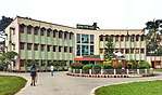 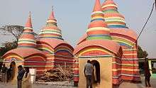 .jpg) .jpg) .jpg) 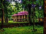 .jpg) From top: Comilla Skyline, Comilla Education Board, Chondimura temple, Mainamati War Cemetery, Dharmasagar Lake, Roopsagar Park, Bangladesh Academy for Rural Development and Mainamati | |
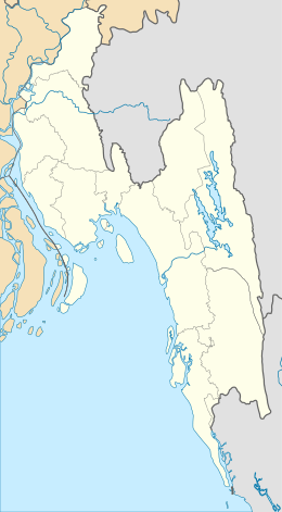 Comilla location in Chittagong Division  Comilla Location in Bangladesh | |
| Coordinates: 23°27′N 91°12′E | |
| Country | Bangladesh |
| Division | Chittagong Division |
| District | Comilla District |
| Municipality established | 1890 |
| City corporation | 10 July 2011 |
| Government | |
| • Type | Mayor–Council |
| • Body | Comilla City Corporation |
| • City Mayor | Monirul Haque Sakku (BNP) |
| Area | |
| • Total | 3,087.33 km2 (1,192.02 sq mi) |
| Elevation | 72 m (236 ft) |
| Population (2011) | |
| • Total | 296,010 |
| • Density | 16,000/km2 (40,000/sq mi) |
| Demonym(s) | Comillian, Kumilli |
| Time zone | UTC+6 (BST) |
| Postal code | 3500–3583 |
| Calling code | 081 |
| Literacy percentage total | 57% |
| Notable sport teams | Comilla Victorians |
| Website | cocc |
History
Ancient era
The Comilla region was once under ancient Samatata and was joined with Tripura State. This district came under the reign of the kings of the Harikela in the ninth century AD. Lamai Mainamati was ruled by the Deva dynasty (eighth century AD), and (during the 10th and mid-11th century AD). In 1732, it became the centre of the Bengal-backed domain of Jagat Manikya.[2]
The Peasants’ Movement against the king of Tripura in 1764, which originally formed under the leadership of Shamsher Gazi is a notable historical event in Comilla.[3] It came under the rule of East India Company in 1765. This district was established as the Tripura district in 1790. It was renamed Comilla in 1960. Chandpur and Brahmanbaria subdivisions of this district were transformed into districts in 1984.
British era
.jpg)
Communal tension spread over Comilla when a Muslim was shot in the town during the partition of Bengal in 1905. On 21 November 1921, Kazi Nazrul Islam composed patriotic songs and tried to awaken the town people by protesting the Prince of Wales's visit to India.[4] During this time, Avay Ashram, as a revolutionary institution, played a significant role. Poet Rabindranath Tagore and Mahatma Gandhi visited Comilla at that time. In 1931, approximately 4000 peasants in Mohini village in Chauddagram Upazila revolted against a land revenue tax. The British Gurkha soldiers fired indiscriminately on the crowd, killing four people.[5] In a major peasant gathering, the police fired at Hasnabad of Laksam Upazila in 1932. Two people were killed and many were wounded. Comilla Victoria Government College in the city was named in memory of Queen Victoria .
World War II
Comilla Cantonment is an important military base and the oldest in East Bengal. It was widely used by the British Indian Army during World War II. It was the headquarter of the British 14th Army. There is a war cemetery, Maynamati War Cemetery,[6] in Comilla that was established after the World War II to remember the Allied soldiers who died during World War I and II, mostly from Commonwealth states and the United States. There are a number of Japanese soldiers buried there as well, from the Second World War.
War of liberation of Bangladesh
_%E0%A6%AA%E0%A6%B0%E0%A6%BF%E0%A6%95%E0%A6%B2%E0%A7%8D%E0%A6%AA%E0%A6%A8%E0%A6%BE.png)
During the Indo-Pakistani War of 1971 for the liberation of Bangladesh, when Pakistan Army created the 39th ad hoc Division in mid-November, from the 14th Division units deployed in those areas, to hold on to the Comilla and Noakhali districts, and the 14th Division was tasked to defend the Sylhet and Brahmanbaria areas only.[7] Pakistan Army's 93,000 troops unconditionally surrendered to the Indian Army and India's local ally Mukti Bahini on 16 December 1971.[8] This day and event is commemorated as the Bijoy Dibos (Bengali: বিজয় দিবস) in Bangladesh and Vijay Diwas in India.[9][10]
Geography

Comilla is bounded by Burichang Upazila and Tripura on the north, Laksham, and Chauddagram on the south, and Barura on the west. The major rivers that pass through Comilla include Gumti[11] and Little Feni. The Tropic of Cancer crosses Comilla town on the south side just over the Tomsom Bridge.
Climate
Comilla has a tropical savanna climate. The Köppen-Geiger climate classification is Aw. The climate of Comilla is generally marked with monsoons, high temperature, considerable humidity and heavy rainfall. The hot season commences early in April and continues till July. The average annual temperature in Comilla is 25.5 °C (77.9 °F). About 2,295 mm (90.35 in) of precipitation falls annually.
| Climate data for Comilla | |||||||||||||
|---|---|---|---|---|---|---|---|---|---|---|---|---|---|
| Month | Jan | Feb | Mar | Apr | May | Jun | Jul | Aug | Sep | Oct | Nov | Dec | Year |
| Average high °C (°F) | 25.7 (78.3) |
28.1 (82.6) |
31.6 (88.9) |
32.8 (91.0) |
32.5 (90.5) |
31.2 (88.2) |
30.7 (87.3) |
31.0 (87.8) |
31.4 (88.5) |
31.0 (87.8) |
29.2 (84.6) |
26.5 (79.7) |
30.1 (86.3) |
| Average low °C (°F) | 12.4 (54.3) |
14.8 (58.6) |
19.6 (67.3) |
23.1 (73.6) |
24.4 (75.9) |
25.2 (77.4) |
25.3 (77.5) |
25.4 (77.7) |
25.3 (77.5) |
23.6 (74.5) |
18.8 (65.8) |
13.8 (56.8) |
21.0 (69.7) |
| Average precipitation mm (inches) | 9 (0.4) |
20 (0.8) |
49 (1.9) |
142 (5.6) |
259 (10.2) |
469 (18.5) |
457 (18.0) |
396 (15.6) |
265 (10.4) |
181 (7.1) |
45 (1.8) |
3 (0.1) |
2,295 (90.4) |
| Source: Climate-Data.org, Climate data | |||||||||||||
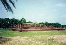
Points of interest
Comilla has a number of tourist attractions. Various archaeological relics discovered in the district, especially from the 7th–8th century, are now preserved in the Mainamati Museum.[12] There is a World War II war cemetery in Comilla, which is protected and maintained by the Commonwealth War Graves Commission.
Sports
Comilla Victorians is a professional cricket team based in Comilla and is the second most successful club in the Bangladesh Premier League.[13] Comilla Victorians also has the most wins in the league.[14]
Administration
Comilla is controlled by the Comilla City Corporation. It has 27 wards.[15]
Metro neighbourhoods
These are the neighbourhoods of Comilla:[16]
- Baghmara
- Bara Para
- Belghar
- Bholain (North)
- Bholain (South)
- Bijoypur
- Chapapur
- Durlovpur
- Chouara
- Galiara
- Purba Jorekaran
- Pachim Jorekaran
- Perul (North)
- Perul (South)
Transportation
Highway
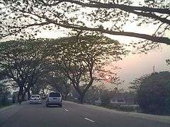
One of the oldest highways of the Indian Subcontinent, 'The Grand Trunk Road', passes through the city. The Dhaka–Chittagong Highway bypasses the city from the cantonment to Poduar Bazar.[17] The inter city bus terminal is located at the entrance of the city, called ShashonGacha.
Railway
Comilla is a nearby city of Laksham Junction and Akhaura Railway Junction. Rail connection is available to Dhaka, Chittagong, Brahmanbaria, and Sylhet.
Education
The Board of Secondary and Higher Secondary Education is responsible for holding public examinations (JSC, S.S.C, and H.S.C) in Comilla and five nearby districts.
Media
Daily newspapers published in Comilla include Comillar Kagoj, Daily Amader Comilla, Shiranam, and Rupasi Bangla, established in 1972. Amod, founded in 1955, is the city's oldest weekly newspaper.[5][18][19]
Notable residents
- Shib Narayan Das, member of BLF. One of the designers of the first flag of Bangladesh.
- Shaheed Dhirendranath Datta was ex-Minister of Law, Language movement activist and Shaheed of 1971.
- Major Abdul Gani, organizer of the First East Bengal Regiment.
- Khondaker Mushtaq Ahmad, President of Bangladesh; he also served as Minister and member of Exile Cabinet of Meherpur Government
- Kazi Zafar Ahmed, Prime Minister
- Mustafa Kamal served as president of the International Cricket Council.
- Shaukat Mahmood, senior journalist and editor of Weekly Economic Times. Elected president of National Press Club.
- Buddhadeb Bosu, Bangla poet, novelist, translator, editor, and essayist.
- Kamrul Ahsan : Secretary to the Government and now serving as Bangladesh Ambassador to Russia. Earlier served as High Commissioner to Canada and Singapore.
- Kazi Nazrul Islam, resided at Comilla.
- Abdul Kadir, poet, researcher, and editor.
See also
- List of universities and schools in Comilla
References
- "Bangladesh changes English spellings of five districts". Bdnews24.com. Dhaka. 2 April 2018. Retrieved 2 April 2018.
- Kilikhar, Bidhas Kanti (1995). Tripura of the 18th Century with Samsher Gazi Against Feudalism: A Historical Study. Agartula: Chhapa Kathi, Tripura State Tribal Cultural Research Institute and Museum. p. 55. OCLC 39290375.
- Nawaz, Ali (2012). "Shamsher Gazi". In Islam, Sirajul; Jamal, Ahmed A. (eds.). Banglapedia: National Encyclopedia of Bangladesh (Second ed.). Asiatic Society of Bangladesh.
- Islam, Rafiqul (2012). "Islam, Kazi Nazrul". In Islam, Sirajul; Jamal, Ahmed A. (eds.). Banglapedia: National Encyclopedia of Bangladesh (Second ed.). Asiatic Society of Bangladesh.
- Siddiqi, Mamun (2003). "Comilla District". In Islam, Sirajul; Jamal, Ahmed A. (eds.). Banglapedia: National Encyclopedia of Bangladesh (First ed.). Asiatic Society of Bangladesh.
During this time Avaya Ashram, as a revolutionary institution, played significant role. Poet Rabindranath Tagore and Mahatma Gandhi visited Comilla at that time. In 1931, the British Gurkha soldiers fired indiscriminately and killed four persons of village Mohini of Chauddagram Upazila when about four thousand peasants of this village revolted against paying land revenue.
- Whitaker's Cumulative Book List. J. Whitaker. 1961. p. 146.
- Salik, Siddiq, Witness to Surrender, pp126
- Team, Editorial (17 December 2017). "Why Do India Celebrate 'Vijay Diwas' On 16th December". SSBToSuccess. Retrieved 18 December 2017.
- "About us". Liberation War Museum. Archived from the original on 8 November 2011. Retrieved 21 November 2011.
- Team, Editorial (17 December 2017). "Why Do India Celebrate 'Vijay Diwas' On 16th December". SSBToSuccess. Retrieved 18 December 2017.
- Chisholm, Hugh, ed. (1911). . Encyclopædia Britannica. 6 (11th ed.). Cambridge University Press. p. 763.
- Huntington, Susan L. (1984). The "Påala-Sena" Schools of Sculpture. Brill Archive. p. xxvi. ISBN 978-90-04-06856-8.
- "Cricket Records | Bangladesh Premier League | Records | Series results". ESPN Cricinfo. Retrieved 22 July 2016.
- "Cricket Records | Bangladesh Premier League | Records | Result summary". ESPN Cricinfo. Archived from the original on 10 September 2016. Retrieved 22 July 2016.
- "History". Comilla City Corporation. Retrieved 22 August 2016.
- মানচিত্রে সদর দক্ষিণ উপজেলা [Map of Sadar South Upazila]. Bangladesh National Information Portal (in Bengali). Government of Bangladesh. Archived from the original on 1 April 2017. Retrieved 22 August 2016.
- Leung, Mikey; Meggitt, Belinda (2012). Bangladesh. Bradt Travel Guides. p. 274. ISBN 978-1-84162-409-9.
- পত্র পত্রিকা [Periodicals]. Comilla District (in Bengali). Bangladesh National Portal.
- "Bangladesh Newspapers and News Media Guide". ABYZ News Links.
External links

- City Corporation
Destinations from Comilla | ||||||||||
|---|---|---|---|---|---|---|---|---|---|---|
| ||||||||||

| Authority control |
|
|---|
- Population and Housing Census 2011 - Volume 3: Urban Area Report (PDF), Bangladesh Bureau of Statistics, August 2014