Khulna District
Khulna District (Bengali: খুলনা জেলা, Khulna Jela also Khulna Zila) is a district of Bangladesh. It is located in the Khulna Division. It is bordered on the north by the Jessore District and the Narail District, on the south by the Bay of Bengal, on the east by the Bagerhat District, and on the west by the Satkhira District.[2]
Khulna খুলনা জেলা | |
|---|---|
 Location of Khulna District in Bangladesh | |
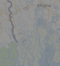
Expandable map of Khulna District | |
| Coordinates: 22.35°N 89.30°E | |
| Country | |
| Division | Khulna Division |
| Area | |
| • Total | 4,389.11 km2 (1,694.64 sq mi) |
| Population (2011 census) | |
| • Total | 2,318,527 |
| • Density | 530/km2 (1,400/sq mi) |
| Literacy rate | |
| • Total | 57.81% |
| Time zone | UTC+06:00 (BST) |
| Postal code | 9000 |
| HDI (2018) | 0.620[1] medium · 6th of 21 |
| Website | www |
Demographics
Geography and climate
Khulna District has a total area of 4,389.11 square kilometres (1,694.64 sq mi).[4] It borders Jessore District to the north, Narail District to the northeast, Bagerhat District to the east, the Bay of Bengal to the south, and Satkhira District to the west.[2]
Major rivers of Khulna District are the Rupsa (a continuation of the Bhairab and Atrai), Arpangachhia, Shibsa, Pasur, and the Koyra.[2]
See also
References
| Wikimedia Commons has media related to Khulna District. |
- "Sub-national HDI - Area Database - Global Data Lab". hdi.globaldatalab.org. Retrieved 2020-03-18.
- Sandipak Mallik (2012). "Khulna District". In Sirajul Islam and Ahmed A. Jamal (ed.). Banglapedia: National Encyclopedia of Bangladesh (Second ed.). Asiatic Society of Bangladesh.
- "C-1 Population By Religious Community". Government of Bangladesh.
- "District Statistics 2011: Khulna" (PDF). Bangladesh Bureau of Statistics. Retrieved October 29, 2017.
| Upazila/Thana: | ||
|---|---|---|

This article is issued from Wikipedia. The text is licensed under Creative Commons - Attribution - Sharealike. Additional terms may apply for the media files.