Netrokona District
Netrokona (Bengali: নেত্রকোণা) is a district in northern Bangladesh. It is a part of Mymensingh Division.
Netrokona নেত্রকোনা | |
|---|---|
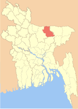 Location of Netrokona District in Bangladesh | |
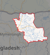
Expandable map of Netrokona District | |
| Coordinates: 24.88°N 90.73°E | |
| Country | |
| Division | Mymensingh Division |
| Area | |
| • Total | 2,794.28 km2 (1,078.88 sq mi) |
| Population (2011 census) | |
| • Total | 2,229,642 |
| • Density | 800/km2 (2,100/sq mi) |
| Demonym(s) | Netrokoni, Netrokonese |
| Time zone | UTC+06:00 (BST) |
| Website | http://www.netrokona.gov.bd/ |
Etymology
The headquarters of Netrokona District was located at the bend of the Mogra River and was called Nadirkona. Many people believe that over a period of time Nadirkona became Netrakona.[1]
History
In 1880, the British Raj approved the area as a mahakuma administrative region.[2] It was effective on 3 January 1882 when the region was officially named as Netrakona Mahakuma. Government of Bangladesh converted it to Netrakona District on 17 January 1984.[1]
Geography
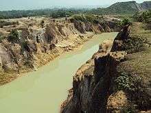
Netrakona is situated in the northern part of Bangladesh, near the Meghalayan border. There are five main rivers in Netrakona: Kangsha, Someshawri, Dhala, Magra, and Teorkhali. It is a part of the Surma-Meghna River System.[3]
The total area of Netrakona District is 2,794.28 km2 (1,078.88 sq mi) of which 9.17 km2 (3.54 sq mi) is under forest. It lies between 24°34’ and 25°12’ north latitudes and between 90°00’ and 91°07’ east longitudes.[1]
Netrakona District is bounded by the Garo Hills in Meghalaya, India on the north, Sunamganj District on the east, Kishoreganj District on the south and Mymensingh District on the west.[1]
Netrakona Pouroshabha (Town of Netrakona) is a municipal town, established in 1887 and with an area of 13.63 km².
Upazilas
Netrokona district is divided into ten upazilas.[4]
Demographics
According to 2011 Bangladesh census, Netrakona District had a population of 2,229,642. Males constituted 49.84% of the population and females 50.16%. Muslims formed 89.78% of the population, Hindus 9.30%, Christians 0.82% and others 0.10%. Netrakona District had a literacy rate of 39.44% for the population 7 years and above.[5]
The major indigenous communities in this district are: Garo, Hajong, Hodi and Bana.[6]
Economy
The economy of Netrakona is largely agrarian. Susang Durgapur, an Upazila of Netrakona, is one of the major sources of country's China-Clay used for ceramic products. Its vast water bodies (Hawor) provides wide varieties of fishes. Bara Bazar and Choto Bazar is commerce centre of Netrakona.
Tourist attractions
- Durgapur : There are a lot of Garo hills at Bijoypur in Durgapur. There is a hill of white clay.
- Birishiri : There is a Tribal Cultural Academy. And also have a historical big pond called Sagor Dighi.
- Hawor : Hawor is a large area of water spaces. Biggest hawor is located in Mohongonj and Khaliajuri . Dingaputa is one of the biggest hawor among them.
- Madanpur Mazar (Shah Sultan Rumi): It is situated 8 km south to the Netrokona Town.
- Ranikong Mission
Religion
The district of Netrakona consists 3146 mosques, 958 temples, 83 churches and eight Buddhist temples.1guruduara
Notable people
- Mustaque Ahmed Ruhi - Former Member of Parliament
- Humayun Ahmed - Author, dramatist and film director.
- Bari Siddiqui - He was a Bangladeshi singer-songwriter, flutist and folk musician.
- Dr. Muhammad Zafar Iqbal - is a Bangladeshi author, physicist, professor and activist. He is a professor of computer science and engineering at Shahjalal University of Science and Technology.
- Nirmalendu Goon - Writer, poet, painter.
- Mustafa Jabbar - President of Bangladesh Association of Software and Information Services (BASIS), President of Bangladesh Computer Samity
- Helal Hafiz - Writer and poet.
- Ahsan Habib- Writer, Cartoonist
- Akhlakul Hossain Ahmed – politician
See also
- Districts of Bangladesh
- Dhaka Division
- History of Mymensingh
- Balish
References
| Wikimedia Commons has media related to Netrokona District. |
- "Bangladesh Population and Housing Census 2011: Zila Report – Netravkona" (PDF). Page xix: Physical features of Netrokona Zila. Bangladesh Bureau of Statistics (BBS), Ministry of Planning, Government of the People’s Republic of Bangladesh. Retrieved 14 December 2018.
- "নেত্রকোণা জেলা". http. Retrieved 2019-07-19.
- "Surma-Meghna River System". Bnglapedia. Retrieved 14 December 2018.
- Sanjay Sarwar (2012). "Netrakona District". In Sirajul Islam and Ahmed A. Jamal (ed.). Banglapedia: National Encyclopedia of Bangladesh (Second ed.). Asiatic Society of Bangladesh.
- "Bangladesh Population and Housing Census 2011: Zila Report – Netrakona" (PDF). Table P01 : Household and Population by Sex and Residence, Table P05 : Population by Religion, Age group and Residence, Table P09 : Literacy of Population 7 Years & Above by Religion, Sex and Residence. Bangladesh Bureau of Statistics (BBS), Ministry of Planning, Government of the People’s Republic of Bangladesh. Retrieved 14 December 2018.
- "Netrokona District". Banglapedia. Retrieved 14 December 2018.
External links
| Barisal Division |
|  |
|---|---|---|
| Chittagong Division | ||
| Dhaka Division | ||
| Khulna Division | ||
| Mymensingh Division | ||
| Rajshahi Division | ||
| Rangpur Division | ||
| Sylhet Division | ||
Netrakona District | ||
|---|---|---|
Capital: Netrokona | ||
| Upazilas | ||
| Constituencies | ||
| Attractions and sites | ||
| Educational institutions | ||
| Inhabited areas | ||
| History | ||
| Transport | ||