Panchbibi Upazila
Panchbibi (Bengali: পাঁচবিবি) is an Upazila of Joypurhat District in the Division of Rajshahi, Bangladesh.[1] It is bounded by Hakimpur and Ghoraghat upazilas and West Bengal of India on the north, Joypurhat Sadar upazila on the south, Gobindaganj and Kalai upazilas on the east, Joypurhat Sadar upazila and West Bengal of India on the west.
Panchbibi পাঁচবিবি | |
|---|---|
Upazila | |
 Panchbibi Location in Bangladesh | |
| Coordinates: 25°11.7′N 89°1.2′E | |
| Country | |
| Division | Rajshahi Division |
| District | Joypurhat District |
| Area | |
| • Total | 278.53 km2 (107.54 sq mi) |
| Population (1991) | |
| • Total | 193,365 |
| • Density | 690/km2 (1,800/sq mi) |
| Time zone | UTC+6 (BST) |
| Website | Official Map of Panchbibi |
Geography
Panchbibi is located at 25.1958°N 89.0208°E . It has 38,555 household units and a total area of 278.53 km².
Panchbibi Upazila is bounded by Hakimpur and Ghoraghat Upazilas in Dinajpur district, and Hili CD Block in Dakshin Dinajpur district, West Bengal, India, on the north, Gobindaganj Upazila in Gaibandha District and Kalai Upazila in Joypurhat District on the east, Joypurhat Sadar Upazila on the south and Joypurhat Sadar Upazila and Balurghat CD Block in Dakshin Dinajpur district, West Bengal, India, on the west.[2][3][4]
Demographics
As of the 1991 Bangladesh census, Panchbibi has a population of 193,365. Males constitute 51.06% of the population, and females 48.94%. This Upazila's population of people aged eighteen and higher is 99,108. Panchbibi has an average literacy rate of 30.6% (7+ years), against the national average of 32.4% literate.[5]
Administration
Panchbibi has 8 Unions/Wards, 222 Mauzas/Mahallas, and 257 villages.
See also
- Upazilas of Bangladesh
- Districts of Bangladesh
- Divisions of Bangladesh
References
- Shahnaz Parveen (2012), "Panchbibi Upazila", in Sirajul Islam and Ahmed A. Jamal (ed.), Banglapedia: National Encyclopedia of Bangladesh (Second ed.), Asiatic Society of Bangladesh
- "Panchbibi Upazila". Banglapedia. Retrieved 8 December 2018.
- "District Census Handbook 2011 Dakshin Dinajpur" (PDF). Map of Dakshin Dinajpur showing CD Blocks on the fourth page. Directorate of Census Operations. Retrieved 8 December 2018.
- "District Human Development Report" (PDF). Uttar Dinajpur. Page 14: Map showing locational setting of Uttar Dinajpur district (includes Dakshin Dinajpur district). Department of Planning, Statistics and Programme Implementation, Government of West Bengal. Archived from the original (PDF) on 24 December 2019. Retrieved 8 December 2018.
- "Population Census Wing, BBS". Archived from the original on 2005-03-27. Retrieved November 10, 2006.
| Upazila/Thana: | ||
|---|---|---|
Headquarters: Rajshahi | ||
| Bogra District | 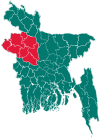 | |
| Joypurhat District | ||
| Naogaon District | ||
| Natore District | ||
| Nawabganj District | ||
| Pabna District | ||
| Rajshahi District | ||
| Sirajganj District | ||