Barisal District
Barisal District, officially known as Barishal District,[2] is a district in south-central Bangladesh, formerly called Bakerganj district, established in 1797.[3] Its headquarters are in the city of Barisal, which is also the headquarters of Barisal Division.[4]
Barisal District বরিশাল জেলা | |
|---|---|
| Barishal District | |
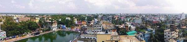 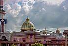 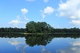 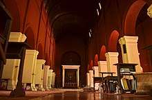   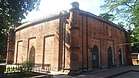 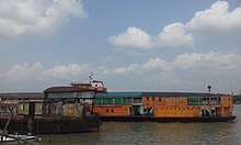 _(4).jpg) 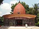 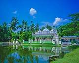 From top: City skyline, Guthia Mosque, Durga Sagar lake, Oxford Mission Church, Brojomohun College, Bell's Park aka Bangabandhu Udyan, Kasba Mosque, Paddle steamer at Kirtonkhola River port, Satlar Bil, Manasa Mandir of Bijoy Gupta and Ulania Zamnindar Bari Mosque. | |
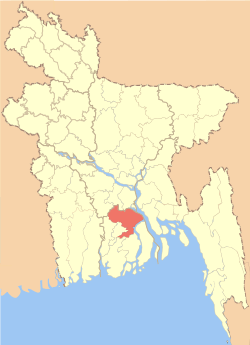 Location of Barisal District in Bangladesh | |
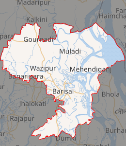
Expandable map of Barisal District | |
| Coordinates: 22.80°N 90.37°E | |
| Country | |
| Division | Barisal Division |
| Bakerganj District | 1760 |
| Area | |
| • Total | 2,784.52 km2 (1,075.11 sq mi) |
| Census 2011 | |
| Population (2011) | |
| • Total | 2,324,310 |
| • Density | 830/km2 (2,200/sq mi) |
| Demonyms | Barisali, Borishailla |
| Time zone | UTC+06:00 (BST) |
| Postal code | 8200 |
| HDI (2018) | 0.672[1] medium · 2nd of 21 |
History
Barisal District is a district in southern Bangladesh and is also the headquarter of Barisal Division.[4] Barisal District traces its origins to Bakerganj district which was established in 1797. It was placed in Barisal Division on 1 January 1993.[3]
Education
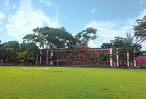
Notable educational institutions in Barisal include Sher-e-Bangla Medical College, University of Barisal, Barisal Engineering College, Barisal Cadet College, Govt. B M College, Govt. Barisal College, Govt. Hatem Ali College, Govt. Woman's College, Barisal Polytechnic Institute, Govt. Fazlul Huq College, Barisal Technical School and College, A. Karim Ideal College, and Ideal Cadet School & College.
Subdivisions
Barisal District is divided into the following Upazilas (formerly called Thanas):
Notable personalities
- Abdur Rahman Biswas, politician, President of Bangladesh
- Anil Biswas, music director composer of Bollywood.
- Mahanambrata Brahmachari, Hindu saint
- Mithun Chakraborty, film actor, singer, producer, writer, social worker, entrepreneur, television presenter of Bollywood
- Kanai Chatterjee, Bengali Maoist leader
- Abdul Gaffar Choudhury, journalist, who wrote Amar Bhaier Rokte Rangano to mark the Bengali Language Movement.
- Jibanananda Das, Bengali poet
- Kusumkumari Das, poet and mother of Jibanananda Das
- Aswini Kumar Dutta, founder of BM College
- Brajamohan Dutta, Bengali philanthropist and social worker
- A. K. Fazlul Huq politician, Chief Minister of undivided Bengal & Governor of erstwhile East Pakistan
- Mohiuddin Jahangir, officer in Sector 7 of the Muktibahini(1971). The highest recognition of bravery in Bangladesh, Bir Sreshtho.
- Shamsuddin Abul Kalam, Bangladeshi novelist
- Sufia Kamal, poet of Bangladesh
- Altaf Mahmud, music director & lyrician, who composed Amar Bhaier Rokte Rangano
- Mahapran Jogendra Nath Mandal, a Dalit and leader of the Namasudra community.
- Tofazzal Hossain Manik Miah, founder editor of The Daily Ittefaq
- Hanif Sanket, Television host, writer, producer.
- Nachiketa, Famous singer "Tollywood,west bengal,India"
- Mosharof Karim, Famous Bangladeshi Actor From Gaurnadi Upazilla, Tv actor
- Major MA jalil, Sector commander in the war of 1971
See also
References
| Wikimedia Commons has media related to Barishal District. |
- "Sub-national HDI - Area Database - Global Data Lab". hdi.globaldatalab.org. Retrieved 18 March 2020.
- Mahadi Al Hasnat (2 April 2018). "Mixed reactions as govt changes English spellings of 5 district names". Dhaka Tribune. Retrieved 8 April 2018.
- KAM Saiful Islam (2012). "Barisal District". In Sirajul Islam and Ahmed A. Jamal (ed.). Banglapedia: National Encyclopedia of Bangladesh (Second ed.). Asiatic Society of Bangladesh.
- About Barisal Local Government Engineering Department, Local Government Division, Ministry of Local Government, Rural Development & Cooperatives; retrieved 14 May 2014.
| Barisal Division |
|  |
|---|---|---|
| Chittagong Division | ||
| Dhaka Division | ||
| Khulna Division | ||
| Mymensingh Division | ||
| Rajshahi Division | ||
| Rangpur Division | ||
| Sylhet Division | ||