Zakiganj Upazila
Zakiganj (Bengali: জকিগঞ্জ, Sylheti: ꠏꠇꠤꠉꠂꠘ꠆ꠎ) is an Upazila of Sylhet District[1] in Sylhet Division, Bangladesh.
Zakiganj জকিগঞ্জ ꠏꠇꠤꠉꠂꠘ꠆ꠎ | |
|---|---|
 Zakiganj Location in Bangladesh | |
| Coordinates: 24°52.7′N 92°22.3′E | |
| Country | |
| Division | Sylhet Division |
| District | Sylhet District |
| Area | |
| • Total | 287.33 km2 (110.94 sq mi) |
| Population (1991) | |
| • Total | 174,038 |
| • Density | 610/km2 (1,600/sq mi) |
| Demonym(s) | Zakiganji, Zokigonji, Zokigoinji |
| Time zone | UTC+6 (BST) |
| Website | www |
History
There are a few theories behind the name of Zakiganj. The first is that is derived from Shah Zaki, a pir who established a khanqah on the banks of the Kushiyara River. A ganj, Perso-Bengali suffix meaning 'marketplace' or 'neighbourhood', was then set up around the khanqah. In memory of Shah Zaki, nearby places are named Pirerkhal and the village Pirerchok. Another theory is that it is named after a man named Ghulam Zaki Majumdar, whose brother Karim Majumdar is who Karimganj district is said to have been named after.[2]
Zakiganj was established as a thana in 1947 and was previously a part of the greater Karimganj district. In the aftermath of the Bangladesh Liberation War of 1971, mass graves were found in Atgram Bazar and Kaliganj Bazar. Zakiganj became an upazila on 1 August 1983.[1]
A 17th century stone inscription was found in the Ghayebi Dighi Masjid in Barothakuri and it is now in display at the Bangladesh National Museum.[3]
Geography
Zakiganj is located at 24.8778°N 92.3722°E . It has 29836 households and total area 287.33 km².
It is situated on the north bank of Kushiyara River, opposite Karimganj town of Assam, India.
Climate
| Climate data for Zakiganj | |||||||||||||
|---|---|---|---|---|---|---|---|---|---|---|---|---|---|
| Month | Jan | Feb | Mar | Apr | May | Jun | Jul | Aug | Sep | Oct | Nov | Dec | Year |
| Average high °C (°F) | 25.3 (77.5) |
27.2 (81.0) |
30.3 (86.5) |
31.3 (88.3) |
31.5 (88.7) |
31.5 (88.7) |
31.9 (89.4) |
31.9 (89.4) |
31.9 (89.4) |
31.3 (88.3) |
29.1 (84.4) |
26.4 (79.5) |
30.0 (85.9) |
| Average low °C (°F) | 11.7 (53.1) |
13.3 (55.9) |
17.2 (63.0) |
20.7 (69.3) |
22.8 (73.0) |
24.5 (76.1) |
25.1 (77.2) |
25.0 (77.0) |
24.5 (76.1) |
22.3 (72.1) |
17.3 (63.1) |
12.9 (55.2) |
19.8 (67.6) |
| Average precipitation mm (inches) | 19 (0.7) |
42 (1.7) |
159 (6.3) |
324 (12.8) |
536 (21.1) |
684 (26.9) |
547 (21.5) |
500 (19.7) |
377 (14.8) |
223 (8.8) |
49 (1.9) |
8 (0.3) |
3,468 (136.5) |
| Source: Climate-data.org | |||||||||||||
Demographics
As of the 1991 Bangladesh census, Zakiganj has a population of 174038. Males constitute 50.55% of the population, and females 49.45%. This Upazila's eighteen up population is 85935. Zakiganj has an average literacy rate of 30.8% (7+ years), and the national average of 32.4% literate.[4] Religions: Muslim 81.48%, Hindu 18.47%, Buddhist, Christian and others 0.05%.
Points of interest
- Derivation of two river (Kushiyara River and Surma River) from Barak River of India
- Customs wharfage
- Hills of Atgram
Administration
Zakiganj has 09 Unions/Wards, 115 Mauzas/Mahallas, and 286 villages.
The unions are:
- Barahal
- Manikpur
- Barathakuri
- Birosree
- Kajalshar
- Khaskanakpur
- Kholachara
- Sharulbagh
- Sultanpur
- Zakiganj
See also
- Upazilas of Bangladesh
- Districts of Bangladesh
- Divisions of Bangladesh
References
- Md. Abdul Hakim (2012), "Zakiganj Upazila", in Sirajul Islam and Ahmed A. Jamal (ed.), Banglapedia: National Encyclopedia of Bangladesh (Second ed.), Asiatic Society of BangladeshCS1 maint: uses authors parameter (link)
- "Upazila History". Zakiganj Upazila.
- "Zakiganj". Daily Sun. 5 October 2015.
- "Population Census Wing, BBS". Archived from the original on 2005-03-27. Retrieved November 10, 2006.
Capital: Sylhet | ||
| Habiganj District | 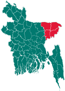 | |
| Moulvibazar District | ||
| Sunamganj District | ||
| Sylhet District | ||