Dinajpur District, Bangladesh
Dinajpur district (Bengali: দিনাজপুর জেলা) is a district in the Rangpur Division of northern Bangladesh. Dinajpur is the largest district among all sixteen northern districts of Bangladesh.
Dinajpur দিনাজপুর | |
|---|---|
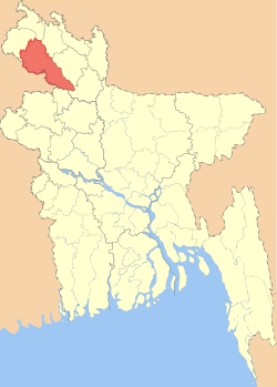 Location of Dinajpur District, Bangladesh in Bangladesh | |

Expandable map of Dinajpur District, Bangladesh | |
| Coordinates: 25.63°N 88.65°E | |
| Country | |
| Division | Rangpur Division |
| Government | |
| Area | |
| • Total | 3,444.30 km2 (1,329.85 sq mi) |
| Population (2011 census) | |
| • Total | 2,990,128 |
| • Density | 870/km2 (2,200/sq mi) |
| Literacy rate | |
| • Total | 85.5% |
| Time zone | UTC+06:00 (BST) |
| HDI (2018) | 0.614[1] medium · 7th of 21 |
| Website | dinajpur |
History
Dinajpur was once a part of the ancient state of Pundravardhana. Devkot which rotated as the capital of Lakhnauti was located 18 kilometres (11 mi) south of Dinajpur town. It is also called "City of Maharajas".
An ancient engraved stone, believed to be from the Gupta era, was recovered from the bank of a pond near Sura Masjid in the Ghoraghat Upazila in Dinajpur in 8 October.
British Colonial Period
The British administrative control in Dinajpur was established in 1786.[2] Dinajpur was the biggest administrative district of undivided Bengal. In 1765 the British got the Dewani of Bengal and in 1772 an English District Collector and Chief of Revenue was appointed in Dinajpur. The area was then notorious for lawlessness. Mr Marriott was Collector in 1786. Next to him Mr Red Fern and Mr Vansittart were Collectors for short periods. The next Collector Mr Hatch started to exercise judicial powers too. The District Magistrate's area at that time extended to Malda, Bagura and Dinajpur. In the last decade of the 18th century indigo plantation started in the district.
The district Dinajpur in British times included a greater portion of Bagura. Malda and parts of Rajshahi, Rangpur and Purnea. At the time of Revenue Survey in 1857–1861 the total area of the district was 11,880 km2 (4,586 sq mi). Between 1795 and 1800, large tracts of land were transferred to Purnea, Rangpur and Rajshahi for administrative convenience and better enforcement of law and order. In 1833 again some estates were transferred to Bagura and Malda. In 1864–65, 1868 and 1870 further transfer of territory from Dinajpur to Malda and Bagura took place. Finally in 1897–98 the whole of Thana Mahadevpur was made over to Rajshahi. At that time, except Thakurgaon Sub division, the rest of Dinajpur district remained under the direct supervision of the collector.
At first, after its formation in 1856, the Dinajpur Municipality used to be run by a town committee presided over by the Deputy Magistrate. This was among the first 40 municipalities in Bengal at that time. Later in 1868, the 'District Town Act' commissioned a chairman of the municipality who replaced the Deputy Magistrate and given a similar rank as a district magistrate. Mr. Patterson was appointed the first chairman of Dinajpur Municipality in 1869.[3]
Recent history
At the time of Partition of India in 1947, part of greater Dinajpur district was included in West Bengal and it was named West Dinajpur district. People of the district took part in the Tebhaga Movement and also had significant contribution in the War of Liberation of 1971.[2] Population Total 2642850; male 1363892, female 1278958; Muslim 2057030, Hindu 521925, Buddhist 27996, Christian 1093 and others 34806. Indigenous communities such as santals, oraon, Mahali, Malpahari, Kol' belong to this upazila.'[4]
Geography
Dinajpur is bounded by Thakurgaon and Panchagarh districts in the north, Gaibandha and Joypurhat districts in the south, Nilphamari and Rangpur districts in the east, and the state of West Bengal, India in the west. The total area of the district is 3,437.98 km2.[2] The main rivers of the district are the Dhepa, the Punarbhaba, and the Atrai rivers.
Total area 3437.98 sq km, located in between 25°10' and 26°04' north latitudes and in between 88°23' and 89°18' east longitudes.[5]
Climate
Dinajpur experiences a hot, wet and humid tropical climate. Under the Köppen climate classification, Dinajpur has a tropical wet and dry climate. The district has a distinct monsoonal season, with an annual average temperature of 25 °C (77 °F) and monthly means varying between 18 °C (64 °F) in January and 29 °C (84 °F) in August.
| Climate data for Dinajpur | |||||||||||||
|---|---|---|---|---|---|---|---|---|---|---|---|---|---|
| Month | Jan | Feb | Mar | Apr | May | Jun | Jul | Aug | Sep | Oct | Nov | Dec | Year |
| Average high °C (°F) | 24 (76) |
27 (80) |
31 (87) |
32 (89) |
33 (91) |
31 (88) |
32 (90) |
31 (88) |
31 (87) |
31 (87) |
28 (83) |
25 (77) |
29 (85) |
| Average low °C (°F) | 14 (58) |
17 (63) |
22 (72) |
25 (77) |
26 (79) |
27 (81) |
27 (81) |
27 (81) |
27 (80) |
25 (77) |
21 (69) |
16 (61) |
23 (73) |
| Average precipitation mm (inches) | 7.6 (0.3) |
20 (0.8) |
58 (2.3) |
120 (4.6) |
270 (10.5) |
360 (14.1) |
400 (15.7) |
320 (12.5) |
260 (10.1) |
160 (6.4) |
30 (1.2) |
5.1 (0.2) |
1,980 (77.9) |
Economy
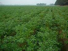
The economy of Dinajpur mainly depends upon agriculture based production. There is a well known proverb about Dinajpur – 'paddy piled up high, sheds full of cows, ponds brimming with fish' [gola bhora dhan, goyal bhora goru, pukur bhora mach]. People in this district are much happier than those in other districts, everything grows easily, it's a peaceful place. Dinajpur is famous for rice production. 'Katharivog' rice is the best produced rice in Bangladesh. Dinajpur is also rich with wheat production. The Lychee(fruit) of Dinajpur is the best of Bangladesh. Dinajpur is also famous for its Mangoes. "Kosba" is called the matrix of mango. Also it grows a plenty of vegetables and seasonal fruits. A huge percentage of people from Dinajpur depends upon agri based products. The main industry also includes rice processing mills. However, Dinajpur is highly rich with natural resources like coal. Of the five coal field discovered so far in Bangladesh, three are in Dinajpur. The name of these deposits are-Barapukuria, Phulbari and Dighipara coal field. At present coal is being produced commercially only from the Barapukuria underground coal mine in Dinajpur district. Current production rate is about 1500 tons per day. The plan to establish an open-pit mine in nearby Phulbari was aborted in 2006 in the wake of a mass protest by the local people.[6] The coal from the Boropukuria Coal Mine is being fed to the 250MW Barapukuria Power Station.
Crops and grown in the district include rice, wheat, maize, potato, brinjal and tomato.
Fruits grown include lychees, mangoes, bananas, jackfruits and blackberries.
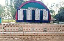
Points of interest
.jpg)

- Ananda Sagar
- Aowkora Mosque – meaning "Echoing Mosque"
- Baraduari
- Dinajpur Museum
- Dinajpur Rajbari
- Dinajpur Zila School
- Dipshikha School in Rudrapur
- Ghughu-danga Zamindar Bari
- Gorashohid Boro-Moydan
- Gour Gabindha
- Habra Zamindar Bari
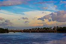
- Hili Land Port – The second-largest land port of Bangladesh and customs station for border trade.[7]
- Kaliya jue Temple
- Kantajew Temple – A late medieval Hindu temple, built from 1704 to 1722 CE
- Korai Bill, Biral
- Matasagar
- Nayabad Mosque
- Nowpara Ideal Village
- Ramsagar
- Shingha Darwaza – Meaning "Lion Gate"
- Shita Coat Bihar – The oldest Buddhist Bihar in the world.
- Shopnopuri artificial amusement park
- Shimanta Shikha club, Hakimpur, Dinajpur.
- Shita Coat Bihar, Nawabganj
- Singra forest, Birganj
- Sita Kuthuri
- Sukhsagar
- The tombs of Chehel Gazi and Gor-e-Shahid Moydan.
Administration

Transport

- Railway Station:
- Dinajpur railway station
- Chirirbandar railway station
- Biral railway station
- Hili railway station
- Parbatipur railway junction
- Fulbari railway station
- Birampur railway station
- Setabgonj railway station
- Kholahati railway station
- Roads & Highways:
- Dinajpur- Dhaka Highway (Via Fulbari, Birampur)
- Dinajpur-Dhaka Highway (Via Rangpur)
- Dinajpur- Panchogor
- Dinajpur- Rangpur Highway (Via Parbotipur)
- Dinajpur- Thakurgaon Highway
- Dinajpur- Dakshin Dinajpur(India) International Highway
Education
Literacy rate and educational institutions Average literacy 85.5%; male 90%, female 75%. Educational institutions: university 1, college 118, vocational and other centres 10, textile institute 1, secondary school 617, primary school 1713, community school 11, NGO school 29, kindergarten 10, madrasa 351.[10] Noted educational institutions are following:
Education Board
Tenth educational board of Bangladesh has been established in Dinajpur in 2007. From 2009 S.S.C. (Secondary School Certificate) and H.S.C. (Higher Secondary School Certificate) exams have been started to be taken. In S.S.C. exam for the first time it stood 2nd in the country in the G.P.A. 5 list.[11]
Hajee Mohammad Danesh Science and Technology University
Hajee Mohammad Danesh Science and Technology University is a government-financed public university of Bangladesh situated 10 km from Dinajpur main town. It serves as an institution of science and technology in northern part of the country. Hajee Mohammad Danesh Science and Technology University was established as an Agricultural Extension Training Institute (AETI) to award a three-year diploma in agriculture. The AETI was later upgraded to Hajee Mohammad Danesh Agricultural College in 1988 having an affiliation from the Bangladesh Agricultural University, Mymensingh. Then the college was upgraded to the status of a university renaming it as Hajee Mohammad Danesh Science and Technology University. First batch of the students were admitted at that time (1999-2000 session). The Act of the University was passed on 8 July 2001 in the Jatio Shongsad (National Assembly) was followed by a gazette notification on 8 April 2002.https://www.hstu.ac.bd/
Dinajpur polytechnic institute is at south Balubari. This polytechnic was started with Civil and Power Technology in 1964.[12]
There are three government colleges in the Dinajpur town. Dinajpur Government College, which was previously known as Surendranath college and Dinajpur City College are for both male and female students. Another government college is "Dinajpur Govt. Women's College" is for female students only http://www.dinajpurgmc.edu.bd/. All colleges are operated under Bangladesh National University.
This district gives the opportunity to read in two Govt. schools, Dinajpur Zilla School (for boys only) and Dinajpur Govt. Girls' High School. Dinajpur Zilla School was established in 1854 during the British reign. It is located at the centre of the Dinajpur town. It owns a hostel too for residential facilities. This school is one of 20 schools in Bangladesh, which has a govt. funded "E-Learning" facility and E-Laboratory. There is Stone made Map of South Asia subcontinent in this school, which was made at 1934. It has a very talented Score in S.S.C participation. There is also an auditorium, a sculpture of celebrating the 150 years of the school, a mosque, an enhanced library and laboratory in this school. There is also a textile institute. Now RIDGE School is the most modern and British standard popular school of Dinajpur.
The METI Handmade School, a primary school for 168 students located in Rudrapur in Dinajpur district of Bangladesh, was built with the assistance of local craftsmen making use of traditional materials, primarily mud and bamboo. An example of sustainable architecture, the project received the Aga Khan Award for Architecture in 2007, not only for its simple, humane approach and beauty but also for the level of cooperation achieved between architects, craftsmen, clients and users.[13]
Dinajpur Medical College and Hospital
It is a government medical college here, which is one of the 36 government funded medical colleges in Bangladesh. It is located in the town of Dinajpur. It admits 160 students into the f-year MBBS (Bachelor of Medicine and Bachelor of Surgery) degree program. There is a four-story building. There are two hostels for boys and three hostels for girls. There are four hostels for intern doctors. About twenty batches of students have passed from this medical college. Dinajpur Medical College Journal is recognised by the BMDC and is published twice a year (ISSN 2070-2019). The 500-bed hospital has high technology and has started to provide more services. There is also a well-developed nursing college behind the hospital building. The hospital has an ultrasound centre for nuclear medicine near Sadar Hospital, Dinajpur. Dinajpur Medical College Hospital now provides health services not only in the Dinajpur District but also to people from other districts near Dinajpur.
Other
Dinajpur Central Shahid Minar is the 2nd largest Shahid minar in the country. Dinajpur Boasts a regional training centre of Bangladesh Krira Shiksha Pratisthan. Bangladesh Krira Shiksha Pratisthan situated at Basher hat near to HSTU campus. It aims to train and educate sports prodigy.
Notable residents
- Narayan Gangopadhyay, a Bengali novelist, poet, essayist, and short story writer, and one of the leading writers of modern Bengali literature.
- Atmasthananda, fifteenth president of the Ramakrishna Math and the Ramakrishna Mission.
- Debojyoti Mishra, an Indian music director and film composer.
- Khaleda Zia – Born in 1945, former Prime Minister of Bangladesh and current leader of the Bangladesh National Party.
- Khurshid Jahan – 1939–2006, former Bangladeshi Minister of Women's and Children's affairs.
- Haji Mohammad Danesh – 1900–1986, Bangladeshi politician and communist activist.
- M. Yousuf Ali – Died in 1999, first Bangladeshi Minister of Education.
- Muhammad Mahbubur Rahman – 9th Chief of Army Staff (abbreviated as CAS) of Bangladesh Army from May 1996 to December 1997. Now he is a member of BNP's standing committee.[14]
- M. Abdur Rahim – (21 November 1927 – 4 September 2016) was a Member of Parliament, member of the constitution drafting committee and an organiser of the liberation war.[15]
- Abdullah Al Kafi – (1945–2005), Member of Parliament for Dinajpur-1.[16][17][18]
- Moinuddin Ahmed Chowdhury – 1921–1998, prominent East Pakistani politician.
- Subhash Dutta – (9 February 1930 – 16 November 2012) was a Bangladeshi filmmaker, theatre and film actor.
- Nitun Kundu founder of OTOBI furniture groupe and designer of the fountain of SAARC fountain in front of Hotel Sonargaon.
- Dhiman Ghosh Bangladeshi cricketer.
- Liton Das Bangladeshi cricketer.
- Lucas Marandi, Roman Catholic Bishop.
See also
References
- "Sub-national HDI - Area Database - Global Data Lab". hdi.globaldatalab.org. Retrieved 18 March 2020.
- Ahmad Hossain (2012). "Dinajpur District". In Sirajul Islam; Ahmed A. Jamal (eds.). Banglapedia: National Encyclopedia of Bangladesh (Second ed.). Asiatic Society of Bangladesh.
- Mehrab Ali, "History of Dinajpur Pourasava" www.dinajpurmunicipality.com
- http://en.banglapedia.org/index.php?title=Dinajpur_District
- http://en.banglapedia.org/index.php?title=Dinajpur_District
- Arifur Rahman; Sanzida Murshed (2012). "Coal". Banglapedia: National Encyclopedia of Bangladesh (Second ed.). Asiatic Society of Bangladesh.
- "Impasse at Hili land port results in loss of Tk20cr". Dhaka Tribune. 22 May 2014. Retrieved 19 February 2015.
- "New DCs in 22 districts". New Age. 26 February 2018. Retrieved 20 September 2018.
- "AL men appointed administrators". The Daily Star. 16 December 2011. Retrieved 19 February 2015.
- http://en.banglapedia.org/index.php?title=Dinajpur_District
- http://www.dinajpureducationboard.gov.bd/
- http://www.dpi.edu.bd/
- "Nine projects receive 2007 Aga Khan Award for Architecture" Archived 2015-11-17 at the Wayback Machine, Aga Khan Development Network. Retrieved 12 March 2012.
- "38th anniversary of return of ashes of Atish Dipankar". Xinhuanet. 5 June 2016. Retrieved 15 March 2018.
- "Organiser of Liberation War". The Daily Sun. 5 September 2016. Retrieved 15 March 2018.
- "Dinajpur-1". Election Commission Bangladesh. Archived from the original on 23 January 2017. Retrieved 12 March 2016.
- "Obituary reference for Kafi in JS". bdnews24.com. 11 September 2005. Retrieved 12 March 2016.
- "JS session adjourned without transacting any business following death of Jamaat MP". bdnews24.com. 11 September 2005. Retrieved 12 March 2016.
Further reading
| Wikimedia Commons has media related to Dinajpur District. |
- Hunter, Sir William Wilson (1876), A Statistical Account of Bengal, Volume 7, Trübner & Company
