Shariatpur District
Shariatpur (Bengali: শরিয়তপুর জেলা, Shariatpur Jela also Shariatpur Zila) is a district in the Dhaka Division of central Bangladesh. It is bounded by Munshiganj district on the north, Barisal district on the south, Chandpur district on the east, Madaripur district on the west. Water bodies Main rivers: Padma, Meghna, Palong (Kirtinasha) and Jayanti. Of the six upazilas of the district Bhedarganj Upazila is the largest (311.24 square kilometres (120.17 sq mi)) and Damudya Upazila is the smallest (91.76 square kilometres (35.43 sq mi)).[2]
Shariatpur শরিয়তপুর | |
|---|---|
| Shariatpur | |
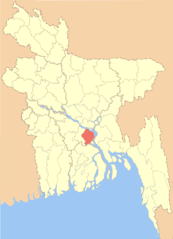 Location of Shariatpur in Bangladesh | |

Expandable map of Shariatpur | |
| Coordinates: 23°12.5′N 90°21′E | |
| Country | |
| Area | |
| • Total | 1,181.53 km2 (456.19 sq mi) |
| Population (2011 census) | |
| • Total | 1,155,824 |
| • Density | 980/km2 (2,500/sq mi) |
| Time zone | UTC+06:00 (BST) |
| Postal code | 8000 |
| HDI (2018) | 0.649[1] medium · 3rd of 21 |
| Website | http://www.shariatpur.gov.bd/ |
History
Shariatpur was named after Haji Shariatullah (1781–1840), who was the founder of Faraizi Movement and an eminent Islamic reformer during British Raj.[3] It was established as a district on 1 March 1984.[2] History of the War of Liberation In 1971 the Pak army in collaboration with their local agents conducted mass killing and plundering; they also set many houses of the district on fire. During Bangladesh Liberation War a number of encounters were held in Shariatpur Sadar Upazila between the freedom fighters and the Pak army in which about 313 Pak soldiers were killed. A number of freedom fighters were killed in two encounters and one frontal battle with the Pak army in Bhedarganj Upazila. Nine freedom fighters including Ahsanul Hoque and Abdul Wahab were killed in an encounter with the Pak army at a place on the southern side of Damudya College. Muktijoddha and Mujib Bahini jointly conducted attack on the Pak army by guerrilla technique in the upazila. Five freedom fighters were killed in an encounter with the Pak army in Gosairhat Upazila. The freedom fighters of Naria raided the Naria Police Station and captured all the arms and ammunitions of the thana. In retaliation, the Pak army sacked the nearby villages. During Bangladesh Liberation War a number of encounters were held between the freedom fighters and the Pak army in Zanjira Upazila in which a number of freedom fighters were killed.
Geography and demography

Shariatpur District is bounded on the north by Munshiganj District, Barisal District on the south, Chandpur District on the east, Madaripur District on the west. Main rivers are Padma, Meghna, Palong, Jayanti,[2] Kirtinasha, and Dharmaganj.
Area of Shariatpur district is 1181.53 km².[2] It consists of 6 upazilas, 6 municipalities, 65 Union Parishad, 616 Mouza, 1243 villages, 213,677 households. [4]
According to the census of 2001, Shariatpur district had a population of 1,082,300 distributed to 213,677 households (average household size 5), including 543,838 men and 538,462 women, or a gender ratio of 101:100.[5]
Administration
There are six upazilas (sub-districts) under this district,[6] namely:
- Shariatpur Sadar Upazila
- Damudya Upazila
- Naria Upazila
- Zanjira Upazila
- Bhedarganj Upazila
- Gosairhat Upazila
- Shakhipur Upazila
Education
There are 772 primary schools,19 lower secondary schools,83 secondary schools and 42 Madrasas in Shariatpur. There are also 3 Public and 13 Private Colleges, 1 polytechnic Institute, 1 Vocational School and College, 1 Private University and one private medical college. The literacy rate (7+ year) 60% (Male 63%, Female 57%) and literacy rate (15+ year) 41% (Male 47%, Female 36%).[4]
Maulana Abdul Matin ( Rah:)
- TM Giasuddin Ahmed, former MP
- Shawkat Ali (politician)
- Iqbal Hossain Apu, MP
- K.M. Hemayet Ullah Auranga
- Aminul Islam Biplob (cricketer)
- Khuda Buksh (1912–1974) regarded as father of insurance in Bangladesh
- Pulin Behari Das (revolutionary)
- Jogesh Chandra Ghosh (scholar, Ayurveda physician, entrepreneur and philanthropist)
- AKM Shahidul Haque (Inspector General of Police, Bangladesh)
- B.M Muzammel Haque (politician)
- Farzana Islam, (academician)
- Sardar AKM Nasiruddin, former MP
- Kamrun Nesa Nilu, former MP
- Master Majibur Rahman, former MP
- Abdur Razzaq (former minister of water resources)
- Nahim Razzaq, MP
- AKM Enamul Haque Shamim, MP
- Siraj Sikder (politician)
See also
References
| Wikimedia Commons has media related to Shariatpur District. |
- "Sub-national HDI - Area Database - Global Data Lab". hdi.globaldatalab.org. Retrieved 2020-03-18.
- Shahidul Haque (2012). "Shariatpur District". In Sirajul Islam and Ahmed A. Jamal (ed.). Banglapedia: National Encyclopedia of Bangladesh (Second ed.). Asiatic Society of Bangladesh.
- Khan, Muin-ud-Din Ahmad (2012). "Shariatullah, Haji". In Islam, Sirajul; Jamal, Ahmed A. (eds.). Banglapedia: National Encyclopedia of Bangladesh (Second ed.). Asiatic Society of Bangladesh.
- "Official Website". 12 March 2015. Retrieved 31 December 2016.
- Household and Population of Statistical Metropolitan Areas in Bangladesh – 2001 (PDF), Population Census Wing, Bangladesh Bureau of Statistics, archived from the original (PDF) on 2007-09-28, retrieved 2007-09-03
- District Statistics 2011: Shariatpur (PDF), retrieved 23 February 2016
| Upazila/Thana: |
| |
|---|---|---|
