Kurigram District
Kurigram District (Bengali: কুড়িগ্রাম) is located in the Rangpur Division, in Northern Bangladesh.[2] It is situated in the northern part of Bangladesh and under Rangpur Division. At first it was a mahakuma and then established as a district in 1984.
Kurigram কুড়িগ্রাম | |
|---|---|
 Location of Kurigram District in Bangladesh | |

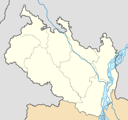
Expandable map of Kurigram District | |
 Kurigram Location in Rangpur Division  Kurigram Location in Bangladesh | |
| Coordinates: 25.75°N 89.66°E | |
| Country | |
| Division | Rangpur Division |
| Area | |
| • Total | 2,245.04 km2 (866.81 sq mi) |
| Population (2011 census) | |
| • Total | 2,069,273 |
| • Density | 920/km2 (2,400/sq mi) |
| Literacy rate | |
| • Total | 56% |
| Time zone | UTC+06:00 (BST) |
| Postal code | 5600 |
| HDI (2018) | 0.591[1] medium · 15th of 21 |
| Website | kurigram |
Etymology
The name "Kurigram" is derived from two words "Kuri" and "Gram". "Gram" means village. The word "Kuri" is non-aryan language. It is a counting terminology which means twenty. Scholar Ja Paliluski has proved that the word has come from Kole language. Kole is a language of Austric language group. In Arab-Austric language "kur" or "kor" means people. The counting system as Kuri has come from this Arab-Austric language.[3]
History
Civilization of this area was built by the combination of the Nigro-Austric and Dravid-Mongolian people which is unanimously recognised as the old Aryan civilization. Sometimes this area was included in Gaurabardhan, sometimes in Pragjotishpur. Gaurabardhan is today's Mahasthangarh, Pragjotishpur is the old name of Kamrup which is today's Assam. This two kingdom was inhabited by non-aryans. No Aryan was able to enter this area due to the defence of non-aryans. As a result, there is no sign of Aryan civilization here. The Kamrup kingdom was divided into many small kingdoms creating Cooch Behar, Uari, Ahom, Kooki, Tripura and Arakan kingdom. The northern side of this town (Nageshwari. Phulbari, Lalmonirhat and Bhurungamari) was included in Cooch Behar and the southern part (Ulipur, Chilmari and Raomari) was in Uari kingdom.
In the beginning of twelfth century, Khen dynasty was emerged in this area. Nildhwaj, Chakradhwaj and Nilambor were the kings of this dynasty. The capital of their kingdom was in Chatra which is situated in today's Bidyananda union of Ulipur upazila. In 1418, Sultan of Gouro, Hosen Shah attacked Nilambar. Nilambar was lost in the battle and then the area was controlled by the Muslims which was later controlled by the Mughal Empire.
During the British regime, broker of East India Company, Debi Singh and Hare Ram came to the area as dewan (controller). The torture and mistreatment of the East India Company caused the Great Bengal famine of 1770. As a result, many rebellion were created which were led by Majnu Shah, Nuruddin Karek Jong, Bhabani Pathak, Debi Choudhurani, Musa Shah, Cherag Ali Shah and many more. In the regime of East India Company, Kurigram was divided into four divisions which were Borobari, Ulipur, Chimari and Nageshwari. At that time "Kuriganj" was a place of Borobari division, Balabari was the central point of Kuriganj. The British government first established Kurigram mahakuma in 22 April 1875. Sir william Hunter described Kurigram as "Kuriganj" in his "Gazetteer of Rangpur District". The Kurigram mahakuma was consisted of 8 thanas named Kurigram, Lalmonirhat, Ulipur, Chilmari, Roumari, Nageshwar, Bhurungamari and Phulbari. It was established as a district on 1 February 1984 consisting of 9 current upazilas.[4]
Geography
Kurigram District is located in the northern region of Bangladesh along the border of India. The population is 2,069,273 (2011 national population census). This district is surrounded by Cooch Behar district of India in the north, Gaibandha district of Bangladesh in the south, Assam state of India in the east and, Lalmonirhat and Rangpur districts of Bangladesh in the west. There are 9 upazilas and 72 unions and 1872 villages in Kurigram. Weather of the Kurigram district is bit different from the middle or southern part of Bangladesh. During summer, temperature is higher and during winter is lower than middle or southern part of Bangladesh. The average maximum temperature is about 32-33 degree Celsius when average minimum temperature is about 10-11 degrees. Heavy rainfall is usually observed during the rainy season like other parts of Bangladesh and the average annual rainfall is about 3000 mm. Several rivers are flowing through the heart of this district. The major rivers are Brahmaputra, Dharla, and Tista with minors are Dudhkumar, Phulkumar, Gangadhar, Jinjiram etc. Three northern subdistricts (namely thana or upazila) of this district (Nageshwari, Bhurungamari, and Phulbari) are recently connected by a beautiful bridge over the Dharla river with the main land of the district.[5] postal code is 5600. It has 278.28 km of international border line.There are 16 rivers in this district. Bramhaputra, Dharla, Tista, Dudhkumar, Fulkumar, Sonabhari, Gingira, Gangadhar, Halhalia are some of its main rivers. In addition to this, there are many minor rivers such as Nilkamal, Shialdaha, Kaljani, Jalchira, Shangkosh, Boalmari, Dharani etc.[6]
Upazilas
Kurigram District consists of nine upazilas:
- Kurigram Sadar Upazila
- Nageshwari Upazila
- Bhurungamari Upazila
- Phulbari Upazila
- Rajarhat Upazila
- Ulipur Upazila
- Chilmari Upazila
- Raomari Upazila
- Char Rajibpur Upazila

Kurigram Sadar (HQ)
"Sadar" (HQ) is a Bengali word and its meaning is, a main part of a certain area. Kurigram Sadar (HQ) is the main part of Kurigram district and it is located almost in the center of the district, on the bank of Dharala river. The total area of this main sub-district is 276.45 km2 and the total population is 217,311 (1991 national population census).
Other sub-districts are also conveniently connected with Kurigram Sadar (HQ) by bus and train service. The only sub-district Char Rajibpur is still isolated from the main land of this district by Brahmaputra river. Kurigram Sadar (HQ) is connected with capital city (Dhaka) and other major districts of Bangladesh by highways.
Nageshwari
Nageshwari subdistrict is one of three northern sub-districts of Kurigram district. It is the located about 22 km far away from the main city of Kurigram and conveniently connected by buses over the recently constructed Dharla bridge. The total area of this sub-district is 415.80 km2 and total population is 279,775 (1991 national population census). It is the biggest sub-district among the three northern sub-districts of Kurigram and nicely located with the status of city corporation namely "Pourosova".
Nageshwari Upazila (Kurigram district) with an area of 415.80 km2, is bounded by Bhurungamari upazila and West Bengal of India on the north, Kurigram sadar upazila on the south, Assam State of India on the east and Phulbari upazila (Kurigram) on the west. Main rivers are Brahmaputra, Dudhkumar, Nilkamal, Shankos and Phulkumar; depressions: 54, most noted of which are Payradanga, Teparkuthi, Naodanga and Madaikhal.
Nageshwari is located at 25.9792°N 89.7083°E. It has 51,889 units of house hold. Nageshwari (Town) consists of 8 mouzas. It has an area of 35.2 km2. The town has a population of 39731; male 52.02% and female 47.98%; population density per km2 1129. Literacy rate among the town people is 28.1%. The town has two dak bungalows.
Nageshwari Thana was established in 1793 and was turned into an upazila in 1983. The upazila consists of 15 union parishads, 79 mouzas and 367 villages.
As of the 1991 Bangladesh census, Population 279,775; male 50.72%, female 49.28%; Muslim 93.53%, Hindu 6.19% and others 0.28%; ethnic nationals: Buno, a tribe of Santal live on the bank of the river Naodanga.
Bhurungamari
It is most northern sub-district of Kurigram district. The total area of this district is about 236 km2 and the total population is 176,822 (1991 national population census). This subdistrict is easily connected with another 2 northern sub-districts and the main part of Kurigram through Nageshwari subdistrict. If you visit the India-Bangladesh border closely located with these sub-districts, you will see the inter country security iron-wire-fences (namely Katatar) between the border of Bangladesh and India. You will also find the "Border Security Force (BSF)" in the part of India and "Border Guard Bangladesh (BGB)" in the part of Bangladesh, who are working as a security forces in their respective sites. Kuchbihar is the nearest Indian district from Bhurungamari.
Phulbari
Phulbari is one of the three northern sub-districts of Kurigram district. The total area of this subdistrict is 163.63 km2 and the total number of populations is 129,668 (1991 national population census). It is also closely located in the Indian border of Kuchbihar district and separated by fence from India. Because of it geographical location, it is very close to Kurigram main city but isolated by Dharla river. As Dharla bridge is closely located with the Nageswari district so if some would like to visit Phulbari by using Dharla bridge it will be far away from Kurigram. The most convenient to visit Phulbari by crossing the Dharla river by using very convenient boat or ferry from Kathalbari ferry port, a part of Kurigram main land. Therefore, most of the peoples use this port, rather than Dharla bridge, to visit Phulbari for business and tourism. In addition to these, Phulbari is also closely located with the Lalmonirhat, another northern district of Bangladesh. Therefore, peoples from Phulbari can easily go to the main city of both districts for business purpose and can keep their communication with big cities. Although the most of the peoples are dependent on agriculture for their living but many of them are dependent on business. There are most of the main bazaars: Kharibary, Balarhat, Pakir Hat, Newashi Bazar, Khochabari Bazar, Kholar Hat, Boroloi Bazar, Baravita, Gongarhat, and Phulbari.
Rajarhat
It is the closest and only western subdistrict of Kurigram. The bus and train are conveniently connected with the main town of Rajarhat from the main city of Kurigram. The total area of this subdistrict is 166.23 km2 and the total population is 158,648 (1991 national population census). Because of its closest location and dual transportation systems from the main city of Kurigram, this town has been developed as a business center and many peoples of this subdistrict are depending on business for their living. However, most of the peoples of this subdistrict are dependent on agriculture for their living.
Ulipur
Ulipur is one of the four southern sub-districts of Kurigram and is also conveniently connected with the main city of Kurigram by road and rail transport systems. This is the most closest south subdistrict of Kurigram with Kurigram main city. The total area of this subdistrict is 504.19 km2 and the total population is 345,205 (1991 national population census). Ulipur town is also conveniently connected with Rajarhar subdistrict by road transport system. The road and rail transport systems from Kurigram main city to Ulipur have further extended to Chilmari, another southern subdistrict of Kurigram. It is the biggest sub-district among all sub-districts of Kurigram and nicely located with the status of city corporation namely "Pourosova".there is a health complex, a govt girls high school, a govt college in Ulipur.Ulipur Government and also public college are very beautiful.
Chilmari
Chilmari is geographically located in a beautiful scenic bank of the Tista and Jamuna rivers. Jamuna is one of the widest and famous of the first three rivers of Bangladesh. Because of this, such geographical location and convenient and dual transport systems from the main city of Kurigram, Chilmari has been developed and most important commercial and river port town of Kurigram district. The total area of this subdistrict is 224.97 km2 and the total population count is 100,516 (1991 national population census). As it is adjacently located in the banks of two important rivers of Bangladesh so many peoples of this district are dependent on fishing, agriculture and business for their living. However, the main profession of most of the peoples are agriculture like most other districts of Bangladesh.
Rowmari
Rowmari is the first independent sub-district of Bangladesh. It has a great contribution in Bangladesh's Independence War, 1971. The Pakistani invading force could never capture Rowmari and there was an independent local government since the first day of independence under the leadership of the then Major Ziaur Rahman and Squadron Leader M. Hamidullah Khan who were based in this regional headquarters of Bangladesh Forces during June to December, 1971.
It is geographically located in the eastern side of Chilmari and south-eastern part of Kurigram Sadar and on the bank of local Jinjiram river. However, this subdistrict is isolated from the main land of Kurigram by Jamuna river. The total area of this subdistrict is 197.80 km2 and the total number of population is 137,040 (1991 national population census). Only water-based transport system is connected this island subdistrict with the main land of Kurigram. However, this subdistrict is very close to Dhaka division of Bangladesh. Now only for Government purposes people go to Kurigram and Good Communication establist from Dhaka to Rajibpur, Rowmari (only 4/5 hours).
Char Rajibpur
Char is a Bengali word and it means "island". So, Char Rajibpur is an island subdistrict of Kurigram and located in the most southern part and on the bank of Jamuna river. The total area of this subdistrict is 111.03 km2 and the total number of population is 58,049 (1991 national population census). Because of its geographical location and smallest size, very few people live here. Only water-based transport system are connected to this island subdistrict with the main land of Kurigram. However, this subdistrict is very close to Jamalpur, another district under Dhaka division of Bangladesh. Now only for Government purposes people go to Kurigram and Good Communication establist from Dhaka to Rajibpur, Rowmari (only 4 hours)
Therefore, Char Rajibpur is the most closest subdistrict of Kurigram with Dhaka, so people are wanted to go Jamalpur under Dhaka division. Now BDR communication existing with Jamalpur and Settlement Office of GOB (Rajibpur) serve to north side of Jamalpur(Shandabari, CharAmkhowa, Dhangdhara).
Char Rajibpur and Rowmari subdistrict of Kurigram should be include into Jamalpur District or can be a new district include Rajibpur, Rowmari and North side of Jamalpur and Division under Dhaka.
This Subdistricts of Kurigram are important communication place of Dhaka to north Bangle without Jamuna Bridge. This way consume time 2 hours.[7]
Language
Most people speak Bengali in Rangpurian tone but understand the formal Bengali. People from town can speak in proper Bengali when many people can speak in English as well. English is known better in the city than in the village areas.
Economy
From the ancient time, Kurigram has been a land of agriculture. The major economic products are Rice, jute (called the golden fiber of Bangladesh), wheat, tobacco, potato etc. During winter season, when ground water level is usually lower than rainy season, peoples use irrigation system to cultivate several high yielding varieties of rice. Several cold storage are also adding value to the economy of this district by preserving agricultural products especially potato during the hot summer season.
Food
Rice and vegetable, meat and fish curries are the common foods of this district like other parts of Bangladesh. Various kinds of fresh water fish are widely available in the district. These fishes are usually collected from the several rivers flowing through the heart of the district. "Korti", a white-wide-thin small fish with multiple number of bones are vary popular in this district, like "Ilish" (Hilsha ilisha) in the every parts of Bangladesh. In addition to this, peoples usually celebrate the various seasons with various kinds of foods. In winter for example, you can enjoy the sweet juice of a date tree.
Education
There are four levels education system in this district like other parts of Bangladesh. These levels are: (1) Primary – 5 years [Grade 1–5] (2) Secondary – 5 years [Grade 6–10] (3) Higher Secondary – 2 years [Grade 11–12] and (4) Tertiary or University Education – 5 years [Undergraduate 4 years and Masters 1 year]. There are 43 colleges, 257 high schools, 563 registered government and 552 non-registered primary schools, 224 madrasa, 1 polytechnical institute and 1 technical school and college in this district.[8] Besides Bengali, the native language, English is compulsory at all levels of education. There are lot of primary and secondary schools, and higher secondary college are available in the every part of the district. In addition to this, some kindergarten school and elementary level English schools are mainly available in the main district city and sub-districts towns.
Health
There are 1 government and two non government hospital and an eye hospital in Kurigram. The district has 100% EPI coverage, 96% sanitation coverage and 96% pure drinking water coverage. There are also 8 upazila health complex, a maternity clinic and a tuberculosis clinic in this district.[9]
Transport
Bus is the cheapest and major transport system of this district for long distance travel. Rail is also conveniently connected with one western (Rajarhat) and two southern sub-districts (Ulipur and Chilmari) of Kurigram. In addition to these, peoples of some other sub-districts e.g. Rowmari, Char Rajibpur, and Phulbari usually use boat and ferries to come into the main land of the district by crossing their nearest rivers. Rickshaw is the most convenient and cheaper, but slower, transport system will be seen all over the district. It is one kind of tricycle, driven by one human being, and can easily carry two persons at a time. Inter district and inter subdistrict buses are frequently depart from the Kurigram bus terminal located in the western part of the city. Train is also well connected with nearest districts e.g. Lalmonirhat, Rangpur but the frequency is quite lower than buses.
Climate
Pleasant climate exist year long except some heavy rain during the rainy season (June–September). Although there are some heavy rainfalls during the rainy season, water often drain quickly due to its slightly higher elevation(33m above sea level). Summer and rainy(monsoon) season are quite hot (mostly 30–35 °C). Winter often gets pretty cold compared to other parts of Bangladesh due to geographical and climatic factors of the Varendra tract. In winter (October–February) minimum temperature is not less than 2 °C and some days are foggy and sun cannot be seen until mid-day during that days.
Places of interest[10]
- Shahi Mosque
- Chandi Mandir
- Dolmancha Mandir
- Bir Protik Taramon Bibi's house
- Naodanga Royal Palace
- Sindur Moti
- Enclaves
- Pangeshwari Temple
- Bhetarbandh Royal Palace
- Chandamari Mosque
- Two Canons of Panga Kingdom (Preserved at the BGB Gate)
- kazir mosque ulipur kurigram
- Chilmari land port
- Ghogadaha Bazar.
Notable people[11]
- Taramon Bibi (Bir Protik)
- Syed Shamsul Haque (poet and writer)
- Kanai Lal Sarker (politician)
See also
References
- "Sub-national HDI - Area Database - Global Data Lab". hdi.globaldatalab.org. Retrieved 2020-03-18.
- Md Kamal Hossain (2012). "Kurigram District". In Sirajul Islam and Ahmed A. Jamal (ed.). Banglapedia: National Encyclopedia of Bangladesh (Second ed.). Asiatic Society of Bangladesh.
- "Background of Kurigram district". Bangladesh national portal.
- "History of Kurigram". Bangladesh National Portal.
- Kurigram
- "Geography of Kurigram". Bangladesh national portal.
- "Geohive". Archived from the original on 2016-03-03. Retrieved 2015-04-22.
- "Kurigram at a glance". Bangladesh national portal.
- "Kurigram at a glance". Bangladesh national portal.
- "Notable places of Kurigram". Bangladesh national portal.
- "Notable personalities of Kurigram". Bangladesh national portal.
External links
| Wikimedia Commons has media related to Kurigram District. |
