Pearl River County, Mississippi
| Pearl River County, Mississippi | ||
|---|---|---|
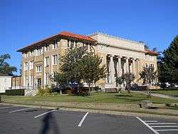 Pearl River County Courthouse in Poplarville | ||
| ||
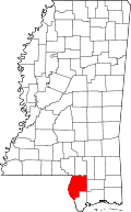 Location in the U.S. state of Mississippi | ||
 Mississippi's location in the U.S. | ||
| Founded | 1890 | |
| Named for | Pearl River | |
| Seat | Poplarville | |
| Largest city | Picayune | |
| Area | ||
| • Total | 819 sq mi (2,121 km2) | |
| • Land | 811 sq mi (2,100 km2) | |
| • Water | 8.0 sq mi (21 km2), 1.0% | |
| Population | ||
| • (2010) | 55,834 | |
| • Density | 69/sq mi (27/km2) | |
| Congressional district | 4th | |
| Time zone | Central: UTC−6/−5 | |
| Website |
www | |

Pearl River County is a county located in the U.S. state of Mississippi, formerly known as Hancock County. The population was 55,834 at the 2010 census.[1] Its county seat is Poplarville.[2]
Pearl River County comprises the Picayune, MS Micropolitan Statistical Area, which is included in the New Orleans-Metairie-Hammond, LA-MS Combined Statistical Area.
Pearl River County is a dry county,[3] and as such, the sale, transportation, and even private possession of beverage alcohol is prohibited by law,[4] except within The City of Picayune (which has exempted itself). The City of Poplarville passed a similar exemption referendum on March 25, 2014.[5]
On September 2, 2005, the 1st Battalion, 134th Field Artillery (Ohio Army National Guard) arrived at the National Guard armory in Poplarville to assist the community and Pearl River County in recovery efforts in the wake of Hurricane Katrina. Initial efforts were the security of banks, pharmacies and gas stations as well as initial responses to rural emergencies. The unit stayed for three weeks ultimately checking on many families and structures in the county.[6]
History
Pearl River County was founded in 1890. On August 29, 2005, Hurricane Katrina inflicted heavy damage on the small town of Poplarville. The storm's most powerful, unofficially recorded gust of wind was reported at Pearl River Community College, at 135 mph (217 km/h). On September 2, 2005, the 1st Battalion, 134th Field Artillery (Ohio Army National Guard) arrived at the National Guard armory in Poplarville to assist the community and Pearl River County in recovery efforts in the wake of Hurricane Katrina. Initial efforts were the security of banks, pharmacies and gas stations as well as initial responses to rural emergencies. The unit stayed for three weeks ultimately checking on every family and structure in the county. On September 5, 2005, Poplarville played host to a visit by George W. Bush, Laura Bush, and Governor Haley Barbour to Pearl River Community College in the aftermath of Hurricane Katrina.[7]
Geography
According to the U.S. Census Bureau, the county has a total area of 819 square miles (2,120 km2), of which 811 square miles (2,100 km2) is land and 8.0 square miles (21 km2) (1.0%) is water.[8] It is the fourth-largest county in Mississippi by land area.
Major highways
Adjacent counties and parishes
- Lamar County (north)
- Forrest County (northeast)
- Stone County (east)
- Hancock County (south)
- St. Tammany Parish, Louisiana (southwest)
- Washington Parish, Louisiana (west)
- Marion County (northwest)
National protected areas
- Bogue Chitto National Wildlife Refuge (part)
- De Soto National Forest (part)
Media
Newspaper
Picayune's local newspaper is the Picayune Item.
Radio
The local radio station is WRJW 1320-AM.
Television and Radio stations of New Orleans and Biloxi/Gulfport listening areas are part of Picayune area.
Demographics
| Historical population | |||
|---|---|---|---|
| Census | Pop. | %± | |
| 1890 | 2,957 | — | |
| 1900 | 6,697 | 126.5% | |
| 1910 | 10,593 | 58.2% | |
| 1920 | 15,648 | 47.7% | |
| 1930 | 19,405 | 24.0% | |
| 1940 | 19,125 | −1.4% | |
| 1950 | 20,641 | 7.9% | |
| 1960 | 22,411 | 8.6% | |
| 1970 | 27,802 | 24.1% | |
| 1980 | 33,795 | 21.6% | |
| 1990 | 38,714 | 14.6% | |
| 2000 | 48,621 | 25.6% | |
| 2010 | 55,834 | 14.8% | |
| Est. 2016 | 55,310 | [9] | −0.9% |
| U.S. Decennial Census[10] 1790-1960[11] 1900-1990[12] 1990-2000[13] 2010-2013[1] | |||
As of the 2010 census Pearl River County had a population of 55,834. The ethnic and racial make-up of the population was 82.2% non-Hispanic white, 12.3% African-American, 0.6% Native American, 0.4% Asian, 0.1% Pacific Islander, 0.1% non-Hispanic from some other race, 1.7% from two or more races (0.5% reporting being white and black) and 2.9% Hispanic or Latino.[14]
As of the census[15] of 2000, there were 48,621 people, 18,078 households, and 13,576 families residing in the county. The population density was 60 people per square mile (23/km²). There were 20,610 housing units at an average density of 25 per square mile (10/km²). The racial makeup of the county was 85.55% White, 12.18% Black or African American, 0.50% Native American, 0.27% Asian, 0.03% Pacific Islander, 0.34% from other races, and 1.13% from two or more races. 1.41% of the population were Hispanic or Latino of any race.
There were 18,078 households out of which 34.80% had children under the age of 18 living with them, 58.30% were married couples living together, 12.50% had a female householder with no husband present, and 24.90% were non-families. 21.70% of all households were made up of individuals and 9.00% had someone living alone who was 65 years of age or older. The average household size was 2.65 and the average family size was 3.08.
In the county, the population was spread out with 27.00% under the age of 18, 9.40% from 18 to 24, 27.10% from 25 to 44, 23.90% from 45 to 64, and 12.60% who were 65 years of age or older. The median age was 36 years. For every 100 females there were 94.40 males. For every 100 females age 18 and over, there were 91.00 males.
The median income for a household in the county was $30,912, and the median income for a family was $35,924. Males had a median income of $30,370 versus $21,519 for females. The per capita income for the county was $15,160. About 15.50% of families and 18.40% of the population were below the poverty line, including 25.60% of those under age 18 and 12.50% of those age 65 or over.
Government
- Supervisors
- District 1: Donald Hart
- District 2: Malcolm Perry
- District 3: Hudson Holliday
- District 4: Farron Moeller
- District 5: Sandy Kane Smith
- Countywide Elected Officials
- Sheriff - David Allison
- Circuit Clerk - Nance Fitzpatrick Stokes
- Chancery Clerk - Melinda Smith Bowman
- Tax Assessor/Collector - Gary Beech
- County Prosecutor - Aaron Russel, Jr.
- Coroner - Derek Turnage
- County Court Judge - Richelle Lumpkin
- State Legislature
- Senator Angela Burks-Hill - District 40
- Senator Joseph "Mike" Seymour - District 47
- Rep. John Corley - District 106
- Rep. Stacey Wilkes- District 108
- Rep. Timmy Ladner - District 93
| Year | Republican | Democratic | Third parties |
|---|---|---|---|
| 2016 | 81.3% 17,782 | 16.5% 3,604 | 2.3% 497 |
| 2012 | 79.0% 17,549 | 19.7% 4,366 | 1.4% 309 |
| 2008 | 79.7% 17,881 | 19.3% 4,320 | 1.1% 242 |
| 2004 | 76.4% 14,896 | 23.0% 4,472 | 0.6% 119 |
| 2000 | 70.3% 11,575 | 28.0% 4,611 | 1.8% 291 |
| 1996 | 57.1% 8,212 | 34.0% 4,892 | 8.9% 1,273 |
| 1992 | 52.2% 7,726 | 31.7% 4,683 | 16.1% 2,388 |
| 1988 | 71.3% 10,220 | 27.5% 3,939 | 1.2% 174 |
| 1984 | 76.1% 9,978 | 23.5% 3,085 | 0.4% 49 |
| 1980 | 56.2% 6,822 | 41.4% 5,028 | 2.4% 291 |
| 1976 | 44.8% 4,332 | 52.0% 5,024 | 3.2% 309 |
| 1972 | 88.0% 7,487 | 10.6% 901 | 1.4% 116 |
| 1968 | 15.7% 1,298 | 11.2% 926 | 73.1% 6,050 |
| 1964 | 84.5% 4,009 | 15.5% 735 | |
| 1960 | 18.7% 651 | 36.6% 1,276 | 44.7% 1,556 |
| 1956 | 39.6% 1,129 | 44.7% 1,274 | 15.6% 445 |
| 1952 | 45.8% 1,741 | 54.2% 2,060 | |
| 1948 | 2.2% 46 | 6.9% 146 | 91.0% 1,929 |
| 1944 | 3.8% 84 | 96.2% 2,131 | |
| 1940 | 4.2% 88 | 95.5% 2,022 | 0.4% 8 |
| 1936 | 6.5% 81 | 93.2% 1,156 | 0.2% 3 |
| 1932 | 6.1% 99 | 93.0% 1,500 | 0.9% 14 |
| 1928 | 51.1% 918 | 48.9% 879 | |
| 1924 | 14.7% 164 | 76.5% 855 | 8.9% 99 |
| 1920 | 10.2% 53 | 89.4% 464 | 0.4% 2 |
| 1916 | 6.3% 35 | 93.5% 521 | 0.2% 1 |
| 1912 | 2.2% 7 | 93.0% 290 | 4.8% 15 |
Communities
Cities
- Lumberton (mostly in Lamar County)
- Picayune
- Poplarville (county seat)
Census-designated places
Other unincorporated communities
See also
References
- 1 2 "State & County QuickFacts". United States Census Bureau. Archived from the original on July 16, 2011. Retrieved September 5, 2013.
- ↑ "Find a County". National Association of Counties. Archived from the original on May 31, 2011. Retrieved 2011-06-07.
- ↑ "Alcoholic Beverage Wet-Dry Map". Mississippi Department of Revenue. Archived from the original on 2014-06-25.
- ↑ Mississippi Code §67-1-9, §67-3-13.
- ↑ Poplarville voters decide to turn the dry city wet. Retrieved 2014-07-16.
- ↑ The Buckeye Response: Ohio National Guard Soldiers and Airmen Answer the Call Retrieved 2012-06-08.
- ↑ "President Visits with Residents of Poplarville, Mississippi" (press release). White House. September 5, 2005.
- ↑ "2010 Census Gazetteer Files". United States Census Bureau. August 22, 2012. Archived from the original on September 28, 2013. Retrieved November 6, 2014.
- ↑ "Population and Housing Unit Estimates". Retrieved June 9, 2017.
- ↑ "U.S. Decennial Census". United States Census Bureau. Archived from the original on May 12, 2015. Retrieved November 6, 2014.
- ↑ "Historical Census Browser". University of Virginia Library. Retrieved November 6, 2014.
- ↑ "Population of Counties by Decennial Census: 1900 to 1990". United States Census Bureau. Retrieved November 6, 2014.
- ↑ "Census 2000 PHC-T-4. Ranking Tables for Counties: 1990 and 2000" (PDF). United States Census Bureau. Retrieved November 6, 2014.
- ↑ 2010 census report for Pearl River County
- ↑ "American FactFinder". United States Census Bureau. Retrieved 2008-01-31.
- ↑ Leip, David. "Dave Leip's Atlas of U.S. Presidential Elections". uselectionatlas.org. Retrieved 2018-03-02.
Places adjacent to Pearl River County, Mississippi | ||||||||||
|---|---|---|---|---|---|---|---|---|---|---|
| ||||||||||
Municipalities and communities of Pearl River County, Mississippi, United States | ||
|---|---|---|
| Cities | | |
| CDPs | ||
| Other unincorporated communities | ||
| Footnotes | ‡This populated place also has portions in an adjacent county or counties | |
.svg.png)