Hide-A-Way Lake, Mississippi
| Hide-A-Way Lake, Mississippi | |
|---|---|
| Unincorporated community | |
 Hide-A-Way Lake, Mississippi  Hide-A-Way Lake, Mississippi | |
| Coordinates: 30°33′54″N 89°38′25″W / 30.56500°N 89.64028°WCoordinates: 30°33′54″N 89°38′25″W / 30.56500°N 89.64028°W | |
| Country | United States |
| State | Mississippi |
| County | Pearl River |
| Area[1] | |
| • Total | 1.825 sq mi (4.73 km2) |
| • Land | 1.531 sq mi (3.97 km2) |
| • Water | 0.294 sq mi (0.76 km2) |
| Elevation | 102 ft (31 m) |
| Population (2010)[1] | |
| • Total | 1,859 |
| • Density | 1,000/sq mi (390/km2) |
| Time zone | UTC-6 (Central (CST)) |
| • Summer (DST) | UTC-5 (CDT) |
| Area code(s) | 601 & 769 |
| GNIS feature ID | 2652409[2] |
Hide-A-Way Lake is an unincorporated community and census-designated place in Pearl River County, Mississippi, United States. Its population was 1,859 as of the 2010 census.[1]
Geography
According to the U.S. Census Bureau, the community has an area of 1.825 square miles (4.73 km2); 1.531 square miles (3.97 km2) of its area is land, and 0.294 square miles (0.76 km2) is water.[1]
References
- 1 2 3 4 "2010 Census Gazetteer Files - Places: Mississippi". U.S. Census Bureau. Retrieved January 29, 2017.
- ↑ "Hide-A-Way Lake". Geographic Names Information System. United States Geological Survey.
Municipalities and communities of Pearl River County, Mississippi, United States | ||
|---|---|---|
| Cities | 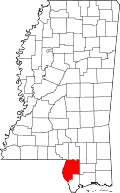 | |
| CDPs | ||
| Other unincorporated communities | ||
| Footnotes | ‡This populated place also has portions in an adjacent county or counties | |
This article is issued from
Wikipedia.
The text is licensed under Creative Commons - Attribution - Sharealike.
Additional terms may apply for the media files.