Montgomery County, Texas
| Montgomery County, Texas | |
|---|---|
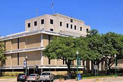 The Montgomery County Courthouse in Conroe | |
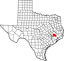 Location in the U.S. state of Texas | |
 Texas's location in the U.S. | |
| Founded | 1837 |
| Named for | Montgomery, Texas |
| Seat | Conroe |
| Largest city | Conroe |
| Area | |
| • Total | 1,077 sq mi (2,789 km2) |
| • Land | 1,042 sq mi (2,699 km2) |
| • Water | 35 sq mi (91 km2), 3.3% |
| Population (est.) | |
| • (2015) | 537,559[1] |
| • Density | 498/sq mi (192/km2) |
| Congressional district | 8th |
| Time zone | Central: UTC−6/−5 |
| Website |
www |
Montgomery County is a county in the U.S. state of Texas. As of the 2010 census, its population was 455,746.[2] A 2016 estimate places the population at 556,203.[3] The county seat is Conroe.[4] The county was created by an act of the Congress of the Republic of Texas on December 14, 1837 and is named for the town of Montgomery. Between 2000 and 2010, its population grew by 55%, the 24th-fastest rate of growth of any county in the United States.
Montgomery County is part of the Houston-The Woodlands-Sugar Land, TX Metropolitan Statistical Area.
Geography
According to the U.S. Census Bureau, the county has a total area of 1,077 square miles (2,790 km2), of which 1,042 square miles (2,700 km2) are land and 35 square miles (91 km2) (3.3%) are covered by water.[5]
Adjacent counties
- Walker County (north)
- San Jacinto County (northeast)
- Liberty County (east)
- Harris County (south)
- Waller County (west)
- Grimes County (northwest)
National protected area
- Sam Houston National Forest (partial)
Demographics
| Historical population | |||
|---|---|---|---|
| Census | Pop. | %± | |
| 1850 | 2,384 | — | |
| 1860 | 5,479 | 129.8% | |
| 1870 | 6,483 | 18.3% | |
| 1880 | 10,154 | 56.6% | |
| 1890 | 11,765 | 15.9% | |
| 1900 | 17,067 | 45.1% | |
| 1910 | 15,679 | −8.1% | |
| 1920 | 17,334 | 10.6% | |
| 1930 | 14,588 | −15.8% | |
| 1940 | 23,055 | 58.0% | |
| 1950 | 24,504 | 6.3% | |
| 1960 | 26,839 | 9.5% | |
| 1970 | 49,479 | 84.4% | |
| 1980 | 128,487 | 159.7% | |
| 1990 | 182,201 | 41.8% | |
| 2000 | 293,768 | 61.2% | |
| 2010 | 455,746 | 55.1% | |
| Est. 2016 | 556,203 | [6] | 22.0% |
| U.S. Decennial Census[7] 1850–2010[8] 2010–2014[2] | |||
As of the 2010 census,[9] there were 455,746 people, 162,530 households, and 121,472 families residing in the county. The population density was 423 people per square mile (163/km²). There were 177,647 housing units at an average density of 165 per square mile (64/km²). The racial makeup of the county was 83.5% White, 4.3% Black or African American, 0.7% Native American, 2.1% Asian, 0.1% Pacific Islander, 7.0% from other races, and 2.3% from two or more races. 20.8% of the population were Hispanic or Latino of any race.
There were 162,530 households out of which 36.20% had children under the age of 18 living with them, 59.50% were married couples living together, 10.60% had a female householder with no husband present, 4.70% had a male householder with no wife present, and 25.30% were non-families. 20.60% of all households were made up of individuals and 6.50% had someone living alone who was 65 years of age or older. The average household size was 2.78 and the average family size was 3.22.
In the county, 27.60% of the population was under the age of 18, 8.00% from 18 to 24, 27.40% from 25 to 44, 26.60% from 45 to 64, and 10.40% who were 65 years of age or older. The median age was 36.1 years. For every 100 females, there were 98.29 males. For every 100 females age 18 and over, there were 95.94 males.
As of the 2000 census, the median income for a household in the county was $50,864, and the median income for a family was $58,983. Males had a median income of $42,400 versus $28,270 for females. The per capita income for the county was $24,544. About 7.10% of families and 9.40% of the population were below the poverty line, including 10.90% of those under age 18 and 10.10% of those age 65 or over.
From 2010-2016, 54% of all vehicle-related fatalities in the county were related to the use of controlled substances, including alcohol, marijuana, methamphetamine and synthetic drugs. According to Tyler Dunman, Montgomery County assistant district attorney, approximately 60-70% of all crime in the county is connected to substance abuse.[10]
Politics
Montgomery County is one of the most heavily Republican counties in Texas, giving 78.1% of its vote to George W. Bush in 2004[11] and 75.8% of its vote to John McCain in 2008.[12] The county has not been won by a Democratic presidential candidate since native Texan Lyndon Johnson won 60.9% of the county's vote in 1964.[13] In 1968, George Wallace, running as a third-party candidate, won the county. And in 1992, Ross Perot, another third-party candidate received more votes than democratic candidate Bill Clinton. In 2016, it was the only county in the United States which Republican nominee Donald Trump won against Democratic nominee Hillary Clinton by a margin of greater than 100,000 votes.
| Year | Republican | Democratic | Third parties |
|---|---|---|---|
| 2016 | 73.0% 150,314 | 22.3% 45,835 | 4.7% 9,755 |
| 2012 | 79.5% 137,969 | 19.0% 32,920 | 1.5% 2,634 |
| 2008 | 75.8% 119,884 | 23.2% 36,703 | 1.1% 1,664 |
| 2004 | 78.1% 104,654 | 21.4% 28,628 | 0.5% 706 |
| 2000 | 75.9% 80,600 | 21.9% 23,286 | 2.2% 2,327 |
| 1996 | 65.2% 51,011 | 26.5% 20,722 | 8.3% 6,469 |
| 1992 | 51.3% 39,976 | 23.8% 18,551 | 24.9% 19,431 |
| 1988 | 68.2% 40,360 | 31.1% 18,394 | 0.7% 392 |
| 1984 | 75.4% 41,230 | 24.3% 13,293 | 0.3% 167 |
| 1980 | 65.6% 26,237 | 31.5% 12,593 | 2.9% 1,141 |
| 1976 | 53.1% 15,739 | 46.3% 13,718 | 0.7% 202 |
| 1972 | 77.5% 15,067 | 22.4% 4,358 | 0.1% 22 |
| 1968 | 32.8% 4,353 | 30.3% 4,021 | 36.8% 4,881 |
| 1964 | 38.6% 3,167 | 60.9% 4,989 | 0.5% 40 |
| 1960 | 47.7% 3,309 | 50.6% 3,510 | 1.7% 118 |
| 1956 | 56.2% 3,360 | 43.1% 2,572 | 0.7% 42 |
| 1952 | 46.3% 2,969 | 53.5% 3,432 | 0.1% 9 |
| 1948 | 16.3% 544 | 53.8% 1,795 | 29.9% 999 |
| 1944 | 6.1% 219 | 80.2% 2,902 | 13.8% 499 |
| 1940 | 10.9% 408 | 89.1% 3,347 | |
| 1936 | 7.1% 186 | 92.6% 2,443 | 0.3% 9 |
| 1932 | 6.0% 126 | 93.9% 1,971 | 0.1% 2 |
| 1928 | 40.4% 613 | 59.6% 905 | 0.1% 1 |
| 1924 | 9.8% 166 | 88.8% 1,500 | 1.4% 23 |
| 1920 | 14.0% 203 | 64.5% 935 | 21.5% 312 |
| 1916 | 16.1% 197 | 72.1% 880 | 11.8% 144 |
| 1912 | 12.7% 120 | 64.7% 613 | 22.6% 214 |
United States Congress
| Senators | Name | Party | First Elected | Level | |
|---|---|---|---|---|---|
| Senate Class 1 | Ted Cruz | Republican | 2012 | Junior Senator | |
| Senate Class 2 | John Cornyn | Republican | 2002 | Senior Senator | |
| Representatives | Name | Party | First Elected | Area(s) of Montgomery County Represented | |
| District 8 | Kevin Brady | Republican | 1996 | Entire county | |
Texas Legislature
Texas Senate
| District | Name | Party | First Elected | Area(s) of Montgomery County Represented | |
|---|---|---|---|---|---|
| 3 | Robert Nichols | Republican | 2006 | North | |
| 4 | Brandon Creighton | Republican | Special election 2014 | South and central (including The Woodlands and Conroe) | |
Texas House of Representatives
| District | Name | Party | First Elected | Area(s) of Montgomery County Represented | |
|---|---|---|---|---|---|
| 3 | Cecil Bell Jr. | Republican | 2012 | Southwest to southeast | |
| 15 | Mark Keough | Republican | 2014 | South (including The Woodlands) | |
| 16 | Will Metcalf | Republican | 2014 | North and east (including Conroe) | |
Education
Public schools
Several school districts operate public schools in the county:
- Conroe ISD
- Magnolia ISD
- Montgomery ISD
- New Caney ISD
- Richards ISD (partial)
- Splendora ISD
- Tomball ISD (partial)
- Willis ISD (partial)
Private schools
Pre-K to 12
- Covenant Christian School
- Christ Community School
- Esprit International School
- The Woodlands Christian Academy
- The John Cooper School
- St. Anthony Of Padua Catholic School
- The Woodlands Preparatory School
- Porter Christian Academy
- Cunae International School The county also is home to two campuses of the Lone Star College System: Montgomery and The University Center. The county operates the Montgomery County Memorial Library System.
Transportation
Airports
Lone Star Executive Airport, a general-aviation airport, is located in Conroe.
The Houston Airport System stated that Montgomery County is within the primary service area of George Bush Intercontinental Airport, an international airport in Houston in Harris County.[15] William P. Hobby Airport in Houston in Harris County also operates regular commercial service.
Major highways
.svg.png)
.svg.png)


Toll Roads
Montgomery County has several toll roads within its borders, most of which are operated as "pass-through toll roads"[16] or shadow toll roads. Currently, the only true toll road within the county is State Highway 99 until the extension of State Highway 249 is completed. Montgomery County also operates two direct-connect flyover ramps that connect between State Highway 242 and Interstate 45, located in The Woodlands.
Communities
Cities
- Conroe (county seat)
- Cut and Shoot
- Houston (mostly in Harris County and a small part in Fort Bend County)
- Magnolia
- Montgomery
- Oak Ridge North
- Panorama Village
- Patton Village
- Shenandoah
- Splendora
- Willis
- Woodbranch
Towns
Census-designated places
- Pinehurst
- Porter Heights
- The Woodlands (small part in Harris County)
Unincorporated communities
See also
References
- ↑ Annual Estimates of the Resident Population: April 1, 2010 to July 1, 2015, U.S. Census Bureau.
- 1 2 "State & County QuickFacts". United States Census Bureau. Archived from the original on July 15, 2011. Retrieved December 22, 2013.
- ↑ "Annual Estimates of the Resident Population: April 1, 2010 to July 1, 2016". U.S. Census Bureau, Population Division. Washington, DC. March 2017. Retrieved March 27, 2017.
- ↑ "Find a County". National Association of Counties. Retrieved 2011-06-07.
- ↑ "2010 Census Gazetteer Files". United States Census Bureau. August 22, 2012. Retrieved May 4, 2015.
- ↑ "Population and Housing Unit Estimates". Retrieved June 9, 2017.
- ↑ "U.S. Decennial Census". United States Census Bureau. Retrieved May 4, 2015.
- ↑ "Texas Almanac: Population History of Counties from 1850–2010" (PDF). Texas Almanac. Retrieved May 4, 2015.
- ↑ "American FactFinder". United States Census Bureau. Retrieved 2011-05-14.
- ↑ Zedaker, Hannah. Officials: Substance abuse rising in Montgomery County. Community Impact Newspaper: June 12, 2017. Retrieved April 23, 2018
- ↑ "Dave Leip's Atlas of U.S. Presidential Elections - Data Graph --2004 Montgomery County, Texas". uselectionatlas.org. Retrieved 22 March 2018.
- ↑ "Dave Leip's Atlas of U.S. Presidential Elections - Data Graph --2008 Montgomery County, Texas". uselectionatlas.org. Retrieved 22 March 2018.
- ↑ "Dave Leip's Atlas of U.S. Presidential Elections - Data Graphs". uselectionatlas.org. Retrieved 22 March 2018.
- ↑ Leip, David. "Dave Leip's Atlas of U.S. Presidential Elections". uselectionatlas.org. Retrieved 22 March 2018.
- ↑ "Master Plan Executive Summary." George Bush Intercontinental Airport Master Plan. Houston Airport System. December 2006. 2-1 (23/130). Retrieved on December 14, 2010.
- ↑ TxDot's Pass-Through Financing Program
External links
- Montgomery County government's website
- Montgomery County in the Handbook of Texas Online from The University of Texas at Austin
- History of the Lake Creek Settlement and the Founding of the Town of Montgomery, Texas
- Early History of Montgomery County, Texas
- Lonestar College – The Lone Star College System, formerly known as the North Harris Montgomery Community College District, is accredited through the Commission on Colleges of the Southern Association of Colleges and Schools (SACS).
- Montgomery County Community Website
Places adjacent to Montgomery County, Texas | ||||||||||
|---|---|---|---|---|---|---|---|---|---|---|
| ||||||||||
Municipalities and communities of Montgomery County, Texas, United States | ||
|---|---|---|
| Cities | | |
| Towns | ||
| CDPs | ||
| Unincorporated communities | ||
| Ghost town | ||
| Footnotes | ‡This populated place also has portions in an adjacent county or counties | |
| Counties | 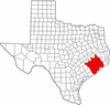 | |
|---|---|---|
| "Principal" cities | ||
| Other cities |
For a complete listing, see list of cities and towns in Houston–The Woodlands–Sugar Land MSA | |
| Unincorporated areas | ||
| Bodies of water | ||
