West Texas
| West Texas | |
| Region | |
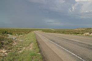 West of Notrees | |
| Country | United States |
|---|---|
| State | Texas |
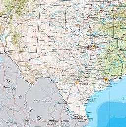 Map of Texas | |
West Texas is a loosely defined part of the U.S. state of Texas, generally encompassing the arid and semiarid lands west of a line drawn between the cities of Wichita Falls, Abilene, and Del Rio.
There is no consensus on the boundary between East Texas and West Texas.[1] While most Texans understand these terms, no boundaries are officially recognized and any two individuals are likely to describe the boundaries of these regions differently. Walter Prescott Webb, the American historian and geographer, suggested that the 98th meridian separates East and West Texas;[2] Texas writer A.C. Greene proposed that West Texas extends west of the Brazos River.[3]
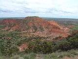
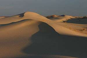
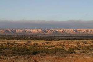
West Texas is often subdivided according to distinct physiographic features. The portion of West Texas that lies west of the Pecos River is often referred to as "Far West Texas" or the "Trans-Pecos", a term first introduced in 1887 by Texas geologist Robert T. Hill.[4] The Trans-Pecos lies within the Chihuahuan Desert, the most arid portion of the state. Another part of West Texas is the Llano Estacado, a vast region of high, level plains extending into Eastern New Mexico and the Texas Panhandle. To the east of the Llano Estacado lies the “redbed country” of the Rolling Plains and to the south of the Llano Estacado lies the Edwards Plateau. The Rolling Plains and the Edwards Plateau subregions act as transitional zones between eastern and western Texas.
Counties
The counties included in the West Texas region vary depending on the organization. The Texas Counties.net website acknowledges the variations, and includes 70 counties in its definition, based on the five principal metropolitan areas it contains: El Paso, Lubbock, Abilene, Midland/Odessa, and San Angelo.[5]
The counties included are Andrews, Bailey, Borden, Brewster, Brown, Callahan, Castro, Cochran, Coke, Coleman, Comanche, Concho, Crane, Crockett, Crosby, Culberson, Dawson, Deaf Smith, Dickens, Eastland, Ector, El Paso, Fisher, Floyd, Gaines, Garza, Glasscock, Hale, Haskell, Hockley, Howard, Hudspeth, Irion, Jeff Davis, Jones, Kent, Kimble, King, Knox, Lamb, Loving, Lubbock, Lynn, Martin, Mason, McCulloch, Menard, Midland, Mitchell, Motley, Nolan, Parmer, Potter, Pecos, Presidio, Randall, Reagan, Reeves, Runnels, Schleicher, Scurry, Shackelford, Stephens, Sterling, Stonewall, Sutton, Taylor, Terrell, Terry, Throckmorton, Tom Green, Upton, Val Verde, Ward, Winkler and Yoakum.
Cities and towns of West Texas
Cities
| Region rank | City | Census 2013 population estimate[6] |
State rank | County |
|---|---|---|---|---|
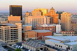
| 1 | El Paso | 674,433 | 6 | El Paso County |
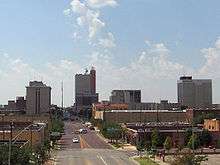
| 2 | Lubbock | 239,538 | 11 | Lubbock County |
| 3 | Amarillo | 196,429 | 14 | Potter County |
| 4 | Midland | 123,933 | 26 | Midland County |
| 5 | Abilene | 120,099 | 27 | Taylor County |
| 6 | Odessa | 110,720 | 30 | Ector County |
| 7 | San Angelo | 97,492 | 37 | Tom Green County |
| 8 | Socorro | 32,517 | 77 | El Paso County |
| 9 | Big Spring | 28,125 | 104 | Howard County |
| 10 | Plainview | 22,194 | 128 | Hale County |

Some of the smaller West Texas cities and towns include: Alpine, Andrews, Anthony, Brownfield, Canutillo, Canyon, Crane, Fort Davis, Fabens, Fort Bliss, San Elizario, Fort Stockton, Hale Center, Iraan, Kermit, Lamesa, Levelland, Littlefield, Marathon, Marfa, McCamey, Mertzon, Monahans, Ozona, Pampa, Pecos, Horizon City, Post, Rankin, Seminole, Slaton, Snyder, Sweetwater, and Van Horn.
Population
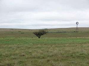
West Texas has a much lower population density than the rest of the state. It was once mostly inhabited by nomadic Native American tribes, such as the Apache, Comanche, and Kiowa, and was chiefly within the countryside called Comancheria until after the Civil War. During this period, Texan settlers grouped themselves into fortified cabins, block houses, and other encampments historically common to their long experience of frontier life since the Colonial American period and even prior to their ancestral homes in the Old World. This period was marked with savage war waged between the US Army, frontier Texans, and the Texas Rangers on one side and native peoples on the other.
During the later 19th century, the growing population of Americans and the end of the Civil War brought more Americans into an area long challenged by the Comanche and their allies. This period was marked by the final mapping and geographical intelligence collection of a denied area held by hostile Indian tribes. In turn, the Comanche way of war reached its possible zenith, having either subjugated or defeated the other Indian clans and what remained of Mexicans in the area. In contrast, the continued support by the US government of Americans settlement, as well as the ferocious martial ability of the Texans, had given the whites a demographic advantage. The subsequent decades of the 19th century had the Texans and their Texan Rangers in association with the US Army smash terrorizing Comanche war bands, recover whites held by the Indians, and break up the economic power of the Comanche. By the end of the 19th century, West Texas had been pacified of hostile Indians, leaving its turbulent history to what remained of outlaw Texans and people such as Judge Roy Bean.
With the defeat of the Comanche and their allies and their removal upon demand by Texas from the state, the area was principally settled by Texans and those from the South. These decades marked the last great cattle drives, the final zenith of American cowboys, small farmers and ranchers battling sheepherders, and Populist Farmers' Alliance.
During the early 20th century, although the economic system became increasingly unfavorable for small farming and ranching, the region had continued economic growth and settlement through a burst of oil booms, and final agricultural wealth as a result of demands arising from World War I. The subsequent years were another period of demographic chaos, as Mexican bandit attacks once again became commonplace, reaching an apex into the 1920s as a result of the Mexican Revolution and resultant refugee crisis. The Great Depression caused additional economic losses, further rural population loss, and paradoxical increases in Mexican settlement, as the remaining large landowners sought to maintain their profits by exploiting Mexican cheap labor. This continuing socioeconomic trends resulted in the region having an even mix of Mexican American and American communities of the modern day. As a result of this historical development, many Mexican Americans still have close family ties in Mexico. Of American settlers, during the frontier migration era, the vast majority were either East Texans or other Southerners going west for new opportunities. The far northern panhandle area of West Texas also has strong influences from the lower Midwest.
Climate
West Texas receives much less rainfall than the rest of Texas and has an arid or semiarid climate, requiring most of its scant agriculture to be heavily dependent on irrigation. This irrigation, and water taken out farther north for the needs of El Paso and Juarez, Mexico, has reduced the once mighty Rio Grande to a stream in some places, even dry at times. Much of West Texas has rugged terrain, including many small mountain ranges while there are none in other parts of the state.
.JPG)
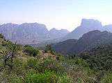

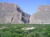 Santa Elena Canyon
Politics
Except for the Trans-Pecos region, West Texas has become well known as a stronghold for conservative politics. Some of the most heavily Republican counties in the United States are located in the region. Former U.S. President George W. Bush spent most of his childhood in West Texas.
The Panhandle and several counties in or west of Midland were one of the first areas of Texas to abandon the state’s “Solid South” Democratic roots; nine counties[lower-alpha 1] have not supported a Democrat for president since 1948. The Rolling Plains to the east remained Democratic for substantially longer: even Walter Mondale in 1984 when losing Texas by 27.50 percentage points carried five counties in this region.[lower-alpha 2] However, since 2000 this region has swung very rapidly towards the Republican Party due to its population’s intransigent opposition to the liberal social policies of the Democratic Party[7] and by 2016 has become nearly so Republican as the Panhandle.
Economy
Major industries include livestock, petroleum and natural gas production, textiles such as cotton, grain, and, because of very large military installations such as Fort Bliss, the defense industry. West Texas has become notable for its numerous wind turbines producing clean, alternative electricity.
As of 2018, the West Texan economy is in an economic period, which has been described as the "West Texas oil boom".[8][9]
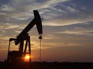 Pumpjacks, like this one south of Midland, are a common sight in West Texas oil fields.
 Irrigated agriculture in West Texas
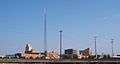
 The Brazos Wind Farm near Fluvanna is one of many wind farms in West Texas.
 Fort Bliss is the number one employer in El Paso
Sports
West Texas does not have major league sports teams. Instead the region has college teams such as Texas Tech Red Raiders and UTEP Miners, which play in NCAA Division I, and NCAA Division II teams of the West Texas A&M Buffaloes, the Texas–Permian Basin Falcons, and the Lubbock Christian Chaparrals and Lady Chaps. El Paso also hosts the El Paso Chihuahuas, a AAA baseball team and Midland hosts the Midland RockHounds, a Double-A baseball team. Oddly in the heat ravaged climate of West Texas, the winter sport of ice hockey can be found in the city of Odessa through a Tier II junior ice hockey team playing out of the North American Hockey League (NAHL) called the Odessa Jackalopes. In 2019, The San Antonio Missions will move to Amarillo and continue play at the Double-A level[10]; a mascot and team name have yet to be announced.
West of the Pecos in popular culture
| Wikimedia Commons has media related to West Texas. |
"West of the Pecos" has become a metaphor for the universe of westerns. "Fastest draw west of the Pecos" and similar superlatives are a cliche, and the title character of Chisum observed ”There’s no law west of Dodge, and no God west of the Pecos”. See West of the Pecos (disambiguation).
See also
- List of geographical regions in Texas
- Llano Estacado
- Beach Mountains
- Chalk Mountains
- Chamizal National Memorial
- Davis Mountains
- Franklin Mountains State Park
- Palo Duro Canyon
- Hueco Tanks State Historic Site
- Guadalupe Mountains
- McKittrick Canyon
- Big Bend National Park
- Ysleta del Sur Pueblo
- Mount Blanco
- Wind power in Texas
- Farm to Market Road 669
- West Texas Intermediate
- Wyler Aerial Tramway
References
- ↑ Cochran, M., Lumpkin, J. and Heflin, R. 1999. West Texas: a portrait of its people and their raw and wondrous land. Lubbock: Texas Tech University Press, 176 pp.
- ↑ Webb, W.P. 1935. The Texas Rangers: a century of frontier defense. New York: Houghton Mifflin Co., 583 pp.
- ↑ Greene, A.C. 1998. Sketches from the five states of Texas. College Station: Texas A&M University Press, 176 pp.
- ↑ Hill, R.T. 1887. The topography and geology of the Cross Timbers and surrounding regions in Northern Texas. The American Journal of Science, 3rd Series, 33:291–303.
- ↑ "The Regions of Texas". Texas Counties.net. Retrieved 13 October 2014.
- ↑ factfinder2.census.gov
- ↑ Cohn, Nate; ‘Demographic Shift: Southern Whites’ Loyalty to G.O.P. Nearing That of Blacks to Democrats’, New York Times, April 24, 2014
- ↑ Clifford, Krauss (March 28, 2018). "$9.5 Billion Purchase by Concho Is Latest Sign of West Texas Oil Boom". New York Times. Retrieved May 15, 2018.
- ↑ Saphir, Ann (May 1, 2018). "Boom in West Texas oil patch lifts wages, prices". Reuters. Retrieved May 15, 2018.
- ↑ http://www.newschannel10.com/story/35716024/missions-aa-baseball-coming-to-amarillo
Notes
- ↑ West Texas counties voting Republican at every election since 1952 comprise Ector County, Gray County, Hansford County, Hutchinson County, Lipscomb County, Midland County, Ochiltree County, Randall County and Roberts County.
- ↑ West Texas Plains “Bible Belt“ counties voting for Mondale in 1984 were Cottle County (which was in fact one of 130 counties nationwide to vote for George McGovern in 1972), Dickens County, Fisher County, Stonewall County and Swisher County.
External links
- Photos of West Texas
- West Texas Vacation Guide - Texas Outside
