Upshur County, Texas
| Upshur County, Texas | |
|---|---|
.jpg) Upshur County Courthouse | |
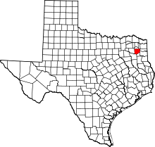 Location in the U.S. state of Texas | |
 Texas's location in the U.S. | |
| Founded | 1846 |
| Named for | Abel P. Upshur |
| Seat | Gilmer |
| Largest city | Gilmer |
| Area | |
| • Total | 593 sq mi (1,536 km2) |
| • Land | 583 sq mi (1,510 km2) |
| • Water | 9.7 sq mi (25 km2), 1.6% |
| Population | |
| • (2010) | 39,309 |
| • Density | 67/sq mi (26/km2) |
| Congressional districts | 1st, 4th |
| Time zone | Central: UTC−6/−5 |
| Website |
www |
Upshur County is a county located in the eastern part of the U.S. state of Texas. As of the 2010 census, the population was 39,309.[1] The county seat is Gilmer.[2] The county is named for Abel P. Upshur, who was U.S. Secretary of State during President John Tyler's administration.
Upshur County is part of the Longview, Texas Metropolitan Statistical Area as well as the Longview–Marshall, TX Combined Statistical Area.
History
Humans have inhabited what is now Upshur county since at least 10,000 years ago. The Caddoan people lived in this area, but were driven out about 1750, probably due to losses from new infectious diseases carried chronically by Europeans.
Later some Cherokee migrated to the area from their territories in the Southeast - Georgia and Alabama. The Cherokee were driven out of here by European-American settlers in 1839, after having been removed from the Southeast.[3]
The first European-American settler in Upshur county was probably Isaac Moody, who settled there in 1836.[3] Upshur County was named for Abel Parker Upshur, Secretary of State under John Tyler.[3]
Upshur County has the distinction of being the county that has the largest settlement in Texas organized by the Church of Jesus Christ of Latter-day Saints. In 1904 the Latter-day Saint South-western States Mission organized a colony at Kelsey, Texas.[4]
Geography
.jpg)
According to the U.S. Census Bureau, the county has a total area of 593 square miles (1,540 km2), of which 583 square miles (1,510 km2) is land and 9.7 square miles (25 km2) (1.6%) is water.[5]
Major Highways
Adjacent counties
- Camp County (north)
- Morris County (northeast)
- Marion County (east)
- Harrison County (southeast)
- Gregg County (south)
- Smith County (southwest)
- Wood County (west)
Demographics
| Historical population | |||
|---|---|---|---|
| Census | Pop. | %± | |
| 1850 | 3,394 | — | |
| 1860 | 10,645 | 213.6% | |
| 1870 | 12,039 | 13.1% | |
| 1880 | 10,266 | −14.7% | |
| 1890 | 12,695 | 23.7% | |
| 1900 | 16,266 | 28.1% | |
| 1910 | 19,960 | 22.7% | |
| 1920 | 22,472 | 12.6% | |
| 1930 | 22,297 | −0.8% | |
| 1940 | 26,178 | 17.4% | |
| 1950 | 20,822 | −20.5% | |
| 1960 | 19,793 | −4.9% | |
| 1970 | 20,976 | 6.0% | |
| 1980 | 28,595 | 36.3% | |
| 1990 | 31,370 | 9.7% | |
| 2000 | 35,291 | 12.5% | |
| 2010 | 39,309 | 11.4% | |
| Est. 2016 | 40,969 | [6] | 4.2% |
| U.S. Decennial Census[7] 1850–2010[8] 2010–2014[1] | |||
As of the census[9] of 2000, there were 35,291 people, 13,290 households, and 10,033 families residing in the county. The population density was 60 people per square mile (23/km²). There were 14,930 housing units at an average density of 25 per square mile (10/km²). The racial makeup of the county was 85.70% White, 10.15% Black or African American, 0.63% Native American, 0.18% Asian, 0.06% Pacific Islander, 2.10% from other races, and 1.17% from two or more races. 3.95% of the population were Hispanic or Latino of any race.
There were 13,290 households out of which 33.50% had children under the age of 18 living with them, 60.70% were married couples living together, 11.00% had a female householder with no husband present, and 24.50% were non-families. 21.80% of all households were made up of individuals and 10.30% had someone living alone who was 65 years of age or older. The average household size was 2.62 and the average family size was 3.05.
In the county, the population was spread out with 27.00% under the age of 18, 8.00% from 18 to 24, 26.60% from 25 to 44, 24.10% from 45 to 64, and 14.30% who were 65 years of age or older. The median age was 38 years. For every 100 females, there were 95.50 males. For every 100 females age 18 and over, there were 91.10 males.
The median income for a household in the county was $33,347, and the median income for a family was $38,857. Males had a median income of $31,216 versus $20,528 for females. The per capita income for the county was $16,358. 14.90% of the population and 12.30% of families were below the poverty line. Out of the total population, 18.60% of those under the age of 18 and 14.00% of those 65 and older were living below the poverty line.
Politics
Upshur County is represented in the Texas House of Representatives by Republican Jay Dean, from Longview.
Per the Texas Constitution of 1876, the chief administrative body of Upshur County is the five-member Upshur County Commissioners Court. The County Judge is elected separately. The county road maintenance is administrated by the County Road Administrator. This system was adopted in Upshur County in November 2002 and reaffirmed by two subsequent elections. The commissioners court oversees all of the Upshur County government's operations.
Upshur County Judge Dean Fowler is in his fourth term and has presided over the Upshur County Criminal, Probate, Civil, and Commissioners Court since January 1, 2003. Commissioner Paula Gentry is in her second term and has served Precinct One since January 1, 2013. Commissioner Don Gross is in his first term and has served Precinct Two since January 1, 2015. Commissioner Frank Berka is in his second term and has served Precinct Three since January 1, 2013. Commissioner Mike Spencer is in his second term and has served Precinct Four since January 1, 2011.
| Year | Republican | Democratic | Third parties |
|---|---|---|---|
| 2016 | 82.5% 13,209 | 14.9% 2,380 | 2.7% 424 |
| 2012 | 79.4% 12,015 | 19.6% 2,971 | 1.0% 152 |
| 2008 | 74.0% 11,222 | 25.0% 3,790 | 1.0% 152 |
| 2004 | 70.4% 10,232 | 29.1% 4,225 | 0.5% 69 |
| 2000 | 66.0% 8,448 | 32.6% 4,180 | 1.4% 180 |
| 1996 | 45.7% 5,174 | 44.5% 5,032 | 9.8% 1,114 |
| 1992 | 37.0% 4,511 | 39.1% 4,776 | 23.9% 2,921 |
| 1988 | 53.2% 5,991 | 46.5% 5,242 | 0.3% 32 |
| 1984 | 61.2% 7,325 | 38.5% 4,614 | 0.3% 37 |
| 1980 | 49.1% 4,836 | 49.7% 4,894 | 1.2% 122 |
| 1976 | 39.9% 3,272 | 59.7% 4,902 | 0.5% 37 |
| 1972 | 71.5% 4,736 | 28.4% 1,879 | 0.1% 9 |
| 1968 | 22.1% 1,519 | 36.0% 2,480 | 41.9% 2,886 |
| 1964 | 35.5% 2,222 | 64.3% 4,027 | 0.2% 13 |
| 1960 | 40.7% 2,262 | 58.5% 3,248 | 0.8% 44 |
| 1956 | 57.5% 2,737 | 41.9% 1,995 | 0.7% 32 |
| 1952 | 44.0% 2,391 | 55.9% 3,040 | 0.1% 6 |
| 1948 | 17.5% 555 | 66.9% 2,118 | 15.5% 492 |
| 1944 | 13.2% 446 | 70.3% 2,369 | 16.4% 554 |
| 1940 | 13.0% 518 | 87.0% 3,480 | |
| 1936 | 12.5% 321 | 87.4% 2,243 | 0.1% 3 |
| 1932 | 4.2% 129 | 95.4% 2,900 | 0.4% 11 |
| 1928 | 29.4% 649 | 70.3% 1,553 | 0.4% 8 |
| 1924 | 8.9% 258 | 89.7% 2,611 | 1.4% 42 |
| 1920 | 26.4% 616 | 52.5% 1,222 | 21.1% 492 |
| 1916 | 11.8% 198 | 80.4% 1,346 | 7.8% 131 |
| 1912 | 13.9% 168 | 74.1% 896 | 12.0% 145 |
Education
The following school districts serve Upshur County:
- Big Sandy ISD (partly in Wood County)
- Gilmer ISD (small portion in Camp County)
- Gladewater ISD (mostly in Gregg County, partly in Smith County)
- Harmony ISD (partly in Wood County)
- New Diana ISD (small portion in Harrison County)
- Ore City ISD (small portion in Harrison, Marion counties)
- Pittsburg ISD (mostly in Camp County, small portion in Wood County)
- Union Grove ISD
- Union Hill ISD (mostly in Upshur County,partly in Wood County)
Communities
Cities
- Clarksville City (mostly in Gregg County)
- East Mountain (small part in Gregg County)
- Gilmer (county seat)
- Gladewater (partly in Gregg County)
- Ore City
- Union Grove
- Warren City (mostly in Gregg County)
Town
Unincorporated communities
- Bethlehem
- Bettie
- Brumley
- Coffeeville
- Cox
- Diana
- Enoch
- Enon
- Ewell
- Grice
- Indian Rock
- Kelsey
- Latch
- Little Mound
- Mings Chapel
- Pritchett
- Rhonesboro
- Rosewood
- Sand Hill
- Shady Grove
- Simpsonville
- West Mountain
- Glenwood
- Lake Providence
- James
- Red Rock
- Sand Hill
- Center Point
- Pleasant Hill
- Smith
- Snow Hill
- Valley View
- Concord
- Hopewell
- Zion Hill
- Cross Roads
- Union Hill
- Piedmont
In popular culture
- The singer-songwriter Michelle Shocked, who grew up in Gilmer, refers to Upshur County in several of her songs.
- Author Edward Hancock II sets many of his stories in and around Upshur County, Texas.
See also
References
- 1 2 "State & County QuickFacts". United States Census Bureau. Retrieved December 29, 2013.
- ↑ "Find a County". National Association of Counties. Retrieved 2011-06-07.
- 1 2 3 UPSHUR COUNTY | The Handbook of Texas Online| Texas State Historical Association (TSHA)
- ↑ Jenson, Andrew. Encyclopedic History of the Church of Jesus Christ of Latter-day Saints. (Salt Lake City: Deseret News Press, 1941) p. 129
- ↑ "2010 Census Gazetteer Files". United States Census Bureau. August 22, 2012. Retrieved May 11, 2015.
- ↑ "Population and Housing Unit Estimates". Retrieved June 9, 2017.
- ↑ "U.S. Decennial Census". United States Census Bureau. Retrieved May 11, 2015.
- ↑ "Texas Almanac: Population History of Counties from 1850–2010" (PDF). Texas Almanac. Retrieved May 11, 2015.
- ↑ "American FactFinder". United States Census Bureau. Retrieved 2011-05-14.
- ↑ Leip, David. "Dave Leip's Atlas of U.S. Presidential Elections". uselectionatlas.org. Retrieved 2018-07-31.
External links
- Upshur County from the Handbook of Texas Online
- Upshur County
Places adjacent to Upshur County, Texas | ||||||||||
|---|---|---|---|---|---|---|---|---|---|---|
| ||||||||||
Municipalities and communities of Upshur County, Texas, United States | ||
|---|---|---|
| Cities | | |
| Town | ||
| Unincorporated communities | ||
| Footnotes | ‡This populated place also has portions in an adjacent county or counties | |
