Freeport, Texas
| Freeport, Texas | |
|---|---|
| City | |
| Motto(s): "Where Fun Happens"[1] | |
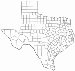 Location in the state of Texas | |
 | |
 Freeport Location in the state of Texas  Freeport Freeport (the US) | |
| Coordinates: 28°57′34″N 95°21′25″W / 28.95944°N 95.35694°WCoordinates: 28°57′34″N 95°21′25″W / 28.95944°N 95.35694°W | |
| Country | United States |
| State | Texas |
| County | Brazoria |
| Incorporated | February 10, 1917 |
| Government | |
| • Type | Council-Manager |
| • City Council |
Mayor Troy Brimmage Larry McDonald Brooks Bass Nicole Mireles Roy Yates |
| • City Manager | Interim Bob Welch |
| Area | |
| • Total | 17.1 sq mi (44.2 km2) |
| • Land | 14.9 sq mi (38.7 km2) |
| • Water | 2.1 sq mi (5.5 km2) |
| Elevation | 5 ft (2 m) |
| Population (2016) | |
| • Total | 12,153 |
| • Density | 806/sq mi (311.1/km2) |
| Time zone | UTC-6 (CST) |
| • Summer (DST) | UTC-5 (CDT) |
| ZIP codes | 77541-77542 |
| Area code(s) | 979 |
| FIPS code | 48-27420[2] |
| GNIS feature ID | 1357720[3] |
| Website |
www |
Freeport is a city in Brazoria County, Texas, United States, located on the Gulf of Mexico. According to the 2016 census, the city population was 12,153,[4] up from 12,049 in 2010.
History

Freeport was founded as a European-American settlement in November 1912 by the Freeport Sulphur Company.[5] The population was 300. However, by 1929, that population had grown to 3,500, and to 4,100 by 1939, influencing a steady increase of economic expansion in Freeport.[6]
By 1937, a Freeport School District had been established, consisting of several segregated schools and 27 teachers. There were two white schools, one black school, and a white high school.[6]
Freeport's most substantial economic growth began with the construction of Dow Chemical Company facilities in the city during 1939. This company is the community's largest employer.[6] Freeport has the company's largest single manufacturing site in the 21st century.[7]
In July 1957, Freeport merged with Velasco, Texas. This had been a temporary capital of the Republic of Texas during the 19th century. Soon thereafter, Freeport's population numbered 11,619.[6] In 2003, the city annexed nearby Bryan Beach.
Economy
Port Freeport is a seaport on the Gulf of Mexico and is currently ranked 26th in international tonnage. The associated chemical plants provide a stable economy. Freeport is the site of the Dow Chemical Company's Texas Operations facility, which is the company's largest integrated site.[7]
Geography
Freeport is located in southern Brazoria County at 28°57′34″N 95°21′25″W / 28.95944°N 95.35694°W (28.959527, -95.356941),[8] near the mouth of the Brazos River in the Gulf of Mexico. In 2003, the city annexed 3.5 miles (5.6 km) of beach bounded on the northeast by the village of Quintana and continuing southwest to the mouth of the Brazos River. This beach is known as Bryan Beach. It is just a few miles away from Surfside and Quintana beaches.
Texas State Highway 288, the Nolan Ryan Expressway, leads north from Freeport 17 miles (27 km) to Angleton, the county seat, and 61 miles (98 km) to downtown Houston. Texas State Highway 36 leads northwest 15 miles (24 km) to Brazoria.
According to the United States Census Bureau, Freeport has a total area of 17.1 square miles (44.2 km2), of which 14.9 square miles (38.7 km2) is land and 2.1 square miles (5.5 km2), or 12.36%, is water.[4]
Demographics
| Historical population | |||
|---|---|---|---|
| Census | Pop. | %± | |
| 1920 | 1,798 | — | |
| 1930 | 3,162 | 75.9% | |
| 1940 | 2,579 | −18.4% | |
| 1950 | 6,012 | 133.1% | |
| 1960 | 11,619 | 93.3% | |
| 1970 | 11,997 | 3.3% | |
| 1980 | 13,444 | 12.1% | |
| 1990 | 11,389 | −15.3% | |
| 2000 | 12,708 | 11.6% | |
| 2010 | 12,049 | −5.2% | |
| U.S. Decennial Census[9] | |||
According to the census[2] numbers as of 2016, there were 12,153 people, 3,788 households with an average of 3.17 persons per household. The median gross rent was $711.00 and the owner-occupied housing rate was 49.5%. The racial makeup of the city was 33.2% White, 13.9% African American, 0.56% Native American, 0.35% Asian, 0.01% Pacific Islander, 20.91% from other races, and 3.24% from two or more races. Hispanic or Latino of any race were 52.0% of the population. Languages spoken in the household other than English is 49.4%.
The mean travel time to work for workers age 16+ was 15.2 minutes. In 2012, there were approximately 1,230 businesses in Freeport with women owning 552.
In the city, the median age for females is 29 years old and for males is 28. 34.1% of the population is 18 years of age or younger.
The median income for a household in the city was $36,044. The per capita income for the city was $17,707. About 27.5% of families were below the poverty line.[10]
Government
Freeport is in the 14th congressional district,[11] and is represented by Congressman Randy Weber.
Education

Public education
Schools in Freeport include Brazosport High School (Grades 9-12), Freeport Intermediate School (Grades 7-8), Lanier Middle School (Grades 5-6), O.A. Fleming Elementary School, Jane Long Elementary School, and Velasco Elementary School (Grades Pre-K-4). They are all maintained through Brazosport Independent School District.[12] Many athletics events for the district take place in Freeport at Hopper Field.
Since the late 1990s, several schools have been rebuilt or are currently being rebuilt due to old age. Such schools include Freeport Intermediate School, O.A. Fleming Elementary School, Jane Long Elementary School, Velasco Elementary School, and Brazosport High School.
Libraries
The Freeport Library is a part of the Brazoria County Library System.[13]
Climate
The climate in this area is characterized by hot, humid summers and generally mild to cool winters. According to the Köppen Climate Classification system, Freeport has a humid subtropical climate, abbreviated "Cfa" on climate maps.[14]
References
- ↑ "The City of Freeport Texas". The City of Freeport Texas. Retrieved October 19, 2012.
- 1 2 "American FactFinder". United States Census Bureau. Archived from the original on 2013-09-11. Retrieved 2008-01-31.
- ↑ "US Board on Geographic Names". United States Geological Survey. 2007-10-25. Retrieved 2008-01-31.
- 1 2 "Geographic Identifiers: 2010 Demographic Profile Data (G001): Freeport city, Texas". U.S. Census Bureau, American Factfinder. Retrieved April 16, 2014.
- ↑ Haynes, Williams (1959). Brimstone, The Stone That Burns. Princeton: D. Van Norstrand Company, Inc. pp. 75–85.
- 1 2 3 4 Freeport, TX, Handbook of Texas, Retrieved 12 August 2007.
- 1 2 "Texas Operation – Freeport, Texas" (PDF). Dow Chemical Company. Retrieved 2011-01-09.
- ↑ "US Gazetteer files: 2010, 2000, and 1990". United States Census Bureau. 2011-02-12. Retrieved 2011-04-23.
- ↑ "Census of Population and Housing". Census.gov. Archived from the original on May 12, 2015. Retrieved June 4, 2015.
- ↑ §https://www.census.gov/quickfacts/fact/table/freeportcitytexas/PST045216
- ↑ "Archived copy". Archived from the original on 2009-03-24. Retrieved 2009-05-16.
- ↑ "Brazosport Independent School District". Brazosport Independent School District. Archived from the original on March 22, 2014. Retrieved October 19, 2012.
- ↑ "Brazoria County Library System". Brazoria County Library System. Archived from the original on October 31, 2012. Retrieved October 19, 2012.
- ↑ Climate Summary for Freeport, Texas
External links
| Wikimedia Commons has media related to Freeport, Texas. |
- City of Freeport official website
- Brazosport ISD
- Port Freeport
- Historic materials about Freeport, hosted by the Portal to Texas History
- Handbook of Texas: Freeport
- The Portal of Texas History
- Brazosport College
- City-Data.com
- Podunk: Profile for Freeport, Texas
- Final Report Freeport Harbor, Texas Channel Improvement Project Communication from the Assistant Secretary, Army, Civil Works, the Department of Defense Transmitting the Freeport Harbor Channel Improvement Project, Brazoria County, Texas Feasibility Report and Environmental Impact Statement, Part 1 Part 2
| Counties |  | |
|---|---|---|
| "Principal" cities | ||
| Other cities |
For a complete listing, see list of cities and towns in Houston–The Woodlands–Sugar Land MSA | |
| Unincorporated areas | ||
| Bodies of water | ||
Municipalities and communities of Brazoria County, Texas, United States | ||
|---|---|---|
| Cities |  | |
| Towns | ||
| Villages | ||
| CDPs | ||
| Other unincorporated communities | ||
| Footnotes | ‡This populated place also has portions in an adjacent county or counties | |
