Rusk County, Texas
| Rusk County, Texas | |
|---|---|
.jpg) Rusk County Courthouse in Henderson | |
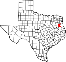 Location in the U.S. state of Texas | |
 Texas's location in the U.S. | |
| Founded | 1843 |
| Named for | Thomas Jefferson Rusk |
| Seat | Henderson |
| Largest city | Henderson |
| Area | |
| • Total | 938 sq mi (2,429 km2) |
| • Land | 924 sq mi (2,393 km2) |
| • Water | 14 sq mi (36 km2), 1.5% |
| Population | |
| • (2010) | 53,330 |
| • Density | 58/sq mi (22/km2) |
| Congressional district | 1st |
| Time zone | Central: UTC−6/−5 |
| Website |
www |
.jpg)
.jpg)
Rusk County is a county located in the U.S. state of Texas. As of the 2010 census, its population was 53,330.[1] Its county seat is Henderson.[2] The county is named for Thomas Jefferson Rusk, a secretary of war of the Republic of Texas.
Rusk County is part of the Longview, TX Metropolitan Statistical Area as well as the Longview–Marshall, TX Combined Statistical Area.
Rusk County is represented by Bryan Hughes, a Republican from Mineola, Texas, in the Texas State Senator for Senate District 1, which includes Rusk County. Travis Clardy, a Republican from Nacogdoches, is the Texas State Representative for House District 11, which includes Rusk County. Trent Ashby, a Republican from Lufkin who was born in Rusk County in 1972, represents District 57, which includes Angelina and several other mostly rural East Texas counties.
History
Prior to Texas annexation in 1845, the land while from time to time occupied by Caddoan peoples, was generally unpopulated until 1819 when Cherokee Indians, led by The Bowl settled in what is now Rusk County.[3] The Treaty of Bowles Village on February 23, 1836 between the Republic of Texas and the Cherokee and twelve affiliated tribes, gave parts of western Rusk County along with parts of today's Gregg and Van Zandt counties, in addition to the whole areas of Cherokee and Smith counties to the tribes.[4] They remained on these lands until the Cherokee War in the summer of 1839. Thus the Cherokee were driven out of Rusk County only to return in 1844 and 1845 with the purchase of 10,000 aces of land by Benjamin Franklin Thompson a white man married to a Cherokee. This established the Mount Tabor Indian Community,[5] some six miles south of present day Kilgore that later spread to incorporate areas near Troup, Arp and Overton, Texas. Originally organized as a part of Nacogdoches County, Rusk was established as its own county by the Congress of the Republic of Texas on January 16, 1843. By 1850, it was the second-most populous county in Texas of the 78 counties that had been organized at that time, according to the 1850 census. Rusk County's population was 8,148 then; it was surpassed only by Harrison County with 11,822 people.
With the discovery of oil in Joinerville in October 1930, an oil boom began that caused county population to nearly double during the next decade, and caused dramatic changes in the county towns. Rusk is one of the five counties that are part of the East Texas Oil Field, whose production has been a major part of the economy since that time.
Rusk County was one of 25 entirely dry counties in Texas until January 2012. The city of Henderson at that time opted to allow selling and serving beer and wine.[6]
Sadly, America's worst school disaster happened in Rusk County in 1937, when nearly 300 people, most of them children, were killed in a natural gas explosion at the London Independent School District (which has since consolidated into West Rusk County Consolidated Independent School District).
Geography
According to the U.S. Census Bureau, the county has a total area of 938 square miles (2,430 km2), of which 924 square miles (2,390 km2) is land and 14 square miles (36 km2) (1.5%) is covered by water.[7]
Major highways
Adjacent counties
- Gregg County (north)
- Harrison County (northeast)
- Panola County (east)
- Shelby County (southeast)
- Nacogdoches County (south)
- Cherokee County (southwest)
- Smith County (northwest)
Demographics
| Historical population | |||
|---|---|---|---|
| Census | Pop. | %± | |
| 1850 | 8,148 | — | |
| 1860 | 15,803 | 93.9% | |
| 1870 | 16,916 | 7.0% | |
| 1880 | 18,986 | 12.2% | |
| 1890 | 18,559 | −2.2% | |
| 1900 | 26,099 | 40.6% | |
| 1910 | 26,946 | 3.2% | |
| 1920 | 31,689 | 17.6% | |
| 1930 | 32,484 | 2.5% | |
| 1940 | 51,023 | 57.1% | |
| 1950 | 42,348 | −17.0% | |
| 1960 | 36,421 | −14.0% | |
| 1970 | 34,102 | −6.4% | |
| 1980 | 41,382 | 21.3% | |
| 1990 | 43,735 | 5.7% | |
| 2000 | 47,372 | 8.3% | |
| 2010 | 53,330 | 12.6% | |
| Est. 2016 | 52,732 | [8] | −1.1% |
| U.S. Decennial Census[9] 1850–2010[10] 2010–2014[1] | |||
As of the census[11] of 2000, 47,372 people, 17,364 households, and 12,727 families resided in the county. The population density was 51 people per square mile (20/km²). The 19,867 housing units averaged 22 per square mile (8/km²). The racial makeup of the county was 74.89% White, 19.21% Black or African American, 0.35% Native American, 0.24% Asian, 0.01% Pacific Islander, 4.22% from other races, and 1.09% from two or more races. About 8.44% of the population was Hispanic or Latino of any race.
Of the 17,364 households, 32.50% had children under the age of 18 living with them, 58.20% were married couples living together, 11.20% had a female householder with no husband present, and 26.70% were not families. About 24.20% of all households was made up of individuals and 12.90% had someone living alone who was 65 years of age or older. The average household size was 2.57 and the average family size was 3.05.
In the county, the population was distributed as 24.90% under the age of 18, 8.30% from 18 to 24, 27.80% from 25 to 44, 23.30% from 45 to 64, and 15.60% who were 65 years of age or older. The median age was 38 years. For every 100 females, there were 104.00 males. For every 100 females age 18 and over, there were 103.10 males.
The median income for a household in the county was $32,898, and for a family was $39,185. Males had a median income of $30,956 versus $19,749 for females. The per capita income for the county was $16,674. About 10.90% of families and 14.60% of the population were below the poverty line, including 20.80% of those under age 18 and 13.00% of those age 65 or over.
Education
The following school districts serve Rusk County:
|
|
Rusk County's first officially authorized school was the Rusk County Academy.[12]
Communities
Cities
- Easton (mostly in Gregg County)
- Henderson (county seat)
- Kilgore (mostly in Gregg County)
- Mount Enterprise
- New London
- Overton (partly in Smith County)
- Reklaw (partly in Cherokee County)
- Tatum (partly in Panola County)
Census-designated place
- Lake Cherokee (partly in Gregg County)
Other unincorporated communities
- Concord
- Elderville, (Gregg County to the north)
- Joinerville
- Laird Hill
- Laneville
- Leverett's Chapel
- Minden
- New Salem[13]
- Price
- Red Level
- Selman City
- Stewart
- Turnertown
Politics
| Year | Republican | Democratic | Third parties |
|---|---|---|---|
| 2016 | 76.7% 14,675 | 20.6% 3,935 | 2.7% 524 |
| 2012 | 75.1% 13,924 | 24.0% 4,451 | 0.9% 171 |
| 2008 | 72.9% 13,646 | 26.6% 4,983 | 0.5% 93 |
| 2004 | 73.0% 13,390 | 26.7% 4,899 | 0.3% 55 |
| 2000 | 69.8% 11,611 | 29.1% 4,841 | 1.1% 181 |
| 1996 | 54.2% 8,423 | 38.6% 5,988 | 7.2% 1,123 |
| 1992 | 45.6% 7,560 | 32.5% 5,391 | 21.9% 3,623 |
| 1988 | 63.7% 9,117 | 35.9% 5,140 | 0.4% 56 |
| 1984 | 70.4% 11,081 | 29.2% 4,599 | 0.4% 61 |
| 1980 | 60.2% 8,705 | 38.6% 5,582 | 1.2% 180 |
| 1976 | 52.7% 6,800 | 47.0% 6,063 | 0.4% 52 |
| 1972 | 73.9% 8,179 | 25.9% 2,867 | 0.2% 26 |
| 1968 | 29.8% 3,739 | 32.5% 4,078 | 37.7% 4,729 |
| 1964 | 45.6% 5,488 | 54.3% 6,528 | 0.1% 17 |
| 1960 | 55.4% 6,001 | 40.5% 4,390 | 4.1% 449 |
| 1956 | 60.0% 5,140 | 39.4% 3,381 | 0.6% 52 |
| 1952 | 49.7% 5,634 | 50.2% 5,694 | 0.1% 12 |
| 1948 | 17.6% 1,294 | 58.6% 4,322 | 23.9% 1,759 |
| 1944 | 9.3% 637 | 76.5% 5,232 | 14.3% 975 |
| 1940 | 8.2% 704 | 91.7% 7,901 | 0.1% 8 |
| 1936 | 6.6% 433 | 93.3% 6,107 | 0.1% 8 |
| 1932 | 8.7% 483 | 91.2% 5,074 | 0.2% 9 |
| 1928 | 37.4% 1,033 | 62.6% 1,732 | |
| 1924 | 17.1% 651 | 81.2% 3,097 | 1.8% 67 |
| 1920 | 26.0% 745 | 54.3% 1,555 | 19.7% 563 |
| 1916 | 20.3% 521 | 72.0% 1,849 | 7.7% 198 |
| 1912 | 21.9% 488 | 65.1% 1,453 | 13.0% 291 |
See also
References
- 1 2 "State & County QuickFacts". United States Census Bureau. Retrieved December 23, 2013.
- ↑ "Find a County". National Association of Counties. Retrieved 2011-06-07.
- ↑ Clarke, Mary Whatley (1971). Chief Bowles and the Texas Cherokees: a history. p. 17.
- ↑ Winfrey, Day (1825–1916). Indian Papers of Texas, Volume I: Treaty between Texas and the Cherokee Indians. pp. 14–17.
- ↑ Pynes, Patrick (2007). Historic Origins of the Mount Tabor Indian Community: Northern Arizona University. p. 74.
- ↑ "TABC map of wet/dry counties as of June 2012". Texas Alcoholic Beverage Commission. Retrieved 2012-07-11.
- ↑ "2010 Census Gazetteer Files". United States Census Bureau. August 22, 2012. Retrieved May 9, 2015.
- ↑ "Population and Housing Unit Estimates". Retrieved June 9, 2017.
- ↑ "U.S. Decennial Census". United States Census Bureau. Retrieved May 9, 2015.
- ↑ "Texas Almanac: Population History of Counties from 1850–2010" (PDF). Texas Almanac. Retrieved May 9, 2015.
- ↑ "American FactFinder". United States Census Bureau. Retrieved 2011-05-14.
- ↑ "Rusk County Academy." Handbook of Texas. Retrieved on October 6, 2010.
- ↑ Handbook of Texas Online, Megan Biesele, "New Salem, TX (Rusk County)," accessed November 26, 2017, http://www.tshaonline.org/handbook/online/articles/hnn16. Uploaded on June 15, 2010. Published by the Texas State Historical Association.
- ↑ Leip, David. "Dave Leip's Atlas of U.S. Presidential Elections". uselectionatlas.org. Retrieved 2018-07-30.
External links
- Rusk County government's website
- Historic materials about Rusk County, hosted by the Portal to Texas History
- Rusk County from the Handbook of Texas Online
- Rusk County Sons of Confederate Veterans
The above website shut down. Their new site can be found *Here
- Rusk County Sheriff's Office
- Rusk County Airport
- Mount Tabor Indian Community tribal government website
Places adjacent to Rusk County, Texas | ||||||||||
|---|---|---|---|---|---|---|---|---|---|---|
| ||||||||||
Municipalities and communities of Rusk County, Texas, United States | ||
|---|---|---|
| Cities | | |
| CDP | ||
| Other unincorporated communities |
| |
| Footnotes | ‡This populated place also has portions in an adjacent county or counties | |
