Val Verde County, Texas
| Val Verde County, Texas | |
|---|---|
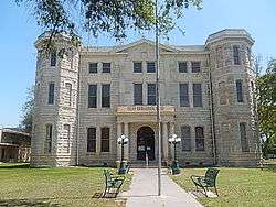 County courthouse | |
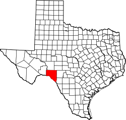 Location in the U.S. state of Texas | |
 Texas's location in the U.S. | |
| Founded | 1885 |
| Named for | Battle of Valverde |
| Seat | Del Rio |
| Largest city | Del Rio |
| Area | |
| • Total | 3,233 sq mi (8,373 km2) |
| • Land | 3,145 sq mi (8,146 km2) |
| • Water | 88 sq mi (228 km2), 2.7% |
| Population | |
| • (2010) | 48,879 |
| • Density | 16/sq mi (6/km2) |
| Congressional district | 23rd |
| Time zone | Central: UTC−6/−5 |
| Website |
www |

Val Verde County is a county located on the southern Edwards Plateau in the U.S. state of Texas. The 2014 population is 51,047.[1] Its county seat is Del Rio.[2] In 1936, Val Verde County received Recorded Texas Historic Landmark number 5625 to commemorate its founding.[3]
Val Verde, which means "green valley", was named for a battle of the American Civil War. In 1862, soldiers of Sibley's Brigade took part in the Texas invasion of New Mexico Territory, where they captured several artillery pieces at the Battle of Val Verde. The battle is memorialized both in the name of the county and a small settlement in Milam County.
The Del Rio, TX Micropolitan Statistical Area includes all of Val Verde County.
History
- First inhabitants were 6,000–10,000 years ago and later came to include Lipan Apache, Coahuiltecan, Jumanos, Tamaulipans and Comanches.[4][5]
- 1590 Spanish explorer Gaspar Castaño de Sosa leads a mining expedition of 170 who pass through Devils Draw. He refers to a stream by the name of Laxas, which is believed Devils River.[6][7][8]
- 1673 Juan Larios opens a mission school at between Del Rio and Eagle Pass.[5][9]
- 1675 Traveling Franciscan priests celebrate Mass at San Felipe Springs.[5][9]
- 1736 Lt. Miguel de la Garza Falcón[10] leads 100 soldiers along the Devils River[11] in pursuit of Apaches.
- 1834 James Grant[12] and John Charles Beales[13] establish settlement on San Felipe Creek,[14] which becomes undesirable due to Indian attacks.
- 1850’s Military bases to protect against Indian attacks include Camp Blake,[15] Camp Hudson[16] and Camp San Felipe.[17]
- 1860 Population of 2,874, includes 108 blacks and 1,103 foreign-born.[5]
- 1868 San Felipe Del Rio community is established on San Felipe Creek next to Camp San Felipe.[5]
- 1869 through 1882 Seminole Negro Indian Scouts (mixed heritage Seminoles with African blood) under John Lapham Bullis, namesake of Camp Bullis, defend the Texas border against Indian attack.[18][19]
- 1883 Galveston Harrisburg and San Antonio Railway is completed.[20] Frank Qualia establishes Val Verde winery.[21][22][23]
- 1884 Langtry community established, named by Judge Roy Bean after Lillie Langtry.[5][24]
- 1885 Val Verde County is organized from Crockett, Kinney, and Pecos counties. Roy Bean elected justice of the peace in Langtry, operating out of the Jersey Lily Saloon and becoming renowned as “the Law West of the Pecos”.[5]
- 1886 Juno and Devils River communities established.[5]
- 1888 Comstock community established.[5][25]
- 1889 Norris community established.[5]
- 1928 Lake Hamilton Dam complete.[5]
- 1904 Lillie Langtry visits the community of Langtry.[26]
- 1929 Lake Walk Dam complete.[5][27]
- 1942 Laughlin Field/Laughin Army Air Field opens to train World War II pilots.[5][28]
- 1945 Laughlin Field closes.[5]
- 1952 Laughlin Field reopens as Laughlin Air Force Base, and serves as a secret U2 unit. Major Rudolf Anderson, a U-2 pilot from Laughlin, is the only casualty of the Cuban Missile Crisis.[29][30]
- 1969 Amistad Dam and Reservoir complete. The project cost $78 million.[5][31]
Geography
According to the U.S. Census Bureau, the county has a total area of 3,233 square miles (8,370 km2), of which 3,145 square miles (8,150 km2) is land and 88 square miles (230 km2) (2.7%) is water.[32]
Major highways
Adjacent counties and municipios
- Crockett County (north)
- Sutton County (northeast)
- Edwards County (east)
- Kinney County (east)
- Terrell County (west)
- Acuña, Coahuila, Mexico (south)
- Jiménez, Coahuila, Mexico (south)
National protected areas
Demographics
| Historical population | |||
|---|---|---|---|
| Census | Pop. | %± | |
| 1890 | 2,874 | — | |
| 1900 | 5,263 | 83.1% | |
| 1910 | 8,613 | 63.7% | |
| 1920 | 12,706 | 47.5% | |
| 1930 | 14,924 | 17.5% | |
| 1940 | 15,453 | 3.5% | |
| 1950 | 16,635 | 7.6% | |
| 1960 | 24,461 | 47.0% | |
| 1970 | 27,471 | 12.3% | |
| 1980 | 35,910 | 30.7% | |
| 1990 | 38,721 | 7.8% | |
| 2000 | 44,856 | 15.8% | |
| 2010 | 48,879 | 9.0% | |
| Est. 2016 | 48,881 | [33] | 0.0% |
| U.S. Decennial Census[34] 1850–2010[35] 2010–2014[1] | |||
As of the census[36] of 2000, there were 44,856 people, 14,151 households, and 11,320 families residing in the county. The population density was 14 people per square mile (5/km²). There were 16,288 housing units at an average density of 5 per square mile (2/km²). The racial makeup of the county was 76.36% White, 4.54% Black or African American, 0.68% Native American, 0.55% Asian, 0.05% Pacific Islander, 18.22% from other races, and 2.60% from two or more races. 75.46% of the population were Hispanic or Latino of any race.
There were 14,151 households out of which 42.90% had children under the age of 18 living with them, 62.50% were married couples living together, 13.90% had a female householder with no husband present, and 20.00% were non-families. 17.50% of all households were made up of individuals and 7.50% had someone living alone who was 65 years of age or older. The average household size was 3.11 and the average family size was 3.55.
In the county, the population was spread out with 32.10% under the age of 18, 9.40% from 18 to 24, 27.90% from 25 to 44, 19.60% from 45 to 64, and 11.00% who were 65 years of age or older. The median age was 31 years. For every 100 females there were 97.00 males. For every 100 females age 18 and over, there were 93.20 males.
The median income for a household in the county was $28,376, and the median income for a family was $31,434. Males had a median income of $26,485 versus $18,039 for females. The per capita income for the county was $12,096. About 22.10% of families and 26.10% of the population were below the poverty line, including 33.80% of those under age 18 and 26.40% of them age 65 or over.
Education
The Val Verde County Library in Del Rio serves the county.[37]
Government
Val Verde County government is led by a four-member Board of County Commissioners, each commissioner representing one of four districts. The county commission appoints a county administrator as chief administrative officer of the county. The chief law enforcement authority of Val Verde is the Val Verde County Sheriff's Office. Joe Frank Martinez,Sheriff Val Verde County Sheriff’s Office. The fire protection arm of the Val Verde is the Val Verde County Fire Rescue. Jerry Rust,Fire Chief Val Verde County Fire Rescue.
County commissioners
Val Verde County is divided into four precincts.[38] One county commissioner is elected from each district to serve a four-year term. Commissioners are chosen in partisan elections by voters from the districts in which they live. The board appoints a county judge to be chief administrative officer of the county, responsible to the commission for the orderly operations of matters within the board’s jurisdiction. The current office holders are,
- Val Verde County Judge : Honorable Judge Efrain Valdez[39]
- Val Verde County Precinct 1 : Martin Wardlaw
- Val Verde County Precinct 2 : Lewis Owens
- Val Verde County Precinct 3 : Robert Beau Nettleton
- Val Verde County Precinct 4 : Gustavo Flores
- Val Verde County Secretary : Elizabeth Ferrino
| Year | Republican | Democratic | Third parties |
|---|---|---|---|
| 2016 | 43.3% 5,890 | 51.1% 6,964 | 5.6% 763 |
| 2012 | 46.6% 5,635 | 52.0% 6,285 | 1.3% 161 |
| 2008 | 44.9% 5,752 | 54.5% 6,982 | 0.7% 86 |
| 2004 | 59.1% 6,968 | 40.3% 4,757 | 0.6% 70 |
| 2000 | 54.2% 6,223 | 44.1% 5,056 | 1.7% 195 |
| 1996 | 41.1% 4,357 | 53.1% 5,623 | 5.9% 620 |
| 1992 | 37.3% 4,102 | 43.2% 4,748 | 19.5% 2,146 |
| 1988 | 50.0% 5,109 | 49.4% 5,044 | 0.6% 58 |
| 1984 | 60.4% 5,909 | 39.4% 3,857 | 0.2% 21 |
| 1980 | 54.1% 5,055 | 44.0% 4,116 | 2.0% 182 |
| 1976 | 42.6% 3,476 | 56.5% 4,603 | 0.9% 73 |
| 1972 | 66.2% 4,052 | 33.5% 2,049 | 0.4% 23 |
| 1968 | 33.6% 1,914 | 56.3% 3,205 | 10.2% 579 |
| 1964 | 27.5% 1,346 | 72.5% 3,555 | 0.0% 1 |
| 1960 | 43.1% 1,551 | 56.9% 2,049 | 0.1% 3 |
| 1956 | 50.8% 1,660 | 48.9% 1,598 | 0.3% 9 |
| 1952 | 51.1% 1,725 | 48.8% 1,647 | 0.0% 1 |
| 1948 | 34.0% 672 | 62.8% 1,242 | 3.2% 64 |
| 1944 | 34.1% 676 | 61.0% 1,210 | 5.0% 99 |
| 1940 | 27.4% 616 | 72.5% 1,628 | 0.1% 3 |
| 1936 | 28.5% 504 | 71.3% 1,262 | 0.3% 5 |
| 1932 | 22.9% 421 | 77.0% 1,412 | 0.1% 2 |
| 1928 | 57.9% 854 | 42.1% 620 | |
| 1924 | 45.8% 457 | 43.5% 434 | 10.7% 107 |
| 1920 | 41.2% 296 | 58.2% 418 | 0.6% 4 |
| 1916 | 23.0% 135 | 75.9% 446 | 1.2% 7 |
| 1912 | 30.1% 196 | 45.7% 298 | 24.2% 158 |
Communities
City
- Del Rio (county seat)
Census-designated places
Unincorporated communities
Notable people
See also
References
- 1 2 "State & County QuickFacts". United States Census Bureau. Retrieved December 29, 2013.
- ↑ "Find a County". National Association of Counties. Retrieved 2011-06-07.
- ↑ "THC Val Verde County". Recorded Texas Historic Landmark. Texas State Historical Association. Retrieved 19 February 2011.
- ↑ Foster, William C; Thoms, Alston V (2008). "The Texas Trans-Pecos, Study Area V". Historic Native Peoples of Texas. University of Texas Press. pp. 137–168. ISBN 978-0-292-71793-0.
- 1 2 3 4 5 6 7 8 9 10 11 12 13 14 15 Smith, Julia Cauble. "Val Verde County". Handbook of Texas Online. Texas State Historical Association. Retrieved 29 November 2010.
- ↑ Tarpley, Fred (1980). 1001 Texas Place Names. University of Texas Press. p. 61. ISBN 978-0-292-76016-5.
- ↑ "Devil's Draw". Handbook of Texas Online. Texas State Historical Association. Retrieved 29 November 2010.
- ↑ Chipman, Donald E. "Gaspar Castaño de Sosa". Handbook of Texas Online. Texas State Historical Association. Retrieved 29 November 2010.
- 1 2 Wade, Maria F; Wade, Don E; Hester, Thomas R (2002). "The Bosque-Larios Expedition". The Native Americans of the Texas Edwards Plateau, 1582-1799. University of Texas Press. pp. 24–54. ISBN 978-0-292-79156-5.
- ↑ Garcia, Clotilde P. "Miguel de la Garza Falcón". Handbook of Texas Online. Texas State Historical Association. Retrieved 29 November 2010.
- ↑ Smith, Julia Cauble. "Devils River". Handbook of Texas Online. Texas State Historical Association. Retrieved 29 November 2010.
- ↑ Blake, Robert Bruce. "James Grant". Handbook of Texas Online. Texas State Historical Association. Retrieved 29 November 2010.
- ↑ Estep, Raymond. "John Charles Beales". Handbook of Texas Online. Texas State Historical Association. Retrieved 29 November 2010.
- ↑ "San Felipe Creek". Handbook of Texas Online. Texas State Historical Association. Retrieved 29 November 2010.
- ↑ Smith, Julia Cauble. "Camp Blake". Handbook of Texas Online. Texas State Historical Association. Retrieved 29 November 2010.
- ↑ Smith, Julia Cauble. "Camp Hudson". Handbook of Texas Online. Texas State Historical Association. Retrieved 29 November 2010.
- ↑ Seale, Axcie. "Camp San Felipe". Handbook of Texas Online. Texas State Historical Association. Retrieved 29 November 2010.
- ↑ Glasrud, Bruce A; Searles, Michael N (2007). "The Black Seminole Indian Scouts in the Big Bend". Buffalo Soldiers in the West: A Black Soldiers Anthology. TAMU Press. pp. 143–152. ISBN 978-1-58544-620-9.
- ↑ Eckhardt, C F. "THE WHIRLWIND Lt. John Lapham Bullis and the Seminole Negro Scouts". Texas Escapes. Texas Escapes - Blueprints For Travel, LLC. Retrieved 29 November 2010.
- ↑ "Galveston Harrisburg and San Antonio Railway". Texas Transportation Museum. Retrieved 29 November 2010.
- ↑ Braudaway, Douglas Lee; Valverde County Historical Commission (1999). Val Verde County (Images of America: Texas). Arcadia Publishing. p. 93. ISBN 978-0-7385-0128-4.
- ↑ Overfelt, Robert C. "Val Verde Winery". Handbook of Texas Online. Texas State Historical Association. Retrieved 29 November 2010.
- ↑ "Val Verde Winery". Val Verde Winery. Retrieved 29 November 2010.
- ↑ "Langtry, Texas". Texas Escapes. Texas Escapes - Blueprints For Travel, LLC. Retrieved 29 November 2010.
- ↑ "Comstock, Texas". Texas Escapes. Texas Escapes - Blueprints For Travel, LLC. Retrieved 29 November 2010.
- ↑ Crutchfield, James A (2007). It Happened in Texas. TwoDot. pp. 104–107. ISBN 978-0-7627-4569-2.
- ↑ "Lake Walk Dam". Handbook of Texas Online. Texas State Historical Association. Retrieved 29 November 2010.
- ↑ Benton, Jeffrey C (2005). Air Force Officer's Guide. Stackpole Books. p. 330. ISBN 978-0-8117-3194-2.
- ↑ "Laughlin AFB". Laughlin AFB. Retrieved 29 November 2010.
- ↑ Leatherwood, Art. "Laughlin Air Force Base". Handbook of Texas Online. Texas State Historical Association. Retrieved 29 November 2010.
- ↑ Braudaway, Douglas (2002). Del Rio: Queen City of the Rio Grande. Arcadia Publishing. p. 125. ISBN 978-0-7385-2387-3.
- ↑ "2010 Census Gazetteer Files". United States Census Bureau. August 22, 2012. Retrieved May 12, 2015.
- ↑ "Population and Housing Unit Estimates". Retrieved June 9, 2017.
- ↑ "U.S. Decennial Census". United States Census Bureau. Retrieved May 12, 2015.
- ↑ "Texas Almanac: Population History of Counties from 1850–2010" (PDF). Texas Almanac. Retrieved May 12, 2015.
- ↑ "American FactFinder". United States Census Bureau. Retrieved 2011-05-14.
- ↑ Home page Archived 2008-06-11 at the Wayback Machine.. Val Verde County Library. Retrieved on March 26, 2010.
- ↑ "Val Verde County, TX". www.valverdecounty.texas.gov. Retrieved 2018-08-01.
- ↑ "Judge's Office | Val Verde County, TX". valverdecounty.texas.gov. Retrieved 2018-08-01.
- ↑ Leip, David. "Dave Leip's Atlas of U.S. Presidential Elections". uselectionatlas.org. Retrieved 9 April 2018.
External links
- Val Verde County from the Handbook of Texas Online
- Texas Beyond History, Hinds Cave
- Texas Beyond History, Lower Pecos Canyonlands
- "Val Verde County Profile" by the Texas Association of Counties
Places adjacent to Val Verde County, Texas | ||||||||||
|---|---|---|---|---|---|---|---|---|---|---|
| ||||||||||
Municipalities and communities of Val Verde County, Texas, United States | ||
|---|---|---|
| City | | |
| CDPs | ||
| Unincorporated communities | ||
