List of long-distance footpaths in the United Kingdom
There are hundreds of long-distance footpaths in the United Kingdom designated in publications from public authorities, guidebooks and OS maps.[1] Most are in rural landscapes, in varying terrain, some passing through National Parks and Areas of Outstanding Natural Beauty.[2] There is no formal definition of a long-distance path, though the British Long Distance Walkers Association defines one as a route "20 miles [32 km] or more in length and mainly off-road."[1] The routes usually follow existing rights of way, often over private land, joined together and sometimes waymarked to make a named route.[3] Generally, the surface is not specially prepared, with rough ground, uneven surfaces and stiles, which can cause accessibility issues for people with disabilities.[4] Exceptions to this can be converted railways, canal towpaths and some popular fell walking routes where stone-pitching and slabs have been laid to prevent erosion.[5] Many long-distance footpaths are arranged around a particular theme such a particular range of hills, historical or geographical connection.[3]
England and Wales: National Trails
National Trails are a network of long-distance paths in England and Wales (plus a small stretch of the Pennine Way in Scotland[6]) funded by Natural England and Natural Resources Wales and maintained by local authorities under a Trail Partnership.[7] As of August 2018, there are over 2,500 miles (4,000 km) of trails on sixteen routes. The newest trail, the England Coast Path, is not complete though more sections are planned to open over the coming months, with a planned completion date of 2020.[7] There are 83 million visits to the National Trails each year and over 80,000 people complete a trail.[8]
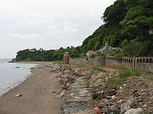
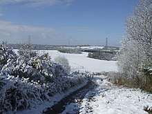
.jpg)
| Name | Length | Region | Endpoint one | Endpoint two | Description | |
|---|---|---|---|---|---|---|
| mi | km | |||||
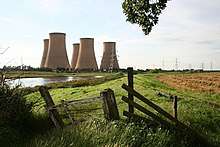
| Cleveland Way | 110 | 180 | North Yorkshire, England | Helmsley | Filey Brigg | Runs around the edge of the North York Moors National Park in a horseshoe configuration. |
| Cotswold Way | 102 | 164 | The Cotswolds, Central England | Chipping Campden, Gloucestershire | Bath, Somerset | Runs along the Cotswold Edge escarpment of the Cotswold Hills. |
| England Coast Path | 2,795 | 4,500† | England | N/A | N/A | Will cover the entire coast of England and will be the longest managed and waymarked coastal path in the world.[9] |
| Glyndŵr's Way | 135 | 217 | Powys, mid Wales | Knighton | Welshpool | Runs in an extended loop. |
| Hadrian's Wall Path | 84 | 135 | England: Tyne and Wear, Northumberland, Cumbria | Wallsend, Tyne and Wear | Bowness-on-Solway, Cumbria | Runs from the east to west coast along the remains of Hadrian's Wall. |
| North Downs Way | 153 | 246 | South Eastern England | Farnham, Surrey | Dover, Kent | Passes through the areas of outstanding natural beauty (AONB) of the Surrey Hills and Kent Downs. |
| Offa's Dyke Path | 177 | 285 | Wales–England border | Sedbury, Gloucestershire | Prestatyn, Denbighshire | Follows close to the border near the remnants of Offa's Dyke. |
| Peddars Way and Norfolk Coast Path‡ | 97 | 156 | England in Suffolk and Norfolk | Knettishall Heath, Knettishall, Suffolk | Cromer, Norfolk | The two paths join at Holme-next-the-Sea. |
| Pembrokeshire Coast Path | 186 | 299 | Pembrokeshire, southwest Wales | Poppit Sands, near St Dogmaels | Amroth | Has a total of 35,000 feet (11,000 m) of ascent and descent and lies almost completely within the Pembrokeshire Coast National Park.[10] |
| Pennine Bridleway | 205 | 330 | Pennines, Northern England | Middleton-by-Wirksworth, Derbyshire | Ravenstonedale, Cumbria | Runs roughly parallel to the Pennine Way. |
| Pennine Way | 267 | 430 | Pennines, Northern England and Southern Scotland | Edale, Derbyshire | Kirk Yetholm, Scottish Borders | Spans the length of the Pennines, according to the Ramblers, "one of Britain's best known and toughest" trails.[11] |
| The Ridgeway | 87 | 140 | Berkshire Downs, Southern England | Overton Hill, near Avebury, Wiltshire | Ivinghoe Beacon, Buckinghamshire | An ancient trackway on a chalk ridge described as Britain's oldest road. |
| South Downs Way | 100 | 160 | South Downs in Southern England | Winchester, Hampshire | Eastbourne, East Sussex | Lies within the South Downs National Park. |
| South West Coast Path (South West Way) | 630 | 1,010 | England: Somerset, Devon, Cornwall & Dorset | Minehead, Somerset | Poole Harbour, Dorset | Originated as a route for the Coastguard to walk from lighthouse to lighthouse patrolling for smugglers.[12] |
| Thames Path | 184 | 296 | Southern England | Kemble, Gloucestershire | Thames Barrier, Charlton | Follows the River Thames from its source to the Thames Barrier in London. |
| Yorkshire Wolds Way | 79 | 127 | Yorkshire, England | Hessle, East Riding of Yorkshire | Filey, North Yorkshire | Runs around the Yorkshire Wolds. |
† When complete in 2020
‡ Treated as one path by National Trails
Scotland: Great Trails

Scotland's Great Trails are long-distance "people-powered" trails (predominantly hiking trails but including cycling, horse-riding and canoe routes) in Scotland.[13] Scottish Natural Heritage maintains the official list of Scotland’s Great Trails and is the custodian of the brand, but responsibility for creating and maintaining each route lies with each local authority through which a route passes, although Scottish Natural Heritage provides some of the finance and publicity.[14] There are 29 routes, offering 1,900 miles (3,000 km) of trails in total.[14]
Each of the routes is clearly waymarked with a dedicated symbol, and run largely off-road. They range in length from 24 to 210 miles (40 to 340 km), and are intended to be tackled over several days, either as a combination of day trips or as an end-to-end expedition. They are primarily intended for walkers, but may have sections suitable for cyclists and horse-riders.[15] One of the trails, the Great Glen Canoe Trail, is designed for canoeists and kayakers.[16]
| Name | Length | Region | Endpoint one | Endpoint two | Description | |
|---|---|---|---|---|---|---|
| mi | km | |||||
| Annandale Way | 55 | 89 | Solway Coast, Dumfries and Galloway | Moffat | Annan | Follows the valley of the River Annan from its source in the Moffat Hills to the sea in the Solway Firth. |
| Arran Coastal Way | 66 | 106 | Isle of Arran | N/A | N/A | A circular route around the coastline of the Isle of Arran. |
| Ayrshire Coastal Path | 100 | 160 | Ayrshire | Glenapp, Ballantrae | Skelmorlie, North Ayrshire | Runs alongside the coast and forms part of the International Appalachian Trail.[17] |
| Berwickshire Coastal Path | 28 | 45 | Scottish Borders and Northen England | Cockburnspath, Scottish Borders | Berwick-upon-Tweed, Northumberland | A coastal path spanning the Anglo-Scottish border. |
| Borders Abbeys Way | 68 | 109 | Scottish Borders | N/A | N/A | A circular route in the Borders passing through the ruins of many Abbeys. The way is as follows: Kelso – Jedburgh – Hawick – Selkirk – Melrose. |
| Cateran Trail | 64 | 103 | Perth and Kinross and Angus | Blairgowrie and Rattray | N/A | A circular route covering many conditions such as farmland, mountains and forest. The trail is as follows: Blairgowrie – Kirkmichael – Spittal of Glenshee – Alyth. |
| Clyde Walkway | 40 | 64 | South Lanarkshire | Glasgow | New Lanark | Runs close to the River Clyde for most of its length. |
| Cowal Way | 57 | 92 | Cowal Peninsula, Argyll and Bute | Portavadie | Inveruglas on Loch Lomond | Connects with the West Highland Way. |
| Cross Borders Drove Road | 52 | 84 | Edinburgh and the Scottish Borders | Little Vantage, near Edinburgh | Hawick | One of the newest trails based on existing routes.[18] |
| Dava Way | 24 | 39 | Moray | Grantown-on-Spey | Forres | Follows the route of the former Highland Railway which closed in 1965.[19] |
| Fife Coastal Path | 117 | 188 | Fife | Kincardine | Newburgh | When opened it originally ran from North Queensferry to Tayport, but was later extended. |
| Formartine and Buchan Way | 53 | 85 | Aberdeenshire | Dyce, near Aberdeen | Fraserburgh and Peterhead | Follows the track of the former railway line the Formartine and Buchan Railway which closed in 1970. The path branches into two sections at Maud.[20] |
| Forth and Clyde Canal Pathway | 66 | 106 | Central Belt | Bowling, Dunbartonshire | Fountainbridge, Edinburgh | Runs between the Firth of Forth and the Firth of Clyde. |
| Great Glen Canoe Trail | 60 | 97 | Scottish Highlands | Banavie, near Fort William | Clachnaharry, near Inverness | Coast-to-coast Canoe trail on man-made canals and locks. |
| Great Glen Way | 79 | 127 | Scottish Highlands | Fort William | Inverness | Follows the Great Glen. |
| Great Trossachs Path | 28 | 45 | Trossachs | Callander, Stirling | Inversnaid on the bank of Loch Lomond | Situated in the Trossachs National Park. |
| John Muir Way | 134 | 216 | Central Belt | Helensburgh, Argyll and Bute | Dunbar, East Lothian | Named in honour of the Scottish conservationist John Muir, who was born in Dunbar in 1838 and became a founder of the United States National Park Service.[21] |
| Kintyre Way | 100 | 160 | Argyll and Bute, Argyllshire | Tarbert | Machrihanish | Located on the Kintyre peninsula.[22] |
| Moray Coast Trail | 50 | 80 | Moray | Forres | Cullen | Forms part of the North Sea Trail. |
| Mull of Galloway Trail | 37 | 60 | Dumfries and Galloway and South Ayrshire | Mull of Galloway | Glenapp, Ballantrae | The Rotary Club of Stranraer created and maintains the path.[23] |
| River Ayr Way | 44 | 71 | Southern Scotland | Glenbuck, East Ayrshire | Ayr, South Ayrshire | Follows the River Ayr for most of the trail. |
| Rob Roy Way | 92 | 148 | Perthshire and Stirlingshire | Drymen, Stirling | Pitlochry, Perth and Kinross | The way takes its name from Rob Roy MacGregor, a Scottish folk hero and outlaw of the early 18th century.[24] |
| Romans and Reivers Route | 52 | 84 | Southern Uplands | Ae | Hawick | For much of the route it follows former Roman roads. |
| St Cuthbert's Way | 62 | 100 | Scottish Borders and Northen England | Melrose, Scottish Borders | Lindisfarne, Northumberland | The walk is named after Cuthbert, a 7th-century saint, a native of the Borders who spent his life in the service of the church.[25] |
| Southern Upland Way | 212 | 341 | Southern Uplands | Portpatrick | Cockburnspath, Berwickshire | A coast-to-coast walk stretching from east to west. |
| Speyside Way | 80 | 130 | Northern Scotland | Aviemore | Buckie, Moray | Follows the River Spey through some of Banffshire, Morayshire and Inverness-shire. |
| Three Lochs Way | 31 | 50 | Highland Boundary Fault to the Southern Highlands | Balloch, West Dunbartonshire | Inveruglas, Argyll and Bute | For much of the way it passes through the Loch Lomond and The Trossachs National Park. |
| West Highland Way | 96 | 154 | Scottish Lowlands to the Scottish Highlands | Milngavie, near Glasgow | Fort William, Highlands | Scotland's first and most popular long-distance walking route.[26] |
| West Island Way | 30 | 48 | Isle of Bute | Kilchattan Bay | Port Bannatyne | The first waymarked long-distance route on a Scottish Island.[27] |
Other UK long-distance paths
Those included here meet the definition of a long-distance path as being around 50 km (31 miles) or more, particularly that they will take more than one day's walking to complete. Some shorter paths linking between major walks (e.g. Maelor Way) are also included.
Southern England
| Name | Length | Region | Endpoint one | Endpoint two | Description | |
|---|---|---|---|---|---|---|
| mi | km | |||||
| 1066 Country Walk | 31 | 50 | East Sussex | Pevensey Castle near Pevensey | Rye | Commemorates the year 1066 and the Battle of Hastings. |
| Avon Valley Path | 34 | 55 | Wiltshire, Hampshire and Dorset | Christchurch | Salisbury | The path takes its name from the River Avon and passes through the western edge of the New Forest. |
| Basingstoke Canal Towpath Trail | 33 | 53 | Hampshire and Surrey | Penny Bridge, Up Nately, Basingstoke | Woodham | Follows the path of the 200-year-old Basingstoke Canal. |
| Bournemouth Coast Path | 20 | 32 | Dorset and Hampshire | Sandbanks | Milford on Sea | The coastal path connects the South West Coast Path (via the Sandbanks Ferry) to the Solent Way. |
| Capital Ring | 75 | 121 | London | N/A | N/A | Circular route through inner London, crossing the Thames at Richmond and Woolwich. |
| Celtic Way | 725 | 1,167 | Wales and Southwest England | Strumble Head, Pembrokeshire | St Michael's Mount, Cornwall | Visits more than 100 pre-historic sites including Stonehenge.[28] |
| Channel to Channel Path | 50 | 80 | South West Peninsula | Seaton, Devon | Watchet, Somerset | Connects the English Channel with the Bristol Channel.[29] |
| Chiltern Way | 134 | 216 | Bedfordshire, Buckinghamshire, Hertfordshire, Luton and Oxfordshire | Hemel Hempstead railway station | N/A | A circular route originaly a 125-mile-long (201 km) Millennium Project.[30] |
| Coleridge Way | 51 | 82 | Somerset and Devon | Nether Stowey | Lynmouth | Starts in the Quantock Hills later moving on to the Brendon Hills, within Exmoor National Park. |
| Dartmoor Way | 95 | 153 | Dartmoor | N/A | N/A | In the Dartmoor National Park in southern Devon. |
| Devonshire Heartland Way | 43 | 69 | Devon | Okehampton | Stoke Canon, Exeter | A west-to-east route across Devon starting in Dartmoor near the Exe Valley.[31] |
| Downs Link | 37 | 60 | Surrey and West Sussex | St. Martha's Hill near Guildford | Shoreham-by-Sea | Heads from the North Downs Way onto the South Downs Way at Steyning. |
| East Devon Way | 38 | 61 | South West England | Exmouth, East Devon | Lyme Regis, West Dorset | Runs inland but links with the South West Coast Path at both ends. |
| Essex Way | 81 | 130 | Essex | Epping | Harwich | Crosses the Dedham Vale and Constable country to finish in the Stour estuary. |
| Exe Valley Way | 45 | 72 | Devon and Somerset | River Exe estuary | Exford in Exmoor National Park | Follows the valley of the River Exe from its source to the coast.[32] |
| Gordano Round | 27 | 43 | North Somerset | Roath Road, Portishead | N/A | The route is around the Gordano Valley in a figure of eight via Clevedon and Abbots Leigh. |
| Great Stones Way | 36 | 58 | Wiltshire | Coate Water Country Park, Swindon | Salisbury Cathedral | Starts Barbury Castle to Old Sarum with optional detours to Avebury and Stonehenge.[33] |
| Greater Ridgeway | 362 | 583 | South and Central England | Lyme Regis, Dorset on the English Channel | Hunstanton on The Wash | Follows the Wessex Ridgeway, The Ridgeway National Trail, the Icknield Way Path and the Peddars Way National Trail. |
| Greensand Way | 108 | 174 | Home counties | Haslemere, Surrey | Hamstreet, Kent | Follows the Greensand Ridge along the Surrey Hills and Chart Hills. |
| Hampshire Millennium Pilgrims Trail | 29 | 47 | Hampshire | Winchester | Portsmouth | Forms part of the historical Pilgrims' Trail is a 155-mile long-distance footpath that connects Winchester Cathedral to Mont Saint-Michel in Normandy.[34] |
| Hardy Way | 220 | 350 | West Country | Hardy's Cottage, Higher Bockhampton | Stinsford, Dorset | The route is almost circular with the endpoints being a mile apart and is named after the writer Thomas Hardy.[35] |
| High Weald Landscape Trail | 90 | 140 | West Sussex, East Sussex, Kent | Horsham | Rye | Passes through the landscapes of the High Weald Area of Outstanding Natural Beauty. |
| Isle of Wight Coastal Path | 70 | 110 | Isle of Wight | Ryde | N/A | Circular coastal route mainly following public footpaths. |
| Itchen Way | 32 | 51 | Hampshire | Hinton Ampner near Alresford | Sholing | Follows the River Itchen from its source. |
| Jubilee Trail | 88 | 142 | Dorset | Forde Abbey | Bokerley Dyke | Created to celebrate The Ramblers' Association's Diamond Jubilee and passes through many historical sites.[36] |
| King's Way | 45 | 72 | Hampshire | Winchester | Portchester | Created by the Ramblers' Association as a memorial to the late Allan King (who formed many local groups in Hampshire). |
| Land's End Trail | 303 | 488 | South West Peninsula | Land's End, Cornwall | Avebury, Wiltshire | Links Land's End with many of England's central long-distance trails.[37] |
| Leland Trail | 28 | 45 | Somerset | King Alfred's Tower, Brewham | Ham Hill | Named after the antiquary and poet John Leland.[38] |
| Liberty Trail | 28 | 45 | Somerset and Dorset | Ham Hill | Lyme Regis | The trail is based on the route rebels travelled to join the Monmouth Rebellion.[39] |
| Limestone Link | 36 | 58 | South West England | Mendip Hills, Somerset | Cold Aston, Gloucestershire | The footpath connects with the Mendip Way and the Cotswold Way. |
| London Outer Orbital Path (The LOOP) | 150 | 240 | London | Erith | Rainham | A circular route around the edge of Outer London. |
| Mendip Way | 50 | 80 | Somerset | Uphill near Weston-super-Mare | Frome | The route is on the Mendip Hills giving views over the Somerset Levels. |
| Monarch's Way | 615 | 990 | Southern England | Worcester | Shoreham-by-Sea, West Sussex | The route approximates the escape route taken by King Charles II in 1651 after being defeated in the Battle of Worcester.[40] |
| New Lipchis Way | 40 | 64 | Hampshire and West Sussex | Liphook | West Wittering | The path passes through Midhurst and Chichester crossing the Western Weald and South Downs. |
| Orange Way | 350 | 560 | Devon, Dorset, Hampshire, Berkshire and Buckinghamshire | Brixham, Devon | London | Follows the march in 1688 of Prince William of Orange and his army from Brixham to London.[41] |
| Oxford Canal Walk | 82 | 132 | Oxfordshire, Warwickshire and the West Midlands | Oxford | Coventry | Follows the Towpath of the Oxford Canal.[42] |
| Oxford Green Belt Way | 52 | 84 | Oxfordshire | N/A | N/A | Circular route through the Oxford Green Belt. |
| Oxfordshire Way | 62 | 100 | Oxfordshire and Gloucestershire | Bourton-on-the-Water | Henley-on-Thames | Passes from the Cotswolds to the Chiltern Hills. |
| Pilgrims' Way | 120 | 190 | South Eastern England | Winchester | Shrine of Thomas Becket, Canterbury | Historical route taken by pilgrims from to the shrine of Thomas Becket. It is an ancient trail of which perhaps two-thirds is still identifiable, much of it now incorporated into the North Downs Way National Trail.[43] |
| Quantock Greenway | 37 | 60 | Somerset | N/A | N/A | The path is a figure-of-eight centred on Triscombe in the Quantock Hills. |
| River Parrett Trail | 50 | 80 | Dorset & Somerset | Chedington | Bridgwater Bay, Bristol Channel | Follows the River Parrett to the coast. |
| Royal Military Canal Path | 27 | 43 | Kent and East Sussex | Seabrook | Pett Level | Follows the Royal Military Canal and touches the northern edge of Romney Marsh. |
| Samaritans Way South West | 103 | 166 | South West England | Clifton Suspension Bridge | Lynmouth | Opened by the Rambler and the Samaritans in part to help local farmers. Only the section from Bristol to Goathurst is waymarked.[44] |
| Sarum Way | 32 | 51 | Wiltshire | N/A | N/A | A circular route around the city of Salisbury, only part of it is waymarked. |
| Saxon Shore Way | 163 | 262 | South East England | Gravesend, Kent | Hastings, East Sussex, | Traces the shoreline as it was in Roman times and visiting many historical sites of the period.[45] |
| Serpent Trail | 64 | 103 | Hampshire, Surrey and West Sussex | Haslemere | Petersfield | Designed to join up the many of the heathland areas in the western Weald. |
| Severn Way | 210 | 340 | Mid Wales and Western England | Plynlimon, the Cambrian Mountains | Bristol | Follows the course of the River Severn from its source to the Severn Estuary. |
| Shipwrights Way | 50 | 80 | Hampshire | Alice Holt Forest | Portsmouth | Traces in the route that might have been taken by timber from forest to shipyards for the constriction of warships.[46] |
| Solent Way | 60 | 97 | Hampshire | Milford on Sea | Emsworth | Follows the coast of the Solent. |
| Stour Valley Walk | 52 | 84 | Kent | Pegwell Bay | Lenham | Follows the River Stour, through the Low Weald and Kent Downs, from its source to its estuary. |
| Stour Valley Way | 64 | 103 | Dorset and Wiltshire | Stourton with Gasper | Hengistbury Head | Follows the River Stour as it winds through the Dorset countryside. |
| St. Swithun's Way | 34 | 55 | Hampshire and Surrey | Winchester Cathedral | Farnham | Named after Swithun, a 9th-century Bishop of Winchester, and roughly follows a short stretch of the Pilgrims' Way. |
| Sussex Border Path | 138 | 222 | West & East Sussex | Thorney Island | Rye | Follows the Sussex border with Hampshire, Surrey and Kent. |
| Sussex Ouse Valley Way | 42 | 68 | West & East Sussex | Lower Beeding | Seaford | Follows the River Ouse from its source to the English Channel. |
| Tarka Trail | 180 | 290 | Devon | Barnstaple | N/A | Consists of two separate circular routes based of the fictional route taken by Tarka the Otter in the book of the same name. |
| Test Way | 49 | 79 | Berkshire and Hampshire | Walbury Hill | Totton and Eling | Passes through the towns of Romsey and Totton and starts in the Test Valley. |
| Thames Down Link | 15 | 24 | London and Surrey | Kingston Bridge | Box Hill Station | Links the Thames Path and the North Downs Way. |
| Three Castles Path | 60 | 97 | Hampshire and Berkshire | Winchester Castle | Windsor Castle | As well as Winchester Castle and Windsor Castle the path passes through Odiham Castle. The route is unwaymarked. |
| Two Moors Way | 102 | 164 | Devon & Somerset | Ivybridge, Dartmoor National Park | Lynmouth, North Devon Coast | A route across Dartmoor over exposed moorland. |
| Vanguard Way | 66 | 106 | Surrey, Kent and East Sussex | East Croydon | Newhaven | Connects Central London with the Wandle Trail along the River Wandle from Croydon. |
| Wayfarers Walk | 70 | 110 | Berkshire and Hampshire | Walbury Hill | Emsworth | Approximates an ancient route that might have been used by drovers taking cattle to market. |
| Wealdway | 83 | 134 | Kent and East Sussex | Gravesend | Eastbourne | Connects the Thames Estuary with the English Channel and also traverses the Ashdown Forest. |
| Wessex Ridgeway | 136 | 219 | Wiltshire and Dorset | Marlborough | Lyme Regis | One of the four long-distance footpaths which are referred to as the Greater Ridgeway. |
| West Deane Way | 45 | 72 | Taunton Deane area of Somerset | Taunton | N/A | Circular walk in the Vale of Taunton Deane. |
| West Devon Way | 36 | 58 | Devon | Okehampton | Radford Castle, Hooe Lake, Plymouth | Links with the Tamar Valley Discovery Trail and the Two Castles Trail to form the 'West Devon Triangle', a 90-mile circuit.[47] |
| Wey South Path | 32 | 51 | Surrey and West Sussex | Guildford | Houghton Bridge | The path follows the banks of the River Wey and the Wey and Arun Canal. |
Thames to Mersey
| Name | Length | Region | Endpoint one | Endpoint two | Description | |
|---|---|---|---|---|---|---|
| mi | km | |||||
| Angles Way | 92 | 148 | Norfolk and Suffolk | Great Yarmouth | Barnhamcross Common, Thetford | Much of the path follows the county border, originally it was 15 miles shorter and ended in Knettishall Heath. |
| Bishop Bennet Way | 34 | 55 | Southwest Cheshire | Beeston | Wirswall | Named after William Bennet who carried out detailed surveys of Roman roads in the area. |
| Boudica's Way | 36 | 58 | East Anglia | Diss railway station, Diss | Norwich railway station, Norwich | Parallel to the old Roman Pye Road, now the A140 road. |
| Centenary Way | 99 | 159 | Warwickshire | Kingsbury Water Park | Lower Quinton | The Way was devised to celebrate one hundred years of Warwickshire County Council.[48] |
| Cheshire Ring | 97 | 156 | Cheshire and Greater Manchester | N/A | N/A | Circular walk alongside six canals, via Dukinfield and Marple |
| Coventry Way | 40 | 64 | Coventry | Meriden, West Midlands | N/A | It forms a circular route around the city of Coventry covering countryside in both the West Midlands and Warwickshire. |
| D'Arcy Dalton Way | 66 | 106 | Gloucestershire, Oxfordshire, Warwickshire | Wormleighton Reservoir, Warwickshire | Wayland's Smithy Long Barrow | Links four long-distance footpaths: Oxford Canal Walk, Thames Path, The Ridgeway and Oxfordshire Way. It follows the western boundary of Oxfordshire in unspoilt countryside.[49] |
| Derwent Valley Heritage Way | 55 | 89 | Derbyshire | Ladybower Reservoir, north of Bamford | Shardlow | Runs around the Derbyshire Dales through Chatsworth, Derbyshire and the Derwent Valley Mills World Heritage Site. |
| Fen Rivers Way | 50 | 80 | Eastern England | Cambridge | King's Lynn, Norfolk | Runs alongside the River Cam and on to the River Great Ouse. |
| Geopark Way | 109 | 175 | West Midlands and South West England | Bridgnorth Castle | Gloucester Cathedral | Links a series of geologically and historically important sites.[50] |
| Gloucestershire Way | 100 | 160 | Gloucestershire | Tutshill | Tewkesbury | Routes through the Forest of Dean, Cotswolds and the Severn Plain. |
| Gritstone Trail | 35 | 56 | Cheshire East and Staffordshire | Disley railway station, Disley | Mow Cop, Kidsgrove | A large portion of the path routes through the Peak District National Park. |
| Heart of England Way | 100 | 160 | Midlands | Milford, Staffordshire | Bourton-on-the-Water, Gloucestershire | Links the Cannock Chase Area of Outstanding Natural Beauty to the with the Cotswolds Area of Outstanding Natural Beauty - it is officially recognised by the four councils it passes through.[51] |
| Herefordshire Trail | 154 | 248 | Herefordshire | Ledbury, Herefordshire | N/A | A circular route designed to link the five market towns: Leominster, Bromyard, Ledbury, Ross-on-Wye and Kington. Waymarks are planned but not yet in place. |
| Hereward Way | 110 | 180 | East Anglia | Oakham | East Harling | Travels through Thetford Forest and links the Viking Way and the Peddars Way long-distance footpaths. The Stamford to Peterborough section is not fully waymarked, but walkers travelling between those two places can follow the waymarked Torpel Way. |
| Hertfordshire Way | 194 | 312 | Hertfordshire | N/A | N/A | A circular walk around open countryside, although some parts are within 20 miles of London. It passes through the county town of Hertford and the towns of Royston and Bishop’s Stortford. |
| Icknield Way Path | 110 | 180 | Buckinghamshire, Cambridgeshire, Norfolk | Ivinghoe Beacon | Knettishall Heath | The path consists of prehistoric pathways passing through many sites of archaeological remains.[52] |
| Jack Mytton Way | 93 | 150 | Shropshire | Bridgnorth | Much Wenlock | The route runs through the Shropshire Hills and the Clee Hills including parts of Wenlock Edge. |
| Jurassic Way | 88 | 142 | The Midlands | Banbury, Oxfordshire | Stamford, Lincolnshire | Most of the route follows a Jurassic limestone ridge, from where its name derives.[53] |
| Lea Valley Walk | 50 | 80 | South East England | Leagrave, Bedfordshire | Limehouse Basin, Limehouse, East London | Follows the River Lea from its source and along the Lee Navigation to the East India Docks in London. |
| Limestone Way | 50 | 80 | Derbyshire, Staffordshire | Castleton | Rocester | A route through the limestone Derbyshire Dales finishing in Dove Valley. |
| Limey Way | 40 | 64 | Derbyshire | Castleton | Dovedale | The route is in the White Peak area on limestone countryside visiting twenty dales. |
| Maelor Way | 24 | 39 | Shropshire, Cheshire and into Wrexham, Wales | Grindley Brook | Bronygarth | Links six long-distance footpaths, the Offa's Dyke Path National Trail, while travelling through meadows and woodland.[54] |
| Mercian Way | 230 | 370 | The Midlands and Northern England | Salisbury | Chester | Part of National Cycle Route 4, but also well used by walkers. |
| Midshires Way | 230 | 370 | South-East England, the Midlands and Northern England | Chiltern Hills near Bledlow, Buckinghamshire | Stockport, Greater Manchester | A footpath and bridleway that links the Ridgeway National Trail with the Pennine Way across Middle England. |
| Mortimer Trail | 30 | 48 | Shropshire and Herefordshire | Ludlow | Kington | Runs through the Welsh Marches on the English side of the Anglo-Welsh border and is named after the Mortimer family of ruling Marcher Lords.[55] |
| Nar Valley Way | 34 | 55 | Norfolk | King's Lynn | Gressenhall | A route through the watershed of the River Nar.[56] |
| Nene Way | 110 | 180 | Northamptonshire, Cambridgeshire and Lincolnshire | Badby | Lincolnshire | Follows the course of the River Nene. |
| New River Path | 28 | 45 | Hertfordshire and North London | New Gauge, Hertford | New River Head, Islington | Follows the course of the New River aqueduct. |
| North Worcestershire Path | 35 | 56 | Worcestershire | Kinver | Major's Green | Links four country parks in the north-east area of the historic county. |
| Ouse Valley Way | 150 | 240 | The Midlands and the East of England | Syresham, Northamptonshire | The Wash | Follows the River Great Ouse from its source to the sea. |
| Pathfinder March | 46 | 74 | Cambridgeshire | N/A | N/A | An annual circular route around former RAF Pathfinder Airfields in Cambridgeshire, held on the Saturday closest to Midsummers Day. |
| Robin Hood Way | 104 | 167 | The Midlands | Nottingham Castle | Edwinstowe, Sherwood Forest | Commemorates the folklore of Robin Hood. |
| Sabrina Way | 203 | 327 | The Midlands and Central England | Hartington, Derbyshire | Great Barrington, Gloucestershire | A bridleway providing a link between the Ridgeway and the Pennine Bridleway. |
| Saffron Trail | 70 | 110 | Essex | Southend on Sea | Saffron Walden | Traverses the county from the south-east to the north-west.[57][58] |
| Sandlings Walk | 60 | 97 | Suffolk | Ipswich | Southwold | Has eleven sculptures along the route and passes through the Suffolk Coast and Heaths Area of Outstanding Natural Beauty.[59] |
| Sandstone Trail | 32 | 51 | Cheshire and Shropshire | Frodsham | Whitchurch | Much of the route follows the Mid Cheshire Ridge but in places, the trail also passes through the Cheshire Plain. |
| Shakespeare's Way | 146 | 235 | Southern England | Stratford-Upon-Avon | Globe Theatre on the South Bank, London | Replicates the route William Shakespeare would take from his home and playhouse. |
| Sheffield Country Walk | 53 | 85 | City of Sheffield | Eckington | N/A | A circular walk around the city boundary.[60] |
| Shropshire Way | 140 | 230 | Shropshire | Shrewsbury | Wem | Routes through the Ironbridge World Heritage Site, with a further 12-mile (19 km) northern spur to Grindley Brook. |
| South Cheshire Way | 32 | 51 | Cheshire, Shropshire and Staffordshire | Grindley Brook | Mow Cop | The path connects with several other long-distance paths, including the Maelor Way, the Staffordshire Way and the Sandstone and Gritstone Trails. |
| Staffordshire Way | 92 | 148 | Staffordshire | Mow Cop | Kinver Edge | Opened in three stages by Staffordshire County Council between 1977 and 1983.[61] |
| Stour Valley Path | 60 | 97 | East Anglia | Newmarket | Cattawade, Manningtree | The path follows the catchment area of the River Stour and the majority of the route forms part of European Path E2. |
| St Edmund Way | 79 | 127 | Essex, Suffolk and Norfolk | Manningtree | Brandon | Follows Stour Valley Path, is not waymarked but is on OS mapping.[62] |
| St. Kenelm's Trail | 95 | 153 | Gloucestershire and Worcestershire | Clent Hills | Winchcombe | Originally devised by John Price, which links the two places most commonly associated with the legend of St Kenelm. |
| St. Peter's Way | 45 | 72 | Essex | Chipping Ongar | Chapel of St Peter-on-the-Wall | Runs across the agricultural land of Essex passing the Hanningfield Reservoir and the inlets of the Blackwater Estuary going on to reach the coast.[63] |
| Suffolk Coast Path | 50 | 80 | Suffolk | Felixstowe | Lowestoft | Follows the Heritage coast. |
| Swan's Way | 65 | 105 | Northamptonshire, Buckinghamshire and Oxfordshire | Salcey Forest, Milton Keynes | Goring-on-Thames | A bridleway that forms the Buckinghamshire section of the Midshires Way. |
| Tas Valley Way | 25 | 40 | Norfolk | Cringleford | Attleborough | Follows the course of the River Tas to the source near to New Buckenham.[64] |
| Three Forests Way | 60 | 97 | Essex and Hertfordshire | Harlow | N/A | A circular route through Epping, Hainault and Hatfield forests on the borders of Essex and Greater London.[65] |
| Three Shires Way | 49 | 79 | East Anglia | Grafham Water, Cambridgeshire | Tathall End, Milton Keynes | A bridleway running through rural landscape and ancient woodland. It originally ended in Salcey Forest but the Grafham Water Circular Ride, of 12.4 miles around the reservoir, has now been added to the route.[66] |
| Trent Valley Way | 116 | 187 | Derbyshire, Nottinghamshire and Lincolnshire | Trent Lock | Alkborough | Follows the River Trent originally created in 1998. |
| Viking Way | 147 | 237 | Lincolnshire and Rutland | Barton-upon-Humber | Oakham | It links other major routes including the Macmillan Way and the Yorkshire Wolds Way, most of the route is designated as part of the European E2 footpath. |
| Way for the Millennium | 41 | 66 | Staffordshire | Newport, Shropshire | Burton upon Trent | An east-west route across the county designed for easy walking. |
| Weavers Way | 61 | 98 | Norfolk | Cromer | Great Yarmouth | Combined with the Peddars Way the trails make a circuit around Norfolk and links with the North Norfolk Coastal Path and the Angles Way.[67] |
| Wherryman's Way | 35 | 56 | Norfolk | Norwich | Great Yarmouth | Follows the River Yare for the most part. |
| Wild Edric's Way | 49 | 79 | Shropshire | Church Stretton | Ludlow | Shares much of its route with the Shropshire Way. |
| Worcestershire Way | 31 | 50 | Worcestershire | Bewdley | Malvern | When created it was partly into Herefordshire being 48-miles-long (77 km). |
| Wychavon Way | 40 | 64 | Worcestershire and Gloucestershire | Droitwich Spa | Winchcombe | The route was originally opened in 1977 to commemorate the Silver Jubilee of Elizabeth II.[68] |
| Wychwood Way | 37 | 60 | Oxfordshire | Market Street, Woodstock | N/A | Circular walk around the heart of the ancient royal forest of Wychwood. |
| Wysis Way | 55 | 89 | Gloucestershire and Monmouthshire | Monmouth | Kemble station | Runs from the Offa's Dyke Path National Trail at Monmouth to the Thames Path National Trail at Kemble. |
Northern England
- Abbeys Amble, 167 km (104 miles) (North Yorkshire)
- Abbott's Hike, 172 km (107 miles) from Ilkley, West Yorkshire, to Pooley Bridge, Cumbria
- Ainsty Bounds Walk, 71 km (44-mile) circular route from Tadcaster North Yorkshire
- Brontë Way, 69 km (43 miles) from Birstall, West Yorkshire, to Padiham, Lancashire
- Bullock Smithy Hike, 90 km (56-mile) circular challenge walk from Hazel Grove, Greater Manchester
- Burnley Way, 64 km (40-mile) circular route around Burnley, Lancashire
- Calderdale Way, 80 km (50-mile) circular route from Greetland, West Yorkshire
- Centenary Way, 134 km (83 miles) from York Minster to Filey (Yorkshire)
- Cistercian Way, 53 km (33 miles) from Grange-over-Sands to Roa Island (Cumbria) [69]
- Coast to Coast Walk, 309 km (192 miles) from St. Bees in Cumbria to Robin Hood's Bay in North Yorkshire
- Cumbria Coastal Way, 241 km (150 miles) from Silverdale in Lancashire to Gretna Green in southern Scotland
- Cumbria Way, 112 km (70 miles) from Ulverston to Carlisle
- Dales High Way, 140 km (90 miles) from Saltaire to Appleby-in-Westmorland
- Dales Way, 126 km (78 miles) from Bowness-on-Windermere to Ilkley, with extensions to Leeds, Shipley and Harrogate
- Ebor Way, 112 km (70 miles) from Ilkley to Helmsley (connecting the Dales Way to the Cleveland Way)
- Esk Valley Walk, 56 km (35 miles) from Castleton to Whitby (North Yorkshire)
- Howardian Way, 46.3 km (29 miles) from Coxwold to Kirkham Priory[70]
- Hyndburn Clog, 53 km (33-mile) circular route around Hyndburn in Lancashire, with a main start point at Stanhill[71]
- Irwell Sculpture Trail, 48 km (30 miles) from Salford Quays to Bacup, Rossendale, following the River Irwell (Greater Manchester, Lancashire)
- Isaac's Tea Trail, 58 km (36-mile) circular route from Ninebanks via Allendale, Nenthead and Alston in the North Pennines Area of Outstanding Natural Beauty
- Kirklees Way, 72 km (45-mile) circular route in Kirklees, West Yorkshire
- Lady Anne's Way, 160 km (99 miles) from Skipton to Penrith, linking the castles of Lady Anne Clifford[72]
- Lake to Lake Walk, 267 km (166 miles) from Windermere in Cumbria (England's largest natural lake) to Kielder Water in Northumberland (England's largest man-made lake)[73]
- Lancashire Coastal Way, 200 km (124 miles) from Silverdale to Freckleton[74]
- Leeds Country Way, 99 km (62-mile) circular route around Leeds, West Yorkshire, within the Leeds metropolitan district
- Lyke Wake Walk, 63 km (39 miles) across the North York Moors
- Nidderdale Way, 85 km (53-mile) circular route centred on Pateley Bridge in North Yorkshire[75]
- Northumberland Coast Path, 103 km (64-mile) coastal route from Cresswell to Berwick-upon-Tweed, part of the North Sea Trail,[76]
- Oldham Way, 64 km (40-mile) circular walk around the Borough of Oldham[77]
- Pendle Way, 72 km (45-mile) circular route starting and finishing at Barley, incorporating Pendle Hill (Lancashire)[78]
- Reiver's Way, 242 km (150 miles) from Corbridge to Alnmouth (Northumberland)
- Ribble Way, 144 km (89 miles) following the River Ribble from Longton to Ribblehead
- Rochdale Way
- Rossendale Way, 75 km (47-mile) circular route around the Rossendale Valley, Lancashire[79]
- Six Dales Trail, 61 kilometres (38 mi) across the Nidderdale AONB from Otley in West Yorkshire to Middleham in North Yorkshire
- St Bega's Way, 58 km (36 miles) from St Bees Priory to St Bega's, Bassenthwaite in Cumbria
- St. Cuthbert's Way, 100 km (62 miles) from Melrose to Lindisfarne (Scottish Borders, Northumberland)
- St. Oswald's Way, 156 km (97 miles) from Lindisfarne to Heavenfield (on Hadrian's Wall), Northumberland)
- Teesdale Way, 161 km (100 miles) from Dufton to Warrenby
- Trans Pennine Trail, 333 km (207 miles) from Southport, Lancashire to Hornsea, East Riding of Yorkshire
- Weardale Way, 117 km (73 miles) from Sunderland to Wearhead
- White Rose Walk, 65 km (40 miles) from Kilburn White Horseto Roseberry Topping (North Yorkshire)
- The White Rose Way, 167 km (104 miles) from Leeds to Scarborough
- Windermere Way, 72 km (45-mile) circular route around Windermere in Cumbria
- Witton Weavers Way, 51.5 km (32-mile) circular route around the West Pennine Moors, Blackburn and Darwen
Wales
- The Beacons Way, an east–west route of 161 km (100 mi) through the heart of the Brecon Beacons National Park
- Cambrian Way, an unwaymarked high level 440 km (273 mi) route from Cardiff to Conwy
- Cistercian Way – 1050 km (650 mi) long, circumnavigates Wales via its Cistercian Abbeys
- Clwydian Way, 243 km (151 mi), circular from Prestatyn via Llangollen, Corwen and Denbigh
- Dyfi Valley Way, 172 km (107 mi) from Aberdyfi to Ynyslas
- Glyndŵr's Way 206 km (128 mi) from Knighton to Machynlleth
- Landsker Borderlands Trail, a 96 km (60 mi) route in Pembrokeshire and Carmarthenshire, centred on Whitland
- Marches Way 320 km (200 mi) from Chester to Cardiff through the Welsh Marches
- The Maelor Way, is a key link path, running 38 km (24 mi) from the Offa's Dyke Path National Trail at Bronygarth to the Shropshire Way, Sandstone Trail, Llangollen Canal, South Cheshire Way, and the Marches Way all at Grindley Brook near Whitchurch
- Monmouthshire Way, 187-kilometre (116 mi) circular route in Monmouthshire.
- Monnow Valley Walk 65 km (40 mi) from Monmouth to Hay-on-Wye following the River Monnow
- North Wales Pilgrims Way 215 km (133 mi) from near Holywell to Aberdaron or Bardsey Island
- O Fon i Fynwy 585 km (364 mi) from Holyhead to Chepstow
- Rhymney Valley Ridgeway Walk, 45 km (28 mi) circular walk around the Caerphilly basin in South Wales
- Saint Illtyd's Walk, 103 km (64 mi) walk from the Carmarthenshire coast at Pembrey Country Park near Llanelli, ending at Margam Abbey in Margam Park
- Taff Trail, 109 km (68 mi) from Brecon to Cardiff
- Usk Valley Walk, 77 km (48 mi) from Caerleon to Brecon
- Valeways Millennium Heritage Trail, a circular walk of 111 km (69 mi) in the Vale of Glamorgan
- The Wales Coast Path, an 870 miles (1,400 km) walking route from Chepstow in the south to Queensferry in the north, following the whole of the coastline of Wales. The following sections continue to be marketed as long-distance footpaths in their own right:
- North Wales Path 96 km (60 mi) from Bangor to Prestatyn
- Anglesey Coastal Path, a circular route of 200 km (124 mi) around the island of Anglesey
- Llŷn Coastal Path (also known as The Pilgrim Trail), 150 km (93 mi) between Caernarfon and Porthmadog in Gwynedd
- Ceredigion Coast Path – currently still being developed, so not all waymarked – 101 km (63 mi) from Ynyslas to Cardigan
- Pembrokeshire Coast Path 300 km (186 mi) coastal trail from Amroth in the south to St. Dogmaels in the north
- Wye Valley Walk, Chepstow – Plynlimon 218 km (135 mi)
Scotland
- Cape Wrath Trail, runs around 300 km (186 mi) from Fort William to Cape Wrath; as the route is unwaymarked, different guides to it suggest slightly different routes. See here.
- Central Scottish Way, 251 km (156 mi) from Milngavie to Byrness (just over the border in Northumberland, England)
- Coast to Coast, 205 km (128 mi), Oban to St Andrews[80] 128 miles, ISBN 978-0-9526900-8-5
- The East Highland Way, runs from Fort William to Aviemore
- John o' Groats Trail, 231 km (145 mi) from Inverness to John o'Groats
- Sir Walter Scott Way from Moffat, Dumfries and Galloway to Cockburnspath, Scottish Borders
Northern Ireland
- Ulster Way, runs for about 960 km (600 mi), mainly in Northern Ireland, with some sections in the Republic of Ireland
The Macmillan Ways
The Macmillan Ways are a set of paths that promotes and raises money for the Macmillan Cancer Relief charity.
| Name | Length | Region | Endpoint one | Endpoint two | Description | |
|---|---|---|---|---|---|---|
| mi | km | |||||
| Macmillan Way | 290 | 470 | Southern England | Abbotsbury in Dorset | Boston, Lincolnshire | For the first 30 miles it crosses open fen then it folows the oolitic limestone belt. It is the longest of the Macmillan Ways. |
| Macmillan Way West | 102 | 164 | Somerset and Devon | Castle Cary | Barnstaple | Follows the River Cary and then onto the Quantock Hills and to Exmoor. |
| Cross Britain Way | 280 | 450 | England and Wales | Boston, Lincolnshire | Barmouth, Gwynedd | The terrain varies from the flat land of The Fens to the Welsh Berwyn Mountains. |
| Macmillan Abbotsbury Langport Link | 40 | 64 | South West England | Abbotsbury | Langport | Allows walkers to go 126 miles (203 km) coast-to-coast from Abbotsbury to Barnstaple, using the Macmillan Way West. |
| Macmillan Cross Cotswold Pathway | 36 | 58 | Cotswolds | Banbury Cross | Bath, Somerset | Provides links from much of Oxfordshire to the Macmillan Way.[81] |
| Cotswold Link | 21 | 34 | Gloucestershire and Oxfordshire | Chipping Campden | Banbury Cross | Links to the Cotswold Way National Trail.[82] |
European walking routes
Several European walking routes pass through the United Kingdom. They all use sections of UK long-distance paths.
See also
- Adventure travel for worldwide options
- Backpacking and Ultralight backpacking
- Hiking and Thru-hiking
- Hillwalking
- Land's End to John o' Groats
- List of Conservation topics
- List of long-distance trails
- Long Distance Walkers Association
- Raad ny Foillan, a long-distance path on the Isle of Man
- Ramblers' Association
- Scrambling
- Walking in London
- Walking in the United Kingdom
References
- 1 2 "What is an LDP? [long-distance footpath]". Long Distance Walkers Association.
- ↑ "Walking". National Parks. Retrieved 22 August 2018.
- 1 2 "Out in the country". Natural England. 29 November 2007: 12-13. Retrieved 22 August 2018.
- ↑ "Out in the country". Natural England. 29 November 2007: 10. Retrieved 22 August 2018.
- ↑ "Path Repair Techniques". www.fixthefells.co.uk. Retrieved 22 August 2018.
- ↑ "The Pennine Way - Route Description & Downloads". National Trails.
- 1 2 "The National Trails". National Trails website. Retrieved 22 August 2018.
- ↑ National Trails Website
- ↑ "England Coast Path". National Trails.
- ↑ "Pembrokeshire Coast Path Statistics". National Trails. Retrieved 21 August 2018.
- ↑ Ramblers' Association. "Pennine Way National Trail". Archived from the original on 20 February 2006.
- ↑ "Heritage". South West Coast Path.
- ↑ "Scotland's Great Trails: the official guide". Scotland's Great Trails. Retrieved 2018-04-11.
- 1 2 "About Scotland's Great Trails". Scotland's Great Trails. Retrieved 2018-04-11.
- ↑ "FAQs". Scotland's Great Trails. Retrieved 2018-07-05.
- ↑ "Great Glen Canoe Trail". Scotland's Great Trails. Retrieved 2018-07-05.
- ↑ "Scottish walking at its best!". ayrshirecoastalpath.org.
- ↑ "The Cross Borders Drove Road". Walk Across Scotland.
- ↑ "Walking and cycling along the Dava Way". www.davaway.org.uk/. Retrieved 21 August 2018.
- ↑ "The Formartine and Buchan Way". www.walkhighlands.co.uk. Retrieved 22 August 2018.
- ↑ "The John Muir Way". walkhighlands.co.uk. Retrieved 22 August 2018.
- ↑ "Route information and maps". Kintyre Way.
- ↑ "Walk the beautiful south-west corner of Scotland". Retrieved 13 August 2018.
- ↑ "The Rob Roy Way". www.walkhighlands.co.uk. Retrieved 22 August 2018.
- ↑ "St Cuthbert's Way". www.walkhighlands.co.uk.
- ↑ "Scotland's Great Trails - The West Highland Way". www.walkhighlands.co.uk.
- ↑ West Island Way
- ↑ "Celtic Way". Long Distance Walkers Association.
- ↑ "Channel to Channel Path". Long Distance Walkers Association.
- ↑ "Chiltern Way". Long Distance Walkers Association.
- ↑ "Devonshire Heartland Way". LDWA. Retrieved 2012
- ↑ "Exe Valley Way". Explore Devon.
- ↑ "Great Stones Way". Long Distance Walkers Association.
- ↑ "Pilgrim's Trail". Hampshire County Council. Retrieved 21 August 2018.
- ↑ "Hardy Way". Long Distance Walkers Association.
- ↑ "Jubilee Trail (Dorset)". LDWA. Retrieved 8 February 2017.
- ↑ "Land's End Trail". LDWA webpage. Retrieved 26 February 2012
- ↑ "Leland Trail". LDWA.
- ↑ Liberty Trail
- ↑ "Monarch's Way". LDWA.
- ↑ "Orange Way". LDWA website. Retrieved 26 May 2012.
- ↑ Oxford Canal Walk
- ↑ "Pilgrims Way". LDWA.
- ↑ "Archived copy". Archived from the original on 7 August 2008. Retrieved 23 June 2008. ,
- ↑ Saxon Shore Way, Visit Kent
- ↑ Shipwrights Way, Hampshire County Council
- ↑ "West Devon Way". The Long Distance Walkers Association. Retrieved 22 August 2018.
- ↑ Ramblers Charity Archived 4 June 2008 at the Wayback Machine. Retrieved 26 February 2012
- ↑ "Darcydalton". The Ramblers. Archived from the original on 5 May 2008. Retrieved 26 February 2012.
- ↑ "Geopark Way". LDWA. Retrieved 19 August 2018.
- ↑ "About the Route". www.heartofenglandway.org. Retrieved 18 August 2018.
- ↑ Icknield Way Path
- ↑ "Jurassic Way". Long Distance Walkers Association.
- ↑ "The Guide to the Maelor Way". Retrieved 21 August 2018.
- ↑ "Mortimer Trail". LDWA.
- ↑ Borough Council of King's Lynn & West Norfolk Archived 15 April 2008 at the Wayback Machine. Retrieved 28 February 2012
- ↑ "Saffron Trail". www.essexwalks.com.
- ↑ "LDWA Saffron Trail". Long Distance Walker's Association.
- ↑ "Sandlings Walk". LDWA.
- ↑
- ↑ "The Staffordshire Way - Official Guide" (PDF). Staffordshire County Council.
- ↑ "St Edmund Way". LDWA. Retrieved 8 February 2017.
- ↑ "The St Peter's Way" (PDF). Essex Highways. Retrieved 21 August 2018.
- ↑ | Tas Valley Way, LDWA
- ↑ Three Forests Way, LDWA
- ↑
- ↑ "About Weavers' Way and points of interest". Norfolk County Council.
- ↑ Wychavon Way, LDWA
- ↑ LDWA webpage Retrieved 26 February 2012
- ↑ "Howardian Way". LDWA. Retrieved 8 February 2017.
- ↑ Hyndburn Borough Council retrieved 26 February 2012
- ↑ Gordon, Sheila (2015). "Lady Anne's Way". Retrieved 16 July 2018.
- ↑ LDWA webpage Retrieved 26 February 2012
- ↑ "Archived copy". Archived from the original on 22 October 2007. Retrieved 15 June 2008.
- ↑ Ramblers Charity Archived 25 June 2008 at the Wayback Machine. Retrieved 28 February 2012
- ↑ LDWA webpage Retrieved 28 February 2012
- ↑ "Oldham Way". LDWA website. Retrieved 26 May 2012.
- ↑
- ↑
- ↑ "Coast to Coast (Scotland)". Long Distance Walker's Association. Retrieved 17 July 2009. – includes links to guidebooks
- ↑ "Macmillan Way - Cross Cotswold Pathway". Long Distance Walkers Association.
- ↑ "Macmillan Way - Cotswold Link - Chipping Campden to Banbury". Long Distance Walkers Association.
External links
| Wikimedia Commons has media related to Trails in the United Kingdom. |