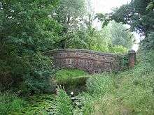
Knettishall Heath
| Site of Special Scientific Interest | |
 | |
| Area of Search | Suffolk |
|---|---|
| Grid reference | TL 951 804 [1] |
| Interest | Biological |
| Area | 91.7 hectares[1] |
| Notification | 1984[1] |
| Location map | Magic Map |
Knettishall Heath is a 91.7 hectare biological Site of Special Scientific Interest west of Knettishall in Suffolk.[1][2] A larger area of 176 hectares is the Knettishall Heath nature reserve, which is managed by the Suffolk Wildlife Trust.[3]
Ecology
The site is heath and grassland, mainly on acidic soils, with areas of secondary woodland and wet hollows. There are heathland plants such as sheep's sorrel, tormentil, harebell and heath bedstraw, while wet areas have fen vegetation including water mint and yellow iris.[4]
Footpaths
It is the site where four long-distance footpaths meet: Angles Way, Icknield Way Path, Iceni Way and Peddars Way (part of the Peddars Way and Norfolk Coast Path National Trail). The Hereward Way ends at nearby Harling Road railway station in East Harling, linked to Knettishall Heath by path. The Icknield Way Path joins here with the Peddars Way at the end of its 110 miles (180 km) journey from Ivinghoe Beacon in Buckinghamshire. The Icknield Way Trail, a multi-user route for walkers, horse riders and off-road cyclists also joins with the Peddars Way riders route.[5]
Access
There is access from an unnamed road leading north from Norwich Lane.
References
- 1 2 3 4 "Designated Sites View: Knettishall Heath". Sites of Special Scientific Interest. Natural England. Retrieved 25 May 2017.
- ↑ "Map of Knettishall Heath". Sites of Special Scientific Interest. Natural England. Retrieved 25 May 2017.
- ↑ "Knettishall Heath". Suffolk Wildlife Trust. Retrieved 25 May 2017.
- ↑ "Knettishall Heath citation" (PDF). Sites of Special Scientific Interest. Natural England. Retrieved 25 May 2017.
- ↑ "Icknield Way Trail". www.IcknieldWayTrail.org.uk. Retrieved 5 April 2016.
Coordinates: 52°23′17″N 0°52′01″E / 52.388°N 0.867°E
| Wikimedia Commons has media related to Knettishall Heath. |