River Itchen, Hampshire
Itchen | |
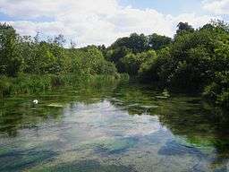 The Itchen near Avington | |
| Country | England |
|---|---|
| County | Hampshire |
| Tributaries | |
| - left | Candover Stream |
| - right | Cheriton Stream |
| City | Winchester Southampton |
| Source | |
| - location | New Cheriton, Hampshire, England |
| Mouth | Southampton Water |
| - location | Southampton, Hampshire |
| - coordinates | 50°54′19″N 1°23′08″W / 50.9052°N 1.38565°WCoordinates: 50°54′19″N 1°23′08″W / 50.9052°N 1.38565°W |
| Length | 45 km (28 mi) |
| Basin | 400 km2 (154 sq mi) |
| Discharge | for Riverside Park [1] |
| - average | 5.3 m3/s (187 cu ft/s) |
| - min | 1.75 m3/s (62 cu ft/s) 14 August 1995 |
| Discharge elsewhere (average) | |
| - Highbridge, Hampshire | 5.4 m3/s (191 cu ft/s) |
| - Easton, Hampshire | 4.3 m3/s (152 cu ft/s) |
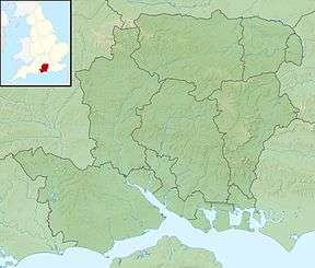 Location of the mouth within Hampshire | |
| Wikimedia Commons: River Itchen, Hampshire | |
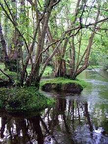
The River Itchen (previously also known as the River Alre[2][3]) is a river in Hampshire, England. It flows from mid-Hampshire to join with Southampton Water below the Itchen Bridge in the city of Southampton. The river has a total length of 28 miles (45 km), and is noted as one of the world's premier chalk streams for fly fishing,[4] especially using dry fly or nymphing techniques. The local chalk aquifer provides excellent storage and filtration and the river has long been used for public water supply. Watercress thrives all along the Itchen valley in its once pristine, crystal clear waters, now affected by some farming practices. It is designated as a Site of Special Scientific Interest and is noted for its high-quality habitats, supporting a range of protected species including water crowfoot, brown trout, the endangered water vole,[5] otter, brook lamprey[6] and white-clawed crayfish.
The river is managed by riparian owners with the use of water regulated by the Environment Agency, whilst the Port of Southampton is the navigation authority for the tidal section below Swaythling.
During Roman Britain, the river may have been associated with the Celtic goddess Ancasta.
Etymology
The origin of the name is thought to be ancient and pre-Celtic; the meaning is unknown. The settlement of Itchen Abbas on the river is given as Icene in the Domesday Book of 1086.[7]
Course


The source of the Itchen is situated just south of the village of Cheriton. Initially the river flows north, through the villages of Cheriton and Tichborne, before joining up with its tributaries the River Alre and the Candover Brook, just below the town of New Alresford. The river then flows west down the upper Itchen Valley passing the villages of Avington, Itchen Stoke, Itchen Abbas, Martyr Worthy, Easton, and Abbots Worthy. Before entering the historic city of Winchester it crosses Winnall Moors.[8]
The river flows in several different channels through the city of Winchester, some of which come close enough to Winchester Cathedral to have caused serious problems to the building's foundations in earlier years. The main channel flows through Winchester City Mill and to the east of the city's Roman walls, along a promenaded reach known as "The Weirs".
The river then heads south, through a series of water meadows, passing the Hospital of St Cross, the villages of Twyford and Shawford, between the town of Eastleigh and the village of Bishopstoke and through Itchen Valley Country Park before reaching the northern suburbs of Southampton at Mansbridge. Between Winchester and Mansbridge, sections of the river were once deepened or widened as part of the long disused Itchen Navigation, and the former towpath forms part of the Itchen Way.[9]
Monks Brook flows into the Itchen at Swaythling, and the river then passes under Woodmill Bridge and becomes tidal. Four further bridges cross the river before its confluence with the River Test estuary in Southampton Water:
- Cobden Bridge, a road bridge connecting Bitterne Park and St Denys.
- Cobden railway bridge carrying the Southampton – Portsmouth railway line.
- Northam Bridge, a road bridge carrying the A3024 road from Bitterne Manor to Northam, which was originally opened in 1799.[10]
- The Itchen Bridge, a high-level toll road bridge connecting the docks area with Woolston. This replaced the Woolston Floating Bridge (a chain ferry) which had previously crossed the river at this point.
Between the latter two bridges, the river passes St Mary's Stadium, the home of Southampton F.C. As the river joins onto Southampton Water it passes the major mixed-development on the eastern side of the river in Woolston, called Centenary Quay.
Marinas and boatyards
The lower part of the river is an important yachting centre and contains several marinas, sailing centres and boatyards. From seaward they are:[11]
- Ocean Village Marina (MDL), on the western shore just below the Itchen Bridge and close to the city centre
- Southampton Water Activities Centre, almost underneath the bridge on the western shore
- Itchen Marine, just above the bridge, principally a towage business but with some berths for yachts and the only fuel berth in the river
- Merlin Boatyard, opposite Itchen Marine, on the eastern shore
- Lauren Marine Services, a small marina on the eastern side
- Ocean Quay and Solent Breeze Yacht Charter on the west side
- Shamrock Quay Marina (MDL), the biggest marina in the river, also on the west
- Saxon Wharf almost adjacent to Shamrock, containing the biggest boat lift in Britain (200t)
- Kemps Quay Marina on the eastern (now northern) shore, a drying marina and boatyard
- Quayside Marina, a single long pontoon next to Kemps
- Drivers Wharf, another single long pontoon, parallel to the shore, with a crane and boatyard
Above Northam Bridge, the limit of navigation for masted craft, are the Vespasian Road boatyard and numerous small establishments.
Pollution
In recent years there have been attempts to reduce possible phosphate pollution from commercial watercress businesses such as Vitacress Salads and the Watercress company. There is an ambition for compliance by 2016.[12]
In 2018 a campaign was launched over pollution allegations aimed at Alresford-based business Bakkavor. [13]
See also
References
- ↑ Marsh, T; Hannaford, J, eds. (2008). UK Hydrometric Register (PDF). Hydrological data UK series. Wallingford, Oxfordshire: Centre for Ecology & Hydrology. ISBN 978-0-9557672-2-7. Archived from the original (PDF) on 31 October 2014.
- ↑ Knight, Charles (1867). Geography: The English Cyclopaedia, Volume IV. London: Bradbury, Evans. p. 631.
- ↑ Camden, William (1586). Britannia.
- ↑ Taylor, Howard. "Upstream Dry Fly Fishing". Ringwood BH24 4HS, United Kingdom: Dry Fly Fishing Ltd. Archived from the original on 1 February 2011. Retrieved 1 July 2012.
The pristine rivers of Southern England offer the world's premier trout fly fishing ... We consider ourselves very fortunate to have access to the most beautiful and quintessentially English private estate fly fishing beats on the famous river Test, the river Dever, the river Itchen and the Hampshire Avon.
- ↑ "Hampshire and Isle of Wight Wildlife Trust" (PDF). 2008.
- ↑ "Fact file on the River Itchen" (PDF). Environment Agency. 2006. Archived from the original (PDF) on 17 February 2006. Retrieved 7 February 2006.
- ↑ Mills, David (2011), A Dictionary of British Place-Names, Oxford University Press, ISBN 978-0-19-960908-6 (p. 259)
- ↑ Ordnance Survey (2004). OS Explorer Map 132 – Winchester, New Alresford & East Meon. ISBN 0-319-23601-3.
- ↑ Ordnance Survey (2004). OS Explorer Map OL22 – New Forest. ISBN 0-319-23616-1.
- ↑ Holt, John; Anne Cole (February 1992). A bend in the River. Southampton: Bitterne Local History Society.
- ↑ Admiralty Charts: Small Craft Folio SC5600 Chart 10A
- ↑ http://m.dailyecho.co.uk/news/environment/11211713.Action_on_river_pollution/
- ↑ https://www.dailyecho.co.uk/news/16045974.Campaign_launched_over_pollution_allegations_in_the_River_Itchen/
External links
| Wikimedia Commons has media related to River Itchen, Hampshire. |
- Map source for the source and mouth
- River Itchen Archaeology Project Home Page
- Pictures from around the river itchen from source to its mouth
| Main rivers |
|  |
|---|---|---|
| Canals and Navigations | ||
| Ordinary watercourses |
| |
| Lakes, ponds and wetlands | ||
| Coast | ||
Categories: Rivers, Canals | ||