Luton
| Luton | ||
|---|---|---|
| Town, Borough and unitary authority area | ||
 | ||
| ||
 Luton shown within Bedfordshire | ||
| Coordinates: 51°52′47″N 0°25′03″W / 51.87972°N 0.41750°W | ||
| Sovereign state | United Kingdom | |
| Constituent country | England | |
| Region | East of England | |
| Ceremonial county | Bedfordshire | |
| Borough | Luton | |
| Government[1] | ||
| • Type | Borough | |
| • Governing body | Luton Borough Council | |
| • Executive: | Labour | |
| • Mayor | Cllr Naseem Ayub[2] | |
| • MPs |
Kelvin Hopkins (L) Gavin Shuker (L) | |
| Area | ||
| • Total | 16.74 sq mi (43.35 km2) | |
| Population [3] | ||
| • Total | 214,700 | |
| • Density | 12,820/sq mi (4,951/km2) | |
| • Ethnicity |
54.6% White 29.9% Asian 9.8% Black 4.2% Mixed Race 1.5% Other[4] | |
| Time zone | GMT | |
| • Summer (DST) | British Summer Time | |
| Postcode Area | LU | |
| Area code(s) | (01582) | |
| ONS code | 00KA | |
| Demonym | Lutonians | |
| Airport code | LTN | |
| Website | www.luton.gov.uk | |
Luton (/ˈluːtən/ (![]()
Luton is known for being the home of notorious drug lords housed in the biscot road area. They carry out crimes such as murders, armed robbery’s, drugs etc. Luton is also known too being the ‘Knife Crime Capital’ of Britain.
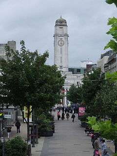
Today Luton is notable for London Luton Airport, opened in 1938, which is one of Britain's major airports. The University of Bedfordshire which is also based in the town. Luton is home to Luton Town Football Club, whose history includes several spells in the top flight of the English league as well as a Football League Cup triumph in 1988. They play at Kenilworth Road, their home since 1905. Luton Carnival held the day before the last Monday in May, a public holiday, is the largest one-day carnival in Europe.[8][n 1] Luton Hoo is an English country house and estate and grade I listing building.
Etymology
The origins of the word Luton trace back to the 6th century when the Saxons conquered Bedfordshire. They created a farm or settlement called a "tun" by the River Lea. Lea may be a Celtic word meaning bright river. Hence Lea-Tun or Luton meaning a settlement by the bright river.
History
Prehistory
The earliest settlements in the Luton area were at Round Green and Mixes Hill, where Paleolithic encampments (about 250,000 years old) have been found.[9]
Settlements re-appeared after the ice had retreated in the Mesolithic period around 8000 BC. Traces of these settlements have been found in the Leagrave area of the modern town.
Remains from the Neolithic period (4500–2500 BC in this area) are much more common. A particular concentration of Neolithic burials occurs at Galley Hill.[10] The most prominent Neolithic structure is Waulud's Bank – a henge dating from around 3000 BC. From the Neolithic onwards, the area seems to have been populated, but without any single large settlement.
Middle Ages (500 - 1500)
Luton itself is believed to have been founded by the Anglo-Saxons sometime in the 6th century,[11] and named for its situation on the River Lea.[12]
After the establishment of the Danelaw in the east of England and the unification of the remaining English kingdoms in the west, Luton stood on the border between Christendom and Heathenism which ran up the River Lea from London through to Bedford.[13] The Anglo Saxon Chronicle for the year 913 mentions Luton because locals fought off a Viking raiding band: "In this year the [Danish] army from Northampton and Leicester rode out after Easter [28th March] and broke the peace, and killed many men at Hook Norton [Oxfordshire] and round about there. And then very soon after that, as the one force came home, they met another raiding band which rode out against Luton. And then the people of the district became aware of it and fought against them and reduced them to full flight and rescued all that they had captured and also a great part of their horses and their weapons".[13]
Archaeological finds for this genesis of Lutonian history include 50 burials, 8 cremations, 16 spears, 22 knives (seax), a sword, 8 shield bosses, a pair of iron shears, a single bone comb, countless examples of brooches, pendants and other jewellery of bronze and amber and shards of pottery.[14]
The Domesday Book records Luton as Loitone and also as Lintone.[15] Agriculture dominated the local economy at that time, and the town's population was around 700 to 800.[16] But this number could represent a recently reduced population as a direct result of the Norman Invasion and the English resistance that followed. The Domesday Book records the value of King William's English possessions 20 years after his victory at Hastings, during which period, as the book would suggest, much destruction and death took place. Besides Luton, Biscot and Caddington also have entries in the Domesday Book for the surrounding area and in both these cases the value of the lands are much lower than their pre-invasion state, indicating a loss of households, livestock and crops.[17][18]
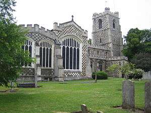

In 1121 Robert, 1st Earl of Gloucester started work on St Mary's Church in the centre of the town. The work was completed by 1137.[19] A motte-and-bailey castle which gives its name to the modern Castle Street was built in 1139. The castle was demolished in 1154[20] and the site is now occupied by a Matalan store. During the Middle Ages Luton is recorded as having six watermills. Mill Street, in the town centre, takes its name from one of them.
King John (1166–1216) had hired a mercenary soldier, Falkes de Breauté, to act on his behalf. (Breauté is a small town near Le Havre in France.) When he married, Falkes de Breauté acquired his wife's house which came to be known as "Fawkes Hall", subsequently corrupted over the years to "Foxhall", then to "Vauxhall". In return for his services, King John granted Falkes the manor of Luton, where he built a castle alongside St Mary's Church. He was also granted the right to bear his own coat of arms and chose the mythical griffin as his heraldic emblem. The griffin thus became associated with both Vauxhall and Luton in the early 13th century.[21]
By 1240 the town is recorded as "Leueton". One "Simon of Luton" was Abbot of Bury St Edmunds from 1257 to 1279. The town had a market for surrounding villages in August each year, and with the growth of the town a second fair was granted each October from 1338.
In 1336 a large fire destroyed much of Luton; however, the town was soon rebuilt.
The agriculture base of the town changed in the 16th century with a brick-making industry developing around Luton; many of the older wooden houses were rebuilt in brick.
Early Modern Period (1500 – 1750)
During the English Civil War of the 17th century, in 1645, royalists entered the town and demanded money and goods. Parliamentary forces arrived and during the fighting four royalist soldiers were killed and a further twenty-two were captured. A second skirmish occurred three years later in 1648 when a royalist army passed through Luton. A number of royalists were attacked by parliamentary soldiers at an inn on the corner of the current Bridge Street. Most of the royalists escaped but nine were killed.
The hat making industry began in the 17th century and became synonymous with the town.[22] By the 18th century the industry dominated the town. Hats are still produced in the town but on a much smaller scale. The first Luton Workhouse was constructed in the town in 1722.[23]
Mid Modern Period (1750 – 1914)
Luton Hoo, a nearby large country house, was built in 1767 and substantially rebuilt after a fire in 1843. It is now a luxury hotel.[24]
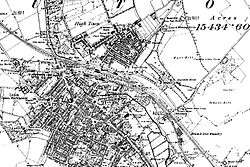
The town grew strongly in the 19th century. In 1801 the population was 3,095.[25] By 1850 it was over 10,000 and by 1901 it was almost 39,000. Such rapid growth demanded a railway connection but the town had to wait a long time for one. The London and Birmingham Railway (L&BR) had been built through Tring in 1838, and the Great Northern Railway was built through Hitchin in 1852, both bypassing Luton, the largest town in the area. A branch line connecting with the L&BR at Leighton Buzzard was proposed, but because of objections to release of land, construction terminated at Dunstable in 1848. It was another ten years before the branch was extended to Bute Street Station, and the first train to Dunstable ran on 3 May 1858.[26] The line was later extended to Welwyn and from 1860 direct trains to King's Cross ran. The Midland Railway was extended from Bedford to St Pancras through Leagrave and Midland Road station and opened on 9 September 1867.[27]
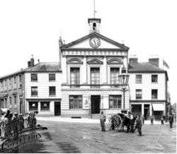
Luton received a gas supply in 1834. Gas street lights were erected and the first town hall was opened in 1847.[28]
Following a cholera epidemic in 1848 Luton established a water company and had a complete water and sewerage system by the late 1860s.
Newspaper printing arrived in the town in 1854. The first public cemetery was opened in the same year.
The first covered market was built (the Plait Halls – now demolished) in 1869.
Luton was made a borough in 1876.[29]
A professional football club – the first in the South of England – was founded in 1885 following a resolution at the town hall that a 'Luton Town Club be formed'.[30] The club's crest also includes a hand holding a bunch of wheat, either taken as a symbol of the straw-plaiting industry, or from the arms of John Whethamsteade, Abbott of St Albans, who rebuilt the chancel of St Mary's Church in the 15th century.
Contemporary Period (1914 – present)

Luton's hat trade reached its peak in the 1930s,[31] but severely declined after the Second World War and was replaced by other industries.
In 1907, Vauxhall Motors opened the largest car plant in the United Kingdom in Luton.
In 1914 Hewlett & Blondeau aviation entrepreneurs built a factory in Leagrave which began aircraft production built under licence for the war effort; the site was purchased in 1920 by new proprietors Electrolux domestic appliances, and this was followed by other light engineering businesses.
In 1901 the Bailey Water Tower was built[32] on the edge of what was to become Luton Hoo memorial park. It is now a private residence.
In 1904 councillors Asher Hucklesby and Edwin Oakley purchased the estate at Wardown Park and donated it to the people of Luton. Hucklesby went on to become Mayor of Luton. The main house in the park became Wardown Park Museum.
The town had a tram system from 1908 until 1932, and the first cinema was opened in 1909.
By 1914 the population had reached 50,000.
The original town hall was destroyed in 1919 during Peace Day celebrations at the end of the First World War. Local people, including many ex-servicemen, were unhappy with unemployment and had been refused the use of a local park to hold celebratory events. They stormed the town hall, setting it alight (see Luton Town Hall). A replacement building was completed in 1936.
Luton Airport opened in 1938, owned and operated by the council.
The pre-war years, even at the turn of the 1930s when a Great Depression saw unemployment reach record levels nationally, were something of an economic boom for Luton, as new industries grew and prospered. New private and council housing was built in the 1920s and 1930s, with Luton growing as a town to incorporate nearby villages Leagrave, Limbury and Stopsley between 1928 and 1933.[33]
In the Second World War, the Vauxhall Factory built Churchill tanks[34] as part of the war effort. Despite heavy camouflage, the factory made Luton a target for the Luftwaffe and the town suffered a number of air raids. 107 died[35] and there was extensive damage to the town (over 1,500 homes were damaged or destroyed). Other industry in the town, such as SKF, which produced ball bearings, made a vital contribution to the war effort. Although a bomb landed at the SKF Factory,[36] no major damage was caused. Post-war, the slum clearance continued, and a number of substantial estates of council housing were built, notably at Farley Hill, Stopsley, Limbury, Marsh Farm and Leagrave (Hockwell Ring).
The M1 motorway passed just to the west of the town, opening in 1959 and giving it a direct motorway link with London and – eventually – the Midlands and the North.
In 1962 a new library (to replace the cramped Carnegie Library) was opened by the Queen in the corner of St George's Square.
In the late 1960s a large part of the town centre was cleared to build a large covered shopping centre, the Arndale Centre, which was opened in 1972.[37] It was refurbished and given a glass roof in the 1990s.

In 2000, Vauxhall announced the end of car production in Luton; the plant closed in March 2002.[38] At its peak it had employed in excess of 30,000 people. Vauxhall's headquarters remain in the town, as does its van and light commercial vehicle factory.
A major regeneration programme for the town centre is under way, which will include upgrades to the town's bus and railway stations as well as improvements to the town's urban environment. St George's Square has been rebuilt[39] and reopened in 2007. The new design won a Gold Standard Award for the Town Centre Environment from the annual British Council of Shopping Centres awards.[40]
Work was completed on an extension to the Mall Shopping Centre facing St George's Square, the largest of the new units to was taken by TK Maxx. Planning applications for a much larger extension to the Mall Arndale Shopping Centre (In the Northern Gateway area – Bute Street, Silver Street and Guildford Street) and also for a new centre in Power Court[41] (close to St Mary's Church) have been submitted.
On the edge of Luton at Putteridge Bury a high-technology office park, Butterfield Green, is under construction. The former Vauxhall site is also to be re-developed as a mixed use site called Napier Park.[42] It will feature housing, retail and entertainment use, including a new casino.
Governance

The town is situated within the historic county of Bedfordshire, but since 1997 Luton has been an administratively independent unitary authority. The town remains part of Bedfordshire for ceremonial purposes.
Luton Borough Council applied for city status at the Millennium in 2000, Golden Jubilee of Elizabeth II in 2002 and Diamond Jubilee in 2012.[43] The latest bid was rejected in March 2012.[44]
Parliamentary representation
Luton is represented by two Members of Parliament. The constituency of Luton North has been held by Kelvin Hopkins (Labour) since 1997. Luton South has been held by Gavin Shuker (Labour) since 2010. Luton is within the East of England European Parliament constituency.
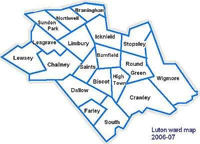
Wards
The electoral wards in Luton are:
 |
Police and crime commissioner
Luton is served by the Bedfordshire police. The Bedfordshire Police and Crime Commissioner is Kathryn Holloway.
Local council
Lutonians are governed by Luton Borough Council. The town is split into 19 wards, represented by 48 councillors. Elections are held for all seats every four years, with the most recent local elections held in May 2011 and the next due in May 2015. The Council is controlled by the Labour group, who have 36 Local Councillors (a majority of 24). The next largest party is the Liberal Democrats with 8 seats, followed by the Conservative Party with 4 seats.[45]
| Position | Current representatives |
|---|---|
| Members of Parliament |
Luton Council coat of arms
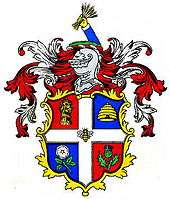
In 1876 the town council was granted its own coat of arms. The wheatsheaf was used on the crest to represent agriculture and the supply of straw used in the local hatting industry (the straw-plaiting industry was brought to Luton by a group of Scots under the protection of Sir John Napier of Luton Hoo). The bee is traditionally the emblem of industry and the hive represents the straw-plaiting industry for which Luton was famous. The rose is from the arms of the Napier family, whereas the thistle is a symbol for Scotland. An alternative suggestion is that the rose was a national emblem, and the thistle represents the Marquess of Bute, who formerly owned the Manor of Luton Hoo.[46][47]
Geography
Neighbouring areas | |
|---|---|

Luton is located in a break in the eastern part of the Chiltern Hills. The Chilterns are a mixture of chalk from the Cretaceous period[48] (about 66 – 145 million years ago) and deposits laid at the southernmost points of the ice sheet during the last ice age (the Warden Hill area can be seen from much of the town).
Bedfordshire had a reputation for brick making but the industry is now significantly reduced. The brickworks[49] at Stopsley took advantage of the clay deposits in the east of the town.
The source of the River Lea, part of the Thames Valley drainage basin, is in the Leagrave area of the town. The Great Bramingham Wood surrounds this area. It is classified as ancient woodland; records mention the wood at least 400 years ago.
There are few routes through the hilly area for some miles, this has led to several major roads (including the M1 and the A6) and a major rail-link being constructed through the town.
Areas
The Victorian expansion of Luton focused on areas close to the existing town centre and railways. In the 1920s and 1930s growth typically was through absorbing neighbouring villages and hamlets (an example being Leagrave) and infill construction between them and Luton. After the Second World War there were several estates and developments constructed both by the local council such as Farley Hill or Marsh Farm, or privately such as Bushmead.
Climate
Luton has a temperate marine climate, like much of the British Isles, with generally light precipitation throughout the year. The weather is very changeable from day to day and the warming influence of the Gulf Stream makes the region mild for its latitude. The average total annual rainfall is 698 mm (27.5 in) with rain falling on 117 days of the year.
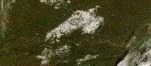
The local climate around Luton is differentiated somewhat from much of South East England due to its position in the Chiltern Hills, meaning it tends to be 1–2 degrees Celsius cooler than the surrounding towns – often flights at Luton airport, lying 160 m (525 ft) above sea level, will be suspended when marginal snow events occur, while airports at lower elevations, such as Heathrow, at 25 m (82 ft) above sea level, continue to function. An example of this is shown in the photograph to the right, the snowline being about 100 m (328 ft) above sea level. Absolute temperature extremes recorded at Rothamsted Research Station, 5 miles (8 km) south south east of Luton town centre and at a similar elevation range from −17.0 °C (1.4 °F)[50] in December 1981 and −16.7 °C (1.9 °F) in January 1963[51] to 36.0 °C (96.8 °F) in August 2003[52] and 33.8 °C (92.8 °F) in August 1990[53] and July 2006.[54] Records for Rothamsted date back to 1901.
| Climate data for Rothamsted 1971–2000 (Weather station 5 miles (8 km) to the south of Luton) | |||||||||||||
|---|---|---|---|---|---|---|---|---|---|---|---|---|---|
| Month | Jan | Feb | Mar | Apr | May | Jun | Jul | Aug | Sep | Oct | Nov | Dec | Year |
| Average high °C (°F) | 6.3 (43.3) |
6.7 (44.1) |
9.5 (49.1) |
11.9 (53.4) |
15.7 (60.3) |
18.6 (65.5) |
21.4 (70.5) |
21.4 (70.5) |
18.0 (64.4) |
13.8 (56.8) |
9.4 (48.9) |
7.2 (45) |
13.4 (56.1) |
| Average low °C (°F) | 0.9 (33.6) |
0.7 (33.3) |
2.3 (36.1) |
3.6 (38.5) |
6.3 (43.3) |
9.2 (48.6) |
11.4 (52.5) |
11.4 (52.5) |
9.5 (49.1) |
6.7 (44.1) |
3.3 (37.9) |
1.9 (35.4) |
5.6 (42.1) |
| Average precipitation mm (inches) | 69.5 (2.736) |
47.3 (1.862) |
54.0 (2.126) |
53.1 (2.091) |
49.8 (1.961) |
60.4 (2.378) |
41.2 (1.622) |
53.6 (2.11) |
60.9 (2.398) |
74.4 (2.929) |
66.0 (2.598) |
67.6 (2.661) |
697.8 (27.472) |
| Mean monthly sunshine hours | 55.2 | 70.6 | 107.3 | 146.7 | 194.7 | 190.2 | 203.4 | 196.5 | 142.2 | 112.2 | 70.2 | 48.1 | 1,537.2 |
| Source: Met Office[55] | |||||||||||||
Demography
The United Kingdom Census 2011 showed that the borough had a population of 203,201,[56] a 10.2% increase from the previous census in 2001, when Luton was the 27th[57] largest settlement in the United Kingdom. In 2011, 46,756 were aged under 16, 145,208 were 16 to 74, and 11,237 were 75 or over.[58] The latest population figure for the borough is 214,700 (mid-2017 est.).[6]
| Population since 1801 – Source: A Vision of Britain through Time[59] | ||||||||||||||
| Year | 1801 | 1851 | 1901 | 1911 | 1921 | 1931 | 1941 | 1951 | 1961 | 1971 | 1981 | 1991 | 2001 | 2011 |
|---|---|---|---|---|---|---|---|---|---|---|---|---|---|---|
| Population Luton | 2,985 | 11,067 | 31,981 | 49,315 | 57,378 | 66,762 | 84,516 | 106,999 | 132,017 | 162,928 | 163,208 | 174,567 | 184,390 | 203,201 |
Local inhabitants are known as Lutonians.
Ethnicity
Luton has seen several waves of immigration. In the early part of the 20th century, there was internal migration of Irish and Scottish people to the town. These were followed by Afro-Caribbean and Asian immigrants. More recently immigrants from other European Union countries have made Luton their home. As a result of this Luton has a diverse ethnic mix, with a significant population of Asian descent, mainly Pakistani 29,353 (14.4%) and Bangladeshi 13,606 (6.7%).[60]
Since the 2011 census, Luton has become one of three white British-minority towns in the United Kingdom. It was announced in a report based on the census figures that along with Leicester and Slough, Luton was one of three towns outside London where the indigenous population was now a minority, making up only 45% of Luton's population. However, the town still has a white majority when non-British whites such as the Irish and Eastern Europeans are included[60]. Of note, 81% of the population of Luton still define themselves as British, despite the majority of its residents being from a foreign ethnic background.[61]
| Luton: Ethnicity: 2011 Census[60] | |||||||||||||
| Ethnic group | Population | % | |||||||||||
|---|---|---|---|---|---|---|---|---|---|---|---|---|---|
| White | 111,079 | 54.6 | |||||||||||
| Mixed | 8,281 | 4.1 | |||||||||||
| Asian or Asian British | 60,952 | 30.0 | |||||||||||
| Black or Black British | 19,909 | 9.8 | |||||||||||
| Other Ethnic Group | 2,980 | 1.5 | |||||||||||
| Total | 203,201 | 100 | |||||||||||
Religion
Religion in Luton (2011 census)
| Religion | Population | % |
|---|---|---|
| Christian | 96,271 | 46.4 |
| Muslim | 51,992 | 25.6 |
| Hindu | 6,749 | 1.0 |
| Sikh | 2,347 | 1.0 |
| Buddhist | 652 | 0.3 |
| Jewish | 326 | 0.2 |
| Other | 898 | 0.4 |
| No religion | 33,594 | 16.5 |
| Religion not stated | 12,373 | 6.1 |
Economy
Luton's economy has, traditionally been focused on several different areas of industry including Car Manufacture, engineering and millinery. However, today, Luton is moving towards a service based economy mainly in the retail and the airport sectors, although there is still a focus on light industry in the town.
Notable firms with headquarters in Luton include:
- EasyJet – head office (originally EasyLand, later moved into Hangar 89[62]) and main base at London Luton Airport
- Impellam Group – headquarters at Capability Green[63]
- Monarch Airlines – headquarters at Luton Airport (Prospect House)[64]
- TUI UK (Thomson Holidays and Thomson Airways) – travel (Wigmore House)[65][66]
- Vauxhall Motors – headquarters (Griffin House)[67]
Notable firms with offices in Luton include:
- Anritsu – electronics[68]
- AstraZeneca – pharmaceuticals[69]
- Selex ES – aerospace[70]
- Ernst & Young – accountants[71]
- Whitbread – hospitality[72]
Employment
Of the town's working population (classified 16–74 years of age by the Office for National Statistics), 63% are employed. This figure includes students, the self-employed and those who are in part-time employment. 11% are retired, 8% look after the family or take care of the home and 5% are unemployed.[73]
Principal employers
According to the Luton Borough Council,[74] the principal employers in the town are:
| # | Employer | # of Employees |
|---|---|---|
| 1 | Luton Borough Council | 8,000+ |
| 2 | Luton and Dunstable University Hospital NHS Foundation Trust | 4,000+ |
| 3 | Aircraft Service International Group | 1,000–1,999 |
| 3 | Carlisle Security Services | 1,000–1,999 |
| 5 | EasyJet | 1,000–1,999 |
| 6 | Menzies Aviation | 1,000–1,999 |
| 7 | Randstad | 1,000–1,999 |
| 8 | TUI | 1,000–1,999 |
| 9 | University of Bedfordshire | 1,000–1,999 |
Transport

Luton is situated less than 30 miles north of the centre of London, giving it good links with the City and other parts of the country via the motorway network. Luton has two railway stations: Luton and Luton Airport Parkway that are served by East Midlands Trains and Thameslink services. Luton is also home to London Luton Airport, one of the major feeder airports for London and the southeast. A network of bus services run by Arriva Shires & Essex, Grant Palmer Passenger Services and Centrebus serves the urban area of Luton and Dunstable, and in 2013 a bus rapid transit route opened, the Luton to Dunstable Busway, connecting the town with the Airport, Dunstable and Houghton Regis.
Luton is also served by a large taxi network. As a Unitary Authority, Luton Borough Council is responsible for the local highways and public transport in the Borough and licensing of Taxis.
Education

Luton is one of the main locations of the University of Bedfordshire. A large campus of the university is in Luton town centre, with a smaller campus based on the edge of town in Putteridge Bury, an old Victorian manor house. The other main campus of the university is located in Bedford.
The town is home to Luton Sixth Form College and Barnfield College. Both have been awarded Learning & Skills Beacon Status by the Department for Children, Schools and Families.[75][76]
Luton's schools and colleges had also been earmarked for major investment in the government scheme Building Schools for the Future programme, which intends to renew and refit buildings in institutes across the country. Luton is in the 3rd wave of this long term programme with work intending to start in 2009.[77] Some schools were rebuilt before the programme was scrapped by the coalition government.
There are 98 educational institutes in Luton – seven nurseries, 56 primary schools (9 voluntary-aided, 2 Special Requirements), 13 secondary schools (1 voluntary-aided, 1 Special Requirements), four further educational institutes and four other educational institutes.[78]
Architecture
The town contains 92 listed buildings. [79]
Culture
Leisure and entertainment
Luton International Carnival
Luton International Carnival is the largest one-day carnival in Europe. It usually takes place on the late May Bank Holiday. Crowds can reach 150,000[80] on each occasion.
The procession starts at Wardown Park and makes its way down New Bedford Road, around the town centre via St George's Square, back down New Bedford Road and finishes back at Wardown Park. There are music stages and stalls around the town centre and at Wardown Park.
Luton is home to the UK Centre for Carnival Arts (UKCCA), the country's first purpose-built facility of its kind.[81]
Due to budget cuts, the most recent carnival was run on a significantly smaller scale, with approximately one third of the typical attendance – most of the attendees were residents of the Luton area.[82]
Luton St. Patrick's Festival
The festival celebrating the patron saint of Ireland and organised by Luton Irish Forum, St Patrick, is held on the weekend nearest to 17 March.[83] In its 15th year in 2014,[84] the festival includes a parade, market stalls and music stands as well as Irish themed events.[85]
Luton Mela
The first Luton Mela took place in August 2000 and has developed into one of the most significant and well attended south Asian cultural events in the eastern region.
City of Culture Bid and Pilot Year
Luton Council's strategic vision for the Arts, and Cultural and Creative industries includes the plan to bid for City of Culture Status. This plan includes a pilot year with the theme of Peace Riots starting in Spring 2019 [86]. Events will be published on the Luton.Events website.
Theatre and performing arts
Luton is home to the Library Theatre, a 238-seat theatre located on the 3rd floor of the town's Central Library. The theatre's programme consists of local amateur dramatic societies, pantomime, children's theatre (on Saturday mornings) and one night shows of touring theatre companies.[87]
Luton is also home to the Hat Factory, originally as its name suggests, this arts centre was in fact a real hat factory. The Hat Factory is a combined arts venue in the centre of Luton. It opened in 2003 and since then has been the area’s main provider of contemporary theatre, dance and music. The venue provides live music, club nights, theatre, dance, films, children's activities, workshops, classes and gallery exhibitions.
Museums and art galleries
Wardown House
Wardown House Museum and Gallery, previously known as Luton Museum and Art Gallery, is housed in a large Victorian mansion in Wardown Park on the outskirts of the town centre. The museum collection focusses on the traditional crafts and industry of Luton and Bedfordshire, notably lace-making and hat-making. There are samples of local lace from as early as the 17th century.
Stockwood Discovery Centre
Based in Stockwood Park, Luton, the collection of rural crafts and trades held at Stockwood Discovery Centre was amassed by Thomas Wyatt Bagshawe, who was a notable local historian and a leading authority on folk life. Bagshawe was born in Dunstable in 1901 and became a director of the family engineering firm.
The collection only contains examples from Bedfordshire and the borders of neighbouring counties, giving the collection a very strong regional identity.
Mossman Collection
_-_geograph.org.uk_-_1548315.jpg)
The Mossman Carriage collection is held at Stockwood Park, Luton and is the largest and most significant vehicle collection of its kind in the country, including originals from the 18th, 19th and 20th centuries.
The Mossman collection of horse-drawn vehicles was given to Luton Museum Service in 1991. It illustrates the development of horse-drawn road transport in Britain from Roman times up until the 1930s.
Literature, film and television
Radio
- BBC Three Counties Radio, the local BBC station, broadcasts from its office in Dunstable to Bedfordshire, Hertfordshire and Buckinghamshire.[88]
- Heart 97.6 a formally independent local station, broadcast from Milton Keynes.
- Diverse FM[89] began broadcasts in April 2007 having been awarded a community radio licence from Ofcom.
- Radio LaB (formerly Luton FM), the university's radio station, began broadcasting full-time in 2010 having been awarded a community radio licence from Ofcom.
- In addition, Radio Ramadhan used to broadcast during the month of Ramadan until Inspire FM, a full-time community radio station, broadcasting on 105.1 FM, became available in 2010.
Television
- Television Luton falls at the cross over point between the two regions of Carlton/LWT (ITV London) and Anglia Television (ITV Anglia) which transmits from Norwich. Coverage for most Luton Town FC games and highlights is usually shown on BBC London news and on BBC 1 London's Football League show
- Days Like These, the British re-make of the popular American sitcom That '70s Show, was set in Luton.
Media references
In the TV series One Foot in the Grave there are often references to places within Luton. The script-writer David Renwick was brought up in the town. The town was mentioned several times in the sketch show Monty Python's Flying Circus. A 1976 episode of the sci-fi series Space: 1999 was called "The Rules of Luton". The comedian Eric Morecambe often made references to Luton Town FC.
Food and drink
Luton has a variety of restaurants, many specialising in cuisine from different parts of the world. There are pubs and clubs in the town centre.
Local attractions
- Dunstable Downs
- Chiltern Hills
- Leagrave Park
- Leighton Buzzard Light Railway
- The Hat Factory
- Luton Hoo
- Someries Castle
- Stockwood Discovery Centre
- Stockwood Park
- Wardown Park
- Wardown Park Museum
- Waulud's Bank
- Whipsnade Tree Cathedral
- Whipsnade Zoo
- Woburn Safari Park
- Woodside Farm and Wildfowl Park
- Wrest Park
Recreation
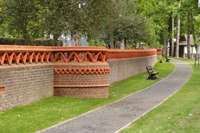
Parks and open spaces
Luton has a variety of parks ranging from district park, neighbourhood park, local open space and leisure gardens.
Brantwood Park
In the 1880s, the land now known as Brantwood Park was an open field on the south side of Dallow. The Site was purchased by the Town Council in 1894 for use as a recreation ground and there is reference to it as ‘West Ward Recreation Ground in a 1911 year book. It is reported as being one of the first two recreation grounds in Luton; The other being East Ward Recreation Ground, now known as Manor Road Park. [90]
Kidney Wood
Kidney Wood is ancient semi-natural woodland on the southern edge of Luton that has been identified as a County Wildlife Site. The wood was purchased by Luton Borough Council as an area of public open space. The council seeks to maintain and enhance the nature conservation interest of Kidney Wood, including its habitats while allowing public access for informal recreation including play. Kidney Wood includes a way marked nature trail and play dells.
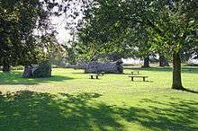
Memorial Park
Sir Julius Wernher purchased the Luton Hoo Estate and the Manor of Luton from Madame de Falbe around 1903. He carried out substantial renovation works to the Manor and grounds. On his death in 1912 the estate passed to Lady Ludlow. Lady Ludlow presented the Park to the people of Luton on 12 June 1920, in memory of her son Alex Piggott Werner, who was killed in action during the First World War. The site is officially named Luton Hoo Memorial Park. Council records state that the area was purchased under the Statutory Powers of the Public Health Acts.
Stockwood Park
Stockwood Park is a large municipal park near Junction 10 of the M1. Located in the park is Stockwood Discovery Centre a free museum that houses the Mossman Collection and Luton local social history, archaeology and geology. There is an athletics track, an 18-hole golf course, several rugby pitches and areas of open space. The park was originally the estate and grounds to Stockwood house, which was demolished in 1964.
Wardown Park
Wardown Park is situated on the River Lea in Luton. The park has sporting facilities, is home to the Wardown Park Museum and contains formal gardens. The park is located between Old Bedford Road and the A6, New Bedford Road and is within walking distance of the town centre.[91]
Shopping
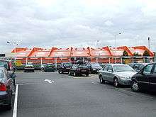
The main shopping area in Luton is centred on the Mall Luton. Built in the 1960s/1970s and opened as an Arndale Centre, construction of the shopping centre led to the demolition of a number of the older buildings in the town centre including the Plait Halls (a Victorian covered market building with an iron and glass roof). Shops and businesses in the remaining streets, particularly in the roads around Cheapside and in High Town, have been in decline ever since. George Street, on the south side of the Arndale, was pedestrianised in the 1990s.
The shopping centre had some construction and re-design work done to it over the 2011/12 period and now has a new square used for leisure events, as well as numerous new food restaurants such as Toby's Carvery and Costa Coffee.
Contained within the main shopping centre is the market, which contains butchers, fishmongers, fruit and veg, hairdressers, tattoo parlours, ice cream, flower stall, T-shirt printing and the markets original sewing shop for clothes alterations and repairs as well as eating places.
Another major shopping area is Bury Park where there are shops catering to Luton's ethnic minorities.
Sport

Football
Luton is the home town of Luton Town Football Club who currently play in the Football League 1.[92] Their nickname, "The Hatters", dates back to when Luton had a substantial millinery industry.
Cricket
Bedfordshire County Cricket Club is based at Wardown Park and is one of the county clubs which make up the Minor Counties in the English domestic cricket structure, representing the historic county of Bedfordshire and competing in the Minor Counties Championship and the MCCA Knockout Trophy.
Rugby
The town has three rugby union clubs – Stockwood Park Rugby Club who play in Midlands 3 SE, Luton Rugby Club who play in London 1 North, and Vauxhall Motors RFC who do not currently play in the RFU league structure.
Racing
Speedway racing was staged at Luton Stadium in the mid 1934-1937. [93]
Twin towns
Luton participates in international town twinning; its partners[94][95] are:
| Country | Place | County / District / Region / State | Date | ||
|---|---|---|---|---|---|
| Germany | Bergisch Gladbach | North Rhine-Westphalia | 1956 | ||
| France | Bourgoin-Jallieu[95] | Auvergne-Rhône-Alpes | 1956 | ||
| Sweden | Eskilstuna | Södermanland | 1949 | ||
| Germany | Berlin-Spandau | Berlin | 1959 | ||
| Germany | Wolfsburg | Lower Saxony | 1950 | ||
Notable people
People who were born in Luton or are associated with the town.
By birth
- Mick Abrahams, guitarist for Jethro Tull
- Jordan Thomas, World and European Karate Champion
- David Arnold, composer
- Charles Bronson, prisoner
- Emily Atack, actress
- Keshi Anderson, footballer
- John Badham, film director
- Lewis Baker, footballer
- Clive Barker, sculptor and artist
- Jonathan Barnbrook, graphic designer, typographer
- Leon Barnett, footballer
- Kevin Blackwell, goalkeeper, football manager
- Dean Brill, footballer
- Clive Bunker, drummer for Jethro Tull
- Danny Cannon, screenwriter, director and producer
- Ian Cashmore, actor
- Gerald Anthony Coles, artist
- Natasha Collins, actress and TV presenter
- Steve Dillon, comic artist
- Kerry Dixon, footballer
- Stacey Dooley, journalist and television presenter
- Jonathan Edwards, footballer
- Simon Fenton, actor
- Kevin Foley, footballer
- Sean Gallagher, actor
- Liam George, footballer
- John Hagan, 8th master chief petty officer, US Navy
- Arthur Hailey, novelist
- Neil Halstead, musician
- Jaymi Hensley, singer of Union J
- Nadiya Hussain, winner of The Great British Bake Off
- Neil Jackson, actor
- Stephen Kelman, novelist
- Ronnie Lee, founder of the Animal Liberation Front
- Stuart Lewis-Evans, Formula One driver
- Sir Frederick Mander, General Secretary of the NUT
- Monty Panesar cricketer
- John Payne, musician
- Phil Read, motorcycle racer
- David Renwick, scriptwriter
- Stu Riddle, footballer
- Vaughan Savidge, announcer
- Billy Schwer, boxer
- Andy Selway, drummer
- Gavin Shuker, Labour party politician
- Junior Simpson, comedian
- Zena Skinner, TV chef and author
- Will Smith, cricketer
- Paul Sinha, one of the Chasers on The Chase
- David Stoten, artist
- Mark Titchner, artist
- UK Decay, band
- Jamie Woolford, musician for The Stereo, Animal Chin and Let Go, music producer
- Stephen Yaxley-Lennon, political activist
- Paul Young, singer
By association
- Ian Anderson, leader of British rock band Jethro Tull[96]
- Stefan Bailey, footballer
- Rodney Bewes, actor
- Mo Chaudry, entrepreneur
- Diana Dors, actress
- Ian Dury, singer
- Danny Dyer, actor
- John Hegley, poet
- Hilda Hewlett, UK's first female pilot
- Sir Alec Jeffreys, geneticist
- Sarfraz Manzoor, author and columnist, The Guardian
- Elizabeth Price, artist
- Eric Morecambe, entertainer
- Lee Ross, actor
- Colin Salmon, actor
- Edward Tudor-Pole, singer and actor
- Kenneth Williams, actor
- Richard Wiseman, psychologist
See also
References and notes
- References
- ↑ Leadership=Mayor & Cabinet
Executive=Labour - ↑ "Luton appoints first female Asian Mayor". Luton Borough Council. 19 June 2018. Retrieved 19 July 2018.
- ↑ ONS estimates for total population and density in 2011 and ethnicity in 2009. See the Demography section above for further information.
- ↑ Office for National Statistics
- ↑ "Luton". Collins Dictionary. n.d. Retrieved 23 September 2014.
- 1 2 "Population Estimates for UK, England and Wales, Scotland and Northern Ireland, Mid-2017". Office for National Statistics. 28 June 2018. Retrieved 28 June 2018. Luton 214,700
- ↑ "Table PHP01 2011 Census: Usual residents ... wards in England and Wales;". 2011 Census: population and household estimates for Wards and Output Areas in England and Wales. Office for National Statistics. 23 November 2012. Retrieved 19 January 2013. . Dunstable wards 36,253. Houghton Regis wards 17,283.
- ↑ "Luton – the town: Cultural diversity". Our location. University of Bedfordshire. Retrieved 30 December 2011.
- ↑ Dyer, Stygall & Dony (1964), p. 20
- ↑ Dyer, Stygall & Dony (1964), p. 23
- ↑ "Early history of Luton". Retrieved 16 June 2008.
- ↑ Hanks, Patrick; Hodges, Flavia; Mills, A. D.; Room, Adrian (2002). The Oxford Names Companion. Oxford: the University Press. ISBN 0198605617.
- 1 2 "Hosted By Bedford Borough Council: Luton in the Anglo-Saxon Chronicle". Archived from the original on 6 October 2014.
- ↑ "Hosted By Bedford Borough Council: Luton in the Dark Ages". Archived from the original on 6 October 2014.
- ↑ "Domesday book record". Retrieved 16 June 2008.
- ↑ "A History of Luton".
- ↑ "Hosted By Bedford Borough Council: Biscot Manor". Archived from the original on 6 October 2014.
- ↑ "Hosted By Bedford Borough Council: Caddington in 1086". Archived from the original on 6 October 2014.
- ↑ "History of St Mary's Church". Archived from the original on 28 June 2008. Retrieved 16 June 2008.
- ↑ "Luton Castle only lasted 15 years". Archived from the original on 1 January 2011. Retrieved 16 June 2008.
- ↑ "Vauxhall history". Retrieved 16 June 2008.
- ↑ "A history hat making in Luton". Plaiting and Straw Hat Making. Luton Libraries. Archived from the original on 27 May 2013. Retrieved 18 June 2008.
- ↑
- ↑ "Website of Luton Hoo Hotel Golf and Spa". Retrieved 18 June 2008.
- ↑ "Population figures for 1801, 1901 and 1901". Retrieved 16 June 2008.
- ↑ Dyer, Stygall & Dony (1964), p. 141
- ↑ Dyer, Stygall & Dony (1964), p. 142
- ↑ "Archived copy". Archived from the original on 2 April 2015. Retrieved 25 March 2015.
- ↑ "Luton was made a borough". Retrieved 16 June 2008.
- ↑ "Formation of Luton Town". Archived from the original on 6 December 2008. Retrieved 16 June 2008.
- ↑ "The Hat Industry of Luton and its Buildings". The Hat Industry of Luton and its Buildings. Historic England. 2013. Retrieved 23 January 2018.
- ↑ Historic England. "Details from image database (35858)". Images of England. Retrieved 22 April 2015.
- ↑ "A History of Luton". Localhistories.org. Retrieved 17 March 2013.
- ↑ "Churchill Tanks at Vauxhall". Bbc.co.uk. Retrieved 17 March 2013.
- ↑ "Deaths during WWII". Localhistories.org. Retrieved 17 March 2013.
- ↑ See book Luton at War volume II, compiled by The Luton News, 2001, ISBN 1-871199-49-2
- ↑ tant-car-hire.co.uk/england/luton.html Arndale opened in 1972 Archived 19 August 2013 at the Wayback Machine.
- ↑ "Vauxhall closure". BBC News. 21 March 2002. Retrieved 17 March 2013.
- ↑ St Georges Square on Luton Council Site Archived 7 December 2008 at the Wayback Machine.
- ↑ Award won by St Georges Square
- ↑ "Website for the development of Power Court". Lutonpowercourt.com. Retrieved 17 March 2013.
- ↑ "Napier Park website". Archived from the original on 19 July 2008. Retrieved 18 June 2008.
- ↑ "Why do towns want to become cities?". BBC News. 22 June 2011.
- ↑ "Three towns win city status for Diamond Jubilee". BBC News. 14 March 2012.
- ↑ Archived 9 May 2011 at the Wayback Machine.
- ↑ "Luton Town Coat of Arms". Retrieved 30 January 2011.
- ↑ "Arms of Luton (England)". Retrieved 18 June 2008.
- ↑ Map of soil distribution in Beds Archived 29 January 2007 at the Wayback Machine.
- ↑ ISBN 1-871199-94-8
- ↑ "Anomaly details for station Rothamsted, UK and index TXx: Maximum value of daily maximum temperature". Royal Netherlands Meteorological Institute.
- ↑ "Anomaly details for station Rothamsted, UK and index TXx: Maximum value of daily maximum temperature". Royal Netherlands Meteorological Institute.
- ↑ "Anomaly details for station Rothamsted, UK and index TXx: Maximum value of daily maximum temperature". Royal Netherlands Meteorological Institute.
- ↑ "Anomaly details for station Rothamsted, UK and index TXx: Maximum value of daily maximum temperature". Royal Netherlands Meteorological Institute.
- ↑ "Met Office: July 2006 – record temperatures and sunshine". Met Office.
- ↑ "Rothamsted 1971–2000 averages". Met Office. Archived from the original on 19 October 2011. Retrieved 30 January 2011.
- ↑ "2011 Census: Population and household estimates fact file, unrounded estimates, local authorities in England and Wales;". 2011 Census: population and household estimates for England and Wales – unrounded figures for the data published 16 July 2012. Office for National Statistics. 24 September 2012. Retrieved 19 January 2013.
- ↑ KS01 Usual resident population: Census 2001, Key Statistics for urban areas Archived 6 March 2006 at the Wayback Machine.
- ↑ "Table PP04 2011 Census: Usual resident population by single year of age, unrounded estimates, local authorities in England and Wales;". 2011 Census: population and household estimates for England and Wales – unrounded figures for the data published 16 July 2012. Office for National Statistics. 24 September 2012. Retrieved 19 January 2013.
- ↑ "Luton: Total Population". A Vision of Britain Through Time. Great Britain Historical GIS Project. Archived from the original on 14 August 2011. Retrieved 16 June 2008.
- 1 2 3 "Local Authority by Ethnic Group". Office for National Statistics. Retrieved 20 February 2013.
- ↑ Philipson, Alice. "White Britons a minority in Leicester, Luton and Slough". Telegraph. Retrieved 17 March 2013.
- ↑ "New headquarters for easyJet at London Luton Airport Archived 28 January 2010 at WebCite." Easyjet. Retrieved on 27 September 2009.
- ↑ "Impellam Group - Company Contacts". Investors.impellam.com. Retrieved 24 September 2017.
- ↑ "customer services & other faqs." Monarch Airlines. Retrieved on 27 September 2009.
- ↑ "Contact Us." TUI UK & Ireland. Retrieved on 4 January 2011. "Wigmore House Wigmore Lane Luton Bedfordshire LU2 9TN"
- ↑ "Luton." Thomson UK. Retrieved on 27 September 2009.
- ↑ "Corporate contact information Archived 30 September 2009 at the Wayback Machine.." Vauxhall Motors. Retrieved on 2 September 2009.
- ↑ "Contact US (Test and Measurement)- Anritsu Europe". Anritsu.com. Retrieved 24 September 2017.
- ↑ "Working with UK Healthcare Professionals". Astrazeneca.co.uk. Retrieved 24 September 2017.
- ↑ "Archived copy". Archived from the original on 17 April 2015. Retrieved 3 April 2015.
- ↑ "Ernst and Young Locations". Ey.com. Retrieved 17 March 2013.
- ↑ "Contact Us". Whitbread.co.uk. Archived from the original on 29 November 2017. Retrieved 24 September 2017.
- ↑ "Employment statistics". National Office of Statistics. Retrieved 16 June 2008.
- ↑ Major Employers in Luton 2014
- ↑ "Barnfield Newsletter". Communiqueonline.com. Archived from the original on 2 May 2013. Retrieved 17 March 2013.
- ↑ "Luton Sixth Form College". Archived from the original on 9 April 2008. Retrieved 16 June 2008.
- ↑ "L2G Building for the Future Programme details". Retrieved 19 June 2008.
- ↑ "LEA School List". Luton Borough Council. Archived from the original on 16 May 2008. Retrieved 16 June 2008.
- ↑ "Building on the statutory list" (PDF).
- ↑ "Luton Carnival Coverage on the BBC". Retrieved 16 June 2008.
- ↑ "Archived copy". Archived from the original on 11 February 2014. Retrieved 5 February 2014.
- ↑ "Archived copy". Archived from the original on 22 August 2013. Retrieved 3 September 2013.
- ↑ "Beds Herts and Bucks – Why Don't You – Luton's turning green!". BBC. Retrieved 17 March 2013.
- ↑ "Luton Irish Forum – St patrick's festival" (PDF). Archived from the original (PDF) on 9 March 2012. Retrieved 17 March 2013.
- ↑ 4 March 2008 15:37. "St Patrick's Day party is coming to Luton". Luton Today. Retrieved 17 March 2013.
- ↑ "8 Strategic vision for the arts cultural and creative industries" (PDF).
- ↑ "Shout Luton Theatre Guide". Archived from the original on 24 June 2008. Retrieved 16 June 2008.
- ↑ "BBC Three Counties Radio". Retrieved 21 January 2018.
- ↑ "Diverse FM". Retrieved 16 June 2008.
- ↑ "Brantwood Park - Luton Borough Council".
- ↑ "Luton Council website". Archived from the original on 9 February 2007. Retrieved 16 June 2008.
- ↑ "Luton Town homepage". Archived from the original on 4 December 2003. Retrieved 16 June 2008.
- ↑ "Defunct Speedway Tracks - Luton".
- ↑ "Town twinning". Luton Borough Council. Archived from the original on 16 May 2008. Retrieved 16 June 2008.
- 1 2 "British towns twinned with French towns". Archant Community Media Ltd. Retrieved 11 July 2013.
- ↑ Wiser, Carl, "Ian Anderson of Jethro Tull" (interview), Songfacts, n.d. Anderson talked in the interview of having, in late 1967, a day job cleaning Luton's Ritz Cinema. Retrieved 6 March 2013.
- Notes
- ↑ Like most long-held UK events on this date, before 1972 it was held during the Christian moving feast and discretionary holiday of Whitsuntide (Pentecost) exactly seven weeks after Easter, in this case usually on the Monday
Bibliography
- Dyer, James; Stygall, Frank; Dony, John (1964). The Story of Luton. Luton: White Crescent Press.
External links
| Look up luton in Wiktionary, the free dictionary. |
| Wikisource has the text of the 1921 Collier's Encyclopedia article Luton. |
| Wikimedia Commons has media related to Luton. |

- Luton Borough Council YouTube channel
- Luton On Sunday: News feed
England Portal | |
| Unitary authorities | |
| Major settlements | |
| Topics |
|
Districts of the East of England | ||
|---|---|---|
| Bedfordshire |  | |
| Cambridgeshire | ||
| Essex | ||
| Hertfordshire | ||
| Norfolk | ||
| Suffolk |
| |
