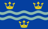
Cambridgeshire


Cambridgeshire (abbreviated Cambs.),[3] is a county in the East of England, bordering Lincolnshire to the north, Norfolk to the north-east, Suffolk to the east, Essex and Hertfordshire to the south, and Bedfordshire and Northamptonshire to the west. The city of Cambridge is the county town. Modern Cambridgeshire was formed in 1974 as an amalgamation of the counties of Cambridgeshire and Isle of Ely and Huntingdon and Peterborough, the former covering the historic county of Cambridgeshire (including the Isle of Ely) and the latter covering the historic county of Huntingdonshire and the Soke of Peterborough, historically part of Northamptonshire. It contains most of the region known as Silicon Fen.
Local government is divided between Cambridgeshire County Council and Peterborough City Council, which, since 1998, forms a separate unitary authority. Under the county council, there are five district councils, Cambridge City Council, South Cambridgeshire District Council, East Cambridgeshire District Council, Huntingdonshire District Council and Fenland District Council.[4]
History
Cambridgeshire is noted as the site of Flag Fen in Fengate, one of the earliest-known Neolithic permanent settlements in the United Kingdom, compared in importance to Balbridie in Aberdeen, Scotland. A great quantity of archaeological finds from the Stone Age, the Bronze Age and the Iron Age were made in East Cambridgeshire. Most items were found in Isleham.
Cambridgeshire was recorded in the Domesday Book as "Grantbridgeshire" (or rather Grentebrigescire) (related to the river Granta).
Covering a large part of East Anglia, Cambridgeshire today is the result of several local government unifications. In 1888 when county councils were introduced, separate councils were set up, following the traditional division of Cambridgeshire, for
- the area in the south around Cambridge, and
- the liberty of the Isle of Ely.
In 1965, these two administrative counties were merged to form Cambridgeshire and the Isle of Ely.[5] Under the Local Government Act 1972 this merged with the county to the west, Huntingdon and Peterborough, which had been formed in 1965, by the merger of Huntingdonshire with the Soke of Peterborough (the latter previously a part of Northamptonshire with its own county council). The resulting county was called simply Cambridgeshire.[6]
Since 1998, the City of Peterborough has been a separately administered area, as a unitary authority. It is associated with Cambridgeshire for ceremonial purposes such as Lieutenancy, and joint functions such as policing and the fire service.[7]
In 2002, the conservation charity Plantlife unofficially designated Cambridgeshire's county flower as the Pasqueflower.
The Cambridgeshire Regiment (or Fen Tigers), the county-based army unit, fought in the Boer War of South Africa, the First World War and Second World War.
Due to the county's flat terrain and proximity to the continent, during the Second World War the military built many airfields here for RAF Bomber Command, RAF Fighter Command, and the allied USAAF. In recognition of this collaboration, the Cambridge American Cemetery and Memorial is located in Madingley. It is the only WWII burial ground in England for American servicemen who died during that event.
Most English counties have nicknames for their people, such as a "Tyke" from Yorkshire and a "Yellowbelly" from Lincolnshire. The traditional nicknames for people from Cambridgeshire are "Cambridgeshire Camel" or "Cambridgeshire Crane", referring to the wildfowl that were once abundant in the fens. The term "Fenners" was often applied to those who come from the flat country to the north of Cambridge. Since the late 20th century, this term is considered to be derogatory and has been discouraged in use.
Original historical documents relating to Cambridgeshire are held by Cambridgeshire Archives and Local Studies.
Geography
- See also Geology of Cambridgeshire
Large areas of the county are extremely low-lying and Holme Fen is notable for being the UK's lowest physical point at 2.75 m (9 ft) below sea level. The highest point is in the village of Great Chishill at 146 m (480 ft) above sea level. Other prominent hills are Little Trees Hill and Wandlebury Hill (both at 74 m (243 ft)) in the Gog Magog Hills, Rivey Hill above Linton, Rowley's Hill and the Madingley Hills.
Green belt
Cambridgeshire contains all its green belt around the city of Cambridge, extending to places such as Waterbeach, Lode, Duxford, Little & Great Abingdon and other communities a few miles away in nearby districts, to afford a protection from the conurbation. It was first drawn up in the 1950s.
Politics
Cambridgeshire contains seven Parliamentary constituencies:
| Constituency | Member of Parliament | |
|---|---|---|
| Cambridge | Daniel Zeichner | |
| Huntingdon | Jonathan Djanogly | |
| North East Cambridgeshire | Stephen Barclay | |
| North West Cambridgeshire | Shailesh Vara | |
| Peterborough | Fiona Onasanya | |
| South Cambridgeshire | Heidi Allen | |
| South East Cambridgeshire | Lucy Frazer | |
Economy
This is a chart of trend of regional gross value added of Cambridgeshire at current basic prices published (pp. 240–253) by Office for National Statistics with figures in millions of English Pounds Sterling.
| Year | Regional Gross Value Added[8] | Agriculture[9] | Industry[10] | Services[11] |
|---|---|---|---|---|
| 1995 | 5,896 | 228 | 1,646 | 4,022 |
| 2000 | 7,996 | 166 | 2,029 | 5,801 |
| 2003 | 10,154 | 207 | 2,195 | 7,752 |
AWG plc is based in Huntingdon. The RAF has several stations in the Huntingdon and St Ives area. RAF Waterbeach, 6 miles north of Cambridge, is a former RAF airfield, now used as an army barracks. RAF Alconbury, 3 miles north of Huntingdon, is being reorganised after a period of obsolescence following the departure of the USAF, to be the focus of RAF/USAFE intelligence operations, with activities at Upwood and Molesworth being transferred there. Most of Cambridgeshire is agricultural. Close to Cambridge is the so-called Silicon Fen area of high-technology (electronics, computing and biotechnology) companies. ARM Limited is based in Cherry Hinton.
Education
Primary and secondary
Cambridgeshire has a completely comprehensive education system with 12 independent schools and over 240 state schools, not including sixth form colleges.
Some of the secondary schools act as Village Colleges, institutions unique to Cambridgeshire. For example, Bottisham Village College.
Tertiary
Cambridgeshire is home to a number of institutes of higher education:
- The University of Cambridge – second-oldest university in the English-speaking world, and regarded as one of the most prestigious academic institutions in the world
- Anglia Ruskin University – has a campus located in Cambridge and a base at Fulbourn
- The Open University – has a regional centre located in Cambridge
- The University Centre Peterborough – operated by Anglia Ruskin University and Peterborough Regional College, located in Peterborough
- The College of West Anglia has a campus at Milton, on the northern outskirts of Cambridge
In addition, Cambridge Regional College and Huntingdonshire Regional College both offer a limited range of higher education courses in conjunction with partner universities.
Settlements

These are the settlements in Cambridgeshire with a town charter, city status or a population over 5,000; for a complete list of settlements see list of places in Cambridgeshire.
- Burwell
- Cambridge
- Chatteris
- Cottenham
- Ely
- Godmanchester
- Huntingdon
- Littleport
- March
- Peterborough (no longer part of the administrative county)
- Ramsey
- Sawston
- Sawtry
- Soham
- St Ives
- St Neots
- Wisbech
- Whittlesey
- Yaxley
See the List of Cambridgeshire settlements by population page for more detail.
The town of Newmarket is surrounded on three sides by Cambridgeshire, being connected by a narrow strip of land to the rest of Suffolk.
Cambridgeshire has seen 32,869 dwellings created from 2002–2013[12] and there are a further 35,360 planned new dwellings between now and 2023.[13]
Climate
Cambridgeshire has a maritime temperate climate which is broadly similar to the rest of the United Kingdom, though it is drier than the UK average due to its low altitude and easterly location, the prevailing southwesterly winds having already deposited moisture on higher ground further west. Average winter temperatures are cooler than the English average, due to Cambridgeshire's inland location and relative nearness to continental Europe, which results in the moderating maritime influence being less strong. Snowfall is slightly more common than in western areas, due to the relative winter coolness and easterly winds bringing occasional snow from the North Sea. In summer temperatures are average or slightly above, due to less cloud cover. It reaches 25 °C (77 °F) on around 10 days each year, and is comparable to parts of Kent and East Anglia.
| Climate data for Cambridge 1971–2000 average | |||||||||||||
|---|---|---|---|---|---|---|---|---|---|---|---|---|---|
| Month | Jan | Feb | Mar | Apr | May | Jun | Jul | Aug | Sep | Oct | Nov | Dec | Year |
| Average high °C (°F) | 7.0 (44.6) |
7.4 (45.3) |
10.2 (50.4) |
12.6 (54.7) |
16.5 (61.7) |
19.4 (66.9) |
22.2 (72) |
22.3 (72.1) |
18.9 (66) |
14.6 (58.3) |
9.9 (49.8) |
7.8 (46) |
14.1 (57.4) |
| Average low °C (°F) | 1.3 (34.3) |
1.1 (34) |
2.9 (37.2) |
4.0 (39.2) |
6.7 (44.1) |
9.8 (49.6) |
12.0 (53.6) |
11.9 (53.4) |
10.1 (50.2) |
7.1 (44.8) |
3.7 (38.7) |
2.3 (36.1) |
6.1 (43) |
| Average rainfall mm (inches) | 45.0 (1.772) |
32.7 (1.287) |
41.5 (1.634) |
43.1 (1.697) |
44.5 (1.752) |
53.8 (2.118) |
38.2 (1.504) |
48.8 (1.921) |
51.0 (2.008) |
53.8 (2.118) |
51.1 (2.012) |
50.0 (1.969) |
553.5 (21.791) |
| Source: Met Office | |||||||||||||
Culture
Sports
Various forms of football have been popular in Cambridgeshire since medieval times at least. In 1579 one match played at Chesterton between townspeople and Cambridge University students ended in a violent brawl that led the Vice-Chancellor to issue a decree forbidding them to play "footeball” outside of college grounds.[14] Despite this and other decrees, football continued to be popular. George Elwes Corrie, Master of Jesus College, observed in 1838, that while walking past a park named Parker's Piece he "saw some forty Gownsmen playing at football. The novelty and liveliness of the scene were amusing!"[15] By 1839, Albert Pell was organising football matches at the university; because each town or school had different rules, students had to devise a compromise set of rules.[16]
At Cambridge University in 1846, H. de Winton and J. C. Thring formed a pioneering football club. Only a few matches were played, but in 1848 interest in football increased and that year the Cambridge rules, the first attempt to codify a form of football were drawn up in Cambridge. The Cambridge rules are generally regarded as the main precursor of Association football.
As a result of its role in the formation of the first football rules, Parker's Piece remains hallowed turf for football fans and historians.[17] In commemoration of the creation of Football; a statue is to be raised in the middle of the park where the game was invented.
Cambridgeshire is also the birthplace of bandy,[18] now an IOC accepted sport.[19] According to documents from 1813, Bury Fen Bandy Club was undefeated for 100 years. A member of the club, Charles Goodman Tebbutt, wrote down the first official rules in 1882.[18] Tebbutt was instrumental in spreading the sport to many countries.[20] Great Britain Bandy Federation is based in Cambridgeshire.[21]
On 6–7 June 2015, the inaugural Tour of Cambridgeshire cycle race took place on closed roads across the county. The event was an official UCI qualification event, and consisted of a Time Trial on the 6th, and a Gran Fondo event on the 7th. The Gran Fondo event was open to the public, and over 6000 riders took part in the 128 km (80 mi) race.
Contemporary art
Cambridge is home to the Kettle's Yard gallery and the artist-run Aid and Abet project space. Nine miles west of Cambridge next to the village of Bourn is Wysing Arts Centre.[22]
Places of interest
| Key | |
| Abbey/Priory/Cathedral | |
| Accessible open space | |
| Amusement/Theme Park | |
| Castle | |
| Country Park | |
| English Heritage | |
| Forestry Commission | |
| Heritage railway | |
| Historic House | |
| Museum (free/not free) | |
| National Trust | |
| Theatre | |
| Zoo | |
- Anglesey Abbey


- Brampton Wood
- Buckden Towers

- Cambridge American Cemetery and Memorial
- Cambridge University Museum of Zoology
- Castor Hanglands NNR
- Cherry Hinton Chalk Pits
- Denny Abbey
- Devil's Dyke
- Down Field Windmill
- Duxford Chapel

- Duxford Airfield
- Elton Hall
- Ely Cathedral
- Fitzwilliam Museum, Cambridge
- Flag Fen
- Fowlmere RSPB reserve
- Gamsey Wood Nature Reserve
- Grafham Water Nature Reserve
- Great Gransden Post Mill
- Hereward Way
- Hinchingbrooke House
- Houghton Mill
- Icknield Way
- Imperial War Museum Duxford
.svg.png)
- Kettle's Yard
- Kimbolton Castle
- King's College, Cambridge
- Lattersey Nature Reserve
- Lode Watermill
- Longthorpe Tower
- Magog Down
- Milton Country Park

- Nene Park
- Nene Valley Railway

- Nene Way
- New Bedford River
- Octavia Hill Birthplace Museum
- Old Bedford River
- Oliver Cromwell's House
- Ouse Valley Way
- Ouse Washes
- Parker's Piece, Cambridge, birthplace of modern football
- Paxton Pits Nature Reserve
- Peckover House & Garden
- Peterborough Cathedral
- Prickwillow Drainage Engine Museum
- Ramsey Abbey
- River Cam
- River Great Ouse
- Round Church, Cambridge
- RSPB Nene Washes
- RSPB Ouse Washes
- Stretham Old Engine
- Three Shires Bridleway
- University of Cambridge Museum of Archaeology and Anthropology
- Wandlebury Country Park
- Wicken Fen
- Wimpole Hall
- Wisbech and March Bramley Line
- WWT Welney
- Wysing Arts Centre
Notable people from Cambridgeshire
See Category:People from Cambridgeshire
See also
- List of Lord Lieutenants of Cambridgeshire
- List of High sheriffs of Cambridgeshire
- Custos Rotulorum of Cambridgeshire – Keepers of the Rolls for Cambridgeshire
- Cambridgeshire (UK Parliament constituency) – Historical list of MPs for Cambridgeshire constituency
- Cambridgeshire Archives and Local Studies
- Cambridgeshire local elections
- Healthcare in Cambridgeshire
- Cambridgeshire Constabulary
- Cambridgeshire Police and Crime Commissioner
Notes
- ↑ "Lord Lieutenant".
- ↑ "High Sheriff - Cambridgeshire Home page". www.highsheriffs.com.
- ↑ Archaically known as the County of Cambridge (EB 1878).
- ↑ "Local government in Cambridgeshire". Cambridgeshire County Council. Retrieved 25 July 2016.
- ↑ The Cambridgeshire and Isle of Ely Order 1964 (SI 1964/366), see Local Government Commission for England (1958 - 1967), Report and Proposals for the East Midlands General Review Area (Report No.3), 31 July 1961 and Report and Proposals for the Lincolnshire and East Anglia General Review Area (Report No.9), 7 May 1965
- ↑ The English Non-metropolitan Districts (Definition) Order 1972 (SI 1972/2039) Part 5: County of Cambridgeshire
- ↑ The Cambridgeshire (City of Peterborough) (Structural, Boundary and Electoral Changes) Order 1996 (SI 1996/1878), see Local Government Commission for England (1992), Final Recommendations for the Future Local Government of Cambridgeshire, October 1994 and Final Recommendations on the Future Local Government of Basildon & Thurrock, Blackburn & Blackpool, Broxtowe, Gedling & Rushcliffe, Dartford & Gravesham, Gillingham & Rochester upon Medway, Exeter, Gloucester, Halton & Warrington, Huntingdonshire & Peterborough, Northampton, Norwich, Spelthorne and the Wrekin, December 1995
- ↑ Components may not sum to totals due to rounding
- ↑ includes hunting and forestry
- ↑ includes energy and construction
- ↑ includes financial intermediation services indirectly measured
- ↑ "Housing Development in Cambridgeshire 2013" (PDF). Archived from the original (PDF) on 24 December 2013. Retrieved 5 February 2016.
- ↑ "Dwelling Commitments in Cambridgeshire" (PDF). Archived from the original (PDF) on 24 December 2013. Retrieved 5 February 2016.
- ↑ Association, The Football. "Sorry. Something's wrong with the pitch. - Cambridgeshire FA". www.cambridgeshirefa.com. Archived from the original on 8 July 2011. Retrieved 2 January 2012.
- ↑ "Archived copy". Archived from the original on 27 October 2006. Retrieved 18 October 2006.
- ↑ Harvey 2005, p. 48
- ↑ Cambridge... the birthplace of football?!, BBC, Cambridgeshire, UK, 2006.
- 1 2 BBC. "A handy Bandy guide..." Retrieved 9 June 2017.
- ↑ "Federation of International Bandy-Olympic". Internationalbandy.com. 12 August 2004. Archived from the original on 19 January 2012. Retrieved 25 September 2010.
- ↑ "Cambridgeshire – History – A handy Bandy guide". BBC. 21 February 2006. Retrieved 25 September 2010.
- ↑ "Members - Federation of International Bandy". www.worldbandy.com.
- ↑ "cultunet". cultunet.com. 3 December 2012. Archived from the original on 29 April 2014. Retrieved 3 February 2013.
References

External links
| Wikimedia Commons has media related to Cambridgeshire. |
- Cambridgeshire County Council
- Cambridgeshire Community Archive Network.
- Images of Cambridgeshire at the English Heritage Archive
- Cambridgeshire at Curlie (based on DMOZ)
- Cambridge Military History Blog
- The Flag Institute: Cambridgeshire
Neighbouring counties | ||||||||||
|---|---|---|---|---|---|---|---|---|---|---|
| ||||||||||
| Unitary authorities | |
|---|---|
| Boroughs or districts | |
| Major settlements | |
| Rivers | |
| Topics |
|