Shoreham-by-Sea
| Shoreham-by-Sea | |
|---|---|
 Shoreham Beach, with the centre of Shoreham top left corner | |
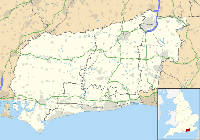 Shoreham-by-Sea Shoreham-by-Sea shown within West Sussex | |
| Area | 3.80 sq mi (9.8 km2) [1] |
| Population | 20,547 2011 Census |
| • Density | 5,407/sq mi (2,088/km2) |
| OS grid reference | TQ220051 |
| • London | 57 miles (92 km) north |
| District | |
| Shire county | |
| Region | |
| Country | England |
| Sovereign state | United Kingdom |
| Post town | SHOREHAM BY SEA |
| Postcode district | BN43 |
| Dialling code | 01273 |
| Police | Sussex |
| Fire | West Sussex |
| Ambulance | South East Coast |
| EU Parliament | South East England |
| UK Parliament | |
Shoreham-by-Sea (often shortened to Shoreham) is a seaside town and port in West Sussex, England.
The town is bordered to its north by the South Downs, to its west by the Adur Valley and to its south by the River Adur and Shoreham Beach on the English Channel. The town lies in the middle of the ribbon of urban development along the English south coast, approximately equidistant from the city of Brighton and Hove to the east and the town of Worthing to the west. Shoreham covers an area of 2,430 acres (980 ha) and has a population of 20,547 (2011 census).
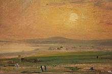
History
Apr2006.jpg)
.jpg)
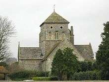
Old Shoreham dates back to pre-Roman times.[2] St Nicolas' Church, inland by the River Adur, is partly Anglo-Saxon[3] The name of the town has an Old English origin.[4] The town and port of New Shoreham was established by the Norman conquerors towards the end of the 11th century.
St Mary de Haura Church (St Mary of the Haven) was built in the decade following 1103 (the Domesday Book was dated 1086), and around this time the town was laid out on a grid pattern that, in essence, survives in the town centre. The church is only half the size of the original – the former nave was ruinous at the time of the civil war although remnants of the original west façade survive in the churchyard to some height.
Muslim scholar Muhammad al-Idrisi, writing c.1153, described Shoreham as "a fine and cultivated city containing buildings and flourishing activity".[5]
The growth of neighbouring Brighton, Hove and Worthing – in particular the arrival of the railway in 1840 – prepared the way for Shoreham's rise as a Victorian sea port, with several shipyards and an active coasting trade. Shoreham Harbour remains in commercial operation to this day.
Southdown Golf Club, Shoreham-by-Sea was founded in 1902, but ceased to operate in the 1940s.[6]
Shoreham Beach
Shoreham Beach, to the south of the town, is a shingle spit deposited over millennia by longshore drift, as an extension to Lancing parish in the west. This blocks the southerly flow of the River Adur which turns east at this point to discharge into the English Channel further along the coast at a point that has varied considerably over time. During the 17th and 18th centuries, the mouth of the river shifted eastwards which restricted trade to the port; by 1810 it was almost opposite Aldrington church. In 1816, work had been completed to fix the position of the river in its present position, flowing into the sea between two piers. Once the harbour mouth was stabilised it was defended by Shoreham Fort which was built in 1857.[7] Converted railway carriages became summer homes around the start of the 20th century, and 'Bungalow Town', as it was then known, became home to the early British film industry. Francis L. Lyndhurst, founded the Sunny South Film Company, which made its first commercial movie on Shoreham Beach in 1912 and built a film studio there.[8][9] Shoreham Beach officially became part of Shoreham-by-Sea in 1910. Much of the housing in the area was cleared for defence reasons during the Second World War and most of what remained after the war is now long gone, having been replaced by modern houses, some of which are extremely expensive, architect designed constructions.[10] The Church of the Good Shepherd, built in 1913, still stands. Along the Adur mud flats adjacent to Shoreham Beach sits (and at high tides floats) a large collection of houseboats made from converted barges, tugs, mine sweepers,[11] Motor Torpedo Boats etc. The seaside shingle bank of Shoreham beach extends further east past the harbour mouth, forming the southern boundary of the commercial harbour in Southwick, Portslade and Hove. The Monarch's Way long-distance footpath, commemorating the flight of Charles II to France after the Battle of Worcester, follows the beach westwards from Hove past Portslade and Southwick, terminating by the harbour mouth's east breakwater.
Landscape and wildlife
Transversed by the River Adur and with the downs and the sea nearby the area supports a diverse wildlife flora and fauna. The mudflats support wading birds and gulls, including the ringed plover which attempts to breed on the coastal shingle. The pied wagtail is common in the town in the winter months. Insects include dragonflies over the flood plains of the river. The south and west facing downs attract at least 33 species of butterfly including a nationally important population of the chalkhill blue butterfly on Mill Hill.[12] The underlying rock is chalk on the downs, with alluvium in the old river channels. The Adur district has a variety of habitats in a small area, including natural chalk downs and butterfly meadows, freshwater and reed beds, salt marsh and estuary, brackish water lagoons, woodland, shingle seashore, chalk platform undersea and large expanses of sand.
The town is the end-point of the Monarch's Way, a 615-mile (990 km) Long-distance footpath, based on the escape route taken by King Charles II in 1651 after being defeated by Cromwell in the Battle of Worcester.[13]
Transport
Shoreham Airport lies to the west of the main town and has been in private ownership since 2006. It is the UK's oldest licensed airport still in operation and has a 1936 Grade II*-listed Art Deco terminal building. The terminal has been a filming location for an episode of Agatha Christie's Poirot, "Lord Edgware Dies",[14] a Crimewatch-type reconstruction (2000, ITV Meridian), BBC Tenko series episode, The Da Vinci Code film scenes and the film Woman in Gold.[15]
The town is served by Shoreham-by-Sea railway station, located on the West Coastway Line.
Local bus services are provided by the Brighton & Hove bus company, Stagecoach South and a local town route is operated by Compass Travel.
Shoreham Tollbridge crosses the River Adur in the west of the town. This bridge is a Grade II* listed building and was the last Sussex toll bridge in use. The bridge was part of the A27 road until it was closed to traffic in 1968. The structure is now too weak to carry vehicles and underwent extensive restoration, then was ceremonially re-opened for pedestrians on 23 October 2008, by Prince Andrew, Duke of York.[16] Adur Ferry Bridge in the south of the town (replacing the old Shoreham footbridge) crosses the River Adur to Shoreham Beach. It was opened to the public by HRH The Duke of Gloucester on 13 November 2013.[17]
Sport and leisure
Shoreham-by-Sea has a non-League football club, Shoreham F.C., who play at Middle Road stadium with a 2000 capacity and a rugby union club, Shoreham RFC, who play at Buckingham Park.
The town centre hosts monthly farmers' and artisans' markets in East Street on the second and fourth Saturday of the month, respectively.
Airshow crash
Most years, in late summer, Shoreham Airport hosts the Royal Air Forces Association (RAFA) Shoreham Airshow. On 22 August 2015, a Hawker Hunter jet fighter taking part in the airshow crashed onto the busy A27 road just outside the airport, killing eleven people and injuring several others.[18][19]
Notable people
- Writer Brian Behan lived on a boat moored in the town in the late 1960s.
- Playwright Charles Bennett was born in Shoreham-by-sea in 1899.
- Mark Benson, former England cricketer and now a cricket umpire, was born in Shoreham-by-Sea in 1958.
- Havergal Brian, English composer, moved from London to Shoreham-by-Sea in 1958. He wrote twenty symphonies there over the next ten years.
- Marcus Butler, a YouTuber who has over four million subscribers.
- Paul Chaloner, s shoutcaster in the eSports community, was born in Shoreham in 1971.
- Raymond O. Faulkner, philologist and compiler of the standard hieroglyphic dictionary, was born in Shoreham in 1894.
- Vanessa Howard, a horror and exploitation film actress, was born in Shoreham-by-Sea in 1948.
- Mel Hopkins, a former footballer with Tottenham Hotspur, Brighton and Hove Albion and Wales retired to Shoreham Beach.
- Artist Alison Lapper and her son Parys, who have appeared on the TV series Child of Our Time, live in Shoreham.
- Bert Longstaff, professional footballer who played for Shoreham F.C. and made over 400 appearances for Brighton & Hove Albion.[20].
- Broadcaster Mike Mendoza, lives on Shoreham Beach.
- Comedian Max Miller, lived in Kingston Lane for a period of time as indicated by a plaque on the building called Ashcroft.
- Fiona Mont, who was dubbed "Britain's most wanted woman" in 2000. It was claimed she was smuggled out of the country in a light aircraft from Shoreham Airport in 1999.[14]
- Kjetil Mørland of the band Absent Elk lives in Shoreham-by-Sea.
- Prof Hugh Nicol, bacteriologist and agricultural chemist.
- Cecil Pashley, local aviation pioneer.
- Phyllis Pearsall, painter, writer and creator of the A to Z map of London lived on Shoreham Beach before her death in 1996.
- Harry Ricardo founded Ricardo Consulting Engineers in Shoreham-by-Sea, where it still has its main offices.[21]
- Captain Henry Roberts (1725–1796) was a native of Shoreham, where he raised his six children. He sailed with Captain James Cook on the second and third voyages and acted as cartographer.
- David Ryall, actor, was born in the town in 1935.
- Leo Sayer, British singer and recording artist, was born in 1948 in Shoreham-by-Sea.
- Hubert Scott-Paine, (the boss of R. J. Mitchell at Supermarine, who designed the Spitfire), was born in 1890 in Shoreham and had a yacht in Stowe's Yard, before moving to Southampton.[22]
- Gemma Spofforth, Olympic swimmer, was born in Shoreham-By-Sea.
- Michael Standing, a professional footballer, was born in Shoreham-by-Sea in 1981.
- Marcus Tudgay, footballer, was born in Shoreham-by-Sea.
- Darren Tulett, football presenter on French television[23]
- Judy Upton, playwright, was born in Shoreham-by-Sea in 1966 and has written several plays associated with Brighton Beach.
- Nicholas van Hoogstraten, British property tycoon, was born in Shoreham-by-Sea in 1946 and was educated at a local Jesuit school.
- Ted Walker, writer, was married in Shoreham. Many works describe the Shoreham coastline and Adur estuary.
- Nathaniel Woodard, the founder of Lancing College and the Woodard Schools, became the curate-in-charge of St. Mary's, New Shoreham in 1846 and his experience there inspired him to start creating schools to improve the level of middle class education. He also greatly developed the use of choral music in the Church.
- Amon Henry Wilds, English architect, moved to Old Shoreham in 1857.
Twin towns
Shoreham (along with the other urban districts of Adur) is twinned with
See also
References
- ↑ "Census 2011: Coastal Communities Data". Office of National Statistics. Retrieved 28 September 2015.
- ↑ "'Old and New Shoreham', A History of the County of Sussex: Volume 6 Part 1: Bramber Rape (Southern Part) pp. 138-149". 1980. Retrieved 27 January 2011.
- ↑ "St Nicolas, Shoreham-by-Sea – West Sussex | Diocese of Chichester". aChurchNearYou.com. Retrieved 26 April 2013.
- ↑ "Shoreham: Toponymy". glaucus.org.uk.
- ↑ http://www.cartographyunchained.com/pdfs/cgid1_pdf.pdf
- ↑ “Southdown Golf Club” Archived 13 March 2016 at the Wayback Machine., “Golf’s Missing Links”.
- ↑ Baines, Gary. "Shoreham Fort – History". www.shorehamfort.co.uk. Friends of Shoreham Fort. Retrieved 7 November 2013.
- ↑ Archived 20 September 2010 at the Wayback Machine.
- ↑
- ↑ BBC – WW2 People's War: Evacuation of Shoreham Beach Archived 18 November 2006 at the Wayback Machine.
- ↑ "Main Page". shorehamhouseboats.co.uk.
- ↑ "Mill Hill 2007". glaucus.org.uk.
- ↑ "Monarch's Way". Long Distance Walkers Association. Retrieved 15 August 2018.
- 1 2 "Fiona Mont GPS 02 "Come fly with me"".
- ↑ "Titles with locations which include Shoreham Airport, Shoreham-by-Sea, West Sussex, England, UK". IMDB. Retrieved 20 September 2013.
- ↑ "Adur District Council : The Old Toll Bridge". Archived from the original on 7 February 2012. Retrieved 28 September 2013.
- ↑ "The Adur Ferry Bridge - Shoreham footbridge". Adur & Worthing Councils. Retrieved 28 November 2016.
- ↑ "Shoreham plane crash: Seven dead after Hawker Hunter hits cars". BBC News. 22 August 2015. Retrieved 22 August 2015.
- ↑ "Air show jet crashes into cars on dual carriageway after loop-the-loop fail". Western Daily Press. Local World. 22 August 2015. Archived from the original on 29 August 2015. Retrieved 22 August 2015.
Around seven people were initially feared dead after the 1950s plane collided with cars in Shoreham-by-Sea, West Sussex at around 1.20pm.
- ↑ "Bert Longstaff – Shoreham's First Professional Footballer". May 2010. Archived from the original on 22 February 2014. Retrieved 26 April 2013.
- ↑ Mendoza, Mike. "Jobs to follow as Ricardo wins planning bid". Shoreham Herald. Retrieved 16 July 2014.
- ↑ Rance, Adrian (1989). Fast Boats and Flying Boats. Southampton, England: Ensign Publications. p. 10. ISBN 1-85455-026-8.
- ↑ Honeyball, Lee. "Brits abroad: Darren Tulett". The Observer. Retrieved 4 December 2013.
External links
| Wikimedia Commons has media related to Shoreham-by-Sea. |