White Peak
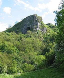
The White Peak is the lower, central and southern part of the Peak District in England, enclosed by the Dark Peak in the west, north and east.[1] However, in contrast to the Dark Peak, the underlying limestone is not capped by impervious millstone grit, so caves and dry river valleys are common features of the area. The soils are poor and calcareous, creating grazing land for both sheep and cattle.
Broadly speaking, the White Peak covers the Derbyshire Peaks from the Hope Valley southwards, and the Staffordshire Peaks[2] north of the Churnet Valley. The White Peak is one of 159 national character areas defined by Natural England; their defined area covers an area of 52,860 hectares (204 sq mi) and includes the area approximately bounded by Ashbourne, Buxton, Castleton, Matlock and Wirksworth.[3]
The largest towns in the White Peak are outside the area of the Peak District national park. These towns include Matlock and Buxton, while Bakewell and most of the villages in the park are in the White Peak area. Around the areas of Tideswell, Flagg, Chelmorton and Youlgrave, long thin fields created by the enclosure of medieval strip fields can be seen. The region is rich in footpaths, bridleways and green tracks that give access to the area. Longer-distance routes include the Limestone Way and the Pennine Bridleway, and former railway trackbeds such as the Monsal Trail, the High Peak Trail, the Tissington Trail and the Manifold Way.
The area is of interest to geologists, since much of the underlying strata have been exposed by extensive quarrying, and can be seen in the old railway cuttings along the Monsal Trail through Monsal Dale and Millers Dale.
References
- ↑ "Accommodation in Derbyshire and the Peak National Park". Discover Derbyshire and the Peak District. Discover Derbyshire and the Peak District. Retrieved 12 August 2018.
- ↑ "The White Peak". peakdistrictonline.co.uk. Retrieved 4 April 2013.
- ↑ "NCA 52: White Peak Key Facts & Data" (PDF). Natural England. Retrieved 4 April 2013.
- Bull, John. The Peak District: A Cultural History (Signal Books, 2012). Explores the culture and history of the two landscapes of the Dark and White Peak.
External links
- More information about the White Peak.