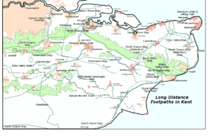
North Downs Way
| North Downs Way | |
|---|---|
 The North Downs Way near Hollingbourne | |
| Length | 153 mi (246 km)[1] |
| Location | South Eastern England, United Kingdom |
| Designation | UK National Trail |
| Trailheads |
Farnham, Surrey Dover, Kent |
| Use | Hiking |
| Elevation | |
| Highest point | Botley Hill, 885 ft (270 m) |
| Hiking details | |
| Season | All year |
The North Downs Way National Trail is a long-distance path in southern England, opened in 1978.[2] It runs from Farnham to Dover, past Guildford, Dorking, Merstham, Otford and Rochester, along the Surrey Hills Area of Outstanding Natural Beauty (AONB) and Kent Downs AONB.
Planning for a new Long Distance Path, as they were classified in 1949, began in Kent in 1950. After an extensive survey, it was agreed that a route on "a line which offers the best scenic qualities for the walker" along the ridge of the North Downs, rather than the Pilgrim's Way (which even in the 1960s was predominantly metalled road), was preferred. Working alongside Surrey County Council, plans were eventually submitted in 1966.[3]
The North Downs Way was officially designated by then Minister of Housing and Local Government, Anthony Greenwood, on 14 July 1969, and opened in parts shortly afterwards, becoming fully open in 1978. At that time, it was 141 miles in length, 36 miles of which were newly created Public Rights of Way.[3]
East of Boughton Lees, the path splits in two, the northern section running via Canterbury and the southern via Wye; at this stage the path crosses the Stour Valley Walk and passes the Wye Crown. The two sections of the path reunite at Dover. The northern route is 131 miles (211 km) long, and the southern route 125 miles (201 km), the current length of the North Downs Way being 153 miles (246 km). The official guide to the trail divides the North Downs Way into fifteen sections.[4]
| Section | Start point | Finish point | Distance km | Ascent metres | Descent metres |
|---|---|---|---|---|---|
| 1 | Farnham | Guildford | 17.7 | 203 | 233 |
| 2 | Guildford | Westhumble | 21.0 | 293 | 288 |
| 3 | Westhumble | Merstham | 16.0 | 442 | 384 |
| 4 | Merstham | Oxted | 12.8 | 311 | 249 |
| 5 | Oxted | Otford | 18.9 | 524 | 587 |
| 6 | Otford | Cuxton | 24.1 | 524 | 587 |
| 7 | Cuxton | Detling | 20.1 | 404 | 299 |
| 8 | Detling | Lenham | 14.9 | 320 | 281 |
| 9 | Lenham | Wye | 17.9 | 128 | 247 |
| 10 | Wye | Etchinghill | 18.1 | 396 | 303 |
| 11 | Etchinghill | Dover | 19.3 | 406 | 506 |
| 12 | Broughton Lees | Chilham | 9.5 | 156 | 171 |
| 13 | Chilham | Canterbury | 11.6 | 187 | 215 |
| 14 | Canterbury | Shepherdswell | 16.7 | 248 | 158 |
| 15 | Shepherdswell | Dover | 13.7 | 152 | 268 |
The pathway is mixed-category in that it varies throughout length from footpath (around 48 percent) status to bridleway, byway and road. Some 19 percent of the Way follows roads, though 75 percent of those are minor lanes.[1]
The path (east of Boughton Lees, the southern section) runs along the ridge of the North Downs hills, and follows parts of the Pilgrims' Way.
As the pathway runs through the downland, the trails and surrounding countryside are characterised by chalk-based soil and calcareous grassland with broadleaf woodland on the upper slopes and livestock grazing on the lower slopes and clay soil and crop agriculture predominant in the valleys.
See also
| Wikimedia Commons has media related to North Downs Way. |
See also
References
- 1 2 National Trails - Facts and Figures about the trail
- ↑ Drewett, J (1985). "Chapter 1: Landscape and Countryside". Surrey. Shire County Guides (2nd ed.). Princes Risborough: Shire Publications. pp. 9–10. ISBN 978-0-7478-0051-4.
- 1 2 County Council, Kent (July 1969). Archive files (CC/C-PL/19/16/1). Maidstone: Kent County Council.
- ↑ Saunders, Colin (Aurum Press). North Downs Way. London. ISBN 9781781310618. Check date values in:
|year=(help)