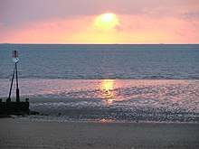
The Wash
| Site of Special Scientific Interest | |
 | |
| Area of Search |
Lincolnshire Norfolk |
|---|---|
| Grid reference | TF 537 402[1] |
| Interest | Biological |
| Area | 62,045.6 hectares (153,318 acres)[1] |
| Notification | 1984[1] |
| Location map | Magic Map |
| Designations | |
|---|---|
| Official name | The Wash |
| Designated | 30 March 1988 |
| Reference no. | 395[2] |
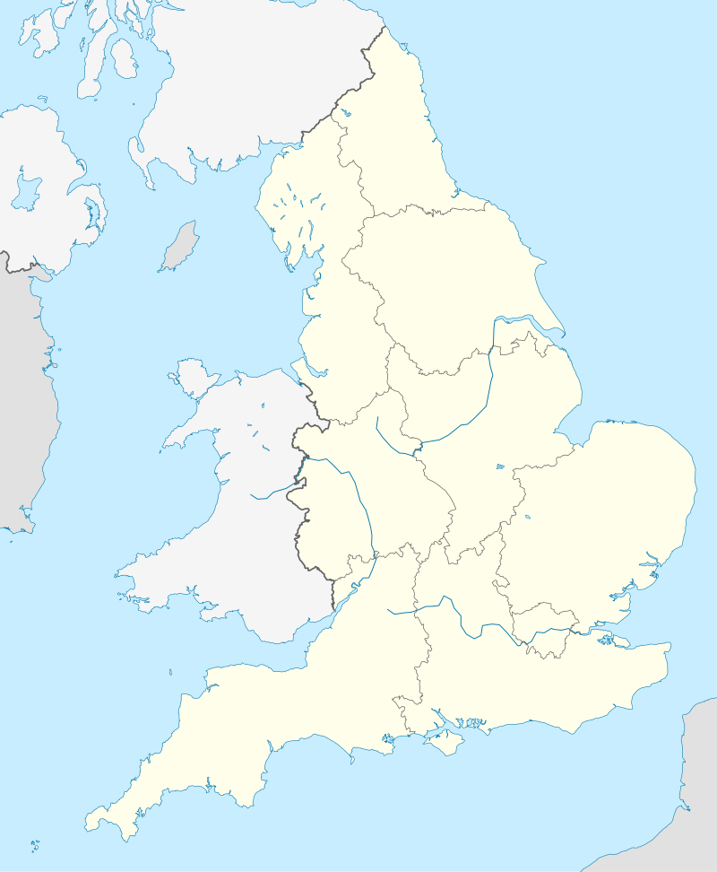
The Wash is a largely rectangular bay and estuary at the north-west corner of East Anglia on the East coast of England, where Norfolk meets Lincolnshire. One of the broadest estuaries in the United Kingdom, it is fed by the rivers Witham, Welland, Nene and Great Ouse. It is a 62,046-hectare (153,320-acre) biological Site of Special Scientific Interest.[1][3] It is also a Nature Conservation Review site, Grade I,[4] a National Nature Reserve,[5] a Ramsar site,[6] a Special Area of Conservation[7] and a Special Protection Area.[8] It is in the Norfolk Coast Area of Outstanding Natural Beauty[9] and part of it is the Snettisham Royal Society for the Protection of Birds nature reserve.[10]
Geography
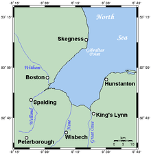
The Wash is a large indentation in the coastline of Eastern England that separates the curved coast of East Anglia from Lincolnshire. It is a large bay with three roughly straight sides meeting at right angles, each about 15 miles (25 km) in length. The eastern coast of the Wash is entirely within Norfolk, and extends from a point a little north of Hunstanton in the north to the mouth of the River Great Ouse at King's Lynn in the south. The opposing coast, which is roughly parallel to the east coast, runs from Gibraltar Point to the mouth of the River Welland, all within Lincolnshire. The southern coast runs roughly north-west to south-east, connecting these two river mouths and is punctuated by the mouth of a third river, the River Nene.
Inland from the Wash the land is flat, low-lying and often marshy: these are the Fens of Lincolnshire, Cambridgeshire and Norfolk.
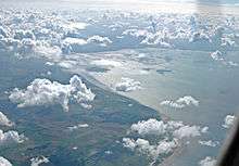
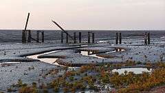
Owing to deposits of sediment and land reclamation, the coastline of the Wash has altered markedly within historical times; several towns once on the coast of the Wash (notably King's Lynn) are now some distance inland. Much of the Wash itself is very shallow, with several large sandbanks, such as Breast Sand, Bulldog Sand, Roger Sand and Old South Sand, which are exposed at low tide, especially along the south coast. For this reason, navigation in the Wash can be hazardous.[11]
Two commercial shipping lane channels lead inland from The Wash, the River Nene leading to Sutton Bridge Docks in Lincolnshire and further inland to the Port of Wisbech in Cambridgeshire, and the River Great Ouse leading to King's Lynn Docks in Norfolk. Both shipping lanes have their own maritime pilot stations to guide and navigate incoming and outgoing cargo ships in The Wash.
A re-survey of the coastline of The Wash carried out by The Ordnance Survey in 2011 revealed an estimated additional 3,000 acres (12 km2) on the coastline of The Wash had been created by accretion since the previous surveys carried out between 1960 and 1980.
Water temperature
The Wash varies enormously in water temperature throughout the year. Winter temperatures are brought near freezing from the cold North Sea flows. Summer water temperatures can reach 20–23 °C (68–73 °F) after prolonged high ambient air temperature and sun. This effect, which typically happens in the shallow areas around beaches, and often only in pockets of water, is exaggerated by the large sheltered tidal reach.
Wash River
At the end of the latest glaciation, and while the sea level remained lower than it is today, the rivers Witham, Welland, Glen, Nene and Great Ouse joined into a large river.
The deep valley of the Wash was formed, not by the interglacial river, but by ice of the Wolstonian and Devensian stages flowing southwards up the slope represented by the modern coast and forming tunnel valleys of which the Silver Pit is one of many. It was this process which gave the Silver Pit its depth and narrowness. When the tunnel valley was free of ice and seawater, it was occupied by the river. This kept it free of sediment, unlike most of the tunnel valleys. Since the sea flooded it, the valley seems to have been kept open by tidal action. During the Ipswichian Stage, though the Wash River probably flowed by way of the site of the Silver Pit, the tunnel valley will not have been formed at this stage as its alignment seems inconsistent.
Wildlife
The Wash is made up of very extensive salt marshes, major intertidal banks of sand and mud, shallow waters and deep channels. The seawall at Freiston has been breached in three places to increase the saltmarsh area, to provide an extra habitat for birds, particularly waders, and also as a natural flood prevention measure. The extensive creeks in the salt marsh, and the vegetation that grows there, helps dissipate wave energy thus improving the protection afforded to land behind the saltmarsh. This last aspect is an example of the recently developing exploration of the possibilities of sustainable coastal management by adopting soft engineering techniques. The same scheme includes new brackish lagoon habitat.
On the eastern side of the Wash, one finds low chalk cliffs with their famous stratum of red chalk, at Hunstanton, and gravel pits (lagoons) at Snettisham RSPB reserve, which are an important roost for waders at high tide. This SPA borders onto the North Norfolk Coast Special Protection Area.
To the north-west, the Wash extends to Gibraltar Point, another Special Protection Area.
The partially confined nature of the Wash habitats, combined with the ample tidal flows, allows shellfish to breed, especially shrimp, cockles and mussels. Some water birds such as oystercatchers feed on shellfish. It is also an important breeding area for common tern, and a feeding area for marsh harriers. Migrating birds, such as geese, duck and wading birds, come to the Wash in huge numbers to spend the winter, with an average total of around 400,000 birds present at any one time.[12] It has been estimated that about two million birds a year use the Wash for feeding and roosting during their annual migrations.
The Wash is recognised as being internationally important for 17 species of bird. These include pink-footed goose, dark-bellied brent goose, shelduck, pintail, oystercatcher, ringed plover, grey plover, golden plover, lapwing, knot, sanderling, dunlin, black-tailed godwit, bar-tailed godwit, curlew, redshank and turnstone.[12]
History
In Roman Britain, embankments were built around the Wash's margins to protect agricultural land from flooding. However, they fell into disrepair after the Roman withdrawal in the year 407.
Before the 12th century, when drainage and embankment efforts led by monks began to separate the land from the estuarine mudflats, the Wash was the tidal part of The Fens that extended as far as Cambridge and Peterborough.
From 865 to sometime around 1066, the Wash was used by the Vikings as a major route to invade East Anglia and Middle England, with Danes establishing themselves in Cambridge in 875.
The local people put up fierce resistance against the Normans for some time after the 1066 Conquest.
Documents before the 16th century referred to the Wash as Metaris Æstuarium ("The Reaping/Mowing/Cutting-Off Estuary"), the name given to it by Ptolemy in Roman times; it is still in occasional use. In the mid-16th century, when large-scale drainage and coastal reclamation works, led by Dutch engineers, began in and around the Wash, documents began to refer to "Waashe" or "Wysche" but only for the tidal parts of the rivers Welland and Nene. During the 17th century, however, "The Washes" came to describe "a very large arme" of the "German Ocean" (the North Sea).
Drainage and reclamation works around the Wash continued until the 1970s, with large areas of salt marsh progressively enclosed by banks and converted to agricultural land so that the Wash is now surrounded by artificial sea defences on all three landward sides.
In the 1970s, two large circular banks were built in the Terrington Marsh area of the Wash, as part of an abortive attempt to turn the entire estuary into a fresh water reservoir. The plan failed, not least because the banks were built using mud dredged from the salt marsh, which then salinated stored fresh water.
Hanse league
From 13th century the market town and seaport of Bishop's Lynn became the first member trading depot (kontor) of the Hanseatic League of ports in the Kingdom of England. During the 14th century, Bishop’s Lynn ranked as the most important port in England, when sea trade with Europe was dominated by the Hanseatic League. The town still retains two former medieval Hanseatic League warehouses — Hanse House built in 1475 and Marriott's Warehouse.
King John and his jewels
King John of England is said to have lost some of his jewels at the Wash in 1216.[13] According to contemporary reports, John travelled from Spalding, Lincolnshire, to Bishop's Lynn, Norfolk, but he was taken ill and decided to return. While he took the longer route by way of Wisbech, he sent his baggage train along the causeway and ford across the mouth of the Wellstream. This route was usable only at low tide; the horse-drawn wagons moved too slowly for the incoming tide, and many were lost.[14] However, scholars cannot agree on whether the king's jewels were actually inside the baggage train,[15] and there is evidence that his regalia were intact after the journey.[16]
The location of the accident is supposed to be somewhere near Sutton Bridge, on the River Nene. The name of the river changed as a result of redirection of the Great Ouse in the 17th century, and Bishop's Lynn became King's Lynn as a result of King Henry VIII's rearrangement of the Church of England.
There is also a suspicion that John left his jewels in Lynn as security for a loan and arranged for their "loss". That looks likely to be apocryphal. However that may be, he stayed the following night, 12–13 October 1216, at Swineshead Abbey, moved on to Newark-on-Trent and died of his illness on 19 October.[17]
Air weapons training range
A Ministry of Defence weapons Range Danger Area is also located along a small region of The Wash coastline, reserved for Royal Air Force, Army Air Corps and NATO-allied bombing and air weapons training—RAF Holbeach, active since 1926, was historically originally part of the former RAF Sutton Bridge station. Another air weapons training range located on The Wash—RAF Wainfleet, operating since 1938, was decommissioned in 2010.
Local traditions
Sailing from out of the South Lincolnshire Fens into the Wash (especially with respect to shell-fishing) is traditionally known locally as "going down below". Although still used today, the origin of the phrase is unknown and it is generally an oral tradition without documentary evidence for it.[18]
Landmark
St Botolph's Church of the Parish of Boston (nicknamed the Boston Stump) is a Lincolnshire landmark that on clear days can be seen from the Norfolk side of the Wash. The Outer Trial Bank, a remnant of a 1970s government experiment, lies approximately 2 miles (3.2 km) off the Lincolnshire coast near the River Nene.
Proposed racetrack
In 1934 a proposal was made with the support of Malcolm Campbell, the famous racing driver and world speed record holder, to build a 15-mile-long (24 km) racetrack on reclaimed land from Boston to Gibraltar Point, near Skegness. The race track would have also been used as a road to the resort of Skegness when there was no racing. There was also to be a long lake for boat racing inside the track loop. In the financial climate of the 1930s, amid the Great Depression, the project did not proceed.
References
- 1 2 3 4 "Designated Sites View: The Wash". Sites of Special Scientific Interest. Natural England. Retrieved 22 June 2018.
- ↑ "The Wash". Ramsar Sites Information Service. Retrieved 25 April 2018.
- ↑ "Map of The Wash". Sites of Special Scientific Interest. Natural England. Retrieved 22 June 2018.
- ↑ Ratcliffe, Derek, ed. (1977). A Nature Conservation Review. 2. Cambridge, UK: Cambridge University Press. p. 11. ISBN 0521 21403 3.
- ↑ "Designated Sites View: The Wash". National Nature Reserves. Natural England. Retrieved 2 June 2018.
- ↑ "Designated Sites View: The Wash". Ramsar Site. Natural England. Retrieved 2 June 2018.
- ↑ "Designated Sites View: The Wash and North Norfolk Coast". Special Areas of Conservation. Natural England. Retrieved 1 June 2018.
- ↑ "Designated Sites View: The Wash". Special Protection Areas. Natural England. Retrieved 2 June 2018.
- ↑ "Norfolk Coast AONB Management Plan 2014-19: Other Conservation Designations within the AONB" (PDF). Norfolk Coast AONB. Retrieved 25 May 2018.
- ↑ "Snettisham". Royal Society for the Protection of Birds. Retrieved 2 June 2018.
- ↑ See assembled navigational guidance
- 1 2 Waterbirds in the UK 2004/05: the wetland bird survey. Banks, Collier, Austin, Hearn and Musgrove. ISBN 1-904870-77-5
- ↑ A. L. Poole (1955). Domesday Book to Magna Carta, 1087-1216. Oxford History of England. p. 485. ISBN 0-19-821707-2.
- ↑ Neil Walker; Thomas Craddock (1849). The History of Wisbech and the Fens, by N. Walker and T. Craddock. pp. 211–212.
- ↑ John Steane (2003). The Archaeology of the Medieval English Monarchy. Routledge. p. 33. ISBN 978-1-134-64159-8.
- ↑ Edward Francis Twining (1960). A History of the Crown Jewels of Europe. B. T. Batsford. p. 114.
- ↑ E. S. Kirkland (2008). A Short History of England for Young People. Lightning Source Incorporated. p. 89. ISBN 978-1-4437-7621-9.
- ↑ "When barges worked up the River Welland" (PDF). Lincolnshire Free Press. 9 February 1993. Retrieved 8 January 2018.
Further reading
- Cook, J. & Ashton, N. High Lodge, Mildenhall in Current Archaeology No. 123 (1991)
- Waters, Richard (2014) [2003]. The Lost Treasure of King John: The Greatest Mystery of the Fens (3rd ed.). Lincoln: Tucann. ISBN 978-1-907516-33-7.
- West, R. G. & Donner, J. J. The Glaciation of East Anglia and the Midlands in Quarterly Journal of the Geological Society of London vol.112 (1955)
External links
| Wikimedia Commons has media related to The Wash. |