Chattanooga–Cleveland–Dalton, TN–GA–AL Combined Statistical Area
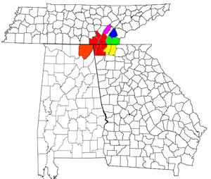
Location of the Chattanooga–Cleveland–Dalton CSA and its components:
Chattanooga Metropolitan Statistical Area
Cleveland Metropolitan Statistical Area
Dalton Metropolitan Statistical Area
Athens Micropolitan Statistical Area
Dayton Micropolitan Statistical Area
Scottsboro Micropolitan Statistical Area
The Chattanooga–Cleveland–Dalton, TN–GA–AL Combined Statistical Area covers a total of thirteen counties – seven in southeast Tennessee, five in northwest Georgia, and one in northeast Alabama. The combined statistical area consists of three metropolitan statistical areas – Chattanooga, Cleveland, and Dalton – as well as the Athens, Dayton, and Scottsboro micropolitan statistical areas. At the 2010 census, the CSA had a population of 923,460.[1]
Counties
- Bradley County, Tennessee
- Catoosa County, Georgia
- Dade County, Georgia
- Hamilton County, Tennessee
- Jackson County, Alabama
- Marion County, Tennessee
- McMinn County, Tennessee
- Murray County, Georgia
- Polk County, Tennessee
- Rhea County, Tennessee
- Sequatchie County, Tennessee
- Walker County, Georgia
- Whitfield County, Georgia
Communities
Places with more than 150,000 inhabitants
- Chattanooga, Tennessee (principal city)
Places with 20,000 to 50,000 inhabitants
- Cleveland, Tennessee (principal city)
- Dalton, Georgia (principal city)
- East Ridge, Tennessee
Places with 10,000 to 20,000 inhabitants
Places with 5,000 to 10,000 inhabitants
Places with 1,000 to 5,000 inhabitants
- Apison, Tennessee (CDP)
- Benton, Tennessee
- Bridgeport, Alabama
- Chattanooga Valley, Georgia (CDP)
- Chatsworth, Georgia
- Chickamauga, Georgia
- Dunlap, Tennessee
- East Cleveland, Tennessee (CDP)
- Englewood, Tennessee
- Etowah, Tennessee
- Fairmount, Tennessee (CDP)
- Falling Water, Tennessee (CDP)
- Graysville, Tennessee
- Hopewell, Tennessee (CDP)
- Hollywood, Alabama
- Indian Springs, Georgia (CDP)
- Jasper, Tennessee
- Kimball, Tennessee
- Lakesite, Tennessee
- Lakeview, Georgia (CDP)
- Lone Oak, Tennessee (CDP)
- Lookout Mountain, Georgia
- Lookout Mountain, Tennessee
- Monteagle, Tennessee (partial)
- Mowbray Mountain, Tennessee (CDP)
- New Hope, Tennessee
- Powells Crossroads, Tennessee
- Ringgold, Georgia
- Rossville, Georgia
- Sale Creek, Tennessee (CDP)
- South Pittsburg, Tennessee
- Spring City, Tennessee
- Stevenson, Alabama
- Trenton, Georgia
- Tunnel Hill, Georgia
- Varnell, Georgia
- Walden, Tennessee
- Whitwell, Tennessee
- Wildwood Lake, Tennessee (CDP)
Places with less than 1,000 inhabitants
- Calhoun, Tennessee
- Charleston, Tennessee
- Cohutta, Georgia
- Copperhill, Tennessee
- Ducktown, Tennessee
- Dutton, Alabama
- Eton, Georgia
- Flat Top Mountain, Tennessee (CDP)
- Hytop, Alabama
- Langston, Alabama
- Niota, Tennessee
- Ooltewah, Tennessee (CDP)
- Orme, Tennessee
- Paint Rock, Alabama
- Pisgah, Alabama
- Pleasant Groves, Alabama
- Riceville, Tennessee (CDP)
- Ridgeside, Tennessee
- Section, Alabama
- Skyline, Alabama
- Woodville, Alabama
Other unincorporated places
- Bakewell, Tennessee
- Birchwood, Tennessee
- Carters, Georgia
- Cisco, Georgia
- Crandall, Georgia
- Delano, Tennessee
- Dennis, Georgia
- East Brainerd, Tennessee
- Farner, Tennessee
- Georgetown, Tennessee (partial)
- Hixson, Tennessee
- Kensington, Georgia
- McDonald, Tennessee
- Ocoee, Tennessee
- Old Fort, Tennessee
- Reliance, Tennessee
- Rocky Face, Georgia
- Rising Fawn, Georgia
- Ten Mile, Tennessee
- Tennga, Georgia
- Tilton, Georgia
- Turtletown, Tennessee
- Wildwood, Georgia
See also
References
- ↑ American FactFinder. U.S. Census Bureau. February 4, 2011.


This article is issued from
Wikipedia.
The text is licensed under Creative Commons - Attribution - Sharealike.
Additional terms may apply for the media files.