Paulding County, Georgia
| Paulding County, Georgia | |
|---|---|
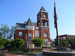 The Old Paulding County Courthouse in Dallas | |
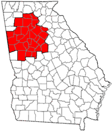
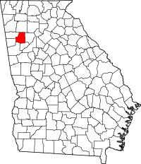 Location in the U.S. state of Georgia | |
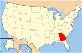 Georgia's location in the U.S. | |
| Founded | December 3, 1832 |
| Named for | John Paulding |
| Seat | Dallas |
| Largest city | Dallas |
| Area | |
| • Total | 314 sq mi (813 km2) |
| • Land | 312 sq mi (808 km2) |
| • Water | 2.1 sq mi (5 km2), 0.7% |
| Population | |
| • (2010) | 142,324 |
| • Density | 453.26/sq mi (175.00/km2) |
| Congressional district | 14th |
| Time zone | Eastern: UTC−5/−4 |
| Website |
www |
Paulding County is a county located in the northwestern part of the U.S. state of Georgia. The estimated 2017 population is 159,445. It is a suburban Atlanta county and a part of "Metro" Atlanta.[1] The county seat is Dallas.[2]
Paulding County is included in the Atlanta-Sandy Springs-Roswell, GA Metropolitan Statistical Area. It is in Georgia's 14th congressional district.
The Paulding County Courthouse, in Dallas, is listed on the National Register of Historic Places.
History
Paulding County was created from Cherokee County by an act of the Georgia General Assembly on December 3, 1832. In 1851, a portion of Paulding County was used to help create Polk County. Other portions of Paulding County were annexed to neighboring counties (Campbell, Carroll, Cobb, Douglas, Haralson, and Polk) between 1832 and 1874. Between 1850 and 1874, Paulding County was expanded through annexation of parts of Carroll, Cobb, Douglas, and Polk counties.
The County is named after John Paulding (October 16, 1758 – February 18, 1818), who was famous for the capture of the British spy Major John André in 1780 during the American Revolution. André was on a mission carrying secret papers from Benedict Arnold when he was captured.
Geography
According to the U.S. Census Bureau, the county has a total area of 314 square miles (810 km2), of which 312 square miles (810 km2) is land and 2.1 square miles (5.4 km2) (0.7%) is water.[3] The Tallapoosa River originates in Paulding County.
The southeastern portion of Paulding County, from just north of Hiram to north of Villa Rica, is located in the Middle Chattahoochee River-Lake Harding sub-basin of the ACF River Basin (Apalachicola-Chattahoochee-Flint River Basin). The very western portion of the county, centered on State Route 101, is located in the Upper Tallapoosa River sub-basin of the ACT River Basin (Coosa-Tallapoosa River Basin), with the majority of the central and northern portions of Paulding County located in the Etowah River sub-basin of the same ACT River Basin.[4]
Adjacent counties
- Bartow County – north
- Cobb County – east
- Douglas County – southeast
- Carroll County – south
- Haralson County – southwest
- Polk County – west
Transportation
Major highways
Secondary highways
- Dallas-Acworth Highway (Old S.R. 381)
- Ridge Road (Old S.R. 61 Connector). Connector in South Paulding that runs between SR 92 and SR 61
- East Paulding Drive (Old S.R. 120 Connector, S.R. 92 Connector and S.R. 176). Road formerly known as Dragstrip Road
- Goldmine Road (Old U.S. 278/S.R. 6). Former route to Yorkville.
- Bill Carruth Parkway, formerly known as West Hiram Parkway, originally known as Egg Farm Road
- Bobo Road (Old S.R. 92)
- Macland Road (Old S.R. 360). All of Macland Road west of S.R. 120.
- Mulberry Rock Road
- Braswell Mountain Road
- Cedarcrest Road
- Seven Hills Boulevard
- Harmony Grove Church Road
- Dabbs Bridge Road
- Vinson Mountain Road
- Brushy Mountain Road
- Nebo Road
Pedestrians and cycling
- Dallas Trail Connect
- Graves Path
- Lindsey Path
- Silver Comet Trail
Demographics
| Historical population | |||
|---|---|---|---|
| Census | Pop. | %± | |
| 1840 | 2,556 | — | |
| 1850 | 7,039 | 175.4% | |
| 1860 | 7,038 | 0.0% | |
| 1870 | 7,639 | 8.5% | |
| 1880 | 10,887 | 42.5% | |
| 1890 | 11,948 | 9.7% | |
| 1900 | 12,969 | 8.5% | |
| 1910 | 14,124 | 8.9% | |
| 1920 | 14,025 | −0.7% | |
| 1930 | 12,327 | −12.1% | |
| 1940 | 12,832 | 4.1% | |
| 1950 | 11,752 | −8.4% | |
| 1960 | 13,101 | 11.5% | |
| 1970 | 17,520 | 33.7% | |
| 1980 | 26,110 | 49.0% | |
| 1990 | 41,611 | 59.4% | |
| 2000 | 81,678 | 96.3% | |
| 2010 | 142,324 | 74.3% | |
| Est. 2016 | 155,825 | [5] | 9.5% |
| U.S. Decennial Census[6] 1790-1960[7] 1900-1990[8] 1990-2000[9] 2010-2013[1] | |||
2000 census
As of the census[10] of 2000, there were 81,678 people, 28,089 households, and 22,892 families residing in the county. The population density was 261 people per square mile (101/km²). There were 29,274 housing units at an average density of 93 per square mile (36/km²). The racial makeup of the county was 90.59% White, 6.96% Black or African American, 0.30% Native American, 0.40% Asian, 0.03% Pacific Islander, 0.57% from other races, and 1.16% from two or more races. 1.71% of the population were Hispanic or Latino of any race.
There were 28,089 households out of which 46.20% had children under the age of 18 living with them, 68.30% were married couples living together, 9.00% had a female householder with no husband present, and 18.50% were non-families. 14.60% of all households were made up of individuals and 3.80% had someone living alone who was 65 years of age or older. The average household size was 2.89 and the average family size was 3.20.
In the county, the population was spread out with 30.70% under the age of 18, 7.60% from 18 to 24, 38.40% from 25 to 44, 17.40% from 45 to 64, and 5.90% who were 65 years of age or older. The median age was 31 years. For every 100 females, there were 100.20 males. For every 100 females age 18 and over, there were 96.80 males.
The median income for a household in the county was $52,161, and the median income for a family was $56,039. Males had a median income of $38,637 versus $27,341 for females. The per capita income for the county was $19,974. About 4.00% of families and 5.50% of the population were below the poverty line, including 5.60% of those under age 18 and 9.50% of those age 65 or over.
Paulding County Georgia is ranked 7th (2007 Census) in population growth among the United States. Being the 2nd Fastest growing county in Georgia. Also the 2nd fastest growing county in Metro Atlanta.
2010 census
As of the 2010 United States Census, there were 142,324 people, 48,105 households, and 38,103 families residing in the county.[11] The population density was 455.8 inhabitants per square mile (176.0/km2). There were 52,130 housing units at an average density of 167.0 per square mile (64.5/km2).[12] The racial makeup of the county was 77.7% white, 17.1% black or African American, 0.9% Asian, 0.3% American Indian, 1.7% from other races, and 2.3% from two or more races. Those of Hispanic or Latino origin made up 5.1% of the population.[11] In terms of ancestry, 14.7% were Irish, 11.6% were American, 11.2% were German, and 10.4% were English.[13]
Of the 48,105 households, 47.7% had children under the age of 18 living with them, 61.5% were married couples living together, 12.8% had a female householder with no husband present, 20.8% were non-families, and 16.6% of all households were made up of individuals. The average household size was 2.94 and the average family size was 3.30. The median age was 33.8 years.[11]
The median income for a household in the county was $62,348 and the median income for a family was $67,117. Males had a median income of $50,114 versus $37,680 for females. The per capita income for the county was $23,450. About 7.0% of families and 8.2% of the population were below the poverty line, including 9.4% of those under age 18 and 11.8% of those age 65 or over.[14]
Education
Media
The county legal organ is The Dallas New Era.[15]
Recreation
- Silver Comet Trail[16]
- White Oak Park
- Ben Hill Strickland Park
- Taylor Farm Parks & Recreation
- Burnt Hickory Park
- Union Park
- Samuel U. Braly Sports Complex
- Mt. Tabor Park
- Sara Babb Park (City of Dallas)
- Veteran's Memorial Park
Cities and Communities
Incorporated Cities
Unincorporated Communities
- New Hope
- Yorkville (95.8 SQ-Miles (1/3 of Paulding)) (Population: 17,526 (2011))
- New Georgia (formerly known as Oval)
- Nebo
- Crossroads (https://geonames.usgs.gov/apex/f?p=gnispq:3:::NO::P3_FID:331481) (Cross Roads (GNIS FID: 331481) is a populated place located in Paulding County at latitude 34.01 and longitude -84.755. Crossroads Community begins where Dallas Acworth Hwy (also Hwy 381) and Cedarcrest Road Intersect. Crossroads extends to Pickets Mill Road on Hwy 381 and Harmony Grove Road on Cedarcrest Road in Paulding County, which includes some of Dallas, Georgia and part of Acworth, Georgia. Specifically, Crossroads includes part of North Eastern Dallas Georgia, 30132 and Acworth, Georigia 30101 in Paulding County bordering Acworth, Georgia in Cobb County. The Paulding County Crossroads Community is not to be confused with Vininings, formerly Crossroads in Cobb County.)
- Bentwater
- Sudie
- Seven Hills
Notable people
- Jayne County, formerly known as Wayne County: legendary punk rock star who became an influential transgender musician after leaving Paulding County for New York City in 1968
- Caleb Lee Hutchinson, American Idol finalist
- Patty Loveless, country music star; and her husband, record producer Emory Gordy, Jr.
- Marty Pevey, Iowa Cubs manager
- Riley Puckett, country music pioneer
- Spencer Scott, Playboy Playmate of the Month for October, 2007
- Ray Traylor, former WWF superstar
- Travis Tritt, country music recording artist
- Zach Wheeler, New York Mets starting pitcher
Politics
| Year | Republican | Democratic | Third parties |
|---|---|---|---|
| 2016 | 68.2% 44,662 | 27.5% 18,025 | 4.3% 2793 |
| 2012 | 71.0% 40,846 | 27.5% 15,825 | 1.5% 872 |
| 2008 | 68.7% 39,192 | 30.2% 17,229 | 1.2% 655 |
| 2004 | 76.1% 30,843 | 23.3% 9,420 | 0.6% 251 |
| 2000 | 69.6% 16,881 | 27.8% 6,743 | 2.6% 636 |
| 1996 | 57.6% 10,152 | 32.3% 5,699 | 10.1% 1782 |
| 1992 | 47.6% 7,180 | 34.5% 5,212 | 17.9% 2696 |
| 1988 | 72.6% 7,329 | 26.9% 2,717 | 0.5% 45 |
| 1984 | 69.8% 6,048 | 30.2% 2,621 | |
| 1980 | 36.9% 2,845 | 60.7% 4,686 | 2.4% 186 |
| 1976 | 20.9% 1,432 | 79.1% 5,420 | |
| 1972 | 73.7% 2,814 | 26.3% 1,004 | |
| 1968 | 19.3% 977 | 20.2% 1023 | 60.4% 3,054 |
| 1964 | 43.2% 1,914 | 56.8% 2,513 | |
| 1960 | 25.3% 812 | 74.7% 2,396 | |
| 1956 | 37.0% 940 | 63.0% 1,599 | |
| 1952 | 26.8% 788 | 73.2% 2,152 | |
| 1948 | 9.6% 139 | 67.4% 981 | 23.1% 336 |
| 1944 | 36.3% 775 | 63.5% 1,355 | 0.1% 3 |
| 1940 | 31.6% 770 | 67.9% 1,653 | 0.5% 12 |
| 1936 | 31.7% 645 | 68.1% 1,386 | 0.2% 3 |
| 1932 | 12.4% 276 | 86.0% 1,914 | 1.6% 36 |
| 1928 | 65.3% 1,301 | 34.7% 690 | |
| 1924 | 41.0% 378 | 45.4% 419 | 13.7% 126 |
| 1920 | 73.7% 954 | 26.3% 340 | |
| 1916 | 53.5% 783 | 45.8% 670 | 0.7% 10 |
| 1912 | 57.1% 500 | 40.0% 350 | 2.9% 25 |
See also
References
- 1 2 "Paulding County, GA". United States Census Bureau. Retrieved April 14, 2018.
- ↑ "Find a County". National Association of Counties. Retrieved 2011-06-07.
- ↑ "US Gazetteer files: 2010, 2000, and 1990". United States Census Bureau. 2011-02-12. Retrieved 2011-04-23.
- ↑ "Georgia Soil and Water Conservation Commission Interactive Mapping Experience". Georgia Soil and Water Conservation Commission. Retrieved 2015-11-20.
- ↑ "Population and Housing Unit Estimates". Retrieved June 9, 2017.
- ↑ "U.S. Decennial Census". United States Census Bureau. Retrieved June 25, 2014.
- ↑ "Historical Census Browser". University of Virginia Library. Retrieved June 25, 2014.
- ↑ "Population of Counties by Decennial Census: 1900 to 1990". United States Census Bureau. Retrieved June 25, 2014.
- ↑ "Census 2000 PHC-T-4. Ranking Tables for Counties: 1990 and 2000" (PDF). United States Census Bureau. Retrieved June 25, 2014.
- ↑ "American FactFinder". United States Census Bureau. Retrieved 2008-01-31.
- 1 2 3 "DP-1 Profile of General Population and Housing Characteristics: 2010 Demographic Profile Data". United States Census Bureau. Retrieved 2015-12-30.
- ↑ "Population, Housing Units, Area, and Density: 2010 - County". United States Census Bureau. Retrieved 2015-12-30.
- ↑ "DP02 SELECTED SOCIAL CHARACTERISTICS IN THE UNITED STATES – 2006-2010 American Community Survey 5-Year Estimates". United States Census Bureau. Retrieved 2015-12-30.
- ↑ "DP03 SELECTED ECONOMIC CHARACTERISTICS – 2006-2010 American Community Survey 5-Year Estimates". United States Census Bureau. Retrieved 2015-12-30.
- ↑ "The Dallas New Era". www.thedallasnewera.com. Retrieved 2018-08-10.
- ↑ "Silver Comet Trail, Paulding County Information - Georgia". www.silvercometga.com. Retrieved 2018-08-10.
- ↑ Leip, David. "Dave Leip's Atlas of U.S. Presidential Elections". uselectionatlas.org. Retrieved 2018-03-22.
External links
Places adjacent to Paulding County, Georgia | ||||||||||
|---|---|---|---|---|---|---|---|---|---|---|
| ||||||||||
Municipalities and communities of Paulding County, Georgia, United States | ||
|---|---|---|
| Cities | | |
| Unincorporated communities | ||
| Footnotes | ‡This populated place also has portions in an adjacent county or counties | |
|  | |||||
|
| ||||||
| ||||||