Madison County, Tennessee
| Madison County, Tennessee | |
|---|---|
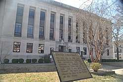 Madison County Courthouse in March 2012 | |
|
Location in the U.S. state of Tennessee | |
 Tennessee's location in the U.S. | |
| Founded | 1821 |
| Named for | James Madison[1] |
| Seat | Jackson |
| Largest city | Jackson |
| Area | |
| • Total | 559 sq mi (1,448 km2) |
| • Land | 557 sq mi (1,443 km2) |
| • Water | 1.5 sq mi (4 km2), 0.3% |
| Population | |
| • (2010) | 98,294 |
| • Density | 176/sq mi (68/km2) |
| Congressional district | 8th |
| Time zone | Central: UTC−6/−5 |
| Website |
www |
Madison County is a county located in the western part of the U.S. state of Tennessee. As of the 2010 census, the population was 98,294.[2] Its county seat is Jackson.[3]
Madison County is included in the Jackson, TN Metropolitan Statistical Area.
History
Madison County was formed in 1821, and named for founding father and president, James Madison. The county was part of lands the United States purchased from the Chickasaw in 1818.[4] After Congressional passage of the Indian Removal Act of 1830, most Chickasaw were forced out of the state and west to Indian Territory beyond the Mississippi River.
Pinson Mounds, one of the largest Woodland period (c. 1-500CE) mound complexes in the United States, is located in Madison County. It has the second-tallest earthwork mound in the United States.[5]
Geography

According to the U.S. Census Bureau, the county has a total area of 559 square miles (1,450 km2), of which 557 square miles (1,440 km2) is land and 1.5 square miles (3.9 km2) (0.3%) is water.[6]
Adjacent counties
- Gibson County (north)
- Carroll County (northeast)
- Henderson County (east)
- Chester County (southeast)
- Hardeman County (south)
- Haywood County (west)
- Crockett County (northwest)
State protected areas
- Pinson Mounds State Archaeological Park
- South Fork Waterfowl Refuge
Demographics
| Historical population | |||
|---|---|---|---|
| Census | Pop. | %± | |
| 1830 | 11,594 | — | |
| 1840 | 16,530 | 42.6% | |
| 1850 | 21,470 | 29.9% | |
| 1860 | 21,535 | 0.3% | |
| 1870 | 23,480 | 9.0% | |
| 1880 | 30,874 | 31.5% | |
| 1890 | 30,497 | −1.2% | |
| 1900 | 36,333 | 19.1% | |
| 1910 | 39,357 | 8.3% | |
| 1920 | 43,824 | 11.3% | |
| 1930 | 51,059 | 16.5% | |
| 1940 | 54,115 | 6.0% | |
| 1950 | 60,128 | 11.1% | |
| 1960 | 60,655 | 0.9% | |
| 1970 | 65,727 | 8.4% | |
| 1980 | 74,546 | 13.4% | |
| 1990 | 77,982 | 4.6% | |
| 2000 | 91,837 | 17.8% | |
| 2010 | 98,294 | 7.0% | |
| Est. 2016 | 97,663 | [7] | −0.6% |
| U.S. Decennial Census[8] 1790–1960[9] 1900–1990[10] 1990–2000[11] 2010–2014[2] | |||

As of the census[13] of 2000, there were 91,837 people, 35,552 households, and 24,637 families residing in the county. The population density was 165 people per square mile (64/km²). There were 38,205 housing units at an average density of 69 per square mile (26/km²). There were 35,552 households out of which 33.50% had children under the age of 18 living with them, 49.80% were married couples living together, 15.90% had a female householder with no husband present, and 30.70% were non-families. 26.20% of all households were made up of individuals and 9.30% had someone living alone who was 65 years of age or older. The average household size was 2.49 and the average family size was 3.00.
The racial makeup of the county was 65.20% non-Hispanic White or European American, 32.46% non-Hispanic Black or African American, 0.16% Native American, 0.63% Asian, 0.01% Pacific Islander, 0.67% from other races, and 0.86% from two or more races. 1.71% of the population were Hispanic or Latino of any race.
There were 35,552 households out of which 33.50% had children under the age of 18 living with them, 49.80% were married couples living together, 15.90% had a female householder with no husband present, and 30.70% were non-families. 26.20% of all households were made up of individuals and 9.30% had someone living alone who was 65 years of age or older. The average household size was 2.49 and the average family size was 3.00.
In the county, the population was spread out with 25.80% under the age of 18, 11.00% from 18 to 24, 29.10% from 25 to 44, 21.70% from 45 to 64, and 12.30% who were 65 years of age or older. The median age was 35 years. For every 100 females, there were 92.10 males. For every 100 females age 18 and over, there were 87.20 males.
The median income for a household in the county was $36,982, and the median income for a family was $44,595. Males had a median income of $34,253 versus $23,729 for females. The per capita income for the county was $19,389. About 10.80% of families and 14.00% of the population were below the poverty line, including 18.40% of those under age 18 and 11.80% of those age 65 or over.
Government
| Year | Republican | Democratic | Third Parties |
|---|---|---|---|
| 2016 | 56.0% 21,335 | 40.5% 15,448 | 3.5% 1,337 |
| 2012 | 54.0% 21,993 | 45.1% 18,367 | 0.8% 342 |
| 2008 | 53.1% 23,290 | 46.1% 20,209 | 0.8% 347 |
| 2004 | 56.1% 21,679 | 43.5% 16,840 | 0.4% 156 |
| 2000 | 52.6% 17,862 | 46.5% 15,781 | 0.9% 287 |
| 1996 | 50.4% 14,908 | 45.9% 13,577 | 3.7% 1,080 |
| 1992 | 47.7% 14,869 | 43.7% 13,629 | 8.7% 2,698 |
| 1988 | 60.5% 16,952 | 39.2% 11,001 | 0.3% 86 |
| 1984 | 59.6% 17,819 | 40.2% 12,006 | 0.2% 55 |
| 1980 | 50.3% 13,667 | 47.8% 12,986 | 2.0% 534 |
| 1976 | 46.1% 11,364 | 52.7% 12,989 | 1.2% 306 |
| 1972 | 72.3% 15,481 | 24.3% 5,203 | 3.4% 725 |
| 1968 | 29.1% 6,143 | 26.2% 5,517 | 44.7% 9,420 |
| 1964 | 50.8% 10,932 | 49.2% 10,573 | |
| 1960 | 50.1% 8,863 | 45.7% 8,083 | 4.2% 747 |
| 1956 | 41.4% 6,642 | 53.3% 8,540 | 5.3% 855 |
| 1952 | 45.5% 7,243 | 54.2% 8,623 | 0.3% 53 |
| 1948 | 18.7% 1,681 | 52.5% 4,722 | 28.8% 2,594 |
| 1944 | 23.9% 1,793 | 75.9% 5,706 | 0.2% 18 |
| 1940 | 17.1% 1,271 | 82.6% 6,154 | 0.3% 23 |
| 1936 | 16.6% 1,223 | 82.9% 6,095 | 0.4% 32 |
| 1932 | 18.6% 1,124 | 79.8% 4,813 | 1.5% 92 |
| 1928 | 34.6% 1,894 | 65.4% 3,574 | |
| 1924 | 22.5% 1,110 | 69.4% 3,422 | 8.1% 399 |
| 1920 | 33.5% 2,665 | 66.5% 5,280 | |
| 1916 | 30.4% 1,194 | 67.8% 2,659 | 1.8% 70 |
| 1912 | 25.1% 1,036 | 65.4% 2,702 | 9.6% 396 |
The county is headed by an elected county mayor (currently Jimmy Harris) and county commission of 25 members elected from 10 districts.[15]
Trivia
This is the Madison County which Kenny Rogers refers to in his song "Reuben James".[16]
Communities

Cities
Unincorporated communities
See also
References
- ↑ Origins Of Tennessee County Names, Tennessee Blue Book 2005–2006, pages 508–513
- 1 2 "State & County QuickFacts". United States Census Bureau. Archived from the original on July 14, 2011. Retrieved December 6, 2013.
- ↑ "Find a County". National Association of Counties. Retrieved June 7, 2011.
- ↑ Harbert Alexander, "Madison County," Tennessee Encyclopedia of History and Culture. Retrieved: October 22, 2013.
- ↑ Mark Norton, "The Pinson Mounds Complex," West Tennessee Historical Society Papers, Vol. 55 (2001). Copy obtained at Pinson Mounds State Archaeological Park.
- ↑ "2010 Census Gazetteer Files". United States Census Bureau. August 22, 2012. Retrieved April 9, 2015.
- ↑ "Population and Housing Unit Estimates". Retrieved June 9, 2017.
- ↑ "U.S. Decennial Census". United States Census Bureau. Retrieved April 9, 2015.
- ↑ "Historical Census Browser". University of Virginia Library. Retrieved April 9, 2015.
- ↑ Forstall, Richard L., ed. (March 27, 1995). "Population of Counties by Decennial Census: 1900 to 1990". United States Census Bureau. Retrieved April 9, 2015.
- ↑ "Census 2000 PHC-T-4. Ranking Tables for Counties: 1990 and 2000" (PDF). United States Census Bureau. April 2, 2001. Retrieved April 9, 2015.
- ↑ Based on 2000 census data
- ↑ "American FactFinder". United States Census Bureau. Retrieved May 14, 2011.
- ↑ Leip, David. "Dave Leip's Atlas of U.S. Presidential Elections". uselectionatlas.org. Retrieved March 11, 2018.
- ↑ Madison County website
- ↑ "65: Reuben James | Chicken Soup for the Soul". www.chickensoup.com. July 2, 2014. Retrieved March 11, 2018.
External links
| Wikimedia Commons has media related to Madison County, Tennessee. |
- Madison County official website
- Madison County, TNGenWeb – free genealogy resources for the county
- Madison County at Curlie (based on DMOZ)
Places adjacent to Madison County, Tennessee | ||||||||||
|---|---|---|---|---|---|---|---|---|---|---|
| ||||||||||
Municipalities and communities of Madison County, Tennessee, United States | ||
|---|---|---|
| Cities | ||
| Unincorporated communities | ||
| Footnotes | ‡This populated place also has portions in an adjacent county or counties | |
