Bleckley County, Georgia
| Bleckley County, Georgia | |
|---|---|
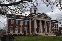 Bleckley County Courthouse in Cochran | |
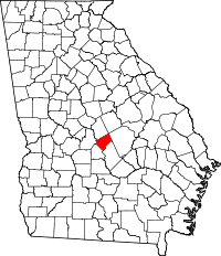 Location in the U.S. state of Georgia | |
 Georgia's location in the U.S. | |
| Founded | 1912 |
| Named for | Logan Edwin Bleckley |
| Government • County Commissioner |
Robert Brockman |
| Seat | Cochran |
| Largest city | Cochran |
| Area | |
| • Total | 219 sq mi (567 km2) |
| • Land | 216 sq mi (559 km2) |
| • Water | 3.3 sq mi (9 km2), 1.5% |
| Population | |
| • (2010) | 13,063 |
| • Density | 61/sq mi (24/km2) |
| Congressional district | 8th |
| Time zone | Eastern: UTC−5/−4 |
| Website |
www |
Bleckley County is a county located in the U.S. state of Georgia. As of the 2010 census, the population was 13,063.[1] The county seat is Cochran.[2]
History
The county was named for Logan Edwin Bleckley, a soldier and Justice of the Supreme Court of Georgia.[3] The state constitutional amendment to create the county was proposed by the Georgia General Assembly on July 30, 1912, and ratified November 5, 1912. Bleckley County was formerly home to Middle Georgia College, the oldest two-year public college in the nation. In 2013 it merged with Macon State College to become Middle Georgia State University.[4]
Bleckley County High School made news on March 2010 for allowing a same-sex couple to attend its senior prom, after another same-sex couple in Mississippi were denied attendance at another senior prom.[5]
Government
Bleckley County is one of eight remaining counties in Georgia that operates under a Sole Commissioner form of government, with a single county commissioner acting as the county executive and legislative branches. The current County Commissioner is Robert Brockman. The Sheriff of Bleckley County is Kris Coody, the Clerk of Superior Court is Dianne C. Brown, the Tax Commissioner is J. David Brown, and the Probate Judge is Hon. Kenneth Powell.
| Year | Republican | Democratic | Third parties |
|---|---|---|---|
| 2016 | 74.8% 3,719 | 22.1% 1,101 | 3.1% 154 |
| 2012 | 72.9% 3,587 | 25.8% 1,269 | 1.3% 64 |
| 2008 | 71.9% 3,657 | 27.1% 1,380 | 0.9% 47 |
| 2004 | 70.8% 3,167 | 28.7% 1,281 | 0.5% 23 |
| 2000 | 65.0% 2,436 | 34.0% 1,273 | 1.1% 40 |
| 1996 | 49.3% 1,632 | 41.3% 1,365 | 9.4% 311 |
| 1992 | 39.7% 1,570 | 43.2% 1,710 | 17.1% 676 |
| 1988 | 62.1% 1,950 | 37.4% 1,175 | 0.4% 13 |
| 1984 | 56.6% 1,912 | 43.4% 1,465 | |
| 1980 | 36.7% 1,261 | 58.6% 2,014 | 4.8% 165 |
| 1976 | 27.2% 972 | 72.8% 2,605 | |
| 1972 | 86.0% 2,308 | 14.0% 377 | |
| 1968 | 20.9% 756 | 11.0% 397 | 68.1% 2,458 |
| 1964 | 72.5% 2,578 | 27.5% 978 | |
| 1960 | 26.6% 633 | 73.5% 1,751 | |
| 1956 | 8.1% 136 | 91.9% 1,537 | |
| 1952 | 11.0% 187 | 89.0% 1,517 | |
| 1948 | 27.1% 227 | 64.0% 536 | 9.0% 75 |
| 1944 | 20.7% 213 | 79.3% 815 | |
| 1940 | 11.3% 100 | 88.4% 785 | 0.3% 3 |
| 1936 | 9.6% 69 | 90.1% 649 | 0.3% 2 |
| 1932 | 2.7% 37 | 97.2% 1,338 | 0.1% 1 |
| 1928 | 10.0% 71 | 90.0% 641 | |
| 1924 | 5.2% 21 | 90.6% 367 | 4.2% 17 |
| 1920 | 100.0% 262 | ||
| 1916 | 3.7% 14 | 94.8% 362 | 1.6% 6 |
Geography
According to the U.S. Census Bureau, the county has a total area of 219 square miles (570 km2), of which 216 square miles (560 km2) is land and 3.3 square miles (8.5 km2) (1.5%) is water.[7]
The eastern quarter of Bleckley County, roughly in a line from west of Danville running southeast, is located in the Lower Oconee River sub-basin of the Altamaha River basin. The central quarter of the county, between Cochran and the previous line, is located in the Little Ocmulgee River sub-basin of the same Altamaha River basin. The western half of the county, west of Cochran, is located in the Lower Ocmulgee River sub-basin of the same larger Altamaha River basin.[8]
Major highways
Adjacent counties
- Wilkinson County - north
- Twiggs County - north
- Laurens County - east
- Dodge County - southeast
- Pulaski County - southwest
- Houston County - west
Demographics
| Historical population | |||
|---|---|---|---|
| Census | Pop. | %± | |
| 1920 | 10,532 | — | |
| 1930 | 9,133 | −13.3% | |
| 1940 | 9,655 | 5.7% | |
| 1950 | 9,218 | −4.5% | |
| 1960 | 9,642 | 4.6% | |
| 1970 | 10,291 | 6.7% | |
| 1980 | 10,767 | 4.6% | |
| 1990 | 10,430 | −3.1% | |
| 2000 | 11,666 | 11.9% | |
| 2010 | 13,063 | 12.0% | |
| Est. 2016 | 12,970 | [9] | −0.7% |
| U.S. Decennial Census[10] 1790-1960[11] 1900-1990[12] 1990-2000[13] 2010-2013[1] | |||
2000 census
As of the census[14] of 2000, there were 11,666 people, 4,372 households, and 3,121 families residing in the county. The population density was 54 people per square mile (21/km²). There were 4,866 housing units at an average density of 22 per square mile (9/km²). The racial makeup of the county was 73.24% White, 24.59% Black or African American, 0.09% Native American, 0.93% Asian, 0.03% Pacific Islander, 0.48% from other races, and 0.63% from two or more races. 0.92% of the population were Hispanic or Latino of any race.
There were 4,372 households out of which 32.90% had children under the age of 18 living with them, 51.80% were married couples living together, 15.50% had a female householder with no husband present, and 28.60% were non-families. 25.50% of all households were made up of individuals and 11.00% had someone living alone who was 65 years of age or older. The average household size was 2.52 and the average family size was 3.02.
In the county, the population was spread out with 26.60% under the age of 18, 11.30% from 18 to 24, 26.50% from 25 to 44, 22.10% from 45 to 64, and 13.60% who were 65 years of age or older. The median age was 35 years. For every 100 females there were 93.00 males. For every 100 females age 18 and over, there were 88.50 males.
The median income for a household in the county was $33,448, and the median income for a family was $41,095. Males had a median income of $30,917 versus $22,912 for females. The per capita income for the county was $15,934. About 11.70% of families and 15.90% of the population were below the poverty line, including 24.10% of those under age 18 and 17.80% of those age 65 or over.
2010 census
As of the 2010 United States Census, there were 13,063 people, 4,660 households, and 3,248 families residing in the county.[15] The population density was 60.5 inhabitants per square mile (23.4/km2). There were 5,304 housing units at an average density of 24.6 per square mile (9.5/km2).[16] The racial makeup of the county was 70.1% white, 27.3% black or African American, 0.8% Asian, 0.1% American Indian, 0.7% from other races, and 1.0% from two or more races. Those of Hispanic or Latino origin made up 2.3% of the population.[15] In terms of ancestry, 14.8% were American, 7.9% were English, and 6.3% were Irish.[17]
Of the 4,660 households, 33.2% had children under the age of 18 living with them, 49.7% were married couples living together, 15.5% had a female householder with no husband present, 30.3% were non-families, and 26.5% of all households were made up of individuals. The average household size was 2.49 and the average family size was 2.99. The median age was 35.9 years.[15]
The median income for a household in the county was $35,661 and the median income for a family was $48,750. Males had a median income of $36,697 versus $26,691 for females. The per capita income for the county was $18,960. About 18.0% of families and 19.5% of the population were below the poverty line, including 29.1% of those under age 18 and 13.4% of those age 65 or over.[18]
Education
Communities
City
Town
Census-designated place
Other unincorporated community
- Cary
- Goldsboro
- Westlake
- Yonkers
See also
References
- 1 2 "State & County QuickFacts". United States Census Bureau. Retrieved February 15, 2014.
- ↑ "Find a County". National Association of Counties. Archived from the original on 2011-05-31. Retrieved 2011-06-07.
- ↑ Krakow, Kenneth K. (1975). Georgia Place-Names: Their History and Origins (PDF). Macon, GA: Winship Press. p. 20. ISBN 0-915430-00-2.
- ↑ "Middle Georgia State College Now a Reality". mgsc.edu. Retrieved 2013-06-18.
- ↑ "Archived copy". Archived from the original on 2010-03-25. Retrieved 2010-03-24.
- ↑ Leip, David. "Dave Leip's Atlas of U.S. Presidential Elections". uselectionatlas.org. Retrieved 2018-03-18.
- ↑ "US Gazetteer files: 2010, 2000, and 1990". United States Census Bureau. 2011-02-12. Retrieved 2011-04-23.
- ↑ "Georgia Soil and Water Conservation Commission Interactive Mapping Experience". Georgia Soil and Water Conservation Commission. Retrieved 2015-11-24.
- ↑ "Population and Housing Unit Estimates". Retrieved June 9, 2017.
- ↑ "U.S. Decennial Census". United States Census Bureau. Archived from the original on May 12, 2015. Retrieved June 18, 2014.
- ↑ "Historical Census Browser". University of Virginia Library. Retrieved June 18, 2014.
- ↑ "Population of Counties by Decennial Census: 1900 to 1990". United States Census Bureau. Retrieved June 18, 2014.
- ↑ "Census 2000 PHC-T-4. Ranking Tables for Counties: 1990 and 2000" (PDF). United States Census Bureau. Retrieved June 18, 2014.
- ↑ "American FactFinder". United States Census Bureau. Archived from the original on 2013-09-11. Retrieved 2011-05-14.
- 1 2 3 "DP-1 Profile of General Population and Housing Characteristics: 2010 Demographic Profile Data". United States Census Bureau. Retrieved 2015-12-27.
- ↑ "Population, Housing Units, Area, and Density: 2010 - County". United States Census Bureau. Retrieved 2015-12-27.
- ↑ "DP02 SELECTED SOCIAL CHARACTERISTICS IN THE UNITED STATES – 2006-2010 American Community Survey 5-Year Estimates". United States Census Bureau. Retrieved 2015-12-27.
- ↑ "DP03 SELECTED ECONOMIC CHARACTERISTICS – 2006-2010 American Community Survey 5-Year Estimates". United States Census Bureau. Retrieved 2015-12-27.
Places adjacent to Bleckley County, Georgia | ||||||||||
|---|---|---|---|---|---|---|---|---|---|---|
| ||||||||||
Municipalities and communities of Bleckley County, Georgia, United States | ||
|---|---|---|
| City | | |
| Town | ||
| CDP | ||
| Footnotes | ‡This populated place also has portions in an adjacent county or counties | |
| Principal cities | 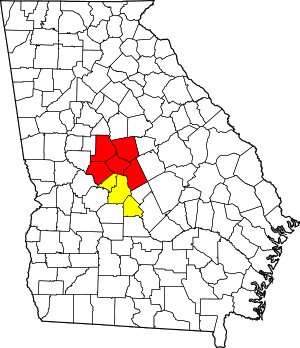 | |
|---|---|---|
| Municipalities | ||
| Other communities | ||
| Counties | ||
| CSA components | ||
External links
- Cochran-Bleckley Chamber of Commerce
- Festivals and Events
- Bleckley County historical marker