Bibb County, Georgia
| Bibb County, Georgia | |
|---|---|
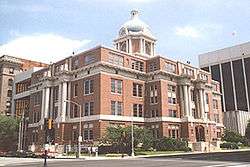 Bibb County courthouse in Macon | |
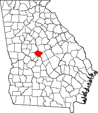 Location in the U.S. state of Georgia | |
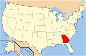 Georgia's location in the U.S. | |
| Founded | December 9, 1822 |
| Named for | William Wyatt Bibb |
| Seat | Macon |
| Largest city | Macon |
| Area | |
| • Total | 255 sq mi (660 km2) |
| • Land | 250 sq mi (647 km2) |
| • Water | 5.6 sq mi (15 km2), 2.2% |
| Population (est.) | |
| • (2015) | 153,721 |
| • Density | 623/sq mi (241/km2) |
| Congressional districts | 2nd, 8th |
| Time zone | Eastern: UTC−5/−4 |
| Website |
www |
Bibb County was a county located in the U.S. state of Georgia. As of the 2010 census, the population was 155,547.[1] On July 31, 2012, by a margin of 57% to 43%, voters in the county approved a measure to consolidate Bibb County with the county seat, Macon and dissolve the government of the only other incorporated municipality in the county, Payne City;[2] however, Payne City was officially dissolved by Governor Nathan Deal on March 27, 2015.[3]
Bibb County is part of the Macon, GA Metropolitan Statistical Area.
Robert Reichert was the first mayor of Macon-Bibb, January 1, 2014.[4]
History
Native Americans (mostly Cherokee) had inhabited the area which would become Bibb County for many centuries. They were forcibly relocated to today's Oklahoma in the Indian Removal in the 1830s, during the administration of President Andrew Jackson. The Indian tribes affected refer to this as the "Trail of Tears," since many died during the march west.
Bibb is one of the counties of the "Black Belt", which originally referred to the fertile dark soil in the uplands. The area was developed by white settlers and African American slaves into cotton plantations during the antebellum years. Cotton generated high profits, since was in demand in the textile mills of the northern states as well as in England. By the 1860 census, shortly before the American Civil War, more than a million enslaved African American lived in Georgia, and they constituted a majority of the population in much of the Black Belt.
Bibb County was created by act of the State Legislature of Georgia on December 9, 1822, with Macon to be incorporated as a town/city in December 1823; designated the County Seat. It was carved from the earlier territories of the counties of Jones, Monroe, Houston, and Twiggs counties. The County Seat has never been changed since, and no other subsequent county in the state has ever been created ("erected") out of land from Bibb County.
The county was named for Dr. William Wyatt Bibb, a physician from Elbert County, who was elected to and served in the U.S. House of Representatives and United States Senate from History of Georgia, moved to the new Alabama Territory, before being elected as the first Governor of the new State of Alabama.
During the Civil War, an estimated ten percent of the white males in the county lost their lives while serving the Confederate States Army.[5] The war ended slavery in Georgia, but it also left much of the state in ruins.
Reconstruction and after
During the Reconstruction years immediately after the war, most white voters were disenfranchised, and wartime Georgia unionists and the former slaves controlled the politics. When white Democrats regained control of the state legislature in the 1870s, they passed laws imposing segregation and limiting the rights of African Americans. A new state constitution was written at the turn of the twentieth century, which in effect disenfranchised most black voters as well thousands of poor white males in order to guarantee Democratic control of the state.
20th century to present
The first foreign Consulate in the county was established in Macon in 2006, with the Royal Danish Consulate of the Kingdom of Denmark. The first ever Honorary Consul to the Principality of Liechtenstein was also established in Macon in 2007.
Government
Macon and Bibb County were consolidated in January 2014. Since then, Macon-Bibb has been governed by a mayor, elected at-large (county-wide), along with a nine-member county commission with members elected from single-member districts.[6][7][8]
Like all other Georgia counties, Bibb has an elected sheriff responsible for maintaining the jail. Bibb's sheriff also manages the county's law enforcement duties, with his deputies acting as the city and county police force. The current (2013) Bibb sheriff is David Davis.
On July 31, 2012, voters in Macon (57.8 percent approval) and Bibb County (56.7 percent approval) passed a referendum to merge the governments of the city of Macon and most of unincorporated Bibb County, based on the authorization of House Bill 1171, passed by the Georgia General Assembly earlier in the year;[9] four previous consolidation attempts (in 1933, 1960, 1972, and 1976) had failed.[10][11][12]
As the result of consolidation, a portion of Macon that extended into adjacent Jones County was deannexed from Macon.
Elections
Macon mayor Robert Reichert became the first mayor of the consolidated city on January 1, 2014. He received 49% of the vote in the general election on September 17 over the other five mayoral candidates; however, winning the election outright required the winner to capture a majority of the vote. He subsequently won 63% of the vote in a runoff election against former Macon mayor C. Jack Ellis.[4]
| Year | Republican | Democratic | Third parties |
|---|---|---|---|
| 2016 | 38.4% 24,043 | 58.8% 36,787 | 2.8% 1766 |
| 2012 | 39.5% 25,623 | 59.5% 38,585 | 0.9% 595 |
| 2008 | 40.7% 27,037 | 58.7% 38,987 | 0.6% 424 |
| 2004 | 48.6% 28,107 | 50.7% 29,322 | 0.6% 359 |
| 2000 | 48.4% 24,071 | 50.2% 24,996 | 1.4% 709 |
| 1996 | 41.6% 20,778 | 53.5% 26,727 | 4.9% 2427 |
| 1992 | 36.7% 19,847 | 51.9% 28,070 | 11.4% 6132 |
| 1988 | 50.0% 22,179 | 49.7% 22,084 | 0.3% 133 |
| 1984 | 47.8% 24,170 | 52.2% 26,427 | |
| 1980 | 31.5% 15,175 | 66.0% 31,770 | 2.5% 1185 |
| 1976 | 28.7% 12,819 | 71.3% 31,902 | |
| 1972 | 72.9% 27,402 | 27.1% 10,201 | |
| 1968 | 32.6% 13,490 | 25.6% 10579 | 41.9% 17,328 |
| 1964 | 59.0% 25,641 | 41.0% 17,831 | |
| 1960 | 42.2% 10,523 | 57.8% 14,387 | |
| 1956 | 32.6% 7,242 | 67.4% 14,966 | |
| 1952 | 29.4% 6,121 | 70.6% 14,687 | |
| 1948 | 27.3% 3,837 | 49.8% 7,011 | 22.9% 3229 |
| 1944 | 26.0% 1,884 | 74.0% 5,352 | |
| 1940 | 16.9% 1,371 | 82.7% 6,729 | 0.5% 37 |
| 1936 | 7.3% 452 | 92.3% 5,722 | 0.4% 23 |
| 1932 | 8.4% 405 | 90.9% 4,372 | 0.6% 31 |
| 1928 | 47.6% 2,078 | 52.4% 2,289 | |
| 1924 | 10.4% 455 | 83.2% 3,647 | 6.5% 283 |
| 1920 | 18.4% 458 | 81.6% 2,030 | |
| 1916 | 2.5% 58 | 88.8% 2,048 | 8.7% 201 |
| 1912 | 3.7% 71 | 90.8% 1,741 | 5.5% 105 |
Geography
According to the U.S. Census Bureau, the county has a total area of 255 square miles (660 km2), of which 250 square miles (650 km2) is land and 5.6 square miles (15 km2) (2.2%) is water.[14] The entirety of Bibb County is located in the Upper Ocmulgee River sub-basin of the Altamaha River basin.[15]
Adjacent counties
- Jones County - northeast
- Twiggs County - east
- Houston County - south
- Peach County - south-southwest
- Crawford County - southwest
- Monroe County - northwest
National protected areas
Transportation
Major highways


- U.S. Route 41 Business (Macon)


- U.S. Route 129 Alternate (Macon)


Pedestrians and cycling
- Heritage Trail
- Ocmulgee Heritage Trail
Demographics
| Historical population | |||
|---|---|---|---|
| Census | Pop. | %± | |
| 1830 | 7,154 | — | |
| 1840 | 9,802 | 37.0% | |
| 1850 | 12,699 | 29.6% | |
| 1860 | 16,291 | 28.3% | |
| 1870 | 21,255 | 30.5% | |
| 1880 | 27,147 | 27.7% | |
| 1890 | 42,370 | 56.1% | |
| 1900 | 50,473 | 19.1% | |
| 1910 | 56,646 | 12.2% | |
| 1920 | 71,304 | 25.9% | |
| 1930 | 77,042 | 8.0% | |
| 1940 | 83,783 | 8.7% | |
| 1950 | 114,079 | 36.2% | |
| 1960 | 141,249 | 23.8% | |
| 1970 | 143,418 | 1.5% | |
| 1980 | 150,256 | 4.8% | |
| 1990 | 149,967 | −0.2% | |
| 2000 | 153,887 | 2.6% | |
| 2010 | 155,547 | 1.1% | |
| Est. 2016 | 152,760 | [16] | −1.8% |
| U.S. Decennial Census[17] 1790-1960[18] 1900-1990[19] 1990-2000[20] 2010-2013[1] | |||
2000 census
As of the census[21] of 2000, there were 153,887 people, 59,667 households, and 39,797 families residing in the county. The population density was 616 people per square mile (238/km²). There were 67,194 housing units at an average density of 269 per square mile (104/km²). The racial makeup of the county was 50.13% White, 47.32% Black or African American, 0.18% Native American, 1.08% Asian, 0.02% Pacific Islander, 0.46% from other races, and 0.81% from two or more races. 1.31% of the population were Hispanic or Latino of any race.
There were 59,667 households out of which 31.90% had children under the age of 18 living with them, 42.30% were married couples living together, 20.60% had a female householder with no husband present, and 33.30% were non-families. 28.20% of all households were made up of individuals and 9.80% had someone living alone who was 65 years of age or older. The average household size was 2.49 and the average family size was 3.06.
In the county, the population was distributed with 26.60% under the age of 18, 10.10% from 18 to 24, 29.00% from 25 to 44, 21.70% from 45 to 64, and 12.70% who were 65 years of age or older. The median age was 35 years. For every 100 females, there were 85.20 males. For every 100 females age 18 and over, there were 80.20 males.
The population tables show a dramatic reduction in population growth from 1920 to 1940, less than half the amounts for censuses before and after these dates; during this period, tens of thousands of African Americans left the state for cities in the North and Midwest, as part of the Great Migration to escape the oppression of Jim Crow and lynchings, for better jobs, education and living conditions. Through such migration, they went from being mostly rural people to being more urbanized than the average in the United States, which has become a mostly suburban population in terms of where residences are located.
The median income for a household in the county was $34,532, and the median income for a family was $43,479. Males had a median income of $34,263 versus $25,540 for females. The per capita income for the county was $19,058. About 15.50% of families and 19.10% of the population were below the poverty line, including 28.20% of those under age 18 and 13.10% of those age 65 or over.
2010 census
As of the 2010 United States Census, there were 155,547 people, 60,295 households, and 38,714 families residing in the county.[22] The population density was 622.8 inhabitants per square mile (240.5/km2). There were 69,662 housing units at an average density of 278.9 per square mile (107.7/km2).[23] The racial makeup of the county was 52.1% black or African American, 43.2% white, 1.6% Asian, 0.2% American Indian, 0.1% Pacific islander, 1.3% from other races, and 1.4% from two or more races. Those of Hispanic or Latino origin made up 2.8% of the population.[22] In terms of ancestry, 8.8% were English, 7.6% were American, 6.6% were Irish, and 5.2% were German.[24]
Of the 60,295 households, 33.7% had children under the age of 18 living with them, 37.5% were married couples living together, 22.0% had a female householder with no husband present, 35.8% were non-families, and 30.3% of all households were made up of individuals. The average household size was 2.48 and the average family size was 3.10. The median age was 35.6 years.[22]
The median income for a household in the county was $38,798 and the median income for a family was $52,158. Males had a median income of $41,219 versus $31,477 for females. The per capita income for the county was $21,436. About 16.4% of families and 22.4% of the population were below the poverty line, including 33.0% of those under age 18 and 12.8% of those age 65 or over.[25]
Recreation
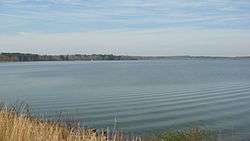
Lake Tobesofkee, about 10 miles (16 km) west of Macon, has three parks. Claystone, Sandy Beach, and Arrowhead Parks, each with a beach, and children's playgrounds. Sandy Beach has lighted tennis courts, a water park with many attractions, and a softball field.[26]
Communities
See also
References
- 1 2 "State & County QuickFacts". United States Census Bureau. Retrieved June 18, 2014.
- ↑ "Macon and Bibb Approve Consolidation". 13WMAZ. August 1, 2012. Archived from the original on January 16, 2013. Retrieved August 2, 2012.
- ↑ "Payne City Officially Dissolved". The Macon Telegraph. April 1, 2015. Archived from the original on May 6, 2015. Retrieved July 27, 2015.
- 1 2 "Archived copy". Archived from the original on 2013-10-16. Retrieved 2013-10-16.
- ↑ "Cotton, Fire, and Dreams". google.com.
- ↑ Jim Gaines (July 28, 2012). "Last details of Macon-Bibb consolidation debate aired". The Telegraph.
- ↑ Mike Stucka (July 31, 2012). "Macon-Bibb County consolidation wins with strong majorities". The Telegraph.
- ↑ Erica Lockwood (July 13, 2012). "Consolidation: 3 Areas of Macon and Bibb Affected Differently". 13 WMAZ. Archived from the original on January 16, 2013.
- ↑ "HB 1171 - Macon-Bibb County; create and incorporate new political body corporate". Archived from the original on 2012-10-30.
- ↑ City-County Consolidation Proposals, 1921 - Present Archived 2012-07-19 at the Wayback Machine., National Association of Counties. Retrieved 2011-02-11.
- ↑ The Effects on City-County Consolidation
- ↑ Consolidation pass for Macon and Bibb county in the 2012 vote.CONSOLIDATION OF CITY AND COUNTY GOVERNMENTS: ATTEMPTS IN FIVE CITIES Archived 2013-01-20 at the Wayback Machine.. Retrieved 2010-09-14.
- ↑ Leip, David. "Dave Leip's Atlas of U.S. Presidential Elections". uselectionatlas.org. Retrieved 2018-03-18.
- ↑ "US Gazetteer files: 2010, 2000, and 1990". United States Census Bureau. 2011-02-12. Retrieved 2011-04-23.
- ↑ "Georgia Soil and Water Conservation Commission Interactive Mapping Experience". Georgia Soil and Water Conservation Commission. Retrieved 2015-11-22.
- ↑ "Population and Housing Unit Estimates". Retrieved June 9, 2017.
- ↑ "U.S. Decennial Census". United States Census Bureau. Archived from the original on May 12, 2015. Retrieved June 18, 2014.
- ↑ "Historical Census Browser". University of Virginia Library. Retrieved June 18, 2014.
- ↑ "Population of Counties by Decennial Census: 1900 to 1990". United States Census Bureau. Retrieved June 18, 2014.
- ↑ "Census 2000 PHC-T-4. Ranking Tables for Counties: 1990 and 2000" (PDF). United States Census Bureau. Retrieved June 18, 2014.
- ↑ "American FactFinder". United States Census Bureau. Archived from the original on 2013-09-11. Retrieved 2011-05-14.
- 1 2 3 "DP-1 Profile of General Population and Housing Characteristics: 2010 Demographic Profile Data". United States Census Bureau. Retrieved 2015-12-27.
- ↑ "Population, Housing Units, Area, and Density: 2010 - County". United States Census Bureau. Retrieved 2015-12-27.
- ↑ "DP02 SELECTED SOCIAL CHARACTERISTICS IN THE UNITED STATES – 2006-2010 American Community Survey 5-Year Estimates". United States Census Bureau. Retrieved 2015-12-27.
- ↑ "DP03 SELECTED ECONOMIC CHARACTERISTICS – 2006-2010 American Community Survey 5-Year Estimates". United States Census Bureau. Retrieved 2015-12-27.
- ↑ "Tobesofkee parks and beaches". Retrieved June 2, 2012.
External links
| Wikimedia Commons has media related to Bibb County, Georgia. |
Places adjacent to Bibb County, Georgia | ||||||||||
|---|---|---|---|---|---|---|---|---|---|---|
| ||||||||||
Municipalities and communities of Bibb County, Georgia, United States | ||
|---|---|---|
| City | | |
| Unincorporated communities | ||
| Footnotes | ‡This populated place also has portions in an adjacent county or counties | |
| Principal cities | 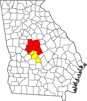 | |
|---|---|---|
| Municipalities | ||
| Other communities | ||
| Counties | ||
| CSA components | ||