Elmore County, Alabama
| Elmore County, Alabama | |
|---|---|
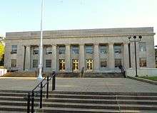 County courthouse in Wetumpka | |
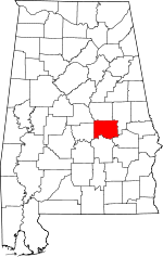 Location in the U.S. state of Alabama | |
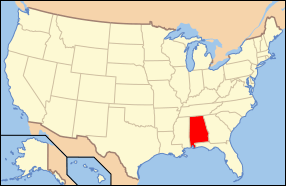 Alabama's location in the U.S. | |
| Founded | February 15, 1866 |
| Named for | John A. Elmore |
| Seat | Wetumpka |
| Largest city | Millbrook |
| Area | |
| • Total | 657 sq mi (1,702 km2) |
| • Land | 618 sq mi (1,601 km2) |
| • Water | 39 sq mi (101 km2), 5.9% |
| Population (est.) | |
| • (2017) | 81,667 |
| • Density | 128/sq mi (49/km2) |
| Demonym(s) | Elmorean |
| Congressional district | 2nd |
| Time zone | Central: UTC−6/−5 |
| Website |
www |
|
Footnotes:
| |
Elmore County is a county of the State of Alabama. As of the 2010 census, the population was 79,303.[1] Its county seat is Wetumpka.[2] Its name is in honor of General John A. Elmore.[3]
Elmore County is part of the Montgomery, AL Metropolitan Statistical Area.
History
Elmore County was established on February 15, 1866, from portions of Autauga, Coosa, Tallapoosa, and Montgomery counties.
Geography
According to the U.S. Census Bureau, the county has a total area of 657 square miles (1,700 km2), of which 618 square miles (1,600 km2) is land and 39 square miles (100 km2) (5.9%) is water.[4]
Major highways
Adjacent counties
- Coosa County (north)
- Tallapoosa County (northeast)
- Macon County (southeast)
- Montgomery County (south)
- Autauga County (west)
- Chilton County (northwest)
Demographics
| Historical population | |||
|---|---|---|---|
| Census | Pop. | %± | |
| 1870 | 14,477 | — | |
| 1880 | 17,502 | 20.9% | |
| 1890 | 21,732 | 24.2% | |
| 1900 | 26,099 | 20.1% | |
| 1910 | 28,245 | 8.2% | |
| 1920 | 28,085 | −0.6% | |
| 1930 | 34,280 | 22.1% | |
| 1940 | 34,546 | 0.8% | |
| 1950 | 31,649 | −8.4% | |
| 1960 | 30,524 | −3.6% | |
| 1970 | 33,661 | 10.3% | |
| 1980 | 43,390 | 28.9% | |
| 1990 | 49,210 | 13.4% | |
| 2000 | 65,874 | 33.9% | |
| 2010 | 79,303 | 20.4% | |
| Est. 2017 | 81,667 | [5] | 3.0% |
| U.S. Decennial Census[6] 1790–1960[7] 1900–1990[8] 1990–2000[9] 2010–2017[1] | |||
As of the census[10] of 2000, there were 65,874 people, 22,737 households, and 17,552 families residing in the county. The population density was 106 people per square mile (41/km2). There were 25,733 housing units at an average density of 41 per square mile (16/km2). The racial makeup of the county was 77.02% White, 20.64% Black or African American, 0.43% Native American, 0.36% Asian, 0.03% Pacific Islander, 0.48% from other races, and 1.04% from two or more races. 1.22% of the population were Hispanic or Latino of any race.
There were 22,737 households out of which 37.40% had children under the age of 18 living with them, 61.40% were married couples living together, 12.00% had a female householder with no husband present, and 22.80% were non-families. 20.00% of all households were made up of individuals and 7.70% had someone living alone who was 65 years of age or older. The average household size was 2.66 and the average family size was 3.07.
In the county, the population was spread out with 25.70% under the age of 18, 8.80% from 18 to 24, 32.10% from 25 to 44, 22.70% from 45 to 64, and 10.70% who were 65 years of age or older. The median age was 35 years. For every 100 females, there were 102.50 males. For every 100 females age 18 and over, there were 101.30 males.
The median income for a household in the county was $41,243, and the median income for a family was $47,155. Males had a median income of $32,643 versus $24,062 for females. The per capita income for the county was $17,650. About 7.40% of families and 10.20% of the population were below the poverty line, including 14.20% of those under age 18 and 11.30% of those age 65 or over. In the late 1990s voters voted to pass a mandatory fire fee for volunteer fire services. All citizens pay this same fee regardless of valuation of the property or income levels.
2010 census
As of the census[11] of 2010, there were 79,303 people, 28,301 households, and 21,003 families residing in the county. The population density was 128 people per square mile (49/km2). There were 32,657 housing units at an average density of 49.7 per square mile (19.2/km2). The racial makeup of the county was 76.2% White, 20.0% Black or African American, 0.4% Native American, 0.7% Asian, 0.1% Pacific Islander, 1.2% from other races, and 1.4% from two or more races. 2.7% of the population were Hispanic or Latino of any race.
There were 28,301 households out of which 32.5% had children under the age of 18 living with them, 56.6% were married couples living together, 13.1% had a female householder with no husband present, and 25.8% were non-families. 22.0% of all households were made up of individuals and 7.8% had someone living alone who was 65 years of age or older. The average household size was 2.61 and the average family size was 3.04.
In the county, the population was spread out with 23.6% under the age of 18, 9.3% from 18 to 24, 27.9% from 25 to 44, 27.4% from 45 to 64, and 11.9% who were 65 years of age or older. The median age was 37.8 years. For every 100 females, there were 95.3 males. For every 100 females age 18 and over, there were 94.7 males.
The median income for a household in the county was $53,128, and the median income for a family was $62,870. Males had a median income of $46,952 versus $31,542 for females. The per capita income for the county was $22,640. About 9.1% of families and 12.4% of the population were below the poverty line, including 16.8% of those under age 18 and 9.4% of those age 65 or over.
Government and infrastructure
The Julia Tutwiler Prison for Women of the Alabama Department of Corrections is in Wetumpka in Elmore County. The prison houses Alabama’s female death row.[12] Wetumpka was previously the site of the Wetumpka State Penitentiary.[13]
| Year | GOP | Dem | Others |
|---|---|---|---|
| 2016 | 74.2% 27,634 | 22.7% 8,443 | 3.2% 1,183 |
| 2012 | 73.9% 26,253 | 25.2% 8,954 | 1.0% 339 |
| 2008 | 75.1% 25,777 | 24.2% 8,301 | 0.7% 237 |
| 2004 | 76.9% 22,056 | 22.6% 6,471 | 0.5% 153 |
| 2000 | 70.5% 16,777 | 27.9% 6,652 | 1.6% 375 |
| 1996 | 61.8% 12,937 | 31.2% 6,530 | 7.1% 1,479 |
| 1992 | 55.7% 11,356 | 30.5% 6,223 | 13.8% 2,809 |
| 1988 | 69.8% 10,852 | 29.0% 4,501 | 1.2% 186 |
| 1984 | 72.7% 11,694 | 26.1% 4,198 | 1.2% 185 |
| 1980 | 57.2% 8,688 | 39.2% 5,947 | 3.7% 555 |
| 1976 | 48.5% 6,551 | 49.2% 6,646 | 2.3% 311 |
| 1972 | 79.9% 8,461 | 17.9% 1,891 | 2.3% 238 |
| 1968 | 6.8% 801 | 14.8% 1,745 | 78.5% 9,266 |
| 1964 | 83.8% 6,363 | 16.2% 1,233 | |
| 1960 | 35.5% 1,919 | 63.6% 3,440 | 0.9% 50 |
| 1956 | 30.0% 1,619 | 62.2% 3,353 | 7.8% 422 |
| 1952 | 23.8% 1,315 | 76.1% 4,199 | 0.1% 4 |
| 1948 | 6.5% 167 | 93.5% 2,403 | |
| 1944 | 5.6% 184 | 94.3% 3,108 | 0.1% 3 |
| 1940 | 3.3% 144 | 96.5% 4,267 | 0.2% 9 |
| 1936 | 4.2% 182 | 92.3% 3,967 | 3.4% 148 |
| 1932 | 4.4% 160 | 87.8% 3,198 | 7.8% 283 |
| 1928 | 57.5% 1,770 | 42.5% 1,309 | 0.1% 2 |
| 1924 | 16.4% 219 | 81.6% 1,088 | 2.0% 26 |
| 1920 | 16.6% 353 | 83.1% 1,762 | 0.3% 6 |
| 1916 | 0.0% 0 | 99.6% 1,631 | 0.4% 7 |
| 1912 | 5.7% 81 | 81.7% 1,152 | 12.6% 177 |
| 1908 | 11.2% 138 | 86.5% 1,063 | 2.3% 28 |
| 1904 | 10.7% 151 | 86.6% 1,226 | 2.7% 38 |
Economy
Over the past two decades, Elmore County has transferred from an economy based on agriculture to one of Alabama's fastest-growing counties. According to a recent report, 1110 jobs were created over the last 4 years.[15]
Elmore County's largest employer is the manufacturing sector. The top ten manufacturers in Elmore County include: GKN Aerospace, Neptune Technologies, Frontier Yarns, Russell Corporation, Madix, Inc, Arrowhead Composites, Hanil USA, YESAC Alabama Corporation, Quality Networks, Inc., and AES Industries.
Education
The Elmore County Public School System serves the county.
Communities
Cities
- Prattville (partly in Autauga County)
- Millbrook (partly in Autauga County)
- Tallassee (partly in Tallapoosa County)
- Wetumpka (county seat)
Towns
Census-designated places
Unincorporated communities
- Burlington
- Equality (partly in Coosa County and Tallapoosa County)
- Kent
- Seman
- Titus
See also
References
- 1 2 "State & County QuickFacts". United States Census Bureau. Archived from the original on February 28, 2014. Retrieved May 16, 2014.
- ↑ "Find a County". National Association of Counties. Archived from the original on 2011-05-31. Retrieved 2011-06-07.
- ↑ Gannett, Henry (1905). The Origin of Certain Place Names in the United States. Govt. Print. Off. p. 118.
- ↑ "2010 Census Gazetteer Files". United States Census Bureau. August 22, 2012. Retrieved August 22, 2015.
- ↑ "Population and Housing Unit Estimates". Retrieved June 9, 2017.
- ↑ "U.S. Decennial Census". United States Census Bureau. Archived from the original on May 12, 2015. Retrieved August 22, 2015.
- ↑ "Historical Census Browser". University of Virginia Library. Retrieved August 22, 2015.
- ↑ Forstall, Richard L., ed. (March 24, 1995). "Population of Counties by Decennial Census: 1900 to 1990". United States Census Bureau. Retrieved August 22, 2015.
- ↑ "Census 2000 PHC-T-4. Ranking Tables for Counties: 1990 and 2000" (PDF). United States Census Bureau. April 2, 2001. Retrieved August 22, 2015.
- ↑ "American FactFinder". United States Census Bureau. Archived from the original on 2013-09-11. Retrieved 2011-05-14.
- ↑ "American FactFinder". United States Census Bureau. Archived from the original on 2013-09-11. Retrieved 2015-07-22.
- ↑ "Annual Report Fiscal Year 2003." Alabama Department of Corrections. 45/84. Retrieved on August 15, 2010. “Tutwiler also has a death row,”
- ↑ "ADOC History Archived 2012-05-11 at the Wayback Machine.." Alabama Department of Corrections. Retrieved on September 6, 2010.
- ↑ "Dave Leip's Atlas of U.S. Presidential Elections". Retrieved November 16, 2016.
- ↑ 1110 Jobs created in Elmore County Archived 2008-12-20 at the Wayback Machine.
External links
- Official site
- Elmore County Tourism site
- Elmore County Corporate Development Information (ECEDA)
- River Region Tourism site
Places adjacent to Elmore County, Alabama | ||||||||||
|---|---|---|---|---|---|---|---|---|---|---|
| ||||||||||
Municipalities and communities of Elmore County, Alabama, United States | ||
|---|---|---|
| Cities | | |
| Towns | ||
| CDPs | ||
| Unincorporated communities | ||
| Footnotes | ‡This populated place also has portions in an adjacent county or counties | |
Coordinates: 32°35′49″N 86°09′05″W / 32.59694°N 86.15139°W