Jackson County, Tennessee
| Jackson County, Tennessee | |
|---|---|
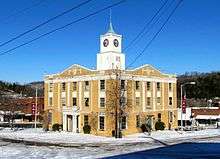 Jackson County Courthouse in Gainesboro | |
|
Location in the U.S. state of Tennessee | |
 Tennessee's location in the U.S. | |
| Founded | 1801 |
| Named for | Andrew Jackson[1] |
| Seat | Gainesboro |
| Largest town | Gainesboro |
| Area | |
| • Total | 320 sq mi (829 km2) |
| • Land | 308 sq mi (798 km2) |
| • Water | 11 sq mi (28 km2), 3.5% |
| Population | |
| • (2010) | 11,638 |
| • Density | 38/sq mi (15/km2) |
| Congressional district | 6th |
| Time zone | Central: UTC−6/−5 |
| Website |
www |
Jackson County is a county located in the U.S. state of Tennessee. The population was 11,638 at the 2010 census, with an estimate of 11,509 in 2015.[2] Its county seat is Gainesboro.[3]
Jackson is part of the Cookeville Micropolitan Statistical Area.
History
Jackson County was created by an act of the Tennessee General Assembly on November 6, 1801. It was the eighteenth county established in the state. It was formed from part of Smith County plus Indian lands. The name honors Andrew Jackson, who by 1801 had already served as a U.S. Congressman and Senator from Tennessee, a Tennessee Supreme Court justice, and a colonel in the Tennessee militia. He became more widely known as commander at the Battle of New Orleans and as the seventh President of the United States[4]
In the 1790s, an Army outpost named Fort Blount was built 10 miles (16 km) west of Gainesboro on the Cumberland River, in what is now western Jackson County. Fort Blount was an important stop for travelers on Avery's Trace. Williamsburg, a town developed around the fort, served as the Jackson County seat from 1807 to 1819.[5] The county's early records were all lost in a disastrous courthouse fire on August 14, 1872.[6]
Geography

According to the U.S. Census Bureau, the county has a total area of 320 square miles (830 km2), of which 308 square miles (800 km2) is land and 11 square miles (28 km2) (3.5%) is water.[7]
Adjacent counties
- Clay County (north)
- Overton County (east)
- Putnam County (south)
- Smith County (southwest)
- Macon County (northwest)
State protected areas
- The Boils Wildlife Management Area
- Cummins Falls State Park
- Cordell Hull Wildlife Management Area (part)
- Washmorgan Hollow State Natural Area
Demographics
| Historical population | |||
|---|---|---|---|
| Census | Pop. | %± | |
| 1810 | 5,401 | — | |
| 1820 | 7,593 | 40.6% | |
| 1830 | 9,698 | 27.7% | |
| 1840 | 12,872 | 32.7% | |
| 1850 | 15,673 | 21.8% | |
| 1860 | 11,725 | −25.2% | |
| 1870 | 12,583 | 7.3% | |
| 1880 | 12,008 | −4.6% | |
| 1890 | 13,325 | 11.0% | |
| 1900 | 15,039 | 12.9% | |
| 1910 | 15,036 | 0.0% | |
| 1920 | 14,955 | −0.5% | |
| 1930 | 13,589 | −9.1% | |
| 1940 | 15,082 | 11.0% | |
| 1950 | 12,348 | −18.1% | |
| 1960 | 9,233 | −25.2% | |
| 1970 | 8,141 | −11.8% | |
| 1980 | 9,398 | 15.4% | |
| 1990 | 9,297 | −1.1% | |
| 2000 | 10,984 | 18.1% | |
| 2010 | 11,638 | 6.0% | |
| Est. 2016 | 11,566 | [8] | −0.6% |
| U.S. Decennial Census[9] 1790-1960[10] 1900-1990[11] 1990-2000[12] 2010-2014[2] | |||

As of the census[14] of 2000, there were 10,984 people, 4,466 households, and 3,139 families residing in the county. The population density was 36 people per square mile (14/km²). There were 5,163 housing units at an average density of 17 per square mile (6/km²). The racial makeup of the county was 98.63% White, 0.15% Black or African American, 0.34% Native American, 0.06% Asian, 0.03% Pacific Islander, 0.12% from other races, and 0.67% from two or more races. 0.81% of the population were Hispanic or Latino of any race.
There were 4,466 households out of which 28.80% had children under the age of 18 living with them, 55.30% were married couples living together, 10.30% had a female householder with no husband present, and 29.70% were non-families. 25.50% of all households were made up of individuals and 10.20% had someone living alone who was 65 years of age or older. The average household size was 2.43 and the average family size was 2.89.
In the county, the population was spread out with 22.30% under the age of 18, 7.80% from 18 to 24, 28.20% from 25 to 44, 26.80% from 45 to 64, and 15.00% who were 65 years of age or older. The median age was 40 years. For every 100 females, there were 97.80 males. For every 100 females age 18 and over, there were 94.90 males.
The median income for a household in the county was $26,502, and the median income for a family was $32,088. Males had a median income of $24,759 versus $19,511 for females. The per capita income for the county was $15,020. About 15.10% of families and 18.10% of the population were below the poverty line, including 15.10% of those under age 18 and 22.50% of those age 65 or over.
Communities
Town
- Gainesboro (county seat)
Census-designated place
Unincorporated communities
- Burristown
- Center Grove
- Granville
- Mayfield
- Nameless
- North Springs
- Shady Grove
- Stone
- Whitleyville
Politics
| Year | Republican | Democratic | Third Parties |
|---|---|---|---|
| 2016 | 72.5% 3,236 | 25.3% 1,129 | 2.3% 101 |
| 2012 | 57.0% 2,383 | 41.6% 1,739 | 1.5% 62 |
| 2008 | 48.5% 2,185 | 49.4% 2,224 | 2.0% 92 |
| 2004 | 40.1% 2,026 | 59.3% 2,998 | 0.6% 32 |
| 2000 | 29.1% 1,384 | 69.5% 3,304 | 1.4% 66 |
| 1996 | 22.7% 944 | 69.4% 2,889 | 7.9% 328 |
| 1992 | 16.6% 708 | 75.3% 3,208 | 8.0% 342 |
| 1988 | 37.2% 1,168 | 62.4% 1,962 | 0.5% 14 |
| 1984 | 34.4% 1,544 | 64.5% 2,894 | 1.1% 48 |
| 1980 | 28.2% 995 | 70.2% 2,480 | 1.7% 60 |
| 1976 | 16.6% 591 | 82.9% 2,959 | 0.5% 19 |
| 1972 | 46.0% 956 | 52.2% 1,085 | 1.8% 38 |
| 1968 | 24.9% 673 | 41.5% 1,122 | 33.6% 908 |
| 1964 | 19.4% 551 | 80.6% 2,291 | |
| 1960 | 39.8% 1,049 | 58.4% 1,539 | 1.8% 48 |
| 1956 | 33.1% 881 | 65.6% 1,743 | 1.3% 35 |
| 1952 | 40.3% 1,138 | 59.6% 1,686 | 0.1% 3 |
| 1948 | 24.5% 536 | 68.7% 1,502 | 6.8% 149 |
| 1944 | 32.9% 695 | 66.6% 1,407 | 0.6% 12 |
| 1940 | 22.7% 605 | 76.9% 2,046 | 0.3% 9 |
| 1936 | 19.8% 422 | 80.0% 1,702 | 0.2% 4 |
| 1932 | 12.9% 256 | 86.9% 1,726 | 0.2% 4 |
| 1928 | 42.2% 614 | 56.8% 827 | 1.0% 15 |
| 1924 | 24.6% 354 | 74.7% 1,074 | 0.7% 10 |
| 1920 | 52.0% 1,187 | 48.0% 1,097 | |
| 1916 | 33.0% 740 | 67.1% 1,506 | |
| 1912 | 31.8% 743 | 57.5% 1,344 | 10.7% 251 |
As a secessionist Middle Tennessee county, Jackson County was historically one of the most Democratic in the state. Only once up to 2008 did a Democrat lose the county – when Warren G. Harding carried Jackson County by ninety votes in his record popular-vote landslide of 1920, due to large increases in voter turnout for the isolationist cause Harding espoused.[16] Along with Lewis County it was one of two Tennessee counties to give pluralities to both Hubert Humphrey in 1968 and George McGovern in 1972.
However, like all of Appalachia and surrounding areas, Jackson County has since 2000 seen a very rapid shift towards the Republican Party due to opposition to the Democratic Party’s liberal views on social issues.[17] Whereas Al Gore (who grew up in nearby Smith County) won almost seventy percent of the vote in 2000, Barack Obama won by only thirty-nine votes in 2008, Mitt Romney became only the second Republican to carry the county in 2012 and Donald Trump four years later received a proportion of the vote for the GOP historically associated with Unionist East Tennessee counties.
See also
References
- ↑ Moldon Tayse, "Jackson County," Tennessee Encyclopedia of History and Culture. Retrieved: 17 October 2013.
- 1 2 "State & County QuickFacts". United States Census Bureau. Archived from the original on July 12, 2011. Retrieved December 3, 2013.
- ↑ "Find a County". National Association of Counties. Archived from the original on May 31, 2011. Retrieved 2011-06-07.
- ↑ Gannett, Henry (1905). The Origin of Certain Place Names in the United States. Govt. Print. Off. p. 167.
- ↑ Benjamin Nance, Fort Blount. Tennessee Encyclopedia of History and Culture, 2002. Retrieved: 5 February 2010.
- ↑ Jackson Historical Society, Jackson County Family History Book, 1996. Retrieved: 17 October 2013.
- ↑ "2010 Census Gazetteer Files". United States Census Bureau. August 22, 2012. Retrieved April 7, 2015.
- ↑ "Population and Housing Unit Estimates". Retrieved June 9, 2017.
- ↑ "U.S. Decennial Census". United States Census Bureau. Archived from the original on May 12, 2015. Retrieved April 7, 2015.
- ↑ "Historical Census Browser". University of Virginia Library. Retrieved April 7, 2015.
- ↑ Forstall, Richard L., ed. (March 27, 1995). "Population of Counties by Decennial Census: 1900 to 1990". United States Census Bureau. Retrieved April 7, 2015.
- ↑ "Census 2000 PHC-T-4. Ranking Tables for Counties: 1990 and 2000" (PDF). United States Census Bureau. April 2, 2001. Retrieved April 7, 2015.
- ↑ Based on 2000 census data
- ↑ "American FactFinder". United States Census Bureau. Archived from the original on September 11, 2013. Retrieved 2011-05-14.
- ↑ Leip, David. "Dave Leip's Atlas of U.S. Presidential Elections". uselectionatlas.org. Retrieved 2018-03-11.
- ↑ Phillips, Kevin P.; The Emerging Republican Majority, p. 287-288 ISBN 1400852293
- ↑ Cohn, Nate; ‘Demographic Shift: Southern Whites’ Loyalty to G.O.P. Nearing That of Blacks to Democrats’, New York Times, April 24, 2014
External links
| Wikimedia Commons has media related to Jackson County, Tennessee. |
- Gainesboro-Jackson County Chamber of Commerce
- Jackson County, TNGenWeb - free genealogy resources for the county
- Jackson County at Curlie (based on DMOZ)
Places adjacent to Jackson County, Tennessee | ||||||||||
|---|---|---|---|---|---|---|---|---|---|---|
| ||||||||||
Municipalities and communities of Jackson County, Tennessee, United States | ||
|---|---|---|
| Town | ||
| CDP | ||
| Unincorporated communities | ||
