Hall County, Georgia
| Hall County, Georgia | |
|---|---|
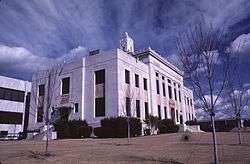 Hall County courthouse in Gainesville | |
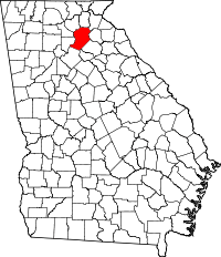 Location in the U.S. state of Georgia | |
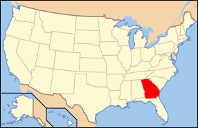 Georgia's location in the U.S. | |
| Founded | December 15, 1818 |
| Named for | Lyman Hall |
| Seat | Gainesville |
| Largest city | Gainesville |
| Area | |
| • Total | 429 sq mi (1,111 km2) |
| • Land | 393 sq mi (1,018 km2) |
| • Water | 37 sq mi (96 km2), 8.5% |
| Population (est.) | |
| • (2015) | 193,535 |
| • Density | 457/sq mi (176/km2) |
| Congressional district | 9th |
| Time zone | Eastern: UTC−5/−4 |
| Website |
www |
Hall County is a county located in the north central portion of the U.S. state of Georgia. As of the 2010 census, the population was 179,684.[1] The county seat is Gainesville.[2]
Hall County comprises the Gainesville, GA Metropolitan Statistical Area, which is also part of the Atlanta-Athens-Clarke County-Sandy Springs, GA Combined Statistical Area.
History
Hall County was created on December 15, 1818, from Cherokee lands ceded by the Treaty of Cherokee Agency (1817) and Treaty of Washington (1819).
The county is named for Dr. Lyman Hall,[3] a signer of the Declaration of Independence and governor of Georgia as both colony and state.
Geography
According to the U.S. Census Bureau, the county has a total area of 429 square miles (1,110 km2), of which 393 square miles (1,020 km2) is land and 37 square miles (96 km2) (8.5%) is water.[4]
Slightly more than half of Hall County, the eastern portion of the county, is located in the Upper Oconee River sub-basin of the Altamaha River basin, while the western half of the county is located in the Upper Chattahoochee River sub-basin of the ACF River Basin (Apalachicola-Chattahoochee-Flint River Basin).[5]
The Chattahoochee River gathers strength in Hall County, as immortalized in Sidney Lanier's poem, "Song of the Chattahoochee":
- OUT of the hills of Habersham,
- Down the valleys of Hall,
- I hurry amain to reach the plain,
- Run the rapid and leap the fall,
- Split at the rock and together again,
Adjacent counties
- White County – north
- Habersham County – northeast
- Banks County – east
- Jackson County – southeast
- Barrow County – south
- Gwinnett County – southwest
- Forsyth County – west
- Dawson County – northwest
- Lumpkin County – northwest
Attractions
- Lake Sidney Lanier
- Lanier Islands (Buford)
- Road Atlanta (Braselton)
- Falcons Complex (Flowery Branch)
- Brenau Downtown Center (Gainesville)
- Atlanta Botanical Gardens (Gainesville)
- Interactive Neighborhood for Kids (Gainesville)
- Elachee Nature Science Center (Gainesville)
- Quinlan Visual Arts Center (Gainesville)
Transportation
Major highways


Mass transit
- The Gainesville AMTRAK station is situated at 116 Industrial Boulevard. Amtrak's Crescent train connects Gainesville with the cities of New York, Philadelphia, Baltimore, Washington, Greensboro, Charlotte, Atlanta, Birmingham and New Orleans.
- Gainesville has a bus transit system, the Gainesville Connection, with 130 stops along three routes through Gainesville.[6] The Hall Area Transit Transportation System began operations in January 2001 with three buses and four mini-buses.[7]
Pedestrians and cycling
- Chicopee Woods Bike Trail
- Wilshire Trail
Demographics
| Historical population | |||
|---|---|---|---|
| Census | Pop. | %± | |
| 1820 | 5,086 | — | |
| 1830 | 11,748 | 131.0% | |
| 1840 | 7,875 | −33.0% | |
| 1850 | 8,713 | 10.6% | |
| 1860 | 9,366 | 7.5% | |
| 1870 | 9,607 | 2.6% | |
| 1880 | 15,298 | 59.2% | |
| 1890 | 18,047 | 18.0% | |
| 1900 | 20,752 | 15.0% | |
| 1910 | 25,730 | 24.0% | |
| 1920 | 26,822 | 4.2% | |
| 1930 | 30,313 | 13.0% | |
| 1940 | 34,822 | 14.9% | |
| 1950 | 40,113 | 15.2% | |
| 1960 | 49,739 | 24.0% | |
| 1970 | 59,405 | 19.4% | |
| 1980 | 75,649 | 27.3% | |
| 1990 | 95,428 | 26.1% | |
| 2000 | 139,277 | 45.9% | |
| 2010 | 179,684 | 29.0% | |
| Est. 2016 | 196,637 | [8] | 9.4% |
| U.S. Decennial Census[9] 1790-1960[10] 1900-1990[11] 1990-2000[12] 2010-2013[1] | |||
Hall County remains extremely rural and many of its residents reside in unincorporated areas, accounting for more than half of the county's population.
2000 census
At the 2000 census,[13] 139,277 people, 80,381 households and 80,009 families resided in the county. The population density was 354 per square mile (137/km²). There were 51,046 housing units at an average density of 130 per square mile (50/km²). The racial makeup of the county was 80.75% White, 7.27% Black or African American, 0.34% Native American, 1.35% Asian, 0.17% Pacific Islander, 8.75% from other races, and 1.36% from two or more races. About 19.56% of the population were Hispanic or Latino of any race.
Of the 80,381 households, 37.10% had children under the age of 18 living with them, 60.20% were married couples living together, 10.80% had a female householder with no husband present, and 24.00% were not families. About 19.20% of all households were made up of individuals and 6.70% had someone living alone who was 65 years of age or older. The average household size was 2.89 and the average family size was 3.26.
Age distribution was 26.90% under the age of 18, 10.80% from 18 to 24, 32.30% from 25 to 44, 20.60% from 45 to 64, and 9.40% who were 65 years of age or older. The median age was 32 years. For every 100 females, there were 103.60 males. For every 100 females age 18 and over, there were 101.90 males.
The median household income was $44,908, and the median family income was $50,100. Males had a median income of $31,769 versus $24,550 for females. The per capita income for the county was $19,690. About 8.50% of families and 12.40% of the population were below the poverty line, including 15.20% of those under age 18 and 14.70% of those age 65 or over.
2010 census
As of the 2010 United States Census, there were 179,684 people, 60,691 households, and 45,275 families residing in the county.[14] The population density was 457.5 inhabitants per square mile (176.6/km2). There were 68,825 housing units at an average density of 175.2 per square mile (67.6/km2).[15] The racial makeup of the county was 74.1% white, 7.4% black or African American, 1.8% Asian, 0.5% American Indian, 0.1% Pacific islander, 13.9% from other races, and 2.2% from two or more races. Those of Hispanic or Latino origin made up 26.1% of the population.[14] In terms of ancestry, 16.8% were American, 10.6% were Irish, 9.3% were English, and 8.9% were German.[16]
Of the 60,691 households, 40.2% had children under the age of 18 living with them, 56.6% were married couples living together, 12.4% had a female householder with no husband present, 25.4% were non-families, and 20.3% of all households were made up of individuals. The average household size was 2.91 and the average family size was 3.35. The median age was 34.5 years.[14]
The median income for a household in the county was $50,876 and the median income for a family was $57,774. Males had a median income of $38,671 versus $31,378 for females. The per capita income for the county was $23,675. About 11.3% of families and 14.8% of the population were below the poverty line, including 21.3% of those under age 18 and 11.6% of those age 65 or over.[17]
Education
Colleges and universities
- Brenau University
- Lanier Technical College
- University of North Georgia, Gainesville Campus (formerly Gainesville State College)
High schools
Middle schools
- Alternative Learning Center/International Center
- C. W. Davis Middle School
- Chestatee Middle School
- Da Vinci Academy
- East Hall Middle School
- Gainesville Middle School
- Lanier Career Academy
- North Georgia Christian School
- North Hall Middle School
- South Hall Middle School
- West Hall Middle School
Communities
- Braselton (partly in Jackson, Barrow, and Gwinnett Counties)
- Buford (mostly in Gwinnett County)
- Chestnut Mountain
- Clermont
- Flowery Branch
- Gainesville
- Gillsville
- Lula (partly in Banks County)
- Murrayville (partly in Lumpkin and White Counties)
- Oakwood
Politics
| Year | Republican | Democratic | Third parties |
|---|---|---|---|
| 2016 | 72.7% 51,733 | 22.7% 16,180 | 4.5% 3229 |
| 2012 | 77.2% 47,481 | 21.1% 12,999 | 1.7% 1,032 |
| 2008 | 74.8% 44,962 | 24.0% 14,457 | 1.2% 711 |
| 2004 | 78.1% 38,883 | 21.1% 10,514 | 0.8% 395 |
| 2000 | 70.4% 26,841 | 26.9% 10,259 | 2.8% 1,050 |
| 1996 | 59.8% 19,280 | 32.2% 10,362 | 8.0% 2577 |
| 1992 | 49.7% 16,108 | 34.6% 11,214 | 15.8% 5111 |
| 1988 | 68.7% 17,415 | 30.7% 7,782 | 0.6% 147 |
| 1984 | 67.0% 15,076 | 33.0% 7,421 | |
| 1980 | 37.8% 7,760 | 59.1% 12,124 | 3.1% 637 |
| 1976 | 28.5% 5,093 | 71.5% 12,804 | |
| 1972 | 81.4% 10,686 | 18.6% 2,440 | |
| 1968 | 36.1% 4,923 | 23.3% 3174 | 40.7% 5,546 |
| 1964 | 34.9% 4,296 | 65.0% 8,003 | 0.1% 11 |
| 1960 | 31.5% 2,903 | 68.5% 6,303 | |
| 1956 | 31.5% 2,752 | 68.5% 5,989 | |
| 1952 | 23.2% 1,845 | 76.8% 6,121 | |
| 1948 | 10.8% 449 | 74.4% 3,093 | 14.8% 617 |
| 1944 | 20.6% 796 | 79.4% 3,066 | 0.0% 1 |
| 1940 | 14.7% 513 | 84.5% 2,943 | 0.8% 26 |
| 1936 | 14.0% 444 | 85.9% 2,731 | 0.2% 6 |
| 1932 | 4.3% 120 | 95.3% 2,649 | 0.4% 11 |
| 1928 | 50.8% 1,573 | 49.2% 1,523 | |
| 1924 | 15.6% 290 | 75.0% 1,398 | 9.4% 175 |
| 1920 | 36.6% 852 | 63.4% 1,475 | |
| 1916 | 16.9% 367 | 76.6% 1,662 | 6.5% 141 |
| 1912 | 17.9% 275 | 74.5% 1,145 | 7.6% 116 |
See also
References
- 1 2 "State & County QuickFacts". United States Census Bureau. Archived from the original on July 11, 2011. Retrieved February 16, 2014.
- ↑ "Find a County". National Association of Counties. Retrieved 2011-06-07.
- ↑ Gannett, Henry (1905). The Origin of Certain Place Names in the United States. Govt. Print. Off. p. 147.
- ↑ "US Gazetteer files: 2010, 2000, and 1990". United States Census Bureau. 2011-02-12. Retrieved 2011-04-23.
- ↑ "Georgia Soil and Water Conservation Commission Interactive Mapping Experience". Georgia Soil and Water Conservation Commission. Retrieved 2015-11-18.
- ↑ "Hall Area Transit Bus Services | City of Gainesville, Georgia". www.gainesville.org. Retrieved 2018-08-07.
- ↑ "History | City of Gainesville, Georgia". www.gainesville.org. Retrieved 2018-08-07.
- ↑ "Population and Housing Unit Estimates". Retrieved June 9, 2017.
- ↑ "U.S. Decennial Census". United States Census Bureau. Retrieved June 23, 2014.
- ↑ "Historical Census Browser". University of Virginia Library. Retrieved June 23, 2014.
- ↑ "Population of Counties by Decennial Census: 1900 to 1990". United States Census Bureau. Retrieved June 23, 2014.
- ↑ "Census 2000 PHC-T-4. Ranking Tables for Counties: 1990 and 2000" (PDF). United States Census Bureau. Retrieved June 23, 2014.
- ↑ "American FactFinder". United States Census Bureau. Retrieved 2011-05-14.
- 1 2 3 "DP-1 Profile of General Population and Housing Characteristics: 2010 Demographic Profile Data". United States Census Bureau. Retrieved 2015-12-29.
- ↑ "Population, Housing Units, Area, and Density: 2010 - County". United States Census Bureau. Retrieved 2015-12-29.
- ↑ "DP02 SELECTED SOCIAL CHARACTERISTICS IN THE UNITED STATES – 2006-2010 American Community Survey 5-Year Estimates". United States Census Bureau. Retrieved 2015-12-29.
- ↑ "DP03 SELECTED ECONOMIC CHARACTERISTICS – 2006-2010 American Community Survey 5-Year Estimates". United States Census Bureau. Retrieved 2015-12-29.
- ↑ Leip, David. "Dave Leip's Atlas of U.S. Presidential Elections". uselectionatlas.org. Retrieved 2018-03-20.
External links
- Economic Development in Hall County, Georgia
- Business Gainesville-Hall County Chamber of Commerce
- Lake Lanier Convention & Visitors Bureau
- Hall County web site from Roadside Georgia
- Hall County Government official site
- GaGEN Web Hall County section
- This Day in Georgia History: December 15, Ed Jackson and Charly Pou, Carl Vinson Institute of Government, The University of Georgia
- Documents from Hall County at the Digital Library of Georgia
- Hall County Sesquicentennial historical marker
- Historic Redwine historical marker
Places adjacent to Hall County, Georgia | ||||||||||
|---|---|---|---|---|---|---|---|---|---|---|
| ||||||||||
Municipalities and communities of Hall County, Georgia, United States | ||
|---|---|---|
| City | | |
| Towns | ||
| Unincorporated communities | ||
| Footnotes | ‡This populated place also has portions in an adjacent county or counties | |
|  | |||||
|
| ||||||
| ||||||