Dale County, Alabama
| Dale County, Alabama | |
|---|---|
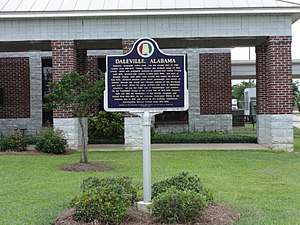 Daleville historical marker | |
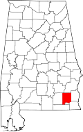 Location in the U.S. state of Alabama | |
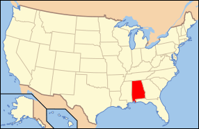 Alabama's location in the U.S. | |
| Founded | December 22, 1824 |
| Named for | Samuel Dale |
| Seat | Ozark |
| Largest city | Ozark |
| Area | |
| • Total | 563 sq mi (1,458 km2) |
| • Land | 561 sq mi (1,453 km2) |
| • Water | 1.6 sq mi (4 km2), 0.3% |
| Population (est.) | |
| • (2017) | 49,226 |
| • Density | 90/sq mi (30/km2) |
| Congressional district | 2nd |
| Time zone | Central: UTC−6/−5 |
| Website |
www |
|
Footnotes:
| |
Dale County is a county of the U.S. state of Alabama. As of the 2010 census the population was 50,251.[1] Its county seat and largest city is Ozark.[2] Its name is in honor of General Samuel Dale.[3]
Dale County comprises the Ozark, AL Micropolitan Statistical Area, which is also included in the Dothan-Enterprise-Ozark, AL Combined Statistical Area.
The vast majority of Fort Rucker, the U.S. Army Aviation Center for Excellence, is located in Dale County.
History
The area now known as Dale County was originally inhabited by members of the Creek Indian nation, who occupied all of southeastern Alabama during this period. Between the years of 1764 and 1783 this region fell under the jurisdiction of the colony of British West Florida.[4] The county, together with the surrounding area, was ceded to the United States in the 1814 Treaty of Fort Jackson, ending the Creek Indian Wars. A blockhouse had been constructed during the conflict on the northwestern side of the Choctawhatchee River, and the first non-Indian residents of Dale County would be veterans who began to settle in the area around 1820.[5]
Dale County was established on December 22, 1824. It originally included the whole of what is now Coffee County and Geneva County, together with the "panhandle" portion of Houston County. The original county seat was located at Dale's Court House (now the town of Daleville), but when Coffee County split from Dale in 1841, the seat was moved to Newton. Here it remained until 1870 when, following a courthouse fire in 1869 and the formation of Geneva County (which took the southern third of Dale County), the county seat was moved to the town of Ozark, where it remains. In 1903 a small portion of the southeast part of Dale county was joined to the newly formed Houston County.
Portions of the 15th Regiment of Alabama Infantry, which served with great distinction throughout the U.S. Civil War, were recruited in Dale County, with all of Co. "E" and part of Co. "H" being composed of Dale County residents. This unit is most famous for being the regiment that confronted the 20th Maine on the Little Round Top during the Battle of Gettysburg on July 2, 1863. Despite several ferocious assaults, the 15th was ultimately unable to dislodge the Union troops, and was ultimately forced to retreat after a desperate bayonet charge led by the 20th Maine's commander, Col. Joshua L. Chamberlain.[6] This assault was vividly recreated in Ronald F. Maxwell's 1993 film Gettysburg. The 15th would continue to serve until the final capitulation of Lee's army at Appomattox Court House in 1865.
Another regiment recruited largely from Dale County was the 33rd Alabama; Companies B, G and I were recruited in the county, with Co. G coming from Daleville; Co. B from Newton, Skipperville, Clopton, Echo and Barnes Cross Roads; and Co. I from Newton, Haw Ridge, Rocky Head, Westville and Ozark.[7][8] This regiment fought with great distinction in the Army of Tennessee, mostly under famed General Patrick Cleburne, once winning the Thanks of the Confederate Congress for its action at Ringgold Gap. The regiment was largely annihilated during the battles of Perryville and Franklin, but a few men survived and returned to Dale County after the war.
Geography
According to the U.S. Census Bureau, the county has a total area of 563 square miles (1,460 km2), of which 561 square miles (1,450 km2) is land and 1.6 square miles (4.1 km2) (0.3%) is water.[9] It is the fifth-smallest county in Alabama by land area and third-smallest by total area.
Major highways


Adjacent counties
- Barbour County (north)
- Henry County (east)
- Houston County (southeast)
- Geneva County (southwest)
- Coffee County (west)
- Pike County (northwest)
Demographics
| Historical population | |||
|---|---|---|---|
| Census | Pop. | %± | |
| 1830 | 2,031 | — | |
| 1840 | 7,397 | 264.2% | |
| 1850 | 6,382 | −13.7% | |
| 1860 | 12,197 | 91.1% | |
| 1870 | 11,325 | −7.1% | |
| 1880 | 12,677 | 11.9% | |
| 1890 | 17,225 | 35.9% | |
| 1900 | 21,189 | 23.0% | |
| 1910 | 21,608 | 2.0% | |
| 1920 | 22,711 | 5.1% | |
| 1930 | 23,175 | 2.0% | |
| 1940 | 22,685 | −2.1% | |
| 1950 | 20,828 | −8.2% | |
| 1960 | 31,066 | 49.2% | |
| 1970 | 52,995 | 70.6% | |
| 1980 | 47,821 | −9.8% | |
| 1990 | 49,633 | 3.8% | |
| 2000 | 49,129 | −1.0% | |
| 2010 | 50,251 | 2.3% | |
| Est. 2017 | 49,226 | [10] | −2.0% |
| U.S. Decennial Census[11] 1790–1960[12] 1900–1990[13] 1990–2000[14] 2010–2017[1] | |||
As of the census[15] of 2000, there were 49,129 people, 18,878 households, and 13,629 families residing in the county. The population density was 88 people per square mile (34/km2). There were 21,779 housing units at an average density of 39 per square mile (15/km2). The racial makeup of the county was 74.4% White, 20.4% Black or African American, 0.60% Native American, 1.1% Asian, 0.15% Pacific Islander, 1.3% from other races, and 2.2% from two or more races. 3.4% of the population were Hispanic or Latino of any race. 2.85% of the population reported speaking Spanish at home, while 1.51% speak German.
There were 18,878 households out of which 36% had children under the age of 18 living with them, 55% were married couples living together, 13.6% had a female householder with no husband present, and 27.8% were non-families. 24.3% of all households were made up of individuals and 8.8% had someone living alone who was 65 years of age or older. The average household size was 2.5 and the average family size was 3.0.
In the county, the population was spread out with 26.6% under the age of 18, 9.6% from 18 to 24, 30.3% from 25 to 44, 21.8% from 45 to 64, and 11.8% who were 65 years of age or older. The median age was 34 years. For every 100 females, there were 98.3 males. For every 100 females age 18 and over, there were 95 males.
The median income for a household in the county was $31,998, and the median income for a family was $37,806. Males had a median income of $29,844 versus $19,988 for females. The per capita income for the county was $16,010. 15% of the population and 12.6% of families were below the poverty line. 19.4% of those under the age of 18 and 16.5% of those 65 and older were living below the poverty line.
2010 census
As of the census[16] of 2010, there were 50,251 people, 20,065 households, and 13,721 families residing in the county. The population density was 90 people per square mile (35/km2). There were 22,677 housing units at an average density of 40 per square mile (15/km2). The racial makeup of the county was 74.1% White, 19.3% Black or African American, 0.7% Native American, 1.1% Asian, 0.1% Pacific Islander, 1.8% from other races, and 3.0% from two or more races. 5.6% of the population were Hispanic or Latino of any race.
There were 20,065 households out of which 30.1% had children under the age of 18 living with them, 48.9% were married couples living together, 14.6% had a female householder with no husband present, and 31.6% were non-families. 27.3% of all households were made up of individuals and 9.6% had someone living alone who was 65 years of age or older. The average household size was 2.46 and the average family size was 2.98.
In the county, the population was spread out with 24.8% under the age of 18, 9.4% from 18 to 24, 26.7% from 25 to 44, 25.7% from 45 to 64, and 13.5% who were 65 years of age or older. The median age was 36.1 years. For every 100 females, there were 97.6 males. For every 100 females age 18 and over, there were 101.0 males.
The median income for a household in the county was $43,353, and the median income for a family was $50,685. Males had a median income of $24,569 versus $34,856 for females. The per capita income for the county was $21,722. 14.8% of the population and 11.4% of families were below the poverty line. 19.6% of those under the age of 18 and 10.2% of those 65 and older were living below the poverty line.
Government
| Year | GOP | DEM | Others |
|---|---|---|---|
| 2016 | 73.7% 13,808 | 23.5% 4,413 | 2.8% 528 |
| 2012 | 70.5% 13,108 | 28.4% 5,286 | 1.1% 207 |
| 2008 | 71.9% 13,886 | 27.3% 5,270 | 0.9% 164 |
| 2004 | 74.7% 13,621 | 24.6% 4,484 | 0.7% 126 |
| 2000 | 67.0% 10,593 | 31.0% 4,906 | 1.9% 307 |
| 1996 | 57.8% 8,288 | 33.0% 4,732 | 9.2% 1,310 |
| 1992 | 51.5% 8,123 | 32.3% 5,098 | 16.3% 2,566 |
| 1988 | 71.8% 9,266 | 26.9% 3,476 | 1.3% 163 |
| 1984 | 75.4% 10,319 | 23.5% 3,215 | 1.2% 158 |
| 1980 | 57.6% 7,247 | 39.3% 4,936 | 3.1% 390 |
| 1976 | 43.3% 4,996 | 55.0% 6,346 | 1.6% 189 |
| 1972 | 83.1% 8,346 | 15.9% 1,594 | 1.0% 98 |
| 1968 | 6.3% 607 | 8.9% 862 | 84.9% 8,236 |
| 1964 | 83.8% 4,970 | 16.2% 963 | |
| 1960 | 38.7% 1,634 | 60.8% 2,563 | 0.5% 21 |
| 1956 | 34.6% 1,284 | 62.5% 2,318 | 3.0% 110 |
| 1952 | 28.5% 1,073 | 70.9% 2,669 | 0.6% 21 |
| 1948 | 14.4% 230 | 85.6% 1,372 | |
| 1944 | 13.3% 325 | 85.6% 2,094 | 1.1% 28 |
| 1940 | 12.8% 374 | 87.0% 2,543 | 0.2% 5 |
| 1936 | 7.4% 193 | 92.5% 2,404 | 0.1% 2 |
| 1932 | 6.3% 155 | 93.7% 2,300 | 0.0% 1 |
| 1928 | 44.8% 1,000 | 55.2% 1,233 | 0.0% 1 |
| 1924 | 20.6% 297 | 77.5% 1,117 | 1.9% 27 |
| 1920 | 35.3% 768 | 63.7% 1,386 | 1.0% 21 |
| 1916 | 31.9% 597 | 67.4% 1,260 | 0.7% 13 |
| 1912 | 6.2% 99 | 66.0% 1,059 | 27.8% 446 |
| 1908 | 26.2% 346 | 69.6% 921 | 4.2% 56 |
| 1904 | 24.2% 345 | 69.9% 997 | 5.9% 84 |
Communities
Cities
- Daleville
- Dothan (partly in Houston County and Henry County)
- Enterprise (partly in Coffee County)
- Level Plains
- Ozark (county seat)
Towns
Census-designated place
- Fort Rucker (U.S. Army base)
Unincorporated communities
Notable people
- Samuel Dale (1772 – May 24, 1841), was an American frontiersman, known as the "Daniel Boone of Alabama", is buried here.
See also
References
- 1 2 "State & County QuickFacts". United States Census Bureau. Archived from the original on August 9, 2014. Retrieved May 16, 2014.
- ↑ "Find a County". National Association of Counties. Archived from the original on 2011-05-31. Retrieved 2011-06-07.
- ↑ Gannett, Henry (1905). The Origin of Certain Place Names in the United States. Govt. Print. Off. p. 98.
- ↑ The Economy of British West Florida, 1763-1783 by Robin F. A. Fabel (University of Alabama Press, 2002)
- ↑ https://web.archive.org/web/20080528150204/http://www.geocities.com/Heartland/Prairie/1767/. Retrieved on 21 July 2008.
- ↑ Desjardin, pp. 69-71, Pfanz, p. 232.
- ↑ 33rd Regiment, Alabama Infantry
- ↑ 33rd Alabama, Company B Archived July 8, 2010, at the Wayback Machine.
- ↑ "2010 Census Gazetteer Files". United States Census Bureau. August 22, 2012. Retrieved August 22, 2015.
- ↑ "Population and Housing Unit Estimates". Retrieved June 9, 2017.
- ↑ "U.S. Decennial Census". United States Census Bureau. Archived from the original on May 12, 2015. Retrieved August 22, 2015.
- ↑ "Historical Census Browser". University of Virginia Library. Retrieved August 22, 2015.
- ↑ Forstall, Richard L., ed. (March 24, 1995). "Population of Counties by Decennial Census: 1900 to 1990". United States Census Bureau. Retrieved August 22, 2015.
- ↑ "Census 2000 PHC-T-4. Ranking Tables for Counties: 1990 and 2000" (PDF). United States Census Bureau. April 2, 2001. Retrieved August 22, 2015.
- ↑ "American FactFinder". United States Census Bureau. Archived from the original on 2013-09-11. Retrieved 2011-05-14.
- ↑ "American FactFinder". United States Census Bureau. Archived from the original on 2013-09-11. Retrieved 2015-07-20.
- ↑ "Dave Leip's Atlas of U.S. Presidential Elections". Retrieved November 16, 2016.
External links
Places adjacent to Dale County, Alabama | ||||||||||
|---|---|---|---|---|---|---|---|---|---|---|
| ||||||||||
Municipalities and communities of Dale County, Alabama, United States | ||
|---|---|---|
| Cities | | |
| Towns | ||
| CDP | ||
| Unincorporated communities | ||
| Footnotes | ‡This populated place also has portions in an adjacent county or counties | |