Broward County, Florida
| Broward County, Florida | ||
|---|---|---|
| County | ||
| Broward County | ||
.JPG) The Broward County Courthouse | ||
| ||
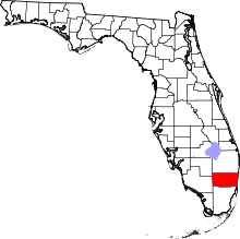 Location in the U.S. state of Florida | ||
 Florida's location in the U.S. | ||
| Founded | April 30, 1915 | |
| Named for | Napoleon B. Broward | |
| Government • Mayor |
Beam Furr | |
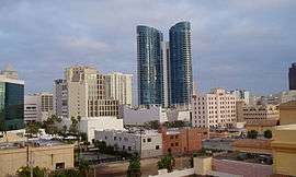
| Seat | Fort Lauderdale | |
| Largest city | Fort Lauderdale | |
| Area | ||
| • Total | 1,323 sq mi (3,427 km2) | |
| • Land | 1,210 sq mi (3,134 km2) | |
| • Water | 113 sq mi (293 km2), 8.5% | |
| Population (est.) | ||
| • (2017) | 1,935,878 | |
| • Density | 1,600/sq mi (600/km2) | |
| Congressional districts | 20th, 22nd, 23rd, 24th | |
| Time zone | Eastern: UTC−5/−4 | |
| Website |
www | |
Broward County is a county in the southeastern part of the U.S. state of Florida. As of 2017, the population was 1,935,878,[1] making it the second-most populous county in Florida and the 17th-most populous in the United States. Its county seat is Fort Lauderdale.[2]
Broward County is one of the three counties in South Florida that make up the Miami metropolitan area, which was home to an estimated 6,012,331 people at the 2010 census.
History
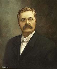
Although the area has been settled since about 1400 B.C., Broward County was founded on April 30, 1915.[3] It was intended to be named Everglades County, but then-Speaker of the Florida House of Representatives Ion Farris amended the bill that established the county to be named in honor of Napoleon Bonaparte Broward, Governor of Florida from 1905 to 1909.[4] Throughout his term as Governor, Broward championed Everglades drainage and was remembered for his campaign to turn the Everglades into “useful land”. This opened up much of today's urban Broward County for development, first as agricultural land and later as residential. A year before Broward became Governor, Dania became the first incorporated community of what is now Broward County, followed by Pompano during his term in 1908, and Fort Lauderdale in 1911 shortly after his term ended.
In 1915, Palm Beach County and Dade County contributed nearly equal portions of land to create Broward County.[3] Broward County began a huge development boom after its incorporation, with the first "tourist hotel", in Fort Lauderdale, opening in 1919. A year later, developers began dredging wetlands in the county to create island communities.[3] By 1925, the boom was considered to have reached its peak, but a 1926 hurricane caused economic depression in the county.[3] The county saw another population and development boom post-World War II where the transformation from agricultural to urbanized residential area began, and another boom between the 1950s and the late 1960s. The effects of a national recession hit the county in 1974 and the population growth finally slowed. The structure of county government was signed into law in 1975 with the passage of the Broward County charter.[3] In 1977 a Land Use Plan was passed and was a major step in limiting urban sprawl.
Geography
| Broward County, FL[5] | ||||||||||||||||||||||||||||||||||||||||||||||||||||||||||||
|---|---|---|---|---|---|---|---|---|---|---|---|---|---|---|---|---|---|---|---|---|---|---|---|---|---|---|---|---|---|---|---|---|---|---|---|---|---|---|---|---|---|---|---|---|---|---|---|---|---|---|---|---|---|---|---|---|---|---|---|---|
| Climate chart (explanation) | ||||||||||||||||||||||||||||||||||||||||||||||||||||||||||||
| ||||||||||||||||||||||||||||||||||||||||||||||||||||||||||||
| ||||||||||||||||||||||||||||||||||||||||||||||||||||||||||||
According to the U.S. Census Bureau, the county has an area of 1,323 square miles (3,430 km2), of which 1,210 square miles (3,100 km2) is land and 113 square miles (290 km2) (8.5%) is water.[6]
Broward County has an average elevation of six feet (1.8 m) above sea level. It is rather new geologically and at the eastern edge of the Florida Platform, a carbonate plateau created millions of years ago. Broward County is composed of Oolite limestone while western Broward is composed mostly of Bryozoa.[7] Broward is among the last areas of Florida to be created and populated with fauna and flora, mostly in the Pleistocene.
Of developable land in Broward County, approximately 471 square miles (1,219.9 km2), the majority is built upon, as the urban area is bordered by the Atlantic Ocean to the east and the Everglades Wildlife Management Area to the west. Within developable land, Broward County has a population density of 3,740 per square mile (1,444 per square kilometer).
Broward approved the construction of Osborne Reef, an artificial reef made of tires off the Fort Lauderdale beach, but it has proven an environmental disaster.[8]
Adjacent counties
- Palm Beach County - north
- Miami-Dade County - south
- Collier County - west
- Hendry County - northwest

Demographics
| Historical population | |||
|---|---|---|---|
| Census | Pop. | %± | |
| 1920 | 5,135 | — | |
| 1930 | 20,094 | 291.3% | |
| 1940 | 39,794 | 98.0% | |
| 1950 | 83,933 | 110.9% | |
| 1960 | 333,946 | 297.9% | |
| 1970 | 620,100 | 85.7% | |
| 1980 | 1,018,200 | 64.2% | |
| 1990 | 1,255,488 | 23.3% | |
| 2000 | 1,623,018 | 29.3% | |
| 2010 | 1,748,066 | 7.7% | |
| Est. 2017 | 1,935,878 | [9] | 10.7% |
| U.S. Decennial Census[10] 1790-1960[11] 1900-1990[12] 1990-2000[13] 2010-2015[1] | |||
2015 5-Year American Community Survey
Households & Families
As of the 2015 5-year ACS, Broward County had 1,843,152 people, 670,284 households, and 425,680 families. Of the 670,284 households in Broward County, 26.2% had children under the age of 18 living with them, 43% were married couples living together, 15.6% had a female householder with no husband present, and 36.5% were non-families. 29.6% of all households were made up of individuals and 11.6% had someone living alone who was 65 years of age or older. The average household size was 2.73 and the average family size was 3.43.[14]
Age
In the county, the population was spread out with 21.7% under the age of 18, 8.5% from 18 to 24, 26.9% from 25 to 44, 27.7% from 45 to 64, and 15.0% who were 65 years of age or older. The median age was 40 years. For every 100 females, there were 94.4 males. For every 100 females age 18 and over, there were 98.7 males.[15]
Race, Ancestry & Nationality
The racial makeup of the county was 62.3% White, 17.1% Hispanic, 12.2% Black or African American, 5.07% Asian, 2.20% from two or more races, 0.66% Native American, 0.16% Pacific Islander, and 0.20% from some other race. The racial makeup of the total Hispanic population in Broward County was: 65.8% White, 5.90% Native American, 2.06% Black or African American, 0.33% Asian, 0.86% Pacific Islander, 26.23% were some other race and 4.57% were from two or more races.[16] In 2015, with relation to ancestry (excluding the various Hispanic and Latino ancestries), 7.38% were Italian, 7.70% American, 6.44% German, 6.54% Irish, and 0.68% English ancestry. Also, among West Indians, 6.33% were Haitian and 5.96% were Jamaican.[17] In 2015, 32.2% of the county’s population was foreign born, with 18.14% being naturalized American citizens.[18] Of foreign born residents, 78.9% were born in Latin America, 7.88% were born in Europe, 8.52% born in Asia, 3.11% in North America, 1.34% born in Africa and 0.15 were born in Oceania.[19]
Income
As of the 2015 5-year ACS, the median income for a household in the county was $51,968, and the median income for a family was $61,809.[20] Of full-time workers, males had a median income of $46,372 versus $39,690 for females.[21] The per capita income for the county was $28,381. About 11.2% of families and 14.5% of the population were below the poverty line, including 19.9% of those under the age 18 and 12.6% of those aged 65 or over.[22]
2010 Census
U.S. Census Bureau 2010 Ethnic/Race Demographics:[23][24][25]
- White (non-Hispanic) : 42.5% (8.7% Irish, 8.2% Italian, 7.9% German, 5.0% English, 3.2% Polish, 2.7% Russian, 1.9% French, 1.0% Scottish, 0.8% Dutch, 0.8% Scotch-Irish, 0.8% Hungarian, 0.6% Swedish, 0.6% French Canadian, 0.5% Greek)[23](63.1% when including White Hispanics)
- Black (non-Hispanic) (26.7% when including Black Hispanics): 17.7%(12.8% West Indian/Afro-Caribbean American [5.7% Haitian, 5.3% Jamaican, 0.4% Trinidadian and Tobagonian, 0.4% Other or Unspecified West Indian, 0.3% Bahamian, 0.2% British West Indian, 0.1% Barbadian,] 0.8% Subsaharan African)[23][26]
- Hispanic or Latino of any race: 26.9% (4.8% Cuban, 4.3% Puerto Rican, 3.8% Colombian, 1.7% Mexican, 1.6% Dominican, 1.4% Peruvian, 1.3% Venezuelan, 0.7% Ecuadoran, 0.7% Honduran, 0.6% Argentinean, 0.5% Nicaraguan, 0.5% Salvadoran)[25][27]
- Asian: 3.2% (1.2% Indian, 0.6% Chinese, 0.5% Other Asian, 0.4% Filipino, 0.3% Vietnamese, 0.1% Japanese, 0.1% Korean)[24][25]
- Two or more races: 2.9%
- American Indian and Alaska Native: 0.3%
- Native Hawaiian and Other Pacific Islander: 0.1%
- Other Races: 3.7% (0.7% Arab)[23]
In 2010, 4.7% of the population considered themselves to be of only "American" ancestry (regardless of race or ethnicity.)[23]
As of 2010, Haitians made up the largest population of immigrants, with Jamaicans coming in second, Colombians in third, followed by Cuban exiled refugees in fourth place, then Peruvians, Venezuelans, Brazilians, Dominicans, Canadians, and Mexicans being the tenth highest group of expatriates.[28] The county also houses many British, French, German, and Spanish expatriates.
There were 810,388 households out of which 28.61% had children under the age of 18 living with them, 42.80% were married couples living together, 15.28% had a female householder with no husband present, and 36.67% were non-families. 28.79% of all households were made up of individuals and 11.07% (3.31% male and 7.76% female) had someone living alone who was 65 years of age or older. The average household size was 2.52 and the average family size was 3.14.[23][29]
The age distribution is 22.4% under the age of 18, 8.4% from 18 to 24, 27.2% from 25 to 44, 27.7% from 45 to 64, and 14.3% who were 65 years of age or older. The median age was 39.7 years. For every 100 females, there were 93.9 males. For every 100 females age 18 and over, there were 91.0 males.[29]
The median income for a household in the county was $51,694, and the median income for a family was $62,619. Males had a median income of $44,935 versus $36,813 for females. The per capita income for the county was $28,631. About 9.1% of families and 12.3% of the population were below the poverty line, including 16.2% of those under age 18 and 12.2% of those aged 65 or over.[30]
In 2010, 30.9% of the county's population was foreign born, with 49.2% being naturalized American citizens. Of foreign born residents, 77.4% were born in Latin America, 9.0% were born in Europe, 8.4% born in Asia, 3.5% in North America, 1.6% born in Africa, and 0.1% were born in Oceania.[23]
According to the 2010 U.S. Census,[31] Broward County is the 9th largest county with same sex households. As of the 2010 Census, there were 9,125 same sex households out of a total of 686,047 households (1.33%).[31]
2000 Census
As of the census of 2000, there were 1,623,018 people, 654,445 households, and 411,645 families residing in the county. The population density was 1,346 people per square mile (520/km²). There were 741,043 housing units at an average density of 615 per square mile (237/km²). The racial makeup of the county was 70.57% White (58% were Non-Hispanic),[32] 20.54% Black or African American, 0.24% Native American, 2.25% Asian, 0.06% Pacific Islander, 3.00% from other races, and 3.35% from two or more races. 16.74% of the population were Hispanic or Latino of any race.
In 2000, with relation to ancestry (excluding the various Hispanic and Latino ancestries), 9.4% were Italian, 7.4% American, 6.8% German, 6.7% Irish, and 4% English ancestry. Also, among West Indians, 5.99% were Haitian and were 5.91% Jamaican.[33] Broward was the only county in the nation outside the Northeast in which Italian-Americans formed the largest ethnic group in 2000. They are concentrated mainly in the Pompano Beach area.[33]
There were 654,445 households out of which 29.30% had children under the age of 18 living with them, 46.1% were married couples living together, 12.5% had a female householder with no husband present, and 37.1% were non-families. 29.6% of all households were made up of individuals and % had someone living alone who was 65 years of age or older. The average household size was 2.45 and the average family size was 3.07.
In the county, the population was spread out with 23.6% under the age of 18, 7.2% from 18 to 24, 31.4% from 25 to 44, 21.7% from 45 to 64, and 16.1% who were 65 years of age or older. The median age was 38 years. For every 100 females, there were 93.3 males. For every 100 females age 18 and over, there were 89.8 males.
The median income for a household in the county was $41,691, and the median income for a family was $50,531. Males had a median income of $36,741 versus $28,529 for females. The per capita income for the county was $23,170. About 8.7% of families and 11.5% of the population were below the poverty line, including 15.3% of those under age 18 and 10.0% of those age 65 or over.
As of 2005, Broward County led the nation's metropolitan areas in new AIDS diagnoses, with a reported rate 58.4 new AIDS diagnoses per 100,000 people. County officials think the numbers may stem from a new and successful HIV testing campaign that has resulted in many people being diagnosed with AIDS at the same time they've been diagnosed with HIV.[34] Without the implementation of the new testing campaign, the reported numbers of new diagnoses would have probably been lower.
Languages
As of 2010, 63.44% of all residents spoke English as their first language, while 22.22% spoke Spanish, 5.42% French Creole (mostly Haitian Creole,) 1.48% Portuguese, 1.41% French, and 0.59% of the population spoke Italian as their mother language. In total, 36.56% of the population spoke languages other than English as their primary language.[35] Since many immigrants are coming from the Anglophone Caribbean, where English is spoken, the change is not as fast as the rate of immigration would suggest.
Economy
Silver Airways has its headquarters on the property of Fort Lauderdale-Hollywood International Airport in an unincorporated area. [36][37][38] Other companies with headquarters in unincorporated areas include Locair.[39]
When Chalk's International Airlines existed, its headquarters was on the grounds of the airport in an unincorporated area.[40] When Bimini Island Air existed, its headquarters were in an unincorporated area.[41]
Communities
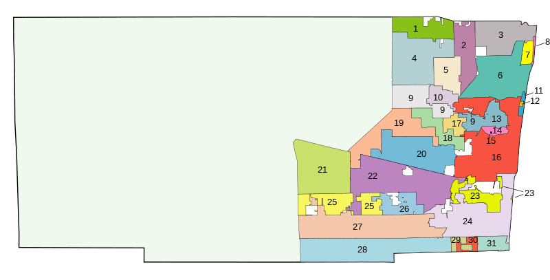
Municipality populations are based on the 2015 5-year American Community Survey.[42][43]
| # | Incorporated Community | Designation | Date incorporated | Population |
|---|---|---|---|---|
| 2 | Coconut Creek | City | February 20, 1967 | 56,816 |
| 26 | Cooper City | City | June 20, 1959 | 33,382 |
| 4 | Coral Springs | City | July 10, 1963 | 126,673 |
| 23 | Dania Beach | City | November 30, 1904 | 30,878 |
| 22 | Davie | Town | November 16, 1925 | 97,372 |
| 3 | Deerfield Beach | City | June 11, 1925 | 78,227 |
| 16 | Fort Lauderdale | City | March 27, 1911 | 173,570 |
| 31 | Hallandale Beach | City | May 11, 1927 | 38,725 |
| 8 | Hillsboro Beach | Town | June 12, 1939 | 1,568 |
| 24 | Hollywood | City | November 28, 1925 | 146,791 |
| 11 | Lauderdale-by-the-Sea | Town | November 30, 1927 | 6,313 |
| 17 | Lauderdale Lakes | City | June 22, 1961 | 34,103 |
| 18 | Lauderhill | City | June 20, 1959 | 69,979 |
| 15 | Lazy Lake | Village | June 3, 1953 | 33 |
| 7 | Lighthouse Point | City | June 13, 1956 | 10,842 |
| 5 | Margate | City | May 30, 1955 | 55,678 |
| 28 | Miramar | City | May 26, 1955 | 131,384 |
| 10 | North Lauderdale | City | July 10, 1963 | 42,853 |
| 13 | Oakland Park | City | June 10, 1929 | 43,347 |
| 1 | Parkland | City | July 10, 1963 | 27,114 |
| 30 | Pembroke Park | Town | October 10, 1957 | 6,244 |
| 27 | Pembroke Pines | City | March 2, 1959 | 162,243 |
| 20 | Plantation | City | April 30, 1953 | 89,904 |
| 6 | Pompano Beach | City | June 6, 1908 | 104,741 |
| 12 | Sea Ranch Lakes | Village | October 6, 1959 | 701 |
| 25 | Southwest Ranches | Town | June 6, 2000 | 7,676 |
| 19 | Sunrise | City | June 22, 1961 | 89,942 |
| 9 | Tamarac | City | August 15, 1963 | 63,227 |
| 29 | West Park | City | March 1, 2005 | 14,779 |
| 21 | Weston | City | September 3, 1996 | 68,423 |
| 14 | Wilton Manors | City | May 13, 1947 | 12,133 |
Formerly unincorporated neighborhoods
|
|
|
|
Census-designated places |
Other unincorporated areas |
Government
| Name | Start of Term | End of Term |
|---|---|---|
| Barbara Sharief | Nov. 17, 2016 | Nov. 17, 2017 |
| Marty Kiar | Nov. 17, 2015 | Nov. 17, 2016 |
| Tim Ryan | Nov. 18, 2014 | Nov. 17, 2015 |
| Barbara Sharief | Nov. 19, 2013 | Nov. 18, 2014 |
The Broward County Charter provides for a separation between the legislative and administrative functions of government. The Board of County Commissioners is the legislative branch of Broward County Government. The County Commission is composed of nine members elected by district. Each Commissioner must be a resident of the district for which he or she seeks election. Each year the Commission elects a Mayor and Vice Mayor. The Mayor's functions include serving as presiding officer, and as the County's official representative. The Commission appoints the County Administrator, County Attorney and County Auditor. The Commission also appoints numerous advisory and regulatory boards.
The County Commission meets in formal session the first four Tuesdays of each month at 10:00 a.m. in Room 422 of the Broward County Governmental Center. Over 507,000 cable subscribers in Broward County have access to Government-access television (GATV) coverage of Commission meetings, which are broadcast live beginning at 10:00 a.m. each Tuesday, and rebroadcast at 5:30 p.m. the following Friday. Meetings can also be viewed via webcasting at www.broward.org.
Voter registration
According to the Secretary of State's office, Democrats maintain a majority among registered voters in Broward County. The county is also one of the few counties in the state where Independents outnumber Republicans among registrants.
| Broward County Voter Registration & Party Enrollment as of August 31, 2017[44] | |||||
|---|---|---|---|---|---|
| Political Party | Total Voters | Percentage | |||
| Republican | 254,773 | 21.58% | |||
| Independent | 327,004 | 27.70% | |||
| Democratic | 595,323 | 50.44% | |||
| Third Parties | 3,269 | 0.28% | |||
| Total | 1,180,369 | 100% | |||
Statewide elections
Over the past 50 years, Broward County has gone from solidly Republican to solidly Democratic.
From 1948 to 1988, the county went Republican in every election except for 1976. In the 1964 presidential election for example, the county supported Barry Goldwater by a 56-44 margin, even as he lost in a landslide nationwide, and in the 1972 presidential election, Broward County voters strongly backed Richard Nixon over George McGovern. From 1992 onward, however, voters of Broward County have supported the Democratic presidential nominee over the Republican nominee by increasing majorities. Broward County is now the most reliably Democratic county in the state,[45][46] with the exception of the much less populous and majority African American Gadsden County in North Florida. This change in voting tendencies can be attributed to the large migrations of middle and upper-class snowbirds and transplants from more liberal states, a growing LGBT community, liberal positions on social issues such as abortion and gun control, and naturalized U.S. citizens born in places such as Latin America, the Caribbean, Canada, Europe, and Asia.
| Year | Republican | Democratic | Third parties |
|---|---|---|---|
| 2014 | 29.52% 138,394 (Scott/Incumbent) | 68.02% 318,950 (Crist) | 2.46% 11,549 |
| 2010 | 33.40% 140,445 (Scott) | 64.59% 271,606 (Sink) | 2.01% 8,480 |
| 2006 | 35.09% 143,043 (Crist) | 62.81% 256,072 (Davis) | 2.10% 8,558 |
| 2002 | 40.02% 175,756 (Bush/Incumbent) | 59.05% 259,370 (McBride) | 0.93% 4,076 |
| 1998 | 37.93% 137,494 (Bush) | 62.07% 225,010 (McKay) | 0.00% 8 |
| 1994 | 34.61% 138,333 (Bush) | 65.39% 261,368 (Chiles/Incumbent) | 0.00% 11 |
| Year | Republican | Democratic | Third parties |
|---|---|---|---|
| 2016 | 31.16% 260,951 | 66.08% 553,320 | 2.76% 23,117 |
| 2012 | 32.23% 244,101 | 67.12% 508,312 | 0.65% 4,941 |
| 2008 | 32.34% 237,729 | 67.02% 492,640 | 0.64% 4,722 |
| 2004 | 34.61% 244,674 | 64.21% 453,873 | 1.18% 8,325 |
| 2000 | 30.93% 177,939 | 67.41% 387,760 | 1.66% 9,540 |
| 1996 | 28.29% 142,870 | 63.51% 320,779 | 8.20% 41,449 |
| 1992 | 30.92% 164,832 | 51.85% 276,361 | 17.23% 91,857 |
| 1988 | 50.00% 220,316 | 49.54% 218,274 | 0.46% 2,015 |
| 1984 | 56.68% 254,608 | 43.32% 194,584 | 0.01% 34 |
| 1980 | 55.95% 229,693 | 35.64% 146,323 | 8.42% 34,545 |
| 1976 | 47.15% 161,411 | 51.55% 176,491 | 1.30% 4,441 |
| 1972 | 72.41% 196,528 | 27.31% 74,127 | 0.28% 754 |
| 1968 | 54.50% 106,122 | 29.07% 56,613 | 16.43% 31,992 |
| 1964 | 55.49% 85,264 | 44.51% 68,406 | |
| 1960 | 58.82% 68,294 | 41.18% 47,811 | |
| 1956 | 72.45% 43,552 | 27.55% 16,561 | |
| 1952 | 69.10% 26,506 | 30.90% 11,854 | |
| 1948 | 50.88% 9,933 | 36.35% 7,096 | 12.76% 2,492 |
| 1944 | 47.45% 5,583 | 52.55% 6,183 | |
| 1940 | 38.31% 3,988 | 61.69% 6,422 | |
| 1936 | 30.30% 1,906 | 69.70% 4,385 | |
| 1932 | 34.27% 1,717 | 65.73% 3,293 | |
| 1928 | 63.63% 2,889 | 34.45% 1,564 | 1.92% 87 |
| 1924 | 41.45% 407 | 42.87% 421 | 15.68% 154 |
| 1920 | 44.24% 442 | 41.54% 415 | 14.21% 142 |
| 1916 | 22.57% 158 | 54.57% 382 | 22.86% 160 |
Education
Primary and secondary schools
Broward County Schools has the sixth largest school district in the country and the second largest in the state after the Miami-Dade district.
Regionally accredited Colleges and universities
- Broward College
- Florida Atlantic University Campus Locations - Main Campus in Palm Beach County
- Nova Southeastern University
- Keiser University
Other Adult Education Providers
- DeVry University
- University of Phoenix
- The Art Institute of Fort Lauderdale
- Florida Career College
- Brown Mackie College
- Atlantic Technical Center and Technical High School
- McFatter Technical College and Technical High School
- Sheridan Technical College and Technical High School
Public libraries
The Broward County Library is one of the largest public library systems in the country, comprising 41 branch locations. There are also five municipal public libraries in the county that are not part of the Broward County Library: Ethel M. Gordon Oakland Park Library, Lighthouse Point Library, Helen B. Hoffman Plantation Library, and Parkland Public Library.
Transportation
Airports
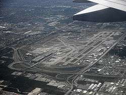
Fort Lauderdale–Hollywood International Airport serves as the primary airport of the Broward County area. The airport is bounded by the cities Fort Lauderdale, Hollywood and Dania Beach,[38] three miles (5 km) southwest of downtown Fort Lauderdale[48] and 21 mi (34 km) north of Miami. The airport is near cruise line terminals at Port Everglades and is popular among tourists bound for the Caribbean. Since the late 1990s, FLL has become an intercontinental gateway, although Miami International Airport still handles most long-haul flights. FLL is ranked as the 19th busiest airport (in terms of passenger traffic) in the United States, as well as the nation's 14th busiest international air gateway and one of the world's 50 busiest airports. FLL is classified by the US Federal Aviation Administration as a "major hub" facility serving commercial air traffic. In 2017 the airport processed 32,511,053 passengers[49] (11.3% more than 2016) including 7,183,275 international passengers (18.6% more than 2016).
- North Perry Airport
- Fort Lauderdale Executive Airport
- Pompano Beach Airpark
- Downtown Fort Lauderdale Heliport
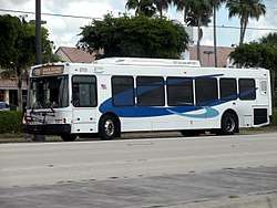
Public transportation
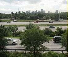
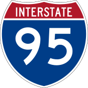
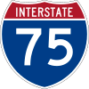
Major expressways


Railroads
Street grid
A street grid stretches throughout Broward County. Most of this grid is loosely based on three primary eastern municipalities, (from South to North) Hollywood, Fort Lauderdale, and Pompano Beach. Deerfield Beach—another primary eastern municipality—has its own street grid, as do two smaller municipalities—Dania and Hallandale.
Greenways System
Construction is underway on a network of recreational trails to connect cities and points of interest in the county.[50][51][52]
Sites of interest
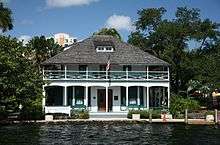
_003.jpg)
Museums & Historical Collections
- Bonnet House Museum & Gardens, Fort Lauderdale
- Coral Springs Museum of Art, Coral Springs
- Fort Lauderdale Antique Car Museum, Fort Lauderdale
- Fort Lauderdale Historical Society, Fort Lauderdale
- Naval Air Station Fort Lauderdale Museum, Fort Lauderdale
- NSU Art Museum, Fort Lauderdale
- Plantation Historical Museum, Plantation
- Stranahan House Museum, Fort Lauderdale
- The African-American Research Library & Cultural Center, Fort Lauderdale[53]
- The International Game Fish Association, including the Fishing Hall of Fame & Museum, in Dania Beach
- The International Swimming Hall of Fame, near the Atlantic Ocean, in Fort Lauderdale
- The Museum of Discovery and Science, Downtown Fort Lauderdale
- Wiener Museum of Decorative Arts, Dania Beach
- Young at Art Museum, Davie
Nature & Wildlife Areas

- Anne Knolb Nature Center, Hollywood
- Butterfly World, a botanical sanctuary in Coconut Creek
- Fern Forest Nature Center, Coconut Creek
- Flamingo Gardens, a botanical garden and wildlife sanctuary
- Secret Woods Nature Center, Dania Beach
- Sawgrass Recreation Park
- The Everglades parks, which have multiple entrances in Broward County
Other Areas & Attractions
- Beach Place, a strip of stores, restaurants, and bars across the street from the beach along the Atlantic coast, in Ft. Lauderdale
- Broward Center for the Performing Arts
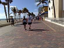
- Hollywood Boardwalk
- Florida Grand Opera
- Fort Lauderdale Swap Shop (colloquially known to locals as simply the Swap Shop)
- Sawgrass Mills, a large outlet shopping mall in Sunrise
- The BB&T Center in Sunrise, where the NHL's Florida Panthers play their games
- The Festival Flea Market Mall in Pompano Beach, America's largest indoor flea market
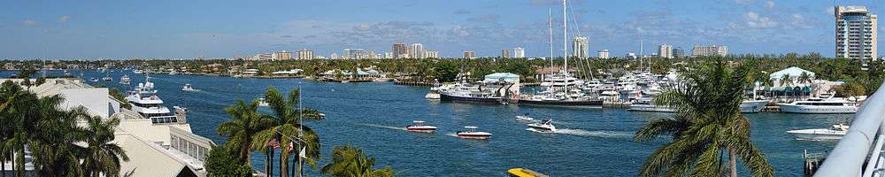
- Riverwalk (Fort Lauderdale)
Additionally, with 23 miles of beach, Broward County is a popular destination for scuba diving, snorkeling, and droves of young Spring break tourists from around the world.[54][55]
See also
References
- 1 2 "US Census 2015 Estimate". United States Census Bureau. Retrieved July 1, 2015.
- ↑ "Find a County". National Association of Counties. Archived from the original on May 31, 2011. Retrieved June 7, 2011.
- 1 2 3 4 5 "broward county history". Greater Fort Lauderdale. Retrieved 2015-10-02.
- ↑ Reese, J. H (May 16, 1913). "Carved from Dade County". The Weekly Miami Metropolis. Miami, Florida. p. 7. Retrieved September 8, 2010.
- ↑ http://www.usa.com/broward-county-fl-weather.htm#HistoricalTemperature
- ↑ "US Gazetteer files: 2010, 2000, and 1990". United States Census Bureau. February 12, 2011. Retrieved April 23, 2011.
- ↑ Notes on Florida Geography, Florida International University
- ↑ "Tire reef off Florida proves a disaster - U.S. news - Environment - msnbc.com". MSNBC. February 16, 2007. Retrieved August 1, 2010.
- ↑ "American FactFinder". Retrieved March 24, 2018.
- ↑ "U.S. Decennial Census". United States Census Bureau. Archived from the original on May 12, 2015. Retrieved June 12, 2014.
- ↑ "Historical Census Browser". University of Virginia Library. Retrieved June 12, 2014.
- ↑ "Population of Counties by Decennial Census: 1900 to 1990". United States Census Bureau. Retrieved June 12, 2014.
- ↑ "Census 2000 PHC-T-4. Ranking Tables for Counties: 1990 and 2000" (PDF). United States Census Bureau. Retrieved June 12, 2014.
- ↑ "Households and Families 2011-2015 American Community Survey 5-Year Estimates". www.census.gov.
- ↑ "Age and Sex 2011-2015 American Community Survey 5-year Estimates". www.census.gov.
- ↑ "Hispanic or Latino Origin By Race 2011-2015 American Community Survey 5-Year Estimates".
- ↑ "People Reporting Ancestry 2011-2015 American Community Survey 5-Year Estimates". www.census.gov.
- ↑ "Nativity and Citizenship Status in the United States 2011-2015 American Community Survey 5-year Estimates". www.census.gov.
- ↑ "Place of Birth for the Foreign-Born Population in the United States Universe: Foreign-born excluding population born at sea 2011-2015 American Community Survey 5-year Estimates".
- ↑ "Income in the Past 12 Months (In 2015 Inflation-Adjusted Dollars) 2011-2015 American Community Survey 5-year Estimates". www.census.gov.
- ↑ "Median Income In the Past 12 Months (In 2015 Inflation-Adjusted Dollars) By Sex By Work Experience In the Past 12 months For The population 15 years and over with Income : 2011-2015 American Community Survey 5-Year Estimates". www.census.gov.
- ↑ "Selected Economic Characteristics 2011-2015 American Community Survey 5-Year Estimates". www.census.gov.
- 1 2 3 4 5 6 7 "Broward County: SELECTED SOCIAL CHARACTERISTICS IN THE UNITED STATES 2006-2010 American Community Survey 5-Year Estimates". factfinder.census.gov. Retrieved October 20, 2015.
- 1 2 "Broward-by-the-Numbers (June 2011): Census 2010 - Early Results (Page 4)" (PDF). www.broward.org. Archived from the original (PDF) on 2015-12-21. Retrieved October 20, 2015.
- 1 2 3 "Broward County Demographic Characteristics". ocala.com. Retrieved October 20, 2015.
- ↑ "Broward County, Florida FIRST ANCESTRY REPORTED Universe: Total population - 2006-2010 American Community Survey 5-Year Estimates". factfinder.census.gov. Retrieved November 11, 2015.
- ↑ "Hispanic or Latino by Type: 2010 more information - 2010 Census Summary File 1". factfinder.census.gov. Retrieved October 20, 2015.
- ↑ "Broward's foreign-born population soars". Sun-Sentinel. Retrieved August 1, 2013.
- 1 2 "Miami-Dade County: Age Groups and Sex: 2010 - 2010 Census Summary File 1". factfinder.census.gov. Retrieved October 20, 2015.
- ↑ "Broward County, Florida: SELECTED ECONOMIC CHARACTERISTICS - 2006-2010 American Community Survey 5-Year Estimates". factfinder.census.gov. Archived from the original on November 29, 2014. Retrieved November 14, 2015.
- 1 2 "Census". Retrieved September 27, 2014.
- ↑ "Demographics of Broward County, FL". MuniNetGuide.com. Archived from the original on 2007-11-11. Retrieved December 19, 2007.
- 1 2 "Broward County, FL Detailed Profile". city-data.com. Retrieved October 20, 2015.
- ↑ "What's New at The Body, November 23, 2005". Thebody.com. Retrieved August 1, 2010.
- ↑ "Modern Language Association Data Center Results, Broward County, Florida". Modern Language Association. Retrieved July 27, 2013.
- ↑ "Fort Lauderdale-Hollywood International Airport > Business > Tenant Directory Archived 2011-12-27 at the Wayback Machine.." Broward County. Retrieved on December 17, 2011. "1100 Lee Wagener Blvd. Fort Lauderdale, FL33315"
- ↑ "Contact Us." Gulfstream International Airlines. Retrieved on December 17, 2011. "1100 Lee Wagener Blvd, Suite 201 Ft. Lauderdale, FL 33315."
- 1 2 "Zoning Map Archived June 8, 2011, at the Wayback Machine.." City of Dania Beach. Retrieved on May 12, 2010.
- ↑ "Contact Us." Locair. Retrieved on June 19, 2010. "Locair, Inc. 268 SW 33rd St. Fort Lauderdale, FL 33315"
- ↑ "Administration." Chalk's International Airlines. March 31, 2004. Retrieved on December 17, 2011. "Chalk’s International Airlines 704 SW 34th Street Ft Lauderdale, Fl. 33315"
- ↑ "Contact Us." Bimini Island Air. Retrieved on July 12, 2011. "Bimini Island Air, Inc./Ltd. 3000 NW 59 Street Fort Lauderdale, FL 33309"
- ↑ "See "Population and Housing Occupancy Status: 2010 - Florida County -- County Subdivision and Place"". 2010 Census. United States Census Bureau, Population Division. Archived from the original on 2013-09-11.
- ↑ "Total Population 2011-2015 American Community Survey 5-Year Estimates". www.census.gov.
- ↑ "Archived copy". Archived from the original on 2016-10-24. Retrieved 2016-10-24.
- ↑ State:Broward Power. St. Petersburg Times. Retrieved November 14, 2006.
- ↑ 2008 General Election Results Archived 2012-10-11 at the Wayback Machine.. South Florida Sun-Sentinel. Retrieved November 11, 2008.
- ↑ Leip, David. "Dave Leip's Atlas of U.S. Presidential Elections". uselectionatlas.org. Retrieved 2018-06-13.
- ↑
- ↑ "TOTAL PASSENGERS (ARRIVING + DEPARTING) – Monthly Stats" (PDF). broward.org. December 2016. Retrieved 2017-05-19.
- ↑ "Topic Galleries - South Florida". Sun-sentinel.com. Archived from the original on June 29, 2009. Retrieved August 1, 2010.
- ↑ "Welcome To Broward County Greenways". Broward.org. Retrieved August 1, 2010.
- ↑ "Topic Galleries". OrlandoSentinel.com. Retrieved December 18, 2012.
- ↑ "African American Research Library : African American Research Library News and Photos - South Florida". Sun Sentinel. Retrieved August 1, 2010.
- ↑ "South Florida Beach Dive Sites". Sink, Florida, Sink!. Retrieved February 24, 2013.
- ↑ "More spring tourists filling hotels". Sun Sentinel. Retrieved 21 April 2015.
External links
| Wikimedia Commons has media related to Broward County, Florida. |
Government links/Constitutional offices
- Broward County Government / Board of County Commissioners
- Broward County Supervisor of Elections
- Broward County Property Appraiser
- Broward County Sheriff's Office
Special districts
Judicial branch
Tourism links
- Greater Fort Lauderdale Convention and Visitors Bureau
- The Waterfront News local newspaper for Broward County, Florida fully and openly available in the Florida Digital Newspaper Library
Official sites
- The Broward Alliance (Broward County's official public/private partnership for economic development)
Coordinates: 26°07′28″N 80°14′58″W / 26.124354°N 80.249503°W
Places adjacent to Broward County, Florida | ||||||||||
|---|---|---|---|---|---|---|---|---|---|---|
| ||||||||||
Municipalities and communities of Broward County, Florida, United States | ||
|---|---|---|
| Cities | | |
| Towns | ||
| Villages | ||
| CDPs | ||
| Unincorporated community | ||
| Indian reservations | ||
| Ghost towns | ||
| Footnotes | ‡This populated place also has portions in an adjacent county or oounties | |
